


Distance Calculator


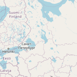


A1, Autostrada Bursztynowa
2949.9 km, 32 h
| Head southeast on Lenču iela (V292) | 90 m | |
| Turn right onto Palasta iela | 800 m | |
| Turn left onto Gaujas iela | 60 m | |
| Turn right onto Rīgas iela | 1.5 km | |
| Continue onto P14 | 3 km | |
| Turn right onto Valmiera — Cēsis — Drabeši (P20) | 4.5 km | |
| Take the ramp | 300 m | |
| Merge left onto A2 | 10 km | |
| Continue straight | 1.5 km | |
| Continue onto A2 | 15 km | |
| Take the ramp | 70 m | |
| Make a slight right onto Kalna iela | 15 m | |
| Turn left onto Pievedceļš Lorupes gravai (V96) | 2 km | |
| Make a sharp right onto A2 | 10 km | |
| Keep right onto Rīga — Sigulda — Igaunijas robeža (Veclaicene) (A2) | 20 km | |
| Take the ramp | 450 m | |
| Continue onto A4 | 20 km | |
| Take the ramp onto A4 | 500 m | |
| Merge left onto Rīga — Daugavpils — Krāslava — Baltkrievijas robeža (Pāternieki) (A6) | 2.5 km | |
| Continue onto Ķesterciema iela (A6) | 2 km | |
| Keep right at the fork | 800 m | |
| Enter the traffic circle and take the 1st exit onto A5 | 30 m | |
| Exit the traffic circle onto A5 | 7 km | |
| Enter the traffic circle and take the 1st exit onto Rīgas apvedceļš (Salaspils — Babīte) (A5) | 50 m | |
| Exit the traffic circle onto Rīgas apvedceļš (Salaspils — Babīte) (A5) | 1.5 km | |
| Enter the traffic circle and take the 3rd exit onto P137 | 200 m | |
| Exit the traffic circle onto P137 | 4 km | |
| Take the ramp onto P137 | 200 m | |
| Merge left onto Ķekavas apvedceļš (A7) | 150 m | |
| Continue onto Rīga — Bauska — Lietuvas robeža (Grenctāle) (A7) | 20 km | |
| Continue onto Rīgas iela (A7) | 1.5 km | |
| Keep right onto Rīgas iela (A7) | 20 km | |
| Continue onto Kalna iela (A7) | 1.5 km | |
| Enter the traffic circle and take the 2nd exit onto A7 | 45 m | |
| Exit the traffic circle onto A7 | 20 km | |
| Continue onto Pasienio g. (A10) | 800 m | |
| Continue onto Via Baltica (A10) | 3.5 km | |
| Continue onto Rygos g. (A10) | 1.5 km | |
| Continue onto Bėrelės g. (A10) | 6 km | |
| Continue onto Via Baltica (A10) | 15 km | |
| Enter the traffic circle and take the 2nd exit towards Panevėžys | 40 m | |
| Exit the traffic circle towards Panevėžys | 3.5 km | |
| Continue onto Baltijos Kelio g. (A10) | 2 km | |
| Continue onto Panevėžio g. (A10) | 1 km | |
| Continue onto Via Baltica (A10) | 150 m | |
| Continue onto Baltijos Kelio g. (A10) | 7 km | |
| Continue onto Via Baltica (A10) | 400 m | |
| Continue onto Kovo 11-osios g. (A10) | 15 km | |
| Keep left towards Panevėžys | 200 m | |
| Enter the traffic circle and take the 1st exit towards Šiauliai | 30 m | |
| Exit the traffic circle towards Šiauliai | 7 km | |
| Enter Panevėžio aplinkl. and take the 2nd exit towards Šiauliai | 30 m | |
| Exit the traffic circle towards Šiauliai | 9 km | |
| Enter the traffic circle and take the 1st exit onto 195 | 20 m | |
| Exit the traffic circle onto 195 | 20 km | |
| Continue onto Pušyno g. (2008) | 4 km | |
| Continue onto Vilainiai — Šventybrastis — Krekenava (2008) | 20 km | |
| Continue onto Melioratorių g. (2008) | 3 km | |
| Continue onto Tiskūnų g. (2008) | 2 km | |
| Turn left onto 229 | 3 km | |
| Take the ramp onto Aristava — Kėdainiai — Cinkiškis (229) | 20 m | |
| Keep right towards Kaunas | 450 m | |
| Merge left onto A8 | 35 km | |
| Merge left onto A1 | 10 km | |
| Take the ramp towards A5: Marijampolė | 600 m | |
| Merge left towards Marijampolė | 600 m | |
| Take the ramp | 30 m | |
| Keep left at the fork | 250 m | |
| Merge left onto Vakarinis aplinkl. (A5) | 4.5 km | |
| Continue onto Via Baltikos kel. (A5) | 4.5 km | |
| Continue onto Baltijos g. (A5) | 5.5 km | |
| Take the ramp towards Marijampolė | 600 m | |
| Merge left onto Marijampolės g. (A5) | 550 m | |
| Continue onto Via Baltica (A5) | 35 km | |
| Continue onto Kauno g. (A5) | 5 km | |
| Continue onto Via Baltica (A5) | 30 km | |
| Continue onto Muitinės g. (A5) | 9 km | |
| Continue onto Via Baltica (S61) | 1 km | |
| Continue straight | 150 m | |
| Continue straight | 300 m | |
| Continue onto Via Baltica (S61) | 250 km | |
| Continue onto Warszawska (S8) | 2 km | |
| Continue towards S8: Warszawa | 1.5 km | |
| Continue onto Trasa Bohaterów Bitwy Warszawskiej 1920 (S8) | 8 km | |
| Continue onto Kardynała Stefana Wyszyńskiego (S8) | 4 km | |
| Continue onto Marszałka Józefa Piłsudskiego (S8) | 550 m | |
| Continue onto Kardynała Stefana Wyszyńskiego (S8) | 1.5 km | |
| Continue onto Trasa Bohaterów Bitwy Warszawskiej 1920 (S8) | 10 km | |
| Continue onto Aleja Bohaterów Bitwy Warszawskiej 1920 (S8) | 6 km | |
| Continue onto Toruńska (S8) | 6 km | |
| Continue onto Most Generała Stefana Grota-Roweckiego (S8) | 700 m | |
| Continue onto Aleja Armii Krajowej (S8) | 4 km | |
| Continue onto Aleja Obrońców Grodna (S8) | 10 km | |
| Keep left towards A2: Poznań | 1 km | |
| Continue onto Autostrada Wolności (A2) | 90 km | |
| Take the ramp towards A1: Gdańsk | 550 m | |
| Keep left towards A1: Katowice | 2 km | |
| Merge left towards Katowice | 250 km | |
| Continue onto D1 | 80 km | |
| Keep left towards D35: Olomouc | 1 km | |
| Keep right towards Olomouc | 30 km | |
| Take the ramp towards Brno | 300 m | |
| Keep right towards Prostějov | 250 m | |
| Keep left towards Prostějov | 2 km | |
| Merge right onto D46 | 35 km | |
| Keep left towards Brno | 450 m | |
| Merge left onto D1 | 35 km | |
| Take the ramp | 45 m | |
| Keep left towards D 2: Bratislava | 350 m | |
| Keep right towards D2: Bratislava | 350 m | |
| Keep left towards Bratislava | 450 m | |
| Keep left at the fork | 300 m | |
| Keep left towards Bratislava (SK) | 150 m | |
| Merge left onto D2 | 100 km | |
| Continue onto D2 | 15 km | |
| Take the ramp towards D4: Žilina | 150 m | |
| Keep left towards Žilina | 500 m | |
| Keep left towards D2: Budapest | 300 m | |
| Merge left onto D2 | 9 km | |
| Continue onto M15 | 150 km | |
| Take the ramp towards M0 | 300 m | |
| Keep right towards E 60: Szeged | 1 km | |
| Keep left towards M0 | 250 m | |
| Merge left onto M0 | 30 km | |
| Take the ramp | 450 m | |
| Keep right towards E 60: Szeged | 1 km | |
| Merge left onto M5 | 150 km | |
| Take the ramp | 350 m | |
| Keep left at the fork | 400 m | |
| Merge left onto M5 | 100 m | |
| Continue onto A1 | 200 km | |
| Keep left towards A 1: Skopje | 200 km | |
| Take the ramp towards A4: Sofia (BG) | 1.5 km | |
| Continue onto A4 | 100 km | |
| Continue onto Автомагистрала Европа (A 6) | 35 km | |
| Keep left towards 8 | 15 km | |
| Enter the traffic circle and take the 3rd exit towards Видин | 150 m | |
| Exit the traffic circle towards Видин | 350 m | |
| Take the ramp on the left towards Видин | 100 m | |
| Merge left onto Околовръстен път (8) | 4 km | |
| Take exit 49 towards А 6: Варна | 1 km | |
| Merge left onto Автомагистрала Европа (A 6) | 15 km | |
| Take exit 64 towards А 1: Пловдив | 1.5 km | |
| Merge left onto Околовръстен път (1) | 8 km | |
| Take the ramp towards A 1: Пловдив | 350 m | |
| Merge left onto Автомагистрала Тракия (A 1) | 150 km | |
| Keep right towards А 4: Свиленград | 100 km | |
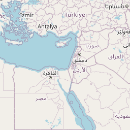
| Keep left towards Turkey | 500 m | |
| Continue onto Kapıkule Sınır Kapısı (D-100) | 10 km | |
| Keep left towards Lalapaşa | 250 km | |
| Keep right towards Bağcılar | 9 km | |
| Continue onto Adnan Menderes Vatan Bulvarı | 300 m | |
| Make a slight right | 45 m | |
| Make a slight left onto Çayır Meydanı Caddesi | 300 m | |
| Turn right onto Bican Bağcıoğlu Yokuşu | 100 m | |
| Make a slight left onto Tatlı Pınar Caddesi | 150 m | |
| Turn left onto Gureba Hastanesi Caddesi | 900 m | |
| Turn left onto Oğuzhan Caddesi | 100 m | |
| Continue onto Akdeniz Caddesi | 600 m | |
| Turn right onto Fevzipaşa Caddesi | 350 m | |
| Continue onto Macar Kardeşler Caddesi | 450 m | |
| Continue towards Vezneciler | 150 m | |
| You have arrived at your destination, on the right | 0 m |
A1, S7
2897.0 km, 33 h
| Head southeast on Lenču iela (V292) | 90 m | |
| Turn right onto Palasta iela | 800 m | |
| Turn left onto Gaujas iela | 60 m | |
| Turn right onto Rīgas iela | 1.5 km | |
| Continue onto P14 | 3 km | |
| Turn right onto Valmiera — Cēsis — Drabeši (P20) | 4.5 km | |
| Take the ramp | 300 m | |
| Merge left onto A2 | 10 km | |
| Continue straight | 1.5 km | |
| Continue onto A2 | 15 km | |
| Take the ramp | 70 m | |
| Make a slight right onto Kalna iela | 15 m | |
| Turn left onto Pievedceļš Lorupes gravai (V96) | 2 km | |
| Make a sharp right onto A2 | 10 km | |
| Keep right onto Rīga — Sigulda — Igaunijas robeža (Veclaicene) (A2) | 20 km | |
| Take the ramp | 450 m | |
| Continue onto A4 | 20 km | |
| Take the ramp onto A4 | 500 m | |
| Merge left onto Rīga — Daugavpils — Krāslava — Baltkrievijas robeža (Pāternieki) (A6) | 2.5 km | |
| Continue onto Ķesterciema iela (A6) | 2 km | |
| Keep right at the fork | 800 m | |
| Enter the traffic circle and take the 1st exit onto A5 | 30 m | |
| Exit the traffic circle onto A5 | 7 km | |
| Enter the traffic circle and take the 1st exit onto Rīgas apvedceļš (Salaspils — Babīte) (A5) | 50 m | |
| Exit the traffic circle onto Rīgas apvedceļš (Salaspils — Babīte) (A5) | 1.5 km | |
| Enter the traffic circle and take the 3rd exit onto P137 | 200 m | |
| Exit the traffic circle onto P137 | 4 km | |
| Take the ramp onto P137 | 200 m | |
| Merge left onto Ķekavas apvedceļš (A7) | 150 m | |
| Continue onto Rīga — Bauska — Lietuvas robeža (Grenctāle) (A7) | 20 km | |
| Continue onto Rīgas iela (A7) | 1.5 km | |
| Keep right onto Rīgas iela (A7) | 20 km | |
| Continue onto Kalna iela (A7) | 1.5 km | |
| Enter the traffic circle and take the 2nd exit onto A7 | 45 m | |
| Exit the traffic circle onto A7 | 20 km | |
| Continue onto Pasienio g. (A10) | 800 m | |
| Continue onto Via Baltica (A10) | 3.5 km | |
| Continue onto Rygos g. (A10) | 1.5 km | |
| Continue onto Bėrelės g. (A10) | 6 km | |
| Continue onto Via Baltica (A10) | 15 km | |
| Enter the traffic circle and take the 2nd exit towards Panevėžys | 40 m | |
| Exit the traffic circle towards Panevėžys | 3.5 km | |
| Continue onto Baltijos Kelio g. (A10) | 2 km | |
| Continue onto Panevėžio g. (A10) | 1 km | |
| Continue onto Via Baltica (A10) | 150 m | |
| Continue onto Baltijos Kelio g. (A10) | 7 km | |
| Continue onto Via Baltica (A10) | 400 m | |
| Continue onto Kovo 11-osios g. (A10) | 15 km | |
| Keep left towards Panevėžys | 200 m | |
| Enter the traffic circle and take the 1st exit towards Šiauliai | 30 m | |
| Exit the traffic circle towards Šiauliai | 7 km | |
| Enter Panevėžio aplinkl. and take the 2nd exit towards Šiauliai | 30 m | |
| Exit the traffic circle towards Šiauliai | 9 km | |
| Enter the traffic circle and take the 1st exit onto 195 | 20 m | |
| Exit the traffic circle onto 195 | 20 km | |
| Continue onto Pušyno g. (2008) | 4 km | |
| Continue onto Vilainiai — Šventybrastis — Krekenava (2008) | 20 km | |
| Continue onto Melioratorių g. (2008) | 3 km | |
| Continue onto Tiskūnų g. (2008) | 2 km | |
| Turn left onto 229 | 3 km | |
| Take the ramp onto Aristava — Kėdainiai — Cinkiškis (229) | 20 m | |
| Keep right towards Kaunas | 450 m | |
| Merge left onto A8 | 35 km | |
| Merge left onto A1 | 10 km | |
| Take the ramp towards A5: Marijampolė | 600 m | |
| Merge left towards Marijampolė | 600 m | |
| Take the ramp | 30 m | |
| Keep left at the fork | 250 m | |
| Merge left onto Vakarinis aplinkl. (A5) | 4.5 km | |
| Continue onto Via Baltikos kel. (A5) | 4.5 km | |
| Continue onto Baltijos g. (A5) | 5.5 km | |
| Take the ramp towards Marijampolė | 600 m | |
| Merge left onto Marijampolės g. (A5) | 550 m | |
| Continue onto Via Baltica (A5) | 35 km | |
| Continue onto Kauno g. (A5) | 5 km | |
| Continue onto Via Baltica (A5) | 30 km | |
| Continue onto Muitinės g. (A5) | 9 km | |
| Continue onto Via Baltica (S61) | 1 km | |
| Continue straight | 150 m | |
| Continue straight | 300 m | |
| Continue onto Via Baltica (S61) | 250 km | |
| Continue onto Warszawska (S8) | 2 km | |
| Continue towards S8: Warszawa | 1.5 km | |
| Continue onto Trasa Bohaterów Bitwy Warszawskiej 1920 (S8) | 8 km | |
| Continue onto Kardynała Stefana Wyszyńskiego (S8) | 4 km | |
| Continue onto Marszałka Józefa Piłsudskiego (S8) | 550 m | |
| Continue onto Kardynała Stefana Wyszyńskiego (S8) | 1.5 km | |
| Continue onto Trasa Bohaterów Bitwy Warszawskiej 1920 (S8) | 10 km | |
| Continue onto Aleja Bohaterów Bitwy Warszawskiej 1920 (S8) | 6 km | |
| Continue onto Toruńska (S8) | 6 km | |
| Continue onto Most Generała Stefana Grota-Roweckiego (S8) | 700 m | |
| Continue onto Aleja Armii Krajowej (S8) | 4 km | |
| Continue onto Aleja Obrońców Grodna (S8) | 10 km | |
| Keep right towards S2: Kraków | 8 km | |
| Continue onto Aleja Legionów Piłsudskiego (S2) | 4.5 km | |
| Take the ramp towards S79: Mokotów | 550 m | |
| Keep right towards S7: Kraków | 2 km | |
| Keep left towards Kraków | 400 m | |
| Keep left towards S7: Kraków | 150 km | |
| Continue onto S7 | 90 km | |
| Take the ramp | 500 m | |
| Enter the traffic circle and take the 2nd exit onto Tadeusza Kościuszki | 55 m | |
| Exit the traffic circle onto Tadeusza Kościuszki | 150 m | |
| Enter the traffic circle and take the 1st exit onto Tadeusza Kościuszki | 30 m | |
| Exit the traffic circle onto Tadeusza Kościuszki | 1.5 km | |
| Continue onto Zachodnia | 2 km | |
| Turn right onto Niepodległości | 100 m | |
| Enter the traffic circle and take the 1st exit onto Kocmyrzowska (776) | 25 m | |
| Exit the traffic circle onto Kocmyrzowska (776) | 3 km | |
| Enter the traffic circle and take the 2nd exit onto Karola Łowińskiego (776) | 30 m | |
| Exit the traffic circle onto Karola Łowińskiego (776) | 700 m | |
| Keep right onto Ujastek | 1 km | |
| Continue right onto Aleja Solidarności | 250 m | |
| Turn left onto Ujastek Mogilski | 400 m | |
| Continue slightly left onto S7 Widoma - Kraków | 600 m | |
| Continue onto S7 | 6 km | |
| Keep right towards A4: Katowice | 900 m | |
| Merge left onto A4 | 10 km | |
| Take the ramp towards 7: Chyżne | 1.5 km | |
| Continue onto Góra Libertowska (7) | 2 km | |
| Continue onto Myślenicka (7) | 6 km | |
| Continue onto Krakowska (7) | 70 km | |
| Take the ramp | 250 m | |
| Turn right onto Ludźmierska (957) | 1 km | |
| Continue onto Kolejowa (957) | 200 m | |
| Continue onto Aleja Tysiąclecia (957) | 1.5 km | |
| Enter the traffic circle and take the 2nd exit towards 49: Jurgów | 25 m | |
| Exit the traffic circle towards 49: Jurgów | 1 km | |
| Enter Rondo Jana Pawła II and take the 1st exit towards 49: Bukowina Tatrzańska | 25 m | |
| Exit the traffic circle towards 49: Bukowina Tatrzańska | 2 km | |
| Enter Rondo Profesora Stefana Banacha and take the 1st exit towards 49: Jurgów | 50 m | |
| Exit the traffic circle towards 49: Jurgów | 15 km | |
| Enter the traffic circle and take the 2nd exit towards 49: Jurgów | 45 m | |
| Exit the traffic circle towards 49: Jurgów | 7 km | |
| Continue onto 66 | 20 km | |
| Turn right to stay on Cesta slobody (537) | 7 km | |
| Turn left onto 3083 | 30 m | |
| Make a slight right onto 3083 | 1.5 km | |
| Continue onto 540 | 7 km | |
| Turn right onto Popradská (66) | 2.5 km | |
| Continue onto 66 | 3 km | |
| Turn left towards D1: Košice | 400 m | |
| Merge left onto D1 | 100 km | |
| Take the ramp towards 20: Miskolc | 200 m | |
| Keep left towards 20: Miskolc | 300 m | |
| Continue onto 20 | 9 km | |
| Continue onto 16 | 3 km | |
| Continue onto Slanecká (16) | 700 m | |
| Continue towards E 58: Miskolc | 900 m | |
| Take the ramp towards centrum | 200 m | |
| Keep left towards Miskolc | 150 m | |
| Continue slightly left onto Južná trieda (17) | 900 m | |
| Continue onto Osloboditeľov (17) | 4 km | |
| Take the ramp on the right | 500 m | |
| Continue onto R4 | 15 km | |
| Continue onto M30 | 50 km | |
| Continue right onto 2631 | 700 m | |
| Enter the traffic circle and take the 1st exit towards 3: Miskolc | 20 m | |
| Exit the traffic circle towards 3: Miskolc | 8 km | |
| Enter the traffic circle and take the 2nd exit towards 3: Miskolc-centrum | 50 m | |
| Exit the traffic circle towards 3: Miskolc-centrum | 1 km | |
| Enter the traffic circle and take the 2nd exit onto 30928 | 55 m | |
| Exit the traffic circle onto 30928 | 300 m | |
| Continue onto 30926 | 350 m | |
| Merge left onto M30 | 30 km | |
| Keep right towards E 71: Budapest | 100 km | |
| Take the ramp towards E 71: Gödöllő | 350 m | |
| Keep left towards M31: Budapest | 550 m | |
| Keep left towards E 71: Budapest | 15 km | |
| Keep left towards E71: Budapest-centrum | 1.5 km | |
| Merge left onto M0 | 20 km | |
| Take the ramp towards M5: Budapest | 400 m | |
| Keep left at the fork | 300 m | |
| Keep right towards E 60: Szeged | 450 m | |
| Keep left towards E 60: Szeged | 800 m | |
| Merge left onto M5 | 150 km | |
| Take the ramp | 350 m | |
| Keep left at the fork | 400 m | |
| Merge left onto M5 | 100 m | |
| Continue onto A1 | 200 km | |
| Keep left towards A 1: Skopje | 200 km | |
| Take the ramp towards A4: Sofia (BG) | 1.5 km | |
| Continue onto A4 | 100 km | |
| Continue onto Автомагистрала Европа (A 6) | 35 km | |
| Keep left towards 8 | 15 km | |
| Enter the traffic circle and take the 3rd exit towards Видин | 150 m | |
| Exit the traffic circle towards Видин | 350 m | |
| Take the ramp on the left towards Видин | 100 m | |
| Merge left onto Околовръстен път (8) | 4 km | |
| Take exit 49 towards А 6: Варна | 1 km | |
| Merge left onto Автомагистрала Европа (A 6) | 15 km | |
| Take exit 64 towards А 1: Пловдив | 1.5 km | |
| Merge left onto Околовръстен път (1) | 8 km | |
| Take the ramp towards A 1: Пловдив | 350 m | |
| Merge left onto Автомагистрала Тракия (A 1) | 150 km | |
| Keep right towards А 4: Свиленград | 100 km | |
| Keep left towards Turkey | 500 m | |
| Continue onto Kapıkule Sınır Kapısı (D-100) | 10 km | |
| Keep left towards Lalapaşa | 250 km | |
| Keep right towards Bağcılar | 9 km | |
| Continue onto Adnan Menderes Vatan Bulvarı | 300 m | |
| Make a slight right | 45 m | |
| Make a slight left onto Çayır Meydanı Caddesi | 300 m | |
| Turn right onto Bican Bağcıoğlu Yokuşu | 100 m | |
| Make a slight left onto Tatlı Pınar Caddesi | 150 m | |
| Turn left onto Gureba Hastanesi Caddesi | 900 m | |
| Turn left onto Oğuzhan Caddesi | 100 m | |
| Continue onto Akdeniz Caddesi | 600 m | |
| Turn right onto Fevzipaşa Caddesi | 350 m | |
| Continue onto Macar Kardeşler Caddesi | 450 m | |
| Continue towards Vezneciler | 150 m | |
| You have arrived at your destination, on the right | 0 m |
Autostrada Wolności, A 2
2387.2 km, 26 h
| Head southeast on Lenču iela (V292) | 90 m | |
| Turn right onto Palasta iela | 800 m | |
| Turn left onto Gaujas iela | 60 m | |
| Turn right onto Rīgas iela | 1.5 km | |
| Continue onto P14 | 3 km | |
| Turn right onto Valmiera — Cēsis — Drabeši (P20) | 4.5 km | |
| Take the ramp | 300 m | |
| Merge left onto A2 | 10 km | |
| Continue straight | 1.5 km | |
| Continue onto A2 | 15 km | |
| Take the ramp | 70 m | |
| Make a slight right onto Kalna iela | 15 m | |
| Turn left onto Pievedceļš Lorupes gravai (V96) | 2 km | |
| Make a sharp right onto A2 | 10 km | |
| Keep right onto Rīga — Sigulda — Igaunijas robeža (Veclaicene) (A2) | 20 km | |
| Take the ramp | 450 m | |
| Continue onto A4 | 20 km | |
| Take the ramp onto A4 | 500 m | |
| Merge left onto Rīga — Daugavpils — Krāslava — Baltkrievijas robeža (Pāternieki) (A6) | 2.5 km | |
| Continue onto Ķesterciema iela (A6) | 2 km | |
| Keep right at the fork | 800 m | |
| Enter the traffic circle and take the 1st exit onto A5 | 30 m | |
| Exit the traffic circle onto A5 | 7 km | |
| Enter the traffic circle and take the 1st exit onto Rīgas apvedceļš (Salaspils — Babīte) (A5) | 50 m | |
| Exit the traffic circle onto Rīgas apvedceļš (Salaspils — Babīte) (A5) | 1.5 km | |
| Enter the traffic circle and take the 3rd exit onto P137 | 200 m | |
| Exit the traffic circle onto P137 | 4 km | |
| Take the ramp onto P137 | 200 m | |
| Merge left onto Ķekavas apvedceļš (A7) | 150 m | |
| Continue onto Rīga — Bauska — Lietuvas robeža (Grenctāle) (A7) | 20 km | |
| Continue onto Rīgas iela (A7) | 1.5 km | |
| Keep right onto Rīgas iela (A7) | 20 km | |
| Continue onto Kalna iela (A7) | 1.5 km | |
| Enter the traffic circle and take the 2nd exit onto A7 | 45 m | |
| Exit the traffic circle onto A7 | 20 km | |
| Continue onto Pasienio g. (A10) | 800 m | |
| Continue onto Via Baltica (A10) | 3.5 km | |
| Continue onto Rygos g. (A10) | 1.5 km | |
| Continue onto Bėrelės g. (A10) | 6 km | |
| Continue onto Via Baltica (A10) | 15 km | |
| Enter the traffic circle and take the 2nd exit towards Panevėžys | 40 m | |
| Exit the traffic circle towards Panevėžys | 3.5 km | |
| Continue onto Baltijos Kelio g. (A10) | 2 km | |
| Continue onto Panevėžio g. (A10) | 1 km | |
| Continue onto Via Baltica (A10) | 150 m | |
| Continue onto Baltijos Kelio g. (A10) | 7 km | |
| Continue onto Via Baltica (A10) | 400 m | |
| Continue onto Kovo 11-osios g. (A10) | 15 km | |
| Keep left towards Panevėžys | 200 m | |
| Enter the traffic circle and take the 1st exit towards Šiauliai | 30 m | |
| Exit the traffic circle towards Šiauliai | 7 km | |
| Enter Panevėžio aplinkl. and take the 2nd exit towards Šiauliai | 30 m | |
| Exit the traffic circle towards Šiauliai | 9 km | |
| Enter the traffic circle and take the 1st exit onto 195 | 20 m | |
| Exit the traffic circle onto 195 | 20 km | |
| Continue onto Pušyno g. (2008) | 4 km | |
| Continue onto Vilainiai — Šventybrastis — Krekenava (2008) | 20 km | |
| Continue onto Melioratorių g. (2008) | 3 km | |
| Continue onto Tiskūnų g. (2008) | 2 km | |
| Turn left onto 229 | 3 km | |
| Take the ramp onto Aristava — Kėdainiai — Cinkiškis (229) | 20 m | |
| Keep right towards Kaunas | 450 m | |
| Merge left onto A8 | 35 km | |
| Merge left onto A1 | 10 km | |
| Take the ramp towards A5: Marijampolė | 600 m | |
| Merge left towards Marijampolė | 600 m | |
| Take the ramp | 30 m | |
| Keep left at the fork | 250 m | |
| Merge left onto Vakarinis aplinkl. (A5) | 4.5 km | |
| Continue onto Via Baltikos kel. (A5) | 4.5 km | |
| Continue onto Baltijos g. (A5) | 5.5 km | |
| Take the ramp towards Marijampolė | 600 m | |
| Merge left onto Marijampolės g. (A5) | 550 m | |
| Continue onto Via Baltica (A5) | 35 km | |
| Continue onto Kauno g. (A5) | 5 km | |
| Continue onto Via Baltica (A5) | 30 km | |
| Continue onto Muitinės g. (A5) | 9 km | |
| Continue onto Via Baltica (S61) | 1 km | |
| Continue straight | 150 m | |
| Continue straight | 300 m | |
| Continue onto Via Baltica (S61) | 250 km | |
| Continue onto Warszawska (S8) | 2 km | |
| Continue towards S8: Warszawa | 1.5 km | |
| Continue onto Trasa Bohaterów Bitwy Warszawskiej 1920 (S8) | 8 km | |
| Continue onto Kardynała Stefana Wyszyńskiego (S8) | 4 km | |
| Continue onto Marszałka Józefa Piłsudskiego (S8) | 550 m | |
| Continue onto Kardynała Stefana Wyszyńskiego (S8) | 1.5 km | |
| Continue onto Trasa Bohaterów Bitwy Warszawskiej 1920 (S8) | 10 km | |
| Continue onto Aleja Bohaterów Bitwy Warszawskiej 1920 (S8) | 6 km | |
| Continue onto Toruńska (S8) | 6 km | |
| Continue onto Most Generała Stefana Grota-Roweckiego (S8) | 700 m | |
| Continue onto Aleja Armii Krajowej (S8) | 4 km | |
| Continue onto Aleja Obrońców Grodna (S8) | 10 km | |
| Keep left towards A2: Poznań | 1 km | |
| Continue onto Autostrada Wolności (A2) | 450 km | |
| Continue onto Oderbrücke (A 12) | 60 km | |
| Merge left towards A 10: Magdeburg | 55 km | |
| Keep right towards A 10: Hamburg | 8 km | |
| Continue towards A 2: Hannover | 90 km | |
| Take the ramp towards B 189: Magdeburg-Zentrum | 350 m | |
| Keep left towards B 189: Magdeburg | 500 m | |
| Keep left towards A 2: Hannover | 350 m | |
| Continue towards A 2: Hannover | 150 m | |
| Merge left onto A 2 | 400 km | |
| Continue onto A 3 | 5 km | |
| Take the ramp towards A 42: Dortmund | 150 m | |
| Keep right towards A 42: Kamp-Lintfort | 600 m | |
| Merge left towards Kamp-Lintfort | 15 km | |
| Keep left towards A 57: Köln | 1 km | |
| Merge left onto A 57 | 5 km | |
| Take the ramp towards Essen | 150 m | |
| Keep right towards A 40: Venlo | 600 m | |
| Merge left towards Venlo | 30 km | |
| Continue onto A67 | 5.5 km | |
| Take the ramp towards A73: Venlo-West/Zuid | 250 m | |
| Keep left towards A73: Venlo-West/Zuid | 550 m | |
| Keep left towards Eindhoven | 900 m | |
| Merge left onto Europaweg (A67) | 20 km | |
| Take exit 37 towards Liessel | 30 km | |
| Keep right towards A67: Antwerpen | 20 km | |
| Continue onto E34 | 55 km | |
| Take the ramp towards R1: Ring | 200 m | |
| Keep left towards R1: Brugge | 1.5 km | |
| Merge left onto R1 | 8 km | |
| Keep left onto E17 | 50 km | |
| Take the ramp towards E17 | 200 m | |
| Keep left towards Brussel | 350 m | |
| Keep left towards E40: Brussel | 1 km | |
| Keep right towards E40: Brussel | 150 m | |
| Keep left towards Brussel | 500 m | |
| Keep right towards Oostende | 700 m | |
| Merge left onto E40 | 50 km | |
| Keep left towards Calais | 40 km | |
| Continue onto L'Européenne (A 16) | 55 km | |
| Take the ramp towards Tunnel sous la Manche | 250 m | |
| Keep left towards Tunnel sous la Manche | 800 m | |
| Keep right at the fork | 100 m | |
| Make a slight left | 55 m | |
| Make a slight right | 25 m | |
| Keep right at the fork | 550 m | |
| Keep left at the fork | 100 m | |
| Keep right at the fork | 15 m | |
| Keep left at the fork | 250 m | |
| Keep right at the fork | 90 m | |
| Keep left at the fork | 25 m | |
| Turn left | 10 m | |
| Keep right at the fork | 200 m | |
| Turn left | 350 m | |
| Turn right | 100 m | |
| Make a slight left | 15 m | |
| Take the ferry Le Shuttle | 60 km | |
| Continue slight right | 150 m | |
| Make a slight right onto Over Bridge 3 | 900 m | |
| Keep left at the fork | 1.5 km | |
| Take the ramp towards London | 250 m | |
| Keep right towards London | 80 km | |
| Continue onto A20 | 15 km | |
| Enter Cliftons Roundabout and take the 2nd exit onto Sidcup Road (A20) | 40 m | |
| Exit the traffic circle onto Sidcup Road (A20) | 400 m | |
| Keep left onto Eltham Road (A20) | 1 km | |
| Continue onto Lee High Road (A20) | 1.5 km | |
| Continue onto Lewisham High Street (A20) | 200 m | |
| Turn left onto Rennell Street (A20) | 100 m | |
| Turn right onto Loampit Vale (A20) | 400 m | |
| Keep left onto Loampit Vale (A20) | 200 m | |
| Continue onto Loampit Hill (A20) | 400 m | |
| Continue onto Lewisham Way (A20) | 1.5 km | |
| Keep left onto Lewisham Way (A2) | 90 m | |
| Merge right onto New Cross Road (A2) | 550 m | |
| Keep right onto New Cross Road (A2) | 800 m | |
| Continue onto Old Kent Road (A2) | 3 km | |
| Take the ramp on the left onto Bricklayers Arms (A201) | 200 m | |
| Merge right onto New Kent Road (A201) | 1 km | |
| Turn left onto Elephant and Castle (A3) | 45 m | |
| Turn right onto St George's Road (A302) | 550 m | |
| Continue onto St Georges Road (A302) | 150 m | |
| Continue onto Westminster Bridge Road (A302) | 550 m | |
| Turn left onto Westminster Bridge Road (A302) | 90 m | |
| Turn right to stay on Westminster Bridge Road (A302) | 500 m | |
| Turn right onto Victoria Embankment (A3211) | 600 m | |
| Turn left onto Northumberland Avenue (A400) | 350 m | |
| Enter Charing Cross and exit onto Charing Cross | 15 m | |
| You have arrived at your destination | 0 m |
Via Baltica, A 38
2500.8 km, 28 h
| Head southeast on Lenču iela (V292) | 90 m | |
| Turn right onto Palasta iela | 800 m | |
| Turn left onto Gaujas iela | 60 m | |
| Turn right onto Rīgas iela | 1.5 km | |
| Continue onto P14 | 3 km | |
| Turn right onto Valmiera — Cēsis — Drabeši (P20) | 4.5 km | |
| Take the ramp | 300 m | |
| Merge left onto A2 | 10 km | |
| Continue straight | 1.5 km | |
| Continue onto A2 | 15 km | |
| Take the ramp | 70 m | |
| Make a slight right onto Kalna iela | 15 m | |
| Turn left onto Pievedceļš Lorupes gravai (V96) | 2 km | |
| Make a sharp right onto A2 | 10 km | |
| Keep right onto Rīga — Sigulda — Igaunijas robeža (Veclaicene) (A2) | 20 km | |
| Take the ramp | 450 m | |
| Continue onto A4 | 20 km | |
| Take the ramp onto A4 | 500 m | |
| Merge left onto Rīga — Daugavpils — Krāslava — Baltkrievijas robeža (Pāternieki) (A6) | 2.5 km | |
| Continue onto Ķesterciema iela (A6) | 2 km | |
| Keep right at the fork | 800 m | |
| Enter the traffic circle and take the 1st exit onto A5 | 30 m | |
| Exit the traffic circle onto A5 | 7 km | |
| Enter the traffic circle and take the 1st exit onto Rīgas apvedceļš (Salaspils — Babīte) (A5) | 50 m | |
| Exit the traffic circle onto Rīgas apvedceļš (Salaspils — Babīte) (A5) | 1.5 km | |
| Enter the traffic circle and take the 3rd exit onto P137 | 200 m | |
| Exit the traffic circle onto P137 | 4 km | |
| Take the ramp onto P137 | 200 m | |
| Merge left onto Ķekavas apvedceļš (A7) | 150 m | |
| Continue onto Rīga — Bauska — Lietuvas robeža (Grenctāle) (A7) | 20 km | |
| Continue onto Rīgas iela (A7) | 1.5 km | |
| Keep right onto Rīgas iela (A7) | 20 km | |
| Continue onto Kalna iela (A7) | 1.5 km | |
| Enter the traffic circle and take the 2nd exit onto A7 | 45 m | |
| Exit the traffic circle onto A7 | 20 km | |
| Continue onto Pasienio g. (A10) | 800 m | |
| Continue onto Via Baltica (A10) | 3.5 km | |
| Continue onto Rygos g. (A10) | 1.5 km | |
| Continue onto Bėrelės g. (A10) | 6 km | |
| Continue onto Via Baltica (A10) | 15 km | |
| Enter the traffic circle and take the 2nd exit towards Panevėžys | 40 m | |
| Exit the traffic circle towards Panevėžys | 3.5 km | |
| Continue onto Baltijos Kelio g. (A10) | 2 km | |
| Continue onto Panevėžio g. (A10) | 1 km | |
| Continue onto Via Baltica (A10) | 150 m | |
| Continue onto Baltijos Kelio g. (A10) | 7 km | |
| Continue onto Via Baltica (A10) | 400 m | |
| Continue onto Kovo 11-osios g. (A10) | 15 km | |
| Keep left towards Panevėžys | 200 m | |
| Enter the traffic circle and take the 1st exit towards Šiauliai | 30 m | |
| Exit the traffic circle towards Šiauliai | 7 km | |
| Enter Panevėžio aplinkl. and take the 2nd exit towards Šiauliai | 30 m | |
| Exit the traffic circle towards Šiauliai | 9 km | |
| Enter the traffic circle and take the 1st exit onto 195 | 20 m | |
| Exit the traffic circle onto 195 | 20 km | |
| Continue onto Pušyno g. (2008) | 4 km | |
| Continue onto Vilainiai — Šventybrastis — Krekenava (2008) | 20 km | |
| Continue onto Melioratorių g. (2008) | 3 km | |
| Continue onto Tiskūnų g. (2008) | 2 km | |
| Turn left onto 229 | 3 km | |
| Take the ramp onto Aristava — Kėdainiai — Cinkiškis (229) | 20 m | |
| Keep right towards Kaunas | 450 m | |
| Merge left onto A8 | 35 km | |
| Merge left onto A1 | 10 km | |
| Take the ramp towards A5: Marijampolė | 600 m | |
| Merge left towards Marijampolė | 600 m | |
| Take the ramp | 30 m | |
| Keep left at the fork | 250 m | |
| Merge left onto Vakarinis aplinkl. (A5) | 4.5 km | |
| Continue onto Via Baltikos kel. (A5) | 4.5 km | |
| Continue onto Baltijos g. (A5) | 5.5 km | |
| Take the ramp towards Marijampolė | 600 m | |
| Merge left onto Marijampolės g. (A5) | 550 m | |
| Continue onto Via Baltica (A5) | 35 km | |
| Continue onto Kauno g. (A5) | 5 km | |
| Continue onto Via Baltica (A5) | 30 km | |
| Continue onto Muitinės g. (A5) | 9 km | |
| Continue onto Via Baltica (S61) | 1 km | |
| Continue straight | 150 m | |
| Continue straight | 300 m | |
| Continue onto Via Baltica (S61) | 250 km | |
| Continue onto Warszawska (S8) | 2 km | |
| Continue towards S8: Warszawa | 1.5 km | |
| Continue onto Trasa Bohaterów Bitwy Warszawskiej 1920 (S8) | 8 km | |
| Continue onto Kardynała Stefana Wyszyńskiego (S8) | 4 km | |
| Continue onto Marszałka Józefa Piłsudskiego (S8) | 550 m | |
| Continue onto Kardynała Stefana Wyszyńskiego (S8) | 1.5 km | |
| Continue onto Trasa Bohaterów Bitwy Warszawskiej 1920 (S8) | 10 km | |
| Continue onto Aleja Bohaterów Bitwy Warszawskiej 1920 (S8) | 6 km | |
| Continue onto Toruńska (S8) | 6 km | |
| Continue onto Most Generała Stefana Grota-Roweckiego (S8) | 700 m | |
| Continue onto Aleja Armii Krajowej (S8) | 4 km | |
| Continue onto Aleja Obrońców Grodna (S8) | 10 km | |
| Keep left towards A2: Poznań | 1 km | |
| Continue onto Autostrada Wolności (A2) | 90 km | |
| Take the ramp towards A1: Gdańsk | 550 m | |
| Keep left towards A1: Katowice | 2 km | |
| Merge left towards Katowice | 30 km | |
| Take the ramp towards S8: Wrocław | 1 km | |
| Merge left onto Trasa Bohaterów Bitwy Warszawskiej 1920 r. (S8) | 2 km | |
| Keep left onto Trasa Bohaterów Bitwy Warszawskiej 1920 r. (S8) | 200 km | |
| Continue onto Autostradowa Obwodnica Wrocławia (A8) | 20 km | |
| Take the ramp towards A4: Katowice | 400 m | |
| Keep right towards A4: Jędrzychowice | 700 m | |
| Merge left onto A4 | 100 km | |
| Keep left towards Jędrzychowice | 50 km | |
| Continue onto A 4 | 150 km | |
| Take the ramp towards A 14: Magdeburg | 600 m | |
| Continue onto A 14 | 70 km | |
| Keep right towards A 38: Göttingen | 1 km | |
| Continue towards Göttingen | 100 km | |
| Keep left towards A 38 | 100 km | |
| Merge left towards Frankfurt am Main | 35 km | |
| Take the ramp towards A 49: Marburg | 200 m | |
| Keep right towards A 49: Marburg | 450 m | |
| Merge left onto A 49 | 800 m | |
| Keep left onto A 49 | 6 km | |
| Take the ramp towards A 44: Dortmund | 700 m | |
| Merge left towards Dortmund | 150 km | |
| Take the ramp towards A 445: Arnsberg | 150 m | |
| Keep right towards A 445: Hamm | 600 m | |
| Merge left onto A 445 | 3.5 km | |
| Turn left onto Werler Straße (B 63) | 7 km | |
| Take the ramp on the left towards A 2: Oberhausen | 300 m | |
| Merge left onto A 2 | 70 km | |
| Continue onto A 3 | 5 km | |
| Take the ramp towards A 42: Dortmund | 150 m | |
| Keep right towards A 42: Kamp-Lintfort | 600 m | |
| Merge left towards Kamp-Lintfort | 15 km | |
| Keep left towards A 57: Köln | 1 km | |
| Merge left onto A 57 | 5 km | |
| Take the ramp towards Essen | 150 m | |
| Keep right towards A 40: Venlo | 600 m | |
| Merge left towards Venlo | 30 km | |
| Continue onto A67 | 5.5 km | |
| Take the ramp towards A73: Venlo-West/Zuid | 250 m | |
| Keep left towards A73: Venlo-West/Zuid | 550 m | |
| Keep left towards Eindhoven | 900 m | |
| Merge left onto Europaweg (A67) | 20 km | |
| Take exit 37 towards Liessel | 30 km | |
| Keep right towards A67: Antwerpen | 20 km | |
| Continue onto E34 | 55 km | |
| Take the ramp towards R1: Ring | 200 m | |
| Keep left towards R1: Brugge | 1.5 km | |
| Merge left onto R1 | 8 km | |
| Keep left onto E17 | 50 km | |
| Take the ramp towards E17 | 200 m | |
| Keep left towards Brussel | 350 m | |
| Keep left towards E40: Brussel | 1 km | |
| Keep right towards E40: Brussel | 150 m | |
| Keep left towards Brussel | 500 m | |
| Keep right towards Oostende | 700 m | |
| Merge left onto E40 | 50 km | |
| Keep left towards Calais | 40 km | |
| Continue onto L'Européenne (A 16) | 55 km | |
| Take the ramp towards Tunnel sous la Manche | 250 m | |
| Keep left towards Tunnel sous la Manche | 800 m | |
| Keep right at the fork | 100 m | |
| Make a slight left | 55 m | |
| Make a slight right | 25 m | |
| Keep right at the fork | 550 m | |
| Keep left at the fork | 100 m | |
| Keep right at the fork | 15 m | |
| Keep left at the fork | 250 m | |
| Keep right at the fork | 90 m | |
| Keep left at the fork | 25 m | |
| Turn left | 10 m | |
| Keep right at the fork | 200 m | |
| Turn left | 350 m | |
| Turn right | 100 m | |
| Make a slight left | 15 m | |
| Take the ferry Le Shuttle | 60 km | |
| Continue slight right | 150 m | |
| Make a slight right onto Over Bridge 3 | 900 m | |
| Keep left at the fork | 1.5 km | |
| Take the ramp towards London | 250 m | |
| Keep right towards London | 80 km | |
| Continue onto A20 | 15 km | |
| Enter Cliftons Roundabout and take the 2nd exit onto Sidcup Road (A20) | 40 m | |
| Exit the traffic circle onto Sidcup Road (A20) | 400 m | |
| Keep left onto Eltham Road (A20) | 1 km | |
| Continue onto Lee High Road (A20) | 1.5 km | |
| Continue onto Lewisham High Street (A20) | 200 m | |
| Turn left onto Rennell Street (A20) | 100 m | |
| Turn right onto Loampit Vale (A20) | 400 m | |
| Keep left onto Loampit Vale (A20) | 200 m | |
| Continue onto Loampit Hill (A20) | 400 m | |
| Continue onto Lewisham Way (A20) | 1.5 km | |
| Keep left onto Lewisham Way (A2) | 90 m | |
| Merge right onto New Cross Road (A2) | 550 m | |
| Keep right onto New Cross Road (A2) | 800 m | |
| Continue onto Old Kent Road (A2) | 3 km | |
| Take the ramp on the left onto Bricklayers Arms (A201) | 200 m | |
| Merge right onto New Kent Road (A201) | 1 km | |
| Turn left onto Elephant and Castle (A3) | 45 m | |
| Turn right onto St George's Road (A302) | 550 m | |
| Continue onto St Georges Road (A302) | 150 m | |
| Continue onto Westminster Bridge Road (A302) | 550 m | |
| Turn left onto Westminster Bridge Road (A302) | 90 m | |
| Turn right to stay on Westminster Bridge Road (A302) | 500 m | |
| Turn right onto Victoria Embankment (A3211) | 600 m | |
| Turn left onto Northumberland Avenue (A400) | 350 m | |
| Enter Charing Cross and exit onto Charing Cross | 15 m | |
| You have arrived at your destination | 0 m |
Autostrada Wolności, A 2
2339.2 km, 25 h
| Head southeast on Lenču iela (V292) | 90 m | |
| Turn right onto Palasta iela | 800 m | |
| Turn left onto Gaujas iela | 60 m | |
| Turn right onto Rīgas iela | 1.5 km | |
| Continue onto P14 | 3 km | |
| Turn right onto Valmiera — Cēsis — Drabeši (P20) | 4.5 km | |
| Take the ramp | 300 m | |
| Merge left onto A2 | 10 km | |
| Continue straight | 1.5 km | |
| Continue onto A2 | 15 km | |
| Take the ramp | 70 m | |
| Make a slight right onto Kalna iela | 15 m | |
| Turn left onto Pievedceļš Lorupes gravai (V96) | 2 km | |
| Make a sharp right onto A2 | 10 km | |
| Keep right onto Rīga — Sigulda — Igaunijas robeža (Veclaicene) (A2) | 20 km | |
| Take the ramp | 450 m | |
| Continue onto A4 | 20 km | |
| Take the ramp onto A4 | 500 m | |
| Merge left onto Rīga — Daugavpils — Krāslava — Baltkrievijas robeža (Pāternieki) (A6) | 2.5 km | |
| Continue onto Ķesterciema iela (A6) | 2 km | |
| Keep right at the fork | 800 m | |
| Enter the traffic circle and take the 1st exit onto A5 | 30 m | |
| Exit the traffic circle onto A5 | 7 km | |
| Enter the traffic circle and take the 1st exit onto Rīgas apvedceļš (Salaspils — Babīte) (A5) | 50 m | |
| Exit the traffic circle onto Rīgas apvedceļš (Salaspils — Babīte) (A5) | 1.5 km | |
| Enter the traffic circle and take the 3rd exit onto P137 | 200 m | |
| Exit the traffic circle onto P137 | 4 km | |
| Take the ramp onto P137 | 200 m | |
| Merge left onto Ķekavas apvedceļš (A7) | 150 m | |
| Continue onto Rīga — Bauska — Lietuvas robeža (Grenctāle) (A7) | 20 km | |
| Continue onto Rīgas iela (A7) | 1.5 km | |
| Keep right onto Rīgas iela (A7) | 20 km | |
| Continue onto Kalna iela (A7) | 1.5 km | |
| Enter the traffic circle and take the 2nd exit onto A7 | 45 m | |
| Exit the traffic circle onto A7 | 20 km | |
| Continue onto Pasienio g. (A10) | 800 m | |
| Continue onto Via Baltica (A10) | 3.5 km | |
| Continue onto Rygos g. (A10) | 1.5 km | |
| Continue onto Bėrelės g. (A10) | 6 km | |
| Continue onto Via Baltica (A10) | 15 km | |
| Enter the traffic circle and take the 2nd exit towards Panevėžys | 40 m | |
| Exit the traffic circle towards Panevėžys | 3.5 km | |
| Continue onto Baltijos Kelio g. (A10) | 2 km | |
| Continue onto Panevėžio g. (A10) | 1 km | |
| Continue onto Via Baltica (A10) | 150 m | |
| Continue onto Baltijos Kelio g. (A10) | 7 km | |
| Continue onto Via Baltica (A10) | 400 m | |
| Continue onto Kovo 11-osios g. (A10) | 15 km | |
| Keep left towards Panevėžys | 200 m | |
| Enter the traffic circle and take the 1st exit towards Šiauliai | 30 m | |
| Exit the traffic circle towards Šiauliai | 7 km | |
| Enter Panevėžio aplinkl. and take the 2nd exit towards Šiauliai | 30 m | |
| Exit the traffic circle towards Šiauliai | 9 km | |
| Enter the traffic circle and take the 1st exit onto 195 | 20 m | |
| Exit the traffic circle onto 195 | 20 km | |
| Continue onto Pušyno g. (2008) | 4 km | |
| Continue onto Vilainiai — Šventybrastis — Krekenava (2008) | 20 km | |
| Continue onto Melioratorių g. (2008) | 3 km | |
| Continue onto Tiskūnų g. (2008) | 2 km | |
| Turn left onto 229 | 3 km | |
| Take the ramp onto Aristava — Kėdainiai — Cinkiškis (229) | 20 m | |
| Keep right towards Kaunas | 450 m | |
| Merge left onto A8 | 35 km | |
| Merge left onto A1 | 10 km | |
| Take the ramp towards A5: Marijampolė | 600 m | |
| Merge left towards Marijampolė | 600 m | |
| Take the ramp | 30 m | |
| Keep left at the fork | 250 m | |
| Merge left onto Vakarinis aplinkl. (A5) | 4.5 km | |
| Continue onto Via Baltikos kel. (A5) | 4.5 km | |
| Continue onto Baltijos g. (A5) | 5.5 km | |
| Take the ramp towards Marijampolė | 600 m | |
| Merge left onto Marijampolės g. (A5) | 550 m | |
| Continue onto Via Baltica (A5) | 35 km | |
| Continue onto Kauno g. (A5) | 5 km | |
| Continue onto Via Baltica (A5) | 30 km | |
| Continue onto Muitinės g. (A5) | 9 km | |
| Continue onto Via Baltica (S61) | 1 km | |
| Continue straight | 150 m | |
| Continue straight | 300 m | |
| Continue onto Via Baltica (S61) | 250 km | |
| Continue onto Warszawska (S8) | 2 km | |
| Continue towards S8: Warszawa | 1.5 km | |
| Continue onto Trasa Bohaterów Bitwy Warszawskiej 1920 (S8) | 8 km | |
| Continue onto Kardynała Stefana Wyszyńskiego (S8) | 4 km | |
| Continue onto Marszałka Józefa Piłsudskiego (S8) | 550 m | |
| Continue onto Kardynała Stefana Wyszyńskiego (S8) | 1.5 km | |
| Continue onto Trasa Bohaterów Bitwy Warszawskiej 1920 (S8) | 10 km | |
| Continue onto Aleja Bohaterów Bitwy Warszawskiej 1920 (S8) | 6 km | |
| Continue onto Toruńska (S8) | 6 km | |
| Continue onto Most Generała Stefana Grota-Roweckiego (S8) | 700 m | |
| Continue onto Aleja Armii Krajowej (S8) | 4 km | |
| Continue onto Aleja Obrońców Grodna (S8) | 10 km | |
| Keep left towards A2: Poznań | 1 km | |
| Continue onto Autostrada Wolności (A2) | 450 km | |
| Continue onto Oderbrücke (A 12) | 60 km | |
| Merge left towards A 10: Magdeburg | 55 km | |
| Keep right towards A 10: Hamburg | 8 km | |
| Continue towards A 2: Hannover | 90 km | |
| Take the ramp towards B 189: Magdeburg-Zentrum | 350 m | |
| Keep left towards B 189: Magdeburg | 500 m | |
| Keep left towards A 2: Hannover | 350 m | |
| Continue towards A 2: Hannover | 150 m | |
| Merge left onto A 2 | 300 km | |
| Take the ramp towards A 1: Köln | 350 m | |
| Keep left towards A 1: Köln | 1 km | |
| Merge left onto A 1 | 100 km | |
| Take the ramp | 90 m | |
| Keep right towards A 4: Aachen | 550 m | |
| Merge left onto A 4 | 50 km | |
| Take the ramp towards A 44: Brüssel | 350 m | |
| Keep left towards A 44: Brüssel | 400 m | |
| Keep right towards A 44: Brüssel | 450 m | |
| Keep left towards A 44: Brüssel | 200 m | |
| Merge left onto A 44 | 10 km | |
| Continue onto König Baudouin Autobahn - Autoroute Roi Baudouin (E40) | 10 km | |
| Continue onto Autoroute Roi Baudouin (E40) | 40 km | |
| Take the ramp on the left towards Namur | 100 km | |
| Keep right towards R5a | 1.5 km | |
| Take the ramp towards Havre | 700 m | |
| Turn right onto A7 | 500 m | |
| Continue straight | 400 m | |
| Keep left towards E19 | 150 m | |
| Merge left onto Autoroute de Wallonie (E19) | 20 km | |
| Keep left towards Paris | 7 km | |
| Continue onto E19 | 300 m | |
| Continue onto A 2 | 20 km | |
| Keep left onto A 2 | 10 km | |
| Keep left towards Cambrai | 50 km | |
| Merge left onto Autoroute du Nord (A 1) | 100 km | |
| Keep left towards A 1: Saint-Denis | 9 km | |
| Keep left towards St-Denis centre | 7 km | |
| Keep right towards Paris centre | 250 m | |
| Turn right onto Boulevard Ney | 200 m | |
| Keep right onto Boulevard Ney | 900 m | |
| Turn left onto Boulevard Ornano | 800 m | |
| Continue onto Boulevard Barbès | 900 m | |
| Make a slight left onto Boulevard de Magenta | 1.5 km | |
| Turn right onto Rue du Faubourg Saint-Martin | 550 m | |
| Continue straight onto Carrefour des Théâtres | 35 m | |
| Turn left onto Rue Saint-Martin | 350 m | |
| Turn left onto Rue Réaumur | 150 m | |
| Turn right onto Rue Beaubourg | 600 m | |
| Continue onto Rue du Renard | 250 m | |
| Turn left onto Rue de la Verrerie | 90 m | |
| Turn right onto Rue du Temple | 90 m | |
| Go straight | 5.5 m | |
| You have arrived at your destination, straight ahead | 0 m |
A 6, Autoroute de l’Est
2419.1 km, 26 h
| Head southeast on Lenču iela (V292) | 90 m | |
| Turn right onto Palasta iela | 800 m | |
| Turn left onto Gaujas iela | 60 m | |
| Turn right onto Rīgas iela | 1.5 km | |
| Continue onto P14 | 3 km | |
| Turn right onto Valmiera — Cēsis — Drabeši (P20) | 4.5 km | |
| Take the ramp | 300 m | |
| Merge left onto A2 | 10 km | |
| Continue straight | 1.5 km | |
| Continue onto A2 | 15 km | |
| Take the ramp | 70 m | |
| Make a slight right onto Kalna iela | 15 m | |
| Turn left onto Pievedceļš Lorupes gravai (V96) | 2 km | |
| Make a sharp right onto A2 | 10 km | |
| Keep right onto Rīga — Sigulda — Igaunijas robeža (Veclaicene) (A2) | 20 km | |
| Take the ramp | 450 m | |
| Continue onto A4 | 20 km | |
| Take the ramp onto A4 | 500 m | |
| Merge left onto Rīga — Daugavpils — Krāslava — Baltkrievijas robeža (Pāternieki) (A6) | 2.5 km | |
| Continue onto Ķesterciema iela (A6) | 2 km | |
| Keep right at the fork | 800 m | |
| Enter the traffic circle and take the 1st exit onto A5 | 30 m | |
| Exit the traffic circle onto A5 | 7 km | |
| Enter the traffic circle and take the 1st exit onto Rīgas apvedceļš (Salaspils — Babīte) (A5) | 50 m | |
| Exit the traffic circle onto Rīgas apvedceļš (Salaspils — Babīte) (A5) | 1.5 km | |
| Enter the traffic circle and take the 3rd exit onto P137 | 200 m | |
| Exit the traffic circle onto P137 | 4 km | |
| Take the ramp onto P137 | 200 m | |
| Merge left onto Ķekavas apvedceļš (A7) | 150 m | |
| Continue onto Rīga — Bauska — Lietuvas robeža (Grenctāle) (A7) | 20 km | |
| Continue onto Rīgas iela (A7) | 1.5 km | |
| Keep right onto Rīgas iela (A7) | 20 km | |
| Continue onto Kalna iela (A7) | 1.5 km | |
| Enter the traffic circle and take the 2nd exit onto A7 | 45 m | |
| Exit the traffic circle onto A7 | 20 km | |
| Continue onto Pasienio g. (A10) | 800 m | |
| Continue onto Via Baltica (A10) | 3.5 km | |
| Continue onto Rygos g. (A10) | 1.5 km | |
| Continue onto Bėrelės g. (A10) | 6 km | |
| Continue onto Via Baltica (A10) | 15 km | |
| Enter the traffic circle and take the 2nd exit towards Panevėžys | 40 m | |
| Exit the traffic circle towards Panevėžys | 3.5 km | |
| Continue onto Baltijos Kelio g. (A10) | 2 km | |
| Continue onto Panevėžio g. (A10) | 1 km | |
| Continue onto Via Baltica (A10) | 150 m | |
| Continue onto Baltijos Kelio g. (A10) | 7 km | |
| Continue onto Via Baltica (A10) | 400 m | |
| Continue onto Kovo 11-osios g. (A10) | 15 km | |
| Keep left towards Panevėžys | 200 m | |
| Enter the traffic circle and take the 1st exit towards Šiauliai | 30 m | |
| Exit the traffic circle towards Šiauliai | 7 km | |
| Enter Panevėžio aplinkl. and take the 2nd exit towards Šiauliai | 30 m | |
| Exit the traffic circle towards Šiauliai | 9 km | |
| Enter the traffic circle and take the 1st exit onto 195 | 20 m | |
| Exit the traffic circle onto 195 | 20 km | |
| Continue onto Pušyno g. (2008) | 4 km | |
| Continue onto Vilainiai — Šventybrastis — Krekenava (2008) | 20 km | |
| Continue onto Melioratorių g. (2008) | 3 km | |
| Continue onto Tiskūnų g. (2008) | 2 km | |
| Turn left onto 229 | 3 km | |
| Take the ramp onto Aristava — Kėdainiai — Cinkiškis (229) | 20 m | |
| Keep right towards Kaunas | 450 m | |
| Merge left onto A8 | 35 km | |
| Merge left onto A1 | 10 km | |
| Take the ramp towards A5: Marijampolė | 600 m | |
| Merge left towards Marijampolė | 600 m | |
| Take the ramp | 30 m | |
| Keep left at the fork | 250 m | |
| Merge left onto Vakarinis aplinkl. (A5) | 4.5 km | |
| Continue onto Via Baltikos kel. (A5) | 4.5 km | |
| Continue onto Baltijos g. (A5) | 5.5 km | |
| Take the ramp towards Marijampolė | 600 m | |
| Merge left onto Marijampolės g. (A5) | 550 m | |
| Continue onto Via Baltica (A5) | 35 km | |
| Continue onto Kauno g. (A5) | 5 km | |
| Continue onto Via Baltica (A5) | 30 km | |
| Continue onto Muitinės g. (A5) | 9 km | |
| Continue onto Via Baltica (S61) | 1 km | |
| Continue straight | 150 m | |
| Continue straight | 300 m | |
| Continue onto Via Baltica (S61) | 250 km | |
| Continue onto Warszawska (S8) | 2 km | |
| Continue towards S8: Warszawa | 1.5 km | |
| Continue onto Trasa Bohaterów Bitwy Warszawskiej 1920 (S8) | 8 km | |
| Continue onto Kardynała Stefana Wyszyńskiego (S8) | 4 km | |
| Continue onto Marszałka Józefa Piłsudskiego (S8) | 550 m | |
| Continue onto Kardynała Stefana Wyszyńskiego (S8) | 1.5 km | |
| Continue onto Trasa Bohaterów Bitwy Warszawskiej 1920 (S8) | 10 km | |
| Continue onto Aleja Bohaterów Bitwy Warszawskiej 1920 (S8) | 6 km | |
| Continue onto Toruńska (S8) | 6 km | |
| Continue onto Most Generała Stefana Grota-Roweckiego (S8) | 700 m | |
| Continue onto Aleja Armii Krajowej (S8) | 4 km | |
| Continue onto Aleja Obrońców Grodna (S8) | 10 km | |
| Keep left towards A2: Poznań | 1 km | |
| Continue onto Autostrada Wolności (A2) | 90 km | |
| Take the ramp towards A1: Gdańsk | 550 m | |
| Keep left towards A1: Katowice | 2 km | |
| Merge left towards Katowice | 30 km | |
| Take the ramp towards S8: Wrocław | 1 km | |
| Merge left onto Trasa Bohaterów Bitwy Warszawskiej 1920 r. (S8) | 2 km | |
| Keep left onto Trasa Bohaterów Bitwy Warszawskiej 1920 r. (S8) | 200 km | |
| Continue onto Autostradowa Obwodnica Wrocławia (A8) | 20 km | |
| Take the ramp towards A4: Katowice | 400 m | |
| Keep right towards A4: Jędrzychowice | 700 m | |
| Merge left onto A4 | 100 km | |
| Keep left towards Jędrzychowice | 50 km | |
| Continue onto A 4 | 150 km | |
| Take the ramp towards A 72: Hof | 1.5 km | |
| Merge left towards Hof: Chemnitz-Rottluff | 100 km | |
| Keep left towards A 9: München | 1.5 km | |
| Merge left onto A 9 | 100 km | |
| Take the ramp towards A 6: Heilbronn | 450 m | |
| Keep left at the fork | 1 km | |
| Keep right towards A 6: Heilbronn | 900 m | |
| Merge left onto A 6 | 20 km | |
| Continue onto A 6 | 200 km | |
| Take the ramp | 100 m | |
| Keep left at the fork | 200 m | |
| Take the ramp towards A 6: Mannheim | 90 m | |
| Merge left onto A 6 | 1.5 km | |
| Take the ramp towards A 5: Basel | 150 m | |
| Keep left towards A 5: Basel | 500 m | |
| Keep left towards A 6: Mannheim | 6 km | |
| Take the ramp towards A 61: Koblenz | 40 km | |
| Take the ramp towards A 6: Saarbrücken | 150 m | |
| Keep left towards A 6: Saarbrücken | 350 m | |
| Keep right towards A 6: Saarbrücken | 450 m | |
| Keep left towards A 6: Saarbrücken | 100 km | |
| Keep right towards A 6: Paris/Metz | 7 km | |
| Continue onto A 320 | 15 km | |
| Merge left onto Autoroute de l’Est (A 4) | 40 km | |
| Keep right towards A 4: Paris | 300 km | |
| Keep left towards Ivry sur Seine | 5 km | |
| Keep left towards Paris centre | 500 m | |
| Continue onto Quai de Bercy | 1.5 km | |
| Continue onto Quai de la Rapée | 400 m | |
| Keep left onto Quai de la Rapée | 400 m | |
| Turn left to stay on Quai de la Rapée | 90 m | |
| Keep right onto Quai de la Rapée | 200 m | |
| Continue onto Pont Morland | 150 m | |
| Continue onto Boulevard Morland | 500 m | |
| Continue slightly right onto Quai des Célestins | 450 m | |
| Continue onto Quai de l'Hôtel de Ville | 450 m | |
| Turn right onto Rue de Lobau | 200 m | |
| Turn left onto Rue de Rivoli | 100 m | |
| Turn left | 5.5 m | |
| You have arrived at your destination, straight ahead | 0 m |
From
To
Distance:
| Cities | Distance |
|---|---|
| Cesis, Vidzeme, Latvia to Istanbul, Istanbul, Turkey | 1,138.28 mi (1,831.88 km) |
| Cesis, Vidzeme, Latvia to London, Westminster, United Kingdom | 1,089.18 mi (1,752.87 km) |
| Cesis, Vidzeme, Latvia to Paris, Paris, France | 1,108.07 mi (1,783.27 km) |
| Cesis, Vidzeme, Latvia to Madrid, Madrid, Spain | 1,736.08 mi (2,793.95 km) |
| Cesis, Vidzeme, Latvia to Ankara, Ankara, Turkey | 1,248.39 mi (2,009.09 km) |
12345
 Accedi con Google