


Distance Calculator
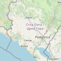


Distance from Elbasan to Podgorica
The shortest distance (air line) between Elbasan and Podgorica is 101.10mi (162.71 km)
The shortest route between Elbasan and Podgorica is 121.72 mi (195.88 km) according to the route planner. The driving time is approx. 3 h 50 m
How far is it between Elbasan and Podgorica.
Elbasan is located in Elbasan, Albaniacountry within 41° 6' 39.96" N 20° 4' 50.16" E (41.1111, 20.0806) coordinates. The local time in Elbasan is 14:49 (12.07.2025)
Podgorica is located in Crna Gora, Montenegrocountry within 42° 26' 28.68" N 19° 15' 46.44" E (42.4413, 19.2629) coordinates. The local time in Podgorica is 14:49 (12.07.2025)
The calculated flying distance from Elbasan to Podgorica is 101.10miles which is equal to 162.71 km.
If you want to go by car, the driving driving distance between Elbasan and Podgorica is 121.72 miles (195.88 km). If you ride your car with an average speef of 112 kilometers/hour (70 miles/h), travel time will be 1 hours 45 minutes.Please check the avg.speed travel time on the right for various options
Estimated Travel Time Between Elbasan and Podgorica
| Average speed | Travel Time |
|---|---|
| 30 mph (48 km/h) | 4 hours 3 minutes |
| 40 mph (64 km/h) | 3 hours 3 minutes |
| 50 mph (80 km/h) | 2 hours 26 minutes |
| 60 mph (67 km/h) | 2 hours 2 minutes |
| 70 mph (112 km/h) | 1 hours 44 minutes |
| 75 mph (120 km/h) | 1 hours 37 minutes |
Related Distances from Elbasan
| Cities | Distance |
|---|---|
| Elbasan to Librazhd-Qender | 14.53 mi (23.38 km) |
| Elbasan to Tirana | 20.32 mi (32.71 km) |
| Elbasan to Kucove | 22.93 mi (36.90 km) |
| Elbasan to Lushnje | 23.34 mi (37.55 km) |
| Elbasan to Kamez | 24.89 mi (40.06 km) |
| Elbasan to Kavaje | 27.46 mi (44.19 km) |
| Elbasan to Berat | 29.21 mi (47.01 km) |
| Elbasan to Kruje | 30.56 mi (49.19 km) |
| Elbasan to Fushe-Kruje | 31.91 mi (51.35 km) |
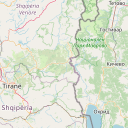
| Elbasan to Pogradec | 33.08 mi (53.23 km) |
| Elbasan to Sukth | 34.09 mi (54.86 km) |
| Elbasan to Burrel | 34.54 mi (55.59 km) |
| Elbasan to Bucimas | 34.77 mi (55.95 km) |
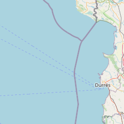
| Elbasan to Durres | 36.09 mi (58.08 km) |
| Elbasan to Fier | 38.19 mi (61.46 km) |
| Elbasan to Patos | 38.22 mi (61.51 km) |
| Elbasan to Lac | 40.93 mi (65.86 km) |
| Elbasan to Peshkopi | 43.44 mi (69.92 km) |
| Elbasan to Korce | 49.52 mi (79.69 km) |
| Elbasan to Lezhe | 51.56 mi (82.98 km) |
| Elbasan to Vlore | 54.39 mi (87.54 km) |
| Elbasan to Kukes | 69.38 mi (111.66 km) |
| Elbasan to Gjirokaster | 72.21 mi (116.22 km) |
| Elbasan to Shkoder | 72.36 mi (116.45 km) |
| Elbasan to Sarande | 85.49 mi (137.58 km) |
Podgorica, Crna Gora, Montenegro
Related Distances to Podgorica
| Cities | Distance |
|---|---|
| Tuzi to Podgorica | 6.29 mi (10.12 km) |
| Golubovci to Podgorica | 7.63 mi (12.28 km) |
| Danilovgrad to Podgorica | 15.92 mi (25.62 km) |
| Cetinje to Podgorica | 18.00 mi (28.97 km) |
| Budva to Podgorica | 23.93 mi (38.51 km) |
| Bar to Podgorica | 25.01 mi (40.25 km) |
| Kotor to Podgorica | 25.15 mi (40.47 km) |
| Niksic to Podgorica | 28.17 mi (45.34 km) |
| Tivat to Podgorica | 28.71 mi (46.21 km) |
| Kolasin to Podgorica | 29.53 mi (47.52 km) |
| Gusinje to Podgorica | 30.26 mi (48.69 km) |
| Andrijevica to Podgorica | 33.42 mi (53.78 km) |
| Savnik to Podgorica | 36.11 mi (58.11 km) |
| Plav to Podgorica | 36.18 mi (58.23 km) |
| Herceg Novi to Podgorica | 37.31 mi (60.05 km) |
| Mojkovac to Podgorica | 39.29 mi (63.23 km) |
| Berane to Podgorica | 40.99 mi (65.96 km) |
| Petnjica to Podgorica | 48.10 mi (77.41 km) |
| Bijelo Polje to Podgorica | 48.19 mi (77.55 km) |
| Zabljak to Podgorica | 49.84 mi (80.20 km) |
| Rozaje to Podgorica | 53.27 mi (85.73 km) |
| Pluzine to Podgorica | 53.66 mi (86.36 km) |
| Pljevlja to Podgorica | 63.43 mi (102.08 km) |
 Accedi con Google