


Distance Calculator


Distance from Greiz to London
The shortest distance (air line) between Greiz and London is 537.66mi (865.27 km)
The shortest route between Greiz and London is 650.03 mi (1046.12 km) according to the route planner. The driving time is approx. 11 h 31 m
How far is it between Greiz and London.
Greiz is located in Greiz, Germanycountry within 50° 39' 16.92" N 12° 11' 58.92" E (50.6547, 12.1997) coordinates. The local time in Greiz is 13:35 (12.08.2025)
London is located in Westminster, United Kingdomcountry within 51° 30' 25.92" N -1° 52' 21" W (51.5072, -0.1275) coordinates. The local time in London is 12:35 (12.08.2025)
The calculated flying distance from Greiz to London is 537.66miles which is equal to 865.27 km.
If you want to go by car, the driving driving distance between Greiz and London is 650.03 miles (1046.12 km). If you ride your car with an average speef of 112 kilometers/hour (70 miles/h), travel time will be 9 hours 20 minutes.Please check the avg.speed travel time on the right for various options
Estimated Travel Time Between Greiz and London
| Average speed | Travel Time |
|---|---|
| 30 mph (48 km/h) | 21 hours 40 minutes |
| 40 mph (64 km/h) | 16 hours 15 minutes |
| 50 mph (80 km/h) | 13 hours 0 minutes |
| 60 mph (67 km/h) | 10 hours 50 minutes |
| 70 mph (112 km/h) | 9 hours 17 minutes |
| 75 mph (120 km/h) | 8 hours 40 minutes |
Related Distances from Greiz
| Cities | Distance |
|---|---|
| Greiz to Leipzig | 47.96 mi (77.18 km) |
| Greiz to Dresden | 72.53 mi (116.72 km) |
| Greiz to Nuremberg | 96.75 mi (155.71 km) |
| Greiz to Berlin | 138.87 mi (223.50 km) |
| Greiz to Hannover | 159.33 mi (256.42 km) |
| Greiz to Frankfurt | 159.45 mi (256.61 km) |
| Greiz to Augsburg | 168.38 mi (270.98 km) |
| Greiz to Munich | 176.17 mi (283.52 km) |
| Greiz to Wiesbaden | 178.91 mi (287.92 km) |
| Greiz to Mannheim | 184.13 mi (296.33 km) |
| Greiz to Bielefeld | 184.19 mi (296.43 km) |
| Greiz to Stuttgart | 187.11 mi (301.13 km) |
| Greiz to Karlsruhe | 203.78 mi (327.95 km) |
| Greiz to Dortmund | 213.83 mi (344.13 km) |
| Greiz to Munster | 217.20 mi (349.54 km) |
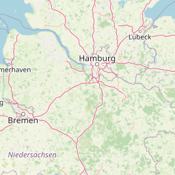
| Greiz to Hamburg | 220.73 mi (355.23 km) |
| Greiz to Bremen | 221.75 mi (356.86 km) |
| Greiz to Wuppertal | 222.32 mi (357.79 km) |
| Greiz to Bonn | 223.23 mi (359.25 km) |
| Greiz to Bochum | 223.76 mi (360.11 km) |
| Greiz to Gelsenkirchen | 229.15 mi (368.79 km) |
| Greiz to Cologne | 229.92 mi (370.03 km) |
| Greiz to Essen | 231.83 mi (373.09 km) |
| Greiz to Dusseldorf | 239.11 mi (384.80 km) |
| Greiz to Duisburg | 242.20 mi (389.78 km) |
London, Westminster, United Kingdom
Related Distances to London
| Cities | Distance |
|---|---|
| Reading to London | 36.57 mi (58.85 km) |
| Worthing to London | 49.00 mi (78.86 km) |
| Portsmouth to London | 63.86 mi (102.77 km) |
| Ipswich to London | 66.81 mi (107.52 km) |
| Southampton to London | 69.28 mi (111.50 km) |
| Coventry to London | 85.69 mi (137.90 km) |
| Leicester to London | 88.80 mi (142.90 km) |
| Birmingham to London | 101.09 mi (162.69 km) |
| Bristol to London | 106.34 mi (171.14 km) |
| Nottingham to London | 108.88 mi (175.23 km) |
| Caerdydd to London | 131.28 mi (211.27 km) |
| Stoke-on-Trent to London | 134.89 mi (217.09 km) |
| Sheffield to London | 141.26 mi (227.34 km) |
| Kingston upon Hull to London | 154.81 mi (249.15 km) |
| Stockport to London | 156.51 mi (251.88 km) |
| Manchester to London | 162.79 mi (261.98 km) |
| Leeds to London | 169.27 mi (272.42 km) |
| Bradford to London | 172.39 mi (277.43 km) |
| Bolton to London | 172.68 mi (277.90 km) |
| Liverpool to London | 178.25 mi (286.86 km) |
| Sunderland to London | 240.48 mi (387.02 km) |
| Newcastle to London | 247.64 mi (398.53 km) |
| Belfast to London | 321.73 mi (517.78 km) |
| Edinburgh to London | 331.63 mi (533.70 km) |
| Glasgow to London | 344.75 mi (554.83 km) |
 Accedi con Google