


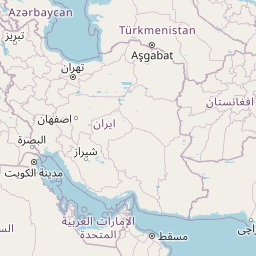
Distance Calculator
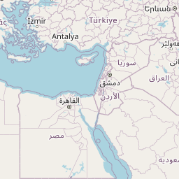


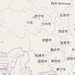


NH52, جاده هرات-قندهار
8401.4 km, 105 h
| Head north | 2 km | |
| Turn left | 250 m | |
| Go straight onto Church Road | 350 m | |
| Turn left to stay on Church Road | 700 m | |
| Turn right | 250 m | |
| Turn left | 200 m | |
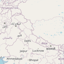
| Turn slight left onto Salem - Kochi - Kanyakumari Road (NH66) | 5 km | |
| Continue onto Chavara Road Bridge (NH66) | 3.5 km | |
| Keep left onto Salem - Kochi - Kanyakumari Road (NH66) | 55 km | |
| Continue onto Railway Over Bridge over NH (NH66) | 700 m | |
| Continue onto Salem-Kochi-Kanyakumari Road NH66 (NH66) | 15 km | |
| Go straight onto Salem - Kochi - Kanyakumari Road (NH66) | 7 km | |
| Turn left onto Salem - Kochi - Kanyakumari Road (NH66) | 2 km | |
| Make a slight left | 450 m | |
| Make a slight left onto Salem - Kochi - Kanyakumari Road (NH66) | 5 km | |
| Merge right onto Salem - Kochi - Kanyakumari Road (NH66) | 4 km | |
| Make a slight left onto Salem - Kochi - Kanyakumari Road (NH66) | 30 km | |
| Continue onto Vytilla Flyover (NH66) | 700 m | |
| Continue onto Salem - Kochi - Kanyakumari Road (NH66) | 5.5 km | |
| Turn left onto Edapally Market Road | 200 m | |
| Make a slight right onto MAJ-Church Road | 150 m | |
| Turn left onto NH-544 | 50 m | |
| Make a U-turn and continue on NH-544 | 90 m | |
| Continue onto Edapally Overbridge | 700 m | |
| Continue onto Salem - Kochi - Kanyakumari Highway (NH544) | 15 km | |
| Continue straight to stay on Salem - Kochi - Kanyakumari Highway (NH544) | 45 km | |
| Take the ramp on the left | 1 km | |
| Make a slight left | 50 m | |
| Continue onto Thrissur-Mamangalam Road | 3.5 km | |
| Continue slightly left onto Mannamangalam Road | 1 km | |
| Turn right onto Mannamangalam Road | 150 m | |
| Enter the traffic circle and take the 2nd exit | 25 m | |
| Exit the traffic circle | 50 m | |
| Continue slightly left onto BC Bishop House Road | 150 m | |
| Enter the traffic circle and take the 1st exit onto MDR | 3.5 m | |
| Exit the traffic circle onto MDR | 700 m | |
| Turn right onto St. Mary's College Road | 900 m | |
| Make a slight left | 150 m | |
| Continue onto Regional theatre Road | 350 m | |
| Turn left onto Sitaram Mill Road (SH69) | 250 m | |
| Make a slight left to stay on Sitaram Mill Road (SH69) | 200 m | |
| Enter Ashwini Roundabout and take the 3rd exit onto Kovilakam Padam Road (MDR) | 60 m | |
| Exit the traffic circle onto Kovilakam Padam Road (MDR) | 900 m | |
| Turn right onto Kodungallur-Shornur Road (SH22) | 200 m | |
| Continue onto Peringaaavu (SH22) | 300 m | |
| Continue onto Kodungallur - Shornur Road (SH22) | 1 km | |
| Continue onto Kodungallur-Shornur Road (SH22) | 7 km | |
| Continue onto Shornur Road (SH22) | 5.5 km | |
| Continue onto Kodungallur - Shornur Road (SH22) | 7 km | |
| Make a slight left to stay on Kodungallur - Shornur Road (SH22) | 9 km | |
| Turn right onto Shornur - Perinthalmanna Road (SH23) | 2.5 km | |
| Turn left onto Shornur - Pattambi Road (SH23) | 3.5 km | |
| Continue onto Shornur - Perinthalmanna Road (SH23) | 8 km | |
| Turn right onto Perumbilavu-Nilambur Road (SH39) | 10 km | |
| Continue onto PERINTHALMANNA - PATTAMBI Road (SH39) | 200 m | |
| Turn right to stay on PERINTHALMANNA - PATTAMBI Road (SH39) | 10 km | |
| Turn left onto Perumbilavu-Nilambur Road (State Highway 39) | 350 m | |
| Turn left to stay on Perumbilavu-Nilambur Road (State Highway 39) | 1 km | |
| Continue onto Perinthalmanna-Nilambur Road (SH73) | 1.5 km | |
| Continue onto Perumbilavu-Nilambur Road (SH39) | 3.5 km | |
| Keep left onto Valanchery - Nilambur Road (SH73) | 6 km | |
| Continue onto Perinthalmanna - pandikkad Road (SH73) | 2 km | |
| Make a slight right to stay on Perinthalmanna - pandikkad Road (SH73) | 550 m | |
| Continue straight to stay on Perinthalmanna - pandikkad Road (SH73) | 1 km | |
| Continue onto Valanchery - Nilambur Road (SH73) | 10 km | |
| Continue onto Wandoor - Nilambur Road (SH73) | 1.5 km | |
| Turn left onto Wandoor - Nilambur Road (SH73) | 7 km | |
| Continue slightly right onto Kozhikode - Nilmbur - Gudallur Road (SH28) | 2.5 km | |
| Continue onto Kozhikode - Nilambur - Gudallur Road (SH28) | 150 m | |
| Turn right onto Mini Bypass Nilambur Road | 700 m | |
| Turn left onto VK Road | 20 m | |
| Turn right | 100 m | |
| Turn right onto Kozhikode - Nilambur - Gudallur Road (SH28) | 15 km | |
| Continue onto Kozhikode - Nilmbur - Gudallur Road (SH28) | 15 km | |
| Continue left onto Calicut - Nilambur - Gudalur Road (SH11) | 6 km | |
| Turn right onto Calicut - Vythiri - Gudalur Road (SH12) | 10 km | |
| Make a slight right to stay on Calicut - Vythiri - Gudalur Road (SH12) | 1 km | |
| Turn left onto Gundlupet-Gudallur-Coimbatore Road (NH181) | 450 m | |
| Make a slight left onto Gundlupet-Gudallur-Coimbatore Rd (NH181) | 30 m | |
| Keep left onto Gundlupet-Gudallur-Coimbatore Road (NH181) | 15 km | |
| Continue left onto Gundlupet-Gudallur-Coimbatore Rd (NH181) | 5 km | |
| Continue onto Gundlupet-Gudallur-Coimbatore Road (NH181) | 10 km | |
| Continue onto Gundlupet-Gudallur-Coimbatore Rd (NH181) | 1.5 km | |
| Make a slight left onto Gundlupet - Coimbatore Highway (NH181) | 150 m | |
| Continue onto Gundlupet-Gudallur-Coimbatore Rd (NH181) | 10 km | |
| Continue onto Kozhikode - Mysuru Highway (NH766) | 30 km | |
| Continue onto Mysore Ooty Highway (NH766) | 6 km | |
| Continue onto Kozhikode - Kollegal Highway (NH766) | 1.5 km | |
| Make a slight right to stay on Kozhikode - Kollegal Highway (NH766) | 15 km | |
| Continue onto Ooty Road | 3.5 km | |
| Continue straight | 1 km | |
| Turn left | 200 m | |
| Enter the traffic circle and take the 3rd exit | 50 m | |
| Exit the traffic circle | 150 m | |
| Continue onto Palace Road | 700 m | |
| Enter Hardinge Circle and take the 2nd exit onto Bangalore Nilgiri Road | 60 m | |
| Exit the traffic circle onto Bangalore Nilgiri Road | 700 m | |
| Enter the traffic circle and take the 2nd exit onto Bangalore Nilgiri Road | 30 m | |
| Exit the traffic circle onto Bangalore Nilgiri Road | 450 m | |
| Enter the traffic circle and take the 2nd exit | 25 m | |
| Exit the traffic circle | 350 m | |
| Turn right onto Ashoka Road | 500 m | |
| Enter the traffic circle and take the 1st exit onto Ashoka Road | 15 m | |
| Exit the traffic circle onto Ashoka Road | 800 m | |
| Enter T. N. Narasimhamurthy Circle and take the 2nd exit | 70 m | |
| Exit the traffic circle | 60 m | |
| Go straight onto Bannimantapa Road | 1.5 km | |
| Make a slight right to stay on Bannimantapa Road | 700 m | |
| Turn left onto Bangalore Road | 350 m | |
| Continue onto Bangalore - Mysore Expressway | 2 km | |
| Continue onto Bengaluru-Mysuru Expressway (NH275) | 2.5 km | |
| Take the ramp on the left | 40 m | |
| Go straight onto Bangalore-Mysore Road (NH150A) | 1 km | |
| Continue straight to stay on Bangalore-Mysore Road (NH150A) | 2.5 km | |
| Enter the traffic circle and take the 2nd exit onto Bangalore-Mysore Road (NH150A) | 35 m | |
| Exit the traffic circle onto Bangalore-Mysore Road (NH150A) | 15 km | |
| Turn right onto NH150A | 250 m | |
| Turn left onto NH150A | 25 km | |
| Make a slight right onto NH150A | 30 km | |
| Keep right onto NH150A | 15 km | |
| Make a slight left onto NH150A | 15 km | |
| Turn right onto NH150A | 50 km | |
| Merge left onto NH69 | 1.5 km | |
| Make a slight right | 900 m | |
| Turn right onto NH150A | 45 km | |
| Turn right | 200 m | |
| Make a U-turn onto NH48 | 45 km | |
| Take the ramp on the left towards NH50 | 350 m | |
| Merge right onto NH50 | 150 km | |
| Take the ramp onto NH67 | 30 m | |
| Keep left onto Bijapur Road (NH50) | 200 km | |
| Continue straight | 800 m | |
| Continue straight | 150 m | |
| Turn left onto NH561A | 80 km | |
| Turn right onto NH561A | 1.5 km | |
| Turn left onto NH561A | 25 km | |
| Turn left onto Shivaji Chowk (NH561A) | 500 m | |
| Turn left onto NH965C | 500 m | |
| Make a sharp right to stay on NH965 | 150 m | |
| Turn right onto NH561A | 2.5 km | |
| Turn left onto NH561A | 35 km | |
| Turn left onto NH561A | 6 km | |
| Keep left onto NH561A | 400 m | |
| Turn right onto NH561A | 25 km | |
| Turn right onto NH561A | 20 km | |
| Go straight onto SH141 | 1.5 km | |
| Make a slight left onto SH141 | 600 m | |
| Continue onto NH561A | 70 km | |
| Make a slight left | 1.5 km | |
| Go straight onto NH561A | 25 km | |
| Continue straight | 700 m | |
| Make a sharp right | 700 m | |
| Continue slightly left onto Ahmednagar Loni Dhanora Road (NH753F) | 1 km | |
| Turn left onto Ahmednagar Loni Dhanora Road | 1.5 km | |
| Make a slight right onto Ahmednagar Loni Dhanora Road (SH10) | 4 km | |
| Continue onto State Highway 10;State Highway 145 (SH10) | 7 km | |
| Turn slight left onto NH160 | 30 m | |
| Turn right onto NH160 | 45 km | |
| Keep right onto NH160 | 30 km | |
| Continue onto NH752G | 25 km | |
| Make a slight right onto NH752G | 25 km | |
| Keep right onto NH753J | 100 m | |
| Go straight onto State Highway 10 (NH160H) | 30 km | |
| Turn right | 800 m | |
| Merge right onto Malegaon Bypass (NH60) | 50 km | |
| Keep right onto Flyover (NH60) | 15 km | |
| Continue onto NH52 | 10 km | |
| Go straight onto NH52 | 3 km | |
| Go straight onto NH52 | 10 km | |
| Make a slight right onto NH52 | 100 km | |
| Go straight onto NH52 | 40 km | |
| Keep right onto NH52 | 60 km | |
| Make a slight left | 450 m | |
| Enter the traffic circle and take the 2nd exit onto A. B. Road (MD4511) | 45 m | |
| Exit the traffic circle onto A. B. Road (MD4511) | 5.5 km | |
| Turn left onto Flyover | 500 m | |
| Turn right onto Flyover | 450 m | |
| Continue onto Annapurna Road | 3 km | |
| Turn left onto Mhow Naka Square | 10 m | |
| Turn left onto MOG LINES | 900 m | |
| Turn left | 100 m | |
| Go straight onto Netaji Subash Marg | 250 m | |
| Enter the traffic circle and take the 2nd exit | 10 m | |
| Exit the traffic circle | 1 km | |
| Turn left | 350 m | |
| Turn right | 700 m | |
| Turn right onto MD4513 | 400 m | |
| Turn left onto SH59 | 50 km | |
| Continue straight | 2 km | |
| Enter the traffic circle and take the 2nd exit | 60 m | |
| Exit the traffic circle | 150 m | |
| Continue onto Hari phatak bridge | 300 m | |
| Turn right | 800 m | |
| Enter the traffic circle and take the 2nd exit | 9 m | |
| Exit the traffic circle | 100 m | |
| Continue straight | 600 m | |
| Turn slight right onto Agar Road | 700 m | |
| Turn slight right onto Agar Road | 350 m | |
| Continue straight | 600 m | |
| Enter the traffic circle and take the 1st exit | 20 m | |
| Exit the traffic circle | 70 m | |
| Continue straight | 3.5 km | |
| Continue onto NH552G | 60 km | |
| Go straight onto NH552G | 30 km | |
| Keep left onto NH552G | 70 km | |
| Take the ramp on the left | 400 m | |
| Merge right onto NH52 | 80 km | |
| Take the ramp on the left onto NH52 | 500 m | |
| Go straight onto Kota Bypass (NH27) | 10 km | |
| Keep right onto NH27 | 150 m | |
| Keep left at the fork | 900 m | |
| Continue onto NH52 | 50 km | |
| Go straight onto NH52 | 30 km | |
| Keep right onto NH52 | 150 km | |
| Go straight onto Tonk Road Flyover (NH52) | 7 km | |
| Continue onto Jaipur - Kota Highway (NH52) | 2 km | |
| Continue onto Bambala Bridge (NH52) | 3 km | |
| Make a slight right onto Tonk Road Flyover | 7 km | |
| Continue onto Sawai Mansingh Road | 4.5 km | |
| Turn right onto Mirza Ismail Road | 1.5 km | |
| Turn left onto Ghat Darwaja Bazaar Road | 900 m | |
| Enter the traffic circle and take the 3rd exit onto Sujrapol Bazaar Road | 90 m | |
| Exit the traffic circle onto Sujrapol Bazaar Road | 900 m | |
| Go straight onto Galta Road | 450 m | |
| Turn left onto Jamwa Ramgarh Road (NH248) | 3.5 km | |
| Enter the traffic circle and take the 2nd exit onto New Rambah Road (NH248) | 30 m | |
| Exit the traffic circle onto New Rambah Road (NH248) | 80 m | |
| Continue onto Jamwa Ramgarh Road (NH248) | 35 km | |
| Merge left onto Jaipur Bypass (NH48) | 350 m | |
| Continue onto Amer Road (NH48) | 7 km | |
| Keep right onto Amer Road (NH48) | 70 km | |
| Turn left onto Narnaul-Bathinda Expressway (NH148B) | 100 m | |
| Keep left onto Narnaul-Bathinda Expressway (NH148B) | 30 km | |
| Keep left onto Narnaul-Bathinda Expressway (NH148B) | 800 m | |
| Take the ramp | 55 m | |
| Merge left onto Narnaul-Bathinda Expressway (NH148B) | 30 m | |
| Turn left | 6 km | |
| Take the ramp on the right | 2.5 km | |
| Continue onto Narnaul Outer Ring Road | 1.5 km | |
| Take the ramp on the left | 2.5 km | |
| Keep right at the fork | 700 m | |
| Keep left towards NH152D | 1 km | |
| Continue onto Trans Haryana Expressway (NH152D) | 100 km | |
| Take the ramp on the left towards NH352 | 300 m | |
| Keep right towards NH352 North | 700 m | |
| Merge right onto NH352 | 25 km | |
| Keep right onto NH352 | 40 km | |
| Continue onto NH52 | 45 km | |
| Turn left onto NH52 | 35 km | |
| Turn left | 450 m | |
| Go straight onto Sangrur Bypass (NH7) | 35 km | |
| Continue onto Bathinda Road (NH7) | 2 km | |
| Keep left onto NH703 | 70 km | |
| Take the ramp on the left | 600 m | |
| Turn right | 50 m | |
| Enter the traffic circle and take the 1st exit onto NH703B | 2.5 m | |
| Exit the traffic circle onto NH703B | 10 km | |
| Enter the traffic circle and take the 2nd exit onto NH703B | 20 m | |
| Exit the traffic circle onto NH703B | 25 km | |
| Merge right onto NH703A | 2.5 km | |
| Continue onto NH54 | 9 km | |
| Keep left onto NH703B | 300 m | |
| Turn left onto NH703B | 30 km | |
| Turn right onto NH354 | 20 km | |
| Turn left onto MDR61 | 25 km | |
| Make a slight left to stay on Attari - Chabhal Road (MDR61) | 1.5 km | |
| Turn left onto GT Road;Sher Shah Suri Marg (NH3) | 1 km | |
| Turn left | 70 m | |
| Turn right | 300 m | |
| Turn right | 450 m | |
| Turn right | 150 m | |
| Turn left onto Grand Trunk Road گرینڈ ٹرنک روڈ (N-5) | 25 m | |
| Keep left onto Grand Trunk Road گرینڈ ٹرنک روڈ (N-5) | 500 m | |
| Continue straight | 250 m | |
| Turn left onto گرینڈ ٹرنک روڈ | 7 m | |
| Turn right to stay on گرینڈ ٹرنک روڈ | 10 km | |
| Take the ramp | 900 m | |
| Merge right onto لاہور رنگ روڈ (L-20) | 20 km | |
| Take the ramp onto لاہور رنگ روڈ (L-20) | 20 m | |
| Make a slight right | 1 km | |
| Merge right onto ایم 2 موٹروے (M-2) | 2 km | |
| Take the ramp on the left towards M-3: ملتان | 3 km | |
| Continue onto ایم 3 موٹروے (M-3) | 200 km | |
| Take exit 6 on the left towards P-4: ٹوبہ ٹیک سنگھ | 1.5 km | |
| Turn right onto Rajana-Kamalia-Chichawati Road (P-4) | 2 km | |
| Continue onto T.T Singh-Rajana Road (P-4) | 15 km | |
| Continue onto T.T Singh-Jhang Road (P-4) | 350 m | |
| Turn left onto علامہ اقبال روڈ | 150 m | |
| Turn right onto Akal Wala Road | 1.5 km | |
| Continue onto Akalwala Road | 30 km | |
| Turn right onto خانیوال روڈ (P-2) | 2 km | |
| Make a sharp left onto Jhang Bhakkar Road | 7 km | |
| Turn left to stay on Jhang Bhakkar Road | 2 km | |
| Turn right to stay on Jhang Bhakkar Road | 4.5 km | |
| Continue right onto Jhang-Bhakkar Road | 1 km | |
| Continue straight to stay on Jhang-Bhakkar Road | 90 km | |
| Continue onto Jhang Bhakkar Road | 20 km | |
| Make a sharp right | 50 m | |
| Turn left onto Darya Khan Road | 10 km | |
| Turn left onto D.I. Khan Road | 15 km | |
| Continue onto Bhakkar Road | 7 km | |
| Make a slight left | 70 m | |
| Enter the traffic circle and take the 1st exit onto قومی شاہراہ 55 (N-55) | 40 m | |
| Exit the traffic circle onto قومی شاہراہ 55 (N-55) | 5.5 km | |
| Turn left onto Daraban Road (N-50) | 50 km | |
| Turn right onto N-50 | 35 km | |
| Go straight onto N-50 | 6 km | |
| Go straight onto N-50 | 100 km | |
| Turn left to stay on D.I. Khan Road (N-50) | 1 km | |
| Continue straight to stay on D.I. Khan Road (N-50) | 550 m | |
| Turn left onto قلعہ سیف اللہ روڈ (N-50) | 350 m | |
| Turn right to stay on قلعہ سیف اللہ روڈ (N-50) | 100 m | |
| Make a slight left to stay on قلعہ سیف اللہ روڈ (N-50) | 40 km | |
| Continue onto کچلاک - ژوب شاہراہ (N-50) | 55 km | |
| Continue straight to stay on کچلاک - ژوب شاہراہ (N-50) | 200 km | |
| Make a slight right to stay on کچلاک - ژوب شاہراہ (N-50) | 20 km | |
| Turn right onto Bostan Road | 10 km | |
| Turn right onto قومی شاہراہ 25 (N-25) | 2 km | |
| Make a slight left to stay on قومی شاہراہ 25 (N-25) | 20 km | |
| Continue straight to stay on قومی شاہراہ 25 (N-25) | 60 km | |
| Turn right | 150 m | |
| Turn right | 150 m | |
| Turn left | 2 km | |
| Continue right onto د کندهار سپین بولدک لاره (N-25) | 80 km | |
| Keep right onto د کندهار سپین بولدک لاره (NH37) | 5.5 km | |
| Enter the traffic circle and take the 2nd exit onto د کندهار سپین بولدک لاره (NH37) | 70 m | |
| Exit the traffic circle onto د کندهار سپین بولدک لاره (NH37) | 15 km | |
| Enter the traffic circle and take the 2nd exit onto د کندهار - غزني لويه لار (NH0101) | 250 m | |
| Exit the traffic circle onto د کندهار - غزني لويه لار (NH0101) | 4.5 km | |
| Enter the traffic circle and take the 3rd exit onto د کندهار - غزني لويه لار (NH0101) | 35 m | |
| Exit the traffic circle onto د کندهار - غزني لويه لار (NH0101) | 600 m | |
| Enter the traffic circle and take the 1st exit onto د کندهار - غزني لويه لار (NH0101) | 15 m | |
| Exit the traffic circle onto د کندهار - غزني لويه لار (NH0101) | 350 m | |
| Enter the traffic circle and take the 2nd exit onto د کندهار-هرات لويه لاره (NH0102) | 45 m | |
| Exit the traffic circle onto د کندهار-هرات لويه لاره (NH0102) | 350 m | |
| Make a slight right to stay on د کندهار-هرات لويه لاره (NH0102) | 2.5 km | |
| Enter the traffic circle and take the 2nd exit onto د کندهار - هرات لويه لار (NH0102) | 100 m | |
| Exit the traffic circle onto د کندهار - هرات لويه لار (NH0102) | 100 km | |
| Make a slight right onto جاده هرات-قندهار (NH0102) | 450 km | |
| Enter the traffic circle and take the 2nd exit onto بلوار قهرمان ملی (NH0102) | 25 m | |
| Exit the traffic circle onto بلوار قهرمان ملی (NH0102) | 15 km | |
| Enter میدان یادگار قربانیان جنگ افغانستان and take the 2nd exit onto بلوار قهرمان ملی (NH0102) | 25 m | |
| Exit the traffic circle onto بلوار قهرمان ملی (NH0102) | 250 m | |
| Turn right onto بلوار احمد شاه بابا (NH0102) | 800 m | |
| Enter میدان مستوفی and take the 3rd exit onto بزرگراه هلال احمر | 60 m | |
| Exit the traffic circle onto بزرگراه هلال احمر | 2.5 km | |
| Continue onto بزرگراه رودکی (خیابان باغ ملت) (NH65) | 2.5 km | |
| Turn left onto بلوار جامی | 800 m | |
| Enter the traffic circle and take the 1st exit onto 122.064 km Islam Qalah Road from Chowk Tank Tayl Mowlawy to <Null> (NH63) | 15 m | |
| Exit the traffic circle onto 122.064 km Islam Qalah Road from Chowk Tank Tayl Mowlawy to <Null> (NH63) | 35 m | |
| Go straight onto بزرگراه هرات-اسلام قلعه (NH63) | 100 km | |
| Turn right | 3 km | |
| Enter the traffic circle and take the 1st exit onto بزرگراه هرات-اسلام قلعه (NH63) | 55 m | |
| Exit the traffic circle onto بزرگراه هرات-اسلام قلعه (NH63) | 450 m | |
| Take the ramp onto بزرگراه هرات-اسلام قلعه (NH63) | 300 m | |
| Continue onto 36 | 450 m | |
| Enter the traffic circle and take the 2nd exit | 30 m | |
| Exit the traffic circle | 350 m | |
| Continue straight | 3.5 km | |
| Continue onto ایست و بازرسی ۱۷ شهریور (36) | 400 m | |
| Continue onto دوغارون - تایباد (36) | 15 km | |
| Enter میدان پیر هرات and take the 1st exit onto بلوار شهید قاسم سلیمانی (36) | 20 m | |
| Exit the traffic circle onto بلوار شهید قاسم سلیمانی (36) | 3 km | |
| Enter میدان امام رضا and take the 1st exit onto تایباد - تربت جام | 15 m | |
| Exit the traffic circle onto تایباد - تربت جام | 10 km | |
| Continue onto تربت جام - تایباد (97) | 45 km | |
| Keep left onto کمربندی تربت جام (97) | 15 km | |
| Continue onto بزرگراه تربت جام - مشهد (97) | 30 km | |
| Enter the traffic circle and take the 1st exit onto بلوار امام رضا (97) | 90 m | |
| Exit the traffic circle onto بلوار امام رضا (97) | 2 km | |
| Enter the traffic circle and take the 1st exit onto 97 | 80 m | |
| Exit the traffic circle onto 97 | 50 km | |
| Enter میدان بسیج and take the 2nd exit onto کمربندی شهید سلیمانی | 100 m | |
| Exit the traffic circle onto کمربندی شهید سلیمانی | 1.5 km | |
| Enter میدان شهید مطهری and take the 2nd exit onto کمربندی شهید سلیمانی | 90 m | |
| Exit the traffic circle onto کمربندی شهید سلیمانی | 1.5 km | |
| Enter میدان الغدیر and take the 2nd exit onto جاده فریمان - مشهد (97) | 150 m | |
| Exit the traffic circle onto جاده فریمان - مشهد (97) | 45 km | |
| Take the ramp on the left | 600 m | |
| Merge right onto جاده مشهد - فریمان (97) | 900 m | |
| Take the ramp | 2.5 km | |
| Take the ramp | 1.5 km | |
| Merge left onto 2 | 20 km | |
| Continue onto 44 | 2 km | |
| Keep right onto مشهد - نیشابور (44) | 80 km | |
| Continue onto امام رضا (44) | 4 km | |
| Continue onto نیشابور - سبزوار (44) | 100 km | |
| Continue onto بزرگراه سبزواری (44) | 8 km | |
| Enter میدان سربداران and take the 3rd exit onto بزرگراه شهید آیت الله رئیسی (44) | 250 m | |
| Exit the traffic circle onto بزرگراه شهید آیت الله رئیسی (44) | 4 km | |
| Continue onto سبزوار - داورزن (44) | 10 km | |
| Continue onto سبزوار -داورزن (44) | 1.5 km | |
| Continue onto سبزوار - داورزن (44) | 150 km | |
| Continue towards شاهرود | 250 km | |
| Enter میدان کمربندی and take the 1st exit onto بزرگراه امام رضا (44) | 150 m | |
| Exit the traffic circle onto بزرگراه امام رضا (44) | 100 km | |
| Take the ramp on the left towards 2: آزادراه گرمسار- قم | 70 km | |
| Keep right towards 2: امام خمینی | 100 km | |
| Take the ramp towards 38: اشتهارد | 500 m | |
| Merge left onto صفادشت-اشتهارد (38) | 15 km | |
| Enter میدان شهید سلطانی and take the 2nd exit onto بلوار آیت الله خامنه ای | 80 m | |
| Exit the traffic circle onto بلوار آیت الله خامنه ای | 1 km | |
| Enter میدان معلم and take the 2nd exit onto بلوار آیت الله خامنه ای | 40 m | |
| Exit the traffic circle onto بلوار آیت الله خامنه ای | 1 km | |
| Enter میدان بسیج and take the 3rd exit onto جاده اشتهارد - بوئین زهرا | 150 m | |
| Exit the traffic circle onto جاده اشتهارد - بوئین زهرا | 25 km | |
| Enter میدان امام رضا and take the 2nd exit onto 38 | 450 m | |
| Exit the traffic circle onto 38 | 2 km | |
| Enter میدان امام حسین and take the 2nd exit onto بلوار بهشتی (38) | 80 m | |
| Exit the traffic circle onto بلوار بهشتی (38) | 2 km | |
| Enter میدان ولایت and take the 1st exit onto بوئین زهرا - دانسفهان (38) | 100 m | |
| Exit the traffic circle onto بوئین زهرا - دانسفهان (38) | 8 km | |
| Enter میدان سیمرغ and take the 1st exit onto بوئین زهرا - دانسفهان (38) | 25 m | |
| Exit the traffic circle onto بوئین زهرا - دانسفهان (38) | 20 km | |
| Keep right onto جاده تاکستان - دانسفهان | 6 km | |
| Enter the traffic circle and take the 2nd exit | 70 m | |
| Exit the traffic circle | 450 m | |
| Continue straight | 5 km | |
| Continue onto بلوار امام حسین | 2 km | |
| Continue onto B423 | 6 km | |
| Keep left onto B423 | 5.5 km | |
| Continue straight | 2 km | |
| Continue onto 32 | 15 km | |
| Make a slight right | 3.5 km | |
| Enter the traffic circle and take the 2nd exit | 50 m | |
| Exit the traffic circle | 150 m | |
| Enter the traffic circle and take the 2nd exit | 100 m | |
| Exit the traffic circle | 400 m | |
| Merge left onto آزادراه قزوین - زنجان (2) | 100 km | |
| Continue onto آزادراه پیامبر اعظم (2) | 250 km | |
| Keep left onto آزادراه پیامبر اعظم (2) | 2 km | |
| Take the ramp | 350 m | |
| Merge left onto بستان آباد - تبریز (32) | 20 km | |
| Continue onto بلوار 29 بهمن | 2 km | |
| Make a slight right onto بزرگراه استاد شهریار | 70 m | |
| Keep right onto بزرگراه استاد شهریار | 2.5 km | |
| Continue onto بزرگراه چایکنار(علامه طباطبایی) | 1 km | |
| Go straight onto بزرگراه چایکنار-علامه طباطبایی | 2 km | |
| Continue onto بزرگراه آزادگان | 3.5 km | |
| Take the ramp onto بزرگراه آذربایجان | 450 m | |
| Merge left onto بزرگراه آذربایجان | 800 m | |
| Keep left at the fork | 100 m | |
| Keep right at the fork | 800 m | |
| Merge right onto بزرگراه شهید بابایی (14) | 4 km | |
| Continue onto روگذر شهید عباس دوران (14) | 700 m | |
| Merge right onto تبریز - مرند (14) | 2 km | |
| Keep left onto جاده تبریز - مرند (14) | 25 km | |
| Enter میدان هفتم تیر and take the 2nd exit onto بزرگراه تبریز - صوفیان - مرند (14) | 90 m | |
| Exit the traffic circle onto بزرگراه تبریز - صوفیان - مرند (14) | 30 km | |
| Keep left onto جاده مرند- ایواوغلی (32) | 60 km | |
| Enter میدان سه راهی خوی and take the 1st exit onto 32 | 10 m | |
| Exit the traffic circle onto 32 | 100 km | |
| Make a sharp left | 500 m | |
| Continue onto قره ضیاالدین - ماکو - بازرگان (32) | 5 km | |
| Enter the traffic circle and take the 1st exit onto بلوار آیت الله مدرس (32) | 90 m | |
| Exit the traffic circle onto بلوار آیت الله مدرس (32) | 5 km | |
| Enter میدان امام حسین and take the 1st exit onto خیابان امام خمینی (32) | 60 m | |
| Exit the traffic circle onto خیابان امام خمینی (32) | 200 m | |
| Continue onto بلوار امام خمینی (32) | 1.5 km | |
| Continue onto بلوار رسالت (32) | 2 km | |
| Enter میدان شیر and take the 1st exit onto بلوار شهید قنبری (32) | 30 m | |
| Exit the traffic circle onto بلوار شهید قنبری (32) | 2 km | |
| Enter the traffic circle and take the 1st exit onto بلوار شهید قنبری | 70 m | |
| Exit the traffic circle onto بلوار شهید قنبری | 200 m | |
| Enter فلکه گاز and take the 1st exit onto ماکو - بازرگان | 35 m | |
| Exit the traffic circle onto ماکو - بازرگان | 7 km | |
| Keep right at the fork | 80 m | |
| Keep left at the fork | 900 m | |
| Continue slightly right onto بزرگراه هاشمی رفسنجانی (32) | 3 km | |
| Continue onto بلوار امام خمینی (32) | 2.5 km | |
| Enter the traffic circle and take the 2nd exit onto 32 | 70 m | |
| Exit the traffic circle onto 32 | 2 km | |
| Continue onto Doğubayazıt - Gürbulak Sınır Kapısı Yolu (D 100) | 30 km | |
| Merge left onto Doğubayazıt Çevre Yolu | 35 m | |
| Keep right onto Doğubayazıt Çevre Yolu (D100) | 7 km | |
| Enter Doğubayazıt - Ağrı Yolu and take the 1st exit onto Doğubayazıt - Ağrı Yolu (D100) | 25 m | |
| Exit the traffic circle onto Doğubayazıt - Ağrı Yolu (D100) | 5 km | |
| Enter Doğubayazıt - Ağrı Yolu and take the 1st exit onto Doğubayazıt - Ağrı Yolu (D100) | 30 m | |
| Exit the traffic circle onto Doğubayazıt - Ağrı Yolu (D100) | 60 km | |
| Exit the traffic circle onto Doğubayazıt - Ağrı Yolu (D100) | 20 km | |
| Continue onto Ağrı Çevre Yolu (D100) | 15 km | |
| Enter Ağrı Çevre Yolu and take the 2nd exit onto Ağrı Çevre Yolu (D100) | 30 m | |
| Exit the traffic circle onto Ağrı Çevre Yolu (D100) | 350 m | |
| Continue onto Ağrı - Erzurum Yolu (D100) | 30 km | |
| Enter Ağrı - Erzurum Yolu and take the 1st exit onto Ağrı - Erzurum Yolu (D100) | 15 m | |
| Exit the traffic circle onto Ağrı - Erzurum Yolu (D100) | 45 km | |
| Enter Ağrı - Erzurum Yolu and take the 2nd exit onto Ağrı - Erzurum Yolu (D100) | 15 m | |
| Exit the traffic circle onto Ağrı - Erzurum Yolu (D100) | 5 km | |
| Enter Ağrı - Erzurum Yolu and take the 1st exit onto Ağrı - Erzurum Yolu (D100) | 20 m | |
| Exit the traffic circle onto Ağrı - Erzurum Yolu (D100) | 8 km | |
| Continue onto Kars - Erzurum Yolu (D 100) | 10 km | |
| Enter Kars - Erzurum Yolu and take the 1st exit onto Kars - Erzurum Yolu (D 100) | 10 m | |
| Exit the traffic circle onto Kars - Erzurum Yolu (D 100) | 6 km | |
| Enter Kars - Erzurum Yolu and take the 2nd exit onto Kars - Erzurum Yolu (D 100) | 20 m | |
| Exit the traffic circle onto Kars - Erzurum Yolu (D 100) | 55 km | |
| Continue onto Erzurum Çevre Yolu (D100) | 30 km | |
| Continue onto Erzincan - Erzurum Yolu (D100) | 30 km | |
| Keep left onto Erzincan - Erzurum Yolu (D100) | 60 m | |
| Keep left onto Erzincan - Erzurum Yolu (D100) | 50 km | |
| Keep straight onto Erzincan - Erzurum Yolu (D100) | 2.5 km | |
| Keep right onto Erzincan - Erzurum Yolu (D100) | 7 km | |
| Exit the traffic circle onto Erzincan - Erzurum Yolu (D100) | 15 km | |
| Continue straight to stay on Erzincan - Erzurum Yolu (D100) | 15 km | |
| Keep right onto Erzincan - Erzurum Yolu (D100) | 40 km | |
| Continue onto Recep Tayyip Erdoğan Bulvarı (D100) | 2 km | |
| Continue onto Barış 42 Sokağı (D100) | 2.5 km | |
| Continue onto Yeni Çevre Yolu Caddesi (D100) | 15 km | |
| Continue onto Erzincan Çevre Yolu (D885) | 450 m | |
| Take the ramp towards Refahiye | 200 m | |
| Merge left onto Erzincan - Sivas Yolu | 70 km | |
| Go straight onto Sivas-Erzincan Yolu (D-100) | 15 km | |
| Continue onto D100 | 35 km | |
| Exit the traffic circle onto Samsun-Erzincan yolu (D100) | 10 km | |
| Enter the traffic circle and take the 1st exit onto Samsun-Erzincan yolu (D100) | 10 m | |
| Exit the traffic circle onto Samsun-Erzincan yolu (D100) | 10 km | |
| Continue onto Tokat-Ercincan yolu (D100) | 8 km | |
| Exit the traffic circle onto Tokat-Ercincan yolu (D100) | 15 km | |
| Continue onto Aşağıkale Tüneli (D100) | 2.5 km | |
| Enter the traffic circle and take the 1st exit onto Tokat-Ercincan yolu (D100) | 15 m | |
| Exit the traffic circle onto Tokat-Ercincan yolu (D100) | 6 km | |
| Enter the traffic circle and take the 1st exit onto Amasya-Erzincan Yolu (D100) | 10 m | |
| Exit the traffic circle onto Amasya-Erzincan Yolu (D100) | 10 km | |
| Enter the traffic circle and take the 1st exit onto Amasya-Erzincan Yolu (D100) | 15 m | |
| Exit the traffic circle onto Amasya-Erzincan Yolu (D100) | 8 km | |
| Enter the traffic circle and take the 1st exit onto D100 | 10 m | |
| Exit the traffic circle onto D100 | 5 km | |
| Enter the traffic circle and take the 2nd exit onto D100 | 10 m | |
| Exit the traffic circle onto D100 | 15 km | |
| Exit the traffic circle onto Amasya-Erzincan Yolu (D100) | 1 km | |
| Exit the traffic circle onto Amasya-Erzincan Yolu (D100) | 3 km | |
| Exit the traffic circle onto Amasya-Erzincan Yolu (D100) | 9 km | |
| Continue onto Ercincan - Amasya yolu (D100) | 4.5 km | |
| Exit the traffic circle onto Ercincan - Amasya yolu (D100) | 2.5 km | |
| Enter the traffic circle and take the 2nd exit onto Ercincan - Amasya yolu (D100) | 20 m | |
| Exit the traffic circle onto Ercincan - Amasya yolu (D100) | 4 km | |
| Continue onto Amasya-Erzincan Yolu (D100) | 7 km | |
| Keep right onto Amasya-Erzincan Yolu (D100) | 2.5 km | |
| Exit the traffic circle onto Amasya-Erzincan Yolu (D100) | 35 km | |
| Enter the traffic circle and take the 1st exit onto Amasya-Erzincan Yolu (D100) | 20 m | |
| Exit the traffic circle onto Amasya-Erzincan Yolu (D100) | 1.5 km | |
| Keep right onto Amasya-Erzincan Yolu (D100) | 1.5 km | |
| Enter the traffic circle and take the 2nd exit onto Amasya-Erzincan Yolu (D100) | 25 m | |
| Exit the traffic circle onto Amasya-Erzincan Yolu (D100) | 4 km | |
| Keep right onto Amasya-Erzincan Yolu (D100) | 700 m | |
| Make a slight left onto Amasya-Erzincan Yolu (D100) | 3 km | |
| Keep right onto Amasya-Erzincan Yolu (D100) | 3 km | |
| Enter the traffic circle and take the 2nd exit onto Amasya-Erzincan Yolu (D100) | 20 m | |
| Exit the traffic circle onto Amasya-Erzincan Yolu (D100) | 1.5 km | |
| Enter the traffic circle and take the 2nd exit onto Amasya-Erzincan Yolu (D100) | 30 m | |
| Exit the traffic circle onto Amasya-Erzincan Yolu (D100) | 30 km | |
| Enter the traffic circle and take the 1st exit onto Amasya-Erzincan Yolu (D100) | 30 m | |
| Exit the traffic circle onto Amasya-Erzincan Yolu (D100) | 3 km | |
| Enter the traffic circle and take the 1st exit onto Amasya-Erzincan Yolu (D100) | 30 m | |
| Exit the traffic circle onto Amasya-Erzincan Yolu (D100) | 3 km | |
| Enter the traffic circle and take the 2nd exit onto D100 | 35 m | |
| Exit the traffic circle onto D100 | 2 km | |
| Enter the traffic circle and take the 1st exit onto Amasya-Erzincan Yolu (D100) | 15 m | |
| Exit the traffic circle onto Amasya-Erzincan Yolu (D100) | 4 km | |
| Exit the traffic circle onto Amasya-Erzincan Yolu (D100) | 2.5 km | |
| Enter the traffic circle and take the 1st exit onto Amasya-Erzincan Yolu (D100) | 25 m | |
| Exit the traffic circle onto Amasya-Erzincan Yolu (D100) | 6 km | |
| Continue onto AMASYA YOLU (D100) | 250 m | |
| Enter the traffic circle and take the 1st exit onto AMASYA YOLU (D100) | 15 m | |
| Exit the traffic circle onto AMASYA YOLU (D100) | 6 km | |
| Enter the traffic circle and take the 2nd exit onto AMASYA YOLU (D100) | 15 m | |
| Exit the traffic circle onto AMASYA YOLU (D100) | 5.5 km | |
| Continue onto Kemal Ilıcak Caddesi (D100) | 600 m | |
| Continue onto Alparslan Türkeş Caddesi (D100) | 1.5 km | |
| Keep right onto Recep Tayyip Erdoğan Bulvarı (D100) | 4.5 km | |
| Continue onto Fatih Sultan Mehmet Caddesi (D100) | 4 km | |
| Make a slight left onto D100 | 15 km | |
| Merge left onto Suluova Otogar Kavşağı (D100) | 35 m | |
| Keep right onto İstiklal Caddesi (D100) | 20 km | |
| Keep left onto Merzifon-Osmancık yolu (D100) | 20 km | |
| Continue onto İstanbul-Samsun yolu (D100) | 15 km | |
| Keep right onto D100 | 20 km | |
| Enter the traffic circle and take the 2nd exit onto İstanbul-Samsun yolu (D100) | 20 m | |
| Exit the traffic circle onto İstanbul-Samsun yolu (D100) | 2.5 km | |
| Enter İstanbul - Samsun Yolu and take the 2nd exit onto Ömer Derindere Bulvarı (D100) | 20 m | |
| Exit the traffic circle onto Ömer Derindere Bulvarı (D100) | 200 km | |
| Continue onto İstanbul - Samsun Yolu (D100) | 15 km | |
| Continue onto İstanbul-Samsun yolu (D100) | 40 km | |
| Continue onto İstanbul-Samsun Yolu (D-100) | 7 km | |
| Continue onto D100 | 200 m | |
| Enter the traffic circle and take the 1st exit onto D100 | 25 m | |
| Exit the traffic circle onto D100 | 7 km | |
| Keep right onto D100 | 5 km | |
| Continue onto D-100 | 5.5 km | |
| Turn left | 600 m | |
| Keep right onto Yeniçağa Kavşağı | 800 m | |
| Merge left onto Anadolu Otoyolu (O-4) | 150 km | |
| Keep right onto Kuzey Marmara Otoyolu (O-7) | 100 km | |
| Keep left onto Kuzey Marmara Otoyolu (O-7) | 25 km | |
| Take the ramp onto Mecidiye Kavşağı | 3 km | |
| Keep right onto Mecidiye 1 Kavşağı | 500 m | |
| Merge left onto Anadolu Otoyolu (O-4) | 15 km | |
| Take the ramp onto İMES Köprülü Kavşağı | 400 m | |
| Keep left towards K.Bakkalköy | 350 m | |
| Keep left onto İMES Köprülü Kavşağı | 500 m | |
| Merge left onto Anadolu Otoyolu (O-4) | 1.5 km | |
| Continue onto O-1-O-2 Çamlıca Bağlantısı (O-4) | 2.5 km | |
| Continue onto Rıdvan Dedeoğlu Viyadüğü (O-4) | 450 m | |
| Continue onto O1-O2 Çamlıca Bağlantısı (O-4) | 1 km | |
| Continue onto O-1-O-2 Çamlıca Bağlantısı (O-4) | 2 km | |
| Take the ramp onto Çamlıca Kavşağı | 1 km | |
| Keep left onto Çamlıca Kavşağı | 300 m | |
| Merge left onto 1. Çevre Yolu (O-1) | 350 m | |
| Take the ramp onto Uzunçayır Köprülü Kavşağı | 300 m | |
| Keep left onto Uzunçayır Köprülü Kavşağı | 700 m | |
| Merge left onto Eski D-100 Karayolu | 1.5 km | |
| Take the ramp | 200 m | |
| Continue onto Avrasya Tüneli | 6 km | |
| Make a slight right | 200 m | |
| Go straight onto Kennedy Caddesi | 350 m | |
| Make a slight right towards Aksaray | 250 m | |
| Continue onto Gazi Mustafa Kemalpaşa Caddesi | 700 m | |
| Continue towards Fatih | 300 m | |
| Make a slight right | 250 m | |
| Go straight towards Vezneciler | 60 m | |
| You have arrived at your destination, on the right | 0 m |
NH44, جاده هرات-قندهار
8740.2 km, 109 h
| Head north | 2 km | |
| Turn left | 250 m | |
| Go straight onto Church Road | 350 m | |
| Turn left to stay on Church Road | 700 m | |
| Turn right | 250 m | |
| Turn left | 200 m | |
| Turn slight left onto Salem - Kochi - Kanyakumari Road (NH66) | 5 km | |
| Continue onto Chavara Road Bridge (NH66) | 3.5 km | |
| Keep left onto Salem - Kochi - Kanyakumari Road (NH66) | 55 km | |
| Continue onto Railway Over Bridge over NH (NH66) | 700 m | |
| Continue onto Salem-Kochi-Kanyakumari Road NH66 (NH66) | 15 km | |
| Go straight onto Salem - Kochi - Kanyakumari Road (NH66) | 7 km | |
| Turn left onto Salem - Kochi - Kanyakumari Road (NH66) | 2 km | |
| Make a slight left | 450 m | |
| Make a slight left onto Salem - Kochi - Kanyakumari Road (NH66) | 5 km | |
| Merge right onto Salem - Kochi - Kanyakumari Road (NH66) | 4 km | |
| Make a slight left onto Salem - Kochi - Kanyakumari Road (NH66) | 30 km | |
| Continue onto Vytilla Flyover (NH66) | 700 m | |
| Continue onto Salem - Kochi - Kanyakumari Road (NH66) | 5.5 km | |
| Turn left onto Edapally Market Road | 200 m | |
| Make a slight right onto MAJ-Church Road | 150 m | |
| Turn left onto NH-544 | 50 m | |
| Make a U-turn and continue on NH-544 | 90 m | |
| Continue onto Edapally Overbridge | 700 m | |
| Continue onto Salem - Kochi - Kanyakumari Highway (NH544) | 15 km | |
| Continue straight to stay on Salem - Kochi - Kanyakumari Highway (NH544) | 80 km | |
| Continue onto Salem - Kochi - Kanyakumari Road (NH544) | 4 km | |
| Continue straight to stay on Salem - Kochi - Kanyakumari Road (NH544) | 30 km | |
| Continue straight to stay on Salem - Kochi - Kanyakumari Highway (NH544) | 50 km | |
| Keep left onto Coimbatore Bypass (NH544) | 80 km | |
| Turn right onto Salem - Cochin - Kanniyakumari Road (Old NH47) (SHU112) | 1.5 km | |
| Turn right onto Erode - Thingalur Road (SH173) | 8 km | |
| Go straight onto Erode - Nasiyanur Road | 700 m | |
| Enter the traffic circle and take the 2nd exit onto Brough Road (SH96) | 35 m | |
| Exit the traffic circle onto Brough Road (SH96) | 1 km | |
| Make a slight left to stay on Brough Road (SH96) | 350 m | |
| Continue onto RKV Road (NH381A) | 1 km | |
| Continue onto Pallipalayam Road (NH381A) | 3 km | |
| Enter the traffic circle and take the 2nd exit onto NH381A | 40 m | |
| Exit the traffic circle onto NH381A | 15 km | |
| Turn right onto Salem - Cochin - Kanniyakumari Road (Old NH47) (SHU117) | 6 km | |
| Turn right onto NH544 | 30 km | |
| Merge right onto NH44 | 700 m | |
| Enter Kondalampatti Roundabout and take the 2nd exit onto Salem Bypass (NH44) | 70 m | |
| Exit the traffic circle onto Salem Bypass (NH44) | 900 m | |
| Continue onto Varanasi Kanyakumari (NH44) | 1 km | |
| Continue onto Varanasi - KanyaKumari Flyover (NH44) | 450 m | |
| Keep left onto Varanasi - KanyaKumari Flyover (NH79) | 300 m | |
| Continue onto Salem Bypass (NH79) | 7 km | |
| Turn left onto Salem Bypass (NH 179A) | 800 m | |
| Make a slight right | 350 m | |
| Turn left | 400 m | |
| Turn right onto Salem - Cuddalore Main Road (NH179A) | 2.5 km | |
| Turn left onto NH179A | 50 km | |
| Continue slightly left onto Harur Bypass Road | 2.5 km | |
| Keep left onto Salem - Thirupathur - Vaniyambadi Road (NH179A) | 25 km | |
| Enter the traffic circle and take the 2nd exit onto Salem - Thirupathur - Vaniyambadi Road (NH179A) | 15 m | |
| Exit the traffic circle onto Salem - Thirupathur - Vaniyambadi Road (NH179A) | 25 km | |
| Enter the traffic circle and take the 2nd exit onto NH179A | 30 m | |
| Exit the traffic circle onto NH179A | 4 km | |
| Enter the traffic circle and take the 2nd exit onto Salem - Thirupathur - Vaniyambadi Road (NH179A) | 20 m | |
| Exit the traffic circle onto Salem - Thirupathur - Vaniyambadi Road (NH179A) | 15 km | |
| Take the ramp on the left | 350 m | |
| Continue slightly left onto Krishnagiri - Ranipet Road (Old NH46) (SHU144) | 4 km | |
| Continue onto Polur - Jamunamarathur - Alangayam - Vaniyambadi Road (SH215) | 400 m | |
| Take the ramp on the right onto NH48 | 30 km | |
| Take the ramp on the left | 400 m | |
| Turn left onto Madanur - Gudiyatham Road (MDR1110) | 5 km | |
| Go straight onto Gudiyatham - Gadambur - Kailasagiri - Vaniyambadi Road (SH130) | 3.5 km | |
| Turn right onto NH75 | 600 m | |
| Turn left onto NH75 | 1 km | |
| Turn left onto Pallikonda - Palamaneri Road (SH127) | 1.5 km | |
| Turn right onto Chittoor - Gudiyattam Road (SH88) | 35 km | |
| Turn left onto Old Madras Road (NH40) | 700 m | |
| Turn right onto National Highway 140 (NH40) | 20 km | |
| Keep right onto National Highway 140 (NH140) | 6 km | |
| Keep right onto National Highway 140 (NH140) | 15 km | |
| Keep straight onto NH140 | 20 km | |
| Keep left onto Tirupati Bypass (NH140) | 20 km | |
| Turn left to stay on Tirupati Bypass (NH71) | 2 km | |
| Enter the traffic circle and take the 2nd exit onto NH71 | 50 m | |
| Exit the traffic circle onto NH71 | 9 km | |
| Go straight onto NH71 | 40 km | |
| Keep right onto NH71 | 3.5 km | |
| Keep left at the fork | 250 m | |
| Merge right onto NH16 | 80 km | |
| Keep right onto Nellore Bypass (NH16) | 60 km | |
| Go straight onto NH16 | 15 km | |
| Go straight onto NH16 | 25 km | |
| Keep right at the fork | 35 m | |
| Keep left at the fork | 200 m | |
| Merge left onto NH16 | 80 km | |
| Go straight onto NH16 | 80 km | |
| Take the ramp on the left onto Flyover Ramp | 400 m | |
| Merge right onto NH65 | 15 km | |
| Enter the traffic circle and take the 2nd exit onto NH65 | 55 m | |
| Exit the traffic circle onto NH65 | 70 km | |
| Keep left onto Kodad Bypass (NH365A) | 5 km | |
| Continue onto Kodad-Khammam (NH365A) | 25 km | |
| Turn right onto Kodad-Khammam (NH365A) | 700 m | |
| Make a slight left to stay on Kodad-Khammam (NH365A) | 3.5 km | |
| Enter the traffic circle and take the 1st exit onto NH365A | 25 m | |
| Exit the traffic circle onto NH365A | 1 km | |
| Enter the traffic circle and take the 1st exit onto NH365A | 20 m | |
| Exit the traffic circle onto NH365A | 900 m | |
| Turn left to stay on Khammam Bypass (NH563) | 30 km | |
| Keep right onto NH563 | 80 km | |
| Enter the traffic circle and take the 2nd exit onto NH563 | 20 m | |
| Exit the traffic circle onto NH563 | 2.5 km | |
| Enter the traffic circle and take the 1st exit onto NH563 | 9 m | |
| Exit the traffic circle onto NH563 | 5.5 km | |
| Enter the traffic circle and take the 2nd exit onto NH563 | 20 m | |
| Exit the traffic circle onto NH563 | 2 km | |
| Turn right onto Naimnagar road (NH563) | 1.5 km | |
| Continue onto KU cross roads (NH563) | 15 km | |
| Keep right onto NH563 | 550 m | |
| Make a slight left onto NH563 | 45 km | |
| Make a slight left onto NH563 | 4 km | |
| Turn right onto NH563 | 1 km | |
| Turn right onto Karimnagar Bypass (NH563) | 4 km | |
| Keep right onto Karimnagar Bypass | 3 km | |
| Make a slight left | 25 km | |
| Make a slight left | 600 m | |
| Turn right | 250 m | |
| Turn left | 100 m | |
| Turn left | 250 m | |
| Turn right | 900 m | |
| Take the ramp on the left | 10 m | |
| Turn right | 40 km | |
| Keep left at the fork | 50 m | |
| Merge right onto NH63 | 1 km | |
| Keep left at the fork | 4.5 km | |
| Continue onto NH363 | 2 km | |
| Go straight | 4 km | |
| Continue onto NH363 | 3.5 km | |
| Make a slight left | 1.5 km | |
| Merge right onto NH363 | 1.5 km | |
| Make a slight left | 1 km | |
| Merge right onto NH363 | 80 km | |
| Continue slightly left onto NH930D | 3 km | |
| Keep right onto NH930D | 20 km | |
| Make a slight right onto NH353B | 350 m | |
| Turn left onto NH353B | 6 km | |
| Turn left onto NH930D | 15 km | |
| Turn right onto Chandrapur Bypass (NH930D) | 2.5 km | |
| Continue onto Chandrapur bypass (NH930D) | 2.5 km | |
| Enter the traffic circle and take the 1st exit onto NH930 | 10 m | |
| Exit the traffic circle onto NH930 | 1 km | |
| Enter the traffic circle and take the 2nd exit onto NH930 | 30 m | |
| Exit the traffic circle onto NH930 | 45 km | |
| Continue onto NH353E | 2 km | |
| Continue onto NH347A | 40 km | |
| Keep right onto NH7 | 100 m | |
| Merge left onto Nagpur Chandrapur Road (NH44) | 50 km | |
| Continue onto NH47 | 7 km | |
| Make a slight right to stay on Wardha Road Flyover (NH47) | 4.5 km | |
| Continue onto South Ambazari Road (NH47) | 350 m | |
| Continue straight to stay on South Ambazari Road | 1.5 km | |
| Continue onto NH53 | 1 km | |
| Make a slight left | 30 m | |
| Keep left onto Koradi Road | 1.5 km | |
| Make a slight right onto Koradi Road | 1.5 km | |
| Take the ramp on the right onto Nagpur Saoner Road | 2.5 km | |
| Take the ramp on the left | 700 m | |
| Take the ramp on the right onto Nagpur Saoner Road (NH47) | 30 km | |
| Take the ramp on the left | 250 m | |
| Keep left at the fork | 90 m | |
| Merge right onto NH547 | 25 km | |
| Make a slight right onto NH547 | 10 km | |
| Make a slight right onto NH547 | 35 km | |
| Enter the traffic circle and take the 3rd exit onto NH547 | 150 m | |
| Exit the traffic circle onto NH547 | 20 km | |
| Enter the traffic circle and take the 1st exit onto NH347 | 90 m | |
| Exit the traffic circle onto NH347 | 6 km | |
| Enter the traffic circle and take the 3rd exit onto National Highway 26B (NH547) | 150 m | |
| Exit the traffic circle onto National Highway 26B (NH547) | 100 km | |
| Turn left | 200 m | |
| Continue straight | 250 m | |
| Merge right onto NH44 | 250 km | |
| Go straight onto NH44 | 100 km | |
| Turn right onto NH27 | 9 km | |
| Take the ramp on the left | 35 m | |
| Merge right onto NH27 | 150 km | |
| Make a slight left | 450 m | |
| Turn left onto NH23 | 700 m | |
| Make a slight right onto NH123 | 6 km | |
| Turn left onto NH123 | 10 km | |
| Make a slight right onto NH123 | 2.5 km | |
| Take the ramp | 450 m | |
| Turn right onto SH42 | 4.5 km | |
| Make a slight right onto SH42 | 10 km | |
| Turn left onto MDR127W | 9 km | |
| Go straight onto SH39 | 600 m | |
| Turn left onto NH321 | 15 km | |
| Turn right | 250 m | |
| Turn right | 900 m | |
| Make a slight left | 45 m | |
| Turn right onto Agra Jaipur Bikaner Road (NH21) | 3 km | |
| Turn left | 350 m | |
| Merge right onto NH44 | 15 km | |
| Go straight onto NH44 | 70 km | |
| Go straight onto NH44 | 6 km | |
| Go straight onto NH44 | 35 km | |
| Take the ramp on the left | 1 km | |
| Merge right onto Delhi Western Peripheral Expressway | 100 km | |
| Take the ramp on the left towards NE5 | 350 m | |
| Merge right onto Delhi - Amritsar - Katra Expressway (NE5) | 100 km | |
| Take the ramp on the left | 700 m | |
| Merge right onto Hissar Ambala Road (NH152) | 20 km | |
| Turn left to stay on Hissar Ambala Road | 900 m | |
| Make a sharp left onto NH352 | 350 m | |
| Make a U-turn and continue on NH352 | 800 m | |
| Continue onto NH52 | 45 km | |
| Turn left onto NH52 | 35 km | |
| Turn left | 450 m | |
| Go straight onto Sangrur Bypass (NH7) | 35 km | |
| Continue onto Bathinda Road (NH7) | 2 km | |
| Keep left onto NH703 | 70 km | |
| Take the ramp on the left | 600 m | |
| Turn right | 50 m | |
| Enter the traffic circle and take the 1st exit onto NH703B | 2.5 m | |
| Exit the traffic circle onto NH703B | 10 km | |
| Enter the traffic circle and take the 2nd exit onto NH703B | 20 m | |
| Exit the traffic circle onto NH703B | 25 km | |
| Merge right onto NH703A | 2.5 km | |
| Continue onto NH54 | 9 km | |
| Keep left onto NH703B | 300 m | |
| Turn left onto NH703B | 30 km | |
| Turn right onto NH354 | 20 km | |
| Turn left onto MDR61 | 25 km | |
| Make a slight left to stay on Attari - Chabhal Road (MDR61) | 1.5 km | |
| Turn left onto GT Road;Sher Shah Suri Marg (NH3) | 1 km | |
| Turn left | 70 m | |
| Turn right | 300 m | |
| Turn right | 450 m | |
| Turn right | 150 m | |
| Turn left onto Grand Trunk Road گرینڈ ٹرنک روڈ (N-5) | 25 m | |
| Keep left onto Grand Trunk Road گرینڈ ٹرنک روڈ (N-5) | 500 m | |
| Continue straight | 250 m | |
| Turn left onto گرینڈ ٹرنک روڈ | 7 m | |
| Turn right to stay on گرینڈ ٹرنک روڈ | 10 km | |
| Take the ramp | 900 m | |
| Merge right onto لاہور رنگ روڈ (L-20) | 20 km | |
| Take the ramp onto لاہور رنگ روڈ (L-20) | 20 m | |
| Make a slight right | 1 km | |
| Merge right onto ایم 2 موٹروے (M-2) | 2 km | |
| Take the ramp on the left towards M-3: ملتان | 3 km | |
| Continue onto ایم 3 موٹروے (M-3) | 200 km | |
| Take exit 6 on the left towards P-4: ٹوبہ ٹیک سنگھ | 1.5 km | |
| Turn right onto Rajana-Kamalia-Chichawati Road (P-4) | 2 km | |
| Continue onto T.T Singh-Rajana Road (P-4) | 15 km | |
| Continue onto T.T Singh-Jhang Road (P-4) | 350 m | |
| Turn left onto علامہ اقبال روڈ | 150 m | |
| Turn right onto Akal Wala Road | 1.5 km | |
| Continue onto Akalwala Road | 30 km | |
| Turn right onto خانیوال روڈ (P-2) | 2 km | |
| Make a sharp left onto Jhang Bhakkar Road | 7 km | |
| Turn left to stay on Jhang Bhakkar Road | 2 km | |
| Turn right to stay on Jhang Bhakkar Road | 4.5 km | |
| Continue right onto Jhang-Bhakkar Road | 1 km | |
| Continue straight to stay on Jhang-Bhakkar Road | 90 km | |
| Continue onto Jhang Bhakkar Road | 20 km | |
| Make a sharp right | 50 m | |
| Turn left onto Darya Khan Road | 10 km | |
| Turn left onto D.I. Khan Road | 15 km | |
| Continue onto Bhakkar Road | 7 km | |
| Make a slight left | 70 m | |
| Enter the traffic circle and take the 1st exit onto قومی شاہراہ 55 (N-55) | 40 m | |
| Exit the traffic circle onto قومی شاہراہ 55 (N-55) | 5.5 km | |
| Turn left onto Daraban Road (N-50) | 50 km | |
| Turn right onto N-50 | 35 km | |
| Go straight onto N-50 | 6 km | |
| Go straight onto N-50 | 100 km | |
| Turn left to stay on D.I. Khan Road (N-50) | 1 km | |
| Continue straight to stay on D.I. Khan Road (N-50) | 550 m | |
| Turn left onto قلعہ سیف اللہ روڈ (N-50) | 350 m | |
| Turn right to stay on قلعہ سیف اللہ روڈ (N-50) | 100 m | |
| Make a slight left to stay on قلعہ سیف اللہ روڈ (N-50) | 40 km | |
| Continue onto کچلاک - ژوب شاہراہ (N-50) | 55 km | |
| Continue straight to stay on کچلاک - ژوب شاہراہ (N-50) | 200 km | |
| Make a slight right to stay on کچلاک - ژوب شاہراہ (N-50) | 20 km | |
| Turn right onto Bostan Road | 10 km | |
| Turn right onto قومی شاہراہ 25 (N-25) | 2 km | |
| Make a slight left to stay on قومی شاہراہ 25 (N-25) | 20 km | |
| Continue straight to stay on قومی شاہراہ 25 (N-25) | 60 km | |
| Turn right | 150 m | |
| Turn right | 150 m | |
| Turn left | 2 km | |
| Continue right onto د کندهار سپین بولدک لاره (N-25) | 80 km | |
| Keep right onto د کندهار سپین بولدک لاره (NH37) | 5.5 km | |
| Enter the traffic circle and take the 2nd exit onto د کندهار سپین بولدک لاره (NH37) | 70 m | |
| Exit the traffic circle onto د کندهار سپین بولدک لاره (NH37) | 15 km | |
| Enter the traffic circle and take the 2nd exit onto د کندهار - غزني لويه لار (NH0101) | 250 m | |
| Exit the traffic circle onto د کندهار - غزني لويه لار (NH0101) | 4.5 km | |
| Enter the traffic circle and take the 3rd exit onto د کندهار - غزني لويه لار (NH0101) | 35 m | |
| Exit the traffic circle onto د کندهار - غزني لويه لار (NH0101) | 600 m | |
| Enter the traffic circle and take the 1st exit onto د کندهار - غزني لويه لار (NH0101) | 15 m | |
| Exit the traffic circle onto د کندهار - غزني لويه لار (NH0101) | 350 m | |
| Enter the traffic circle and take the 2nd exit onto د کندهار-هرات لويه لاره (NH0102) | 45 m | |
| Exit the traffic circle onto د کندهار-هرات لويه لاره (NH0102) | 350 m | |
| Make a slight right to stay on د کندهار-هرات لويه لاره (NH0102) | 2.5 km | |
| Enter the traffic circle and take the 2nd exit onto د کندهار - هرات لويه لار (NH0102) | 100 m | |
| Exit the traffic circle onto د کندهار - هرات لويه لار (NH0102) | 100 km | |
| Make a slight right onto جاده هرات-قندهار (NH0102) | 450 km | |
| Enter the traffic circle and take the 2nd exit onto بلوار قهرمان ملی (NH0102) | 25 m | |
| Exit the traffic circle onto بلوار قهرمان ملی (NH0102) | 15 km | |
| Enter میدان یادگار قربانیان جنگ افغانستان and take the 2nd exit onto بلوار قهرمان ملی (NH0102) | 25 m | |
| Exit the traffic circle onto بلوار قهرمان ملی (NH0102) | 250 m | |
| Turn right onto بلوار احمد شاه بابا (NH0102) | 800 m | |
| Enter میدان مستوفی and take the 3rd exit onto بزرگراه هلال احمر | 60 m | |
| Exit the traffic circle onto بزرگراه هلال احمر | 2.5 km | |
| Continue onto بزرگراه رودکی (خیابان باغ ملت) (NH65) | 2.5 km | |
| Turn left onto بلوار جامی | 800 m | |
| Enter the traffic circle and take the 1st exit onto 122.064 km Islam Qalah Road from Chowk Tank Tayl Mowlawy to <Null> (NH63) | 15 m | |
| Exit the traffic circle onto 122.064 km Islam Qalah Road from Chowk Tank Tayl Mowlawy to <Null> (NH63) | 35 m | |
| Go straight onto بزرگراه هرات-اسلام قلعه (NH63) | 100 km | |
| Turn right | 3 km | |
| Enter the traffic circle and take the 1st exit onto بزرگراه هرات-اسلام قلعه (NH63) | 55 m | |
| Exit the traffic circle onto بزرگراه هرات-اسلام قلعه (NH63) | 450 m | |
| Take the ramp onto بزرگراه هرات-اسلام قلعه (NH63) | 300 m | |
| Continue onto 36 | 450 m | |
| Enter the traffic circle and take the 2nd exit | 30 m | |
| Exit the traffic circle | 350 m | |
| Continue straight | 3.5 km | |
| Continue onto ایست و بازرسی ۱۷ شهریور (36) | 400 m | |
| Continue onto دوغارون - تایباد (36) | 15 km | |
| Enter میدان پیر هرات and take the 1st exit onto بلوار شهید قاسم سلیمانی (36) | 20 m | |
| Exit the traffic circle onto بلوار شهید قاسم سلیمانی (36) | 3 km | |
| Enter میدان امام رضا and take the 1st exit onto تایباد - تربت جام | 15 m | |
| Exit the traffic circle onto تایباد - تربت جام | 10 km | |
| Continue onto تربت جام - تایباد (97) | 45 km | |
| Keep left onto کمربندی تربت جام (97) | 15 km | |
| Continue onto بزرگراه تربت جام - مشهد (97) | 30 km | |
| Enter the traffic circle and take the 1st exit onto بلوار امام رضا (97) | 90 m | |
| Exit the traffic circle onto بلوار امام رضا (97) | 2 km | |
| Enter the traffic circle and take the 1st exit onto 97 | 80 m | |
| Exit the traffic circle onto 97 | 50 km | |
| Enter میدان بسیج and take the 2nd exit onto کمربندی شهید سلیمانی | 100 m | |
| Exit the traffic circle onto کمربندی شهید سلیمانی | 1.5 km | |
| Enter میدان شهید مطهری and take the 2nd exit onto کمربندی شهید سلیمانی | 90 m | |
| Exit the traffic circle onto کمربندی شهید سلیمانی | 1.5 km | |
| Enter میدان الغدیر and take the 2nd exit onto جاده فریمان - مشهد (97) | 150 m | |
| Exit the traffic circle onto جاده فریمان - مشهد (97) | 45 km | |
| Take the ramp on the left | 600 m | |
| Merge right onto جاده مشهد - فریمان (97) | 900 m | |
| Take the ramp | 2.5 km | |
| Take the ramp | 1.5 km | |
| Merge left onto 2 | 20 km | |
| Continue onto 44 | 2 km | |
| Keep right onto مشهد - نیشابور (44) | 80 km | |
| Continue onto امام رضا (44) | 4 km | |
| Continue onto نیشابور - سبزوار (44) | 100 km | |
| Continue onto بزرگراه سبزواری (44) | 8 km | |
| Enter میدان سربداران and take the 3rd exit onto بزرگراه شهید آیت الله رئیسی (44) | 250 m | |
| Exit the traffic circle onto بزرگراه شهید آیت الله رئیسی (44) | 4 km | |
| Continue onto سبزوار - داورزن (44) | 10 km | |
| Continue onto سبزوار -داورزن (44) | 1.5 km | |
| Continue onto سبزوار - داورزن (44) | 150 km | |
| Continue towards شاهرود | 250 km | |
| Enter میدان کمربندی and take the 1st exit onto بزرگراه امام رضا (44) | 150 m | |
| Exit the traffic circle onto بزرگراه امام رضا (44) | 100 km | |
| Take the ramp on the left towards 2: آزادراه گرمسار- قم | 70 km | |
| Keep right towards 2: امام خمینی | 100 km | |
| Take the ramp towards 38: اشتهارد | 500 m | |
| Merge left onto صفادشت-اشتهارد (38) | 15 km | |
| Enter میدان شهید سلطانی and take the 2nd exit onto بلوار آیت الله خامنه ای | 80 m | |
| Exit the traffic circle onto بلوار آیت الله خامنه ای | 1 km | |
| Enter میدان معلم and take the 2nd exit onto بلوار آیت الله خامنه ای | 40 m | |
| Exit the traffic circle onto بلوار آیت الله خامنه ای | 1 km | |
| Enter میدان بسیج and take the 3rd exit onto جاده اشتهارد - بوئین زهرا | 150 m | |
| Exit the traffic circle onto جاده اشتهارد - بوئین زهرا | 25 km | |
| Enter میدان امام رضا and take the 2nd exit onto 38 | 450 m | |
| Exit the traffic circle onto 38 | 2 km | |
| Enter میدان امام حسین and take the 2nd exit onto بلوار بهشتی (38) | 80 m | |
| Exit the traffic circle onto بلوار بهشتی (38) | 2 km | |
| Enter میدان ولایت and take the 1st exit onto بوئین زهرا - دانسفهان (38) | 100 m | |
| Exit the traffic circle onto بوئین زهرا - دانسفهان (38) | 8 km | |
| Enter میدان سیمرغ and take the 1st exit onto بوئین زهرا - دانسفهان (38) | 25 m | |
| Exit the traffic circle onto بوئین زهرا - دانسفهان (38) | 20 km | |
| Keep right onto جاده تاکستان - دانسفهان | 6 km | |
| Enter the traffic circle and take the 2nd exit | 70 m | |
| Exit the traffic circle | 450 m | |
| Continue straight | 5 km | |
| Continue onto بلوار امام حسین | 2 km | |
| Continue onto B423 | 6 km | |
| Keep left onto B423 | 5.5 km | |
| Continue straight | 2 km | |
| Continue onto 32 | 15 km | |
| Make a slight right | 3.5 km | |
| Enter the traffic circle and take the 2nd exit | 50 m | |
| Exit the traffic circle | 150 m | |
| Enter the traffic circle and take the 2nd exit | 100 m | |
| Exit the traffic circle | 400 m | |
| Merge left onto آزادراه قزوین - زنجان (2) | 100 km | |
| Continue onto آزادراه پیامبر اعظم (2) | 250 km | |
| Keep left onto آزادراه پیامبر اعظم (2) | 2 km | |
| Take the ramp | 350 m | |
| Merge left onto بستان آباد - تبریز (32) | 20 km | |
| Continue onto بلوار 29 بهمن | 2 km | |
| Make a slight right onto بزرگراه استاد شهریار | 70 m | |
| Keep right onto بزرگراه استاد شهریار | 2.5 km | |
| Continue onto بزرگراه چایکنار(علامه طباطبایی) | 1 km | |
| Go straight onto بزرگراه چایکنار-علامه طباطبایی | 2 km | |
| Continue onto بزرگراه آزادگان | 3.5 km | |
| Take the ramp onto بزرگراه آذربایجان | 450 m | |
| Merge left onto بزرگراه آذربایجان | 800 m | |
| Keep left at the fork | 100 m | |
| Keep right at the fork | 800 m | |
| Merge right onto بزرگراه شهید بابایی (14) | 4 km | |
| Continue onto روگذر شهید عباس دوران (14) | 700 m | |
| Merge right onto تبریز - مرند (14) | 2 km | |
| Keep left onto جاده تبریز - مرند (14) | 25 km | |
| Enter میدان هفتم تیر and take the 2nd exit onto بزرگراه تبریز - صوفیان - مرند (14) | 90 m | |
| Exit the traffic circle onto بزرگراه تبریز - صوفیان - مرند (14) | 30 km | |
| Keep left onto جاده مرند- ایواوغلی (32) | 60 km | |
| Enter میدان سه راهی خوی and take the 1st exit onto 32 | 10 m | |
| Exit the traffic circle onto 32 | 100 km | |
| Make a sharp left | 500 m | |
| Continue onto قره ضیاالدین - ماکو - بازرگان (32) | 5 km | |
| Enter the traffic circle and take the 1st exit onto بلوار آیت الله مدرس (32) | 90 m | |
| Exit the traffic circle onto بلوار آیت الله مدرس (32) | 5 km | |
| Enter میدان امام حسین and take the 1st exit onto خیابان امام خمینی (32) | 60 m | |
| Exit the traffic circle onto خیابان امام خمینی (32) | 200 m | |
| Continue onto بلوار امام خمینی (32) | 1.5 km | |
| Continue onto بلوار رسالت (32) | 2 km | |
| Enter میدان شیر and take the 1st exit onto بلوار شهید قنبری (32) | 30 m | |
| Exit the traffic circle onto بلوار شهید قنبری (32) | 2 km | |
| Enter the traffic circle and take the 1st exit onto بلوار شهید قنبری | 70 m | |
| Exit the traffic circle onto بلوار شهید قنبری | 200 m | |
| Enter فلکه گاز and take the 1st exit onto ماکو - بازرگان | 35 m | |
| Exit the traffic circle onto ماکو - بازرگان | 7 km | |
| Keep right at the fork | 80 m | |
| Keep left at the fork | 900 m | |
| Continue slightly right onto بزرگراه هاشمی رفسنجانی (32) | 3 km | |
| Continue onto بلوار امام خمینی (32) | 2.5 km | |
| Enter the traffic circle and take the 2nd exit onto 32 | 70 m | |
| Exit the traffic circle onto 32 | 2 km | |
| Continue onto Doğubayazıt - Gürbulak Sınır Kapısı Yolu (D 100) | 30 km | |
| Merge left onto Doğubayazıt Çevre Yolu | 35 m | |
| Keep right onto Doğubayazıt Çevre Yolu (D100) | 7 km | |
| Enter Doğubayazıt - Ağrı Yolu and take the 1st exit onto Doğubayazıt - Ağrı Yolu (D100) | 25 m | |
| Exit the traffic circle onto Doğubayazıt - Ağrı Yolu (D100) | 5 km | |
| Enter Doğubayazıt - Ağrı Yolu and take the 1st exit onto Doğubayazıt - Ağrı Yolu (D100) | 30 m | |
| Exit the traffic circle onto Doğubayazıt - Ağrı Yolu (D100) | 60 km | |
| Exit the traffic circle onto Doğubayazıt - Ağrı Yolu (D100) | 20 km | |
| Continue onto Ağrı Çevre Yolu (D100) | 15 km | |
| Enter Ağrı Çevre Yolu and take the 2nd exit onto Ağrı Çevre Yolu (D100) | 30 m | |
| Exit the traffic circle onto Ağrı Çevre Yolu (D100) | 350 m | |
| Continue onto Ağrı - Erzurum Yolu (D100) | 30 km | |
| Enter Ağrı - Erzurum Yolu and take the 1st exit onto Ağrı - Erzurum Yolu (D100) | 15 m | |
| Exit the traffic circle onto Ağrı - Erzurum Yolu (D100) | 45 km | |
| Enter Ağrı - Erzurum Yolu and take the 2nd exit onto Ağrı - Erzurum Yolu (D100) | 15 m | |
| Exit the traffic circle onto Ağrı - Erzurum Yolu (D100) | 5 km | |
| Enter Ağrı - Erzurum Yolu and take the 1st exit onto Ağrı - Erzurum Yolu (D100) | 20 m | |
| Exit the traffic circle onto Ağrı - Erzurum Yolu (D100) | 8 km | |
| Continue onto Kars - Erzurum Yolu (D 100) | 10 km | |
| Enter Kars - Erzurum Yolu and take the 1st exit onto Kars - Erzurum Yolu (D 100) | 10 m | |
| Exit the traffic circle onto Kars - Erzurum Yolu (D 100) | 6 km | |
| Enter Kars - Erzurum Yolu and take the 2nd exit onto Kars - Erzurum Yolu (D 100) | 20 m | |
| Exit the traffic circle onto Kars - Erzurum Yolu (D 100) | 55 km | |
| Continue onto Erzurum Çevre Yolu (D100) | 30 km | |
| Continue onto Erzincan - Erzurum Yolu (D100) | 30 km | |
| Keep left onto Erzincan - Erzurum Yolu (D100) | 60 m | |
| Keep left onto Erzincan - Erzurum Yolu (D100) | 50 km | |
| Keep straight onto Erzincan - Erzurum Yolu (D100) | 2.5 km | |
| Keep right onto Erzincan - Erzurum Yolu (D100) | 7 km | |
| Exit the traffic circle onto Erzincan - Erzurum Yolu (D100) | 15 km | |
| Continue straight to stay on Erzincan - Erzurum Yolu (D100) | 15 km | |
| Keep right onto Erzincan - Erzurum Yolu (D100) | 40 km | |
| Continue onto Recep Tayyip Erdoğan Bulvarı (D100) | 2 km | |
| Continue onto Barış 42 Sokağı (D100) | 2.5 km | |
| Continue onto Yeni Çevre Yolu Caddesi (D100) | 15 km | |
| Continue onto Erzincan Çevre Yolu (D885) | 450 m | |
| Take the ramp towards Refahiye | 200 m | |
| Merge left onto Erzincan - Sivas Yolu | 70 km | |
| Go straight onto Sivas-Erzincan Yolu (D-100) | 15 km | |
| Continue onto D100 | 35 km | |
| Exit the traffic circle onto Samsun-Erzincan yolu (D100) | 10 km | |
| Enter the traffic circle and take the 1st exit onto Samsun-Erzincan yolu (D100) | 10 m | |
| Exit the traffic circle onto Samsun-Erzincan yolu (D100) | 10 km | |
| Continue onto Tokat-Ercincan yolu (D100) | 8 km | |
| Exit the traffic circle onto Tokat-Ercincan yolu (D100) | 15 km | |
| Continue onto Aşağıkale Tüneli (D100) | 2.5 km | |
| Enter the traffic circle and take the 1st exit onto Tokat-Ercincan yolu (D100) | 15 m | |
| Exit the traffic circle onto Tokat-Ercincan yolu (D100) | 6 km | |
| Enter the traffic circle and take the 1st exit onto Amasya-Erzincan Yolu (D100) | 10 m | |
| Exit the traffic circle onto Amasya-Erzincan Yolu (D100) | 10 km | |
| Enter the traffic circle and take the 1st exit onto Amasya-Erzincan Yolu (D100) | 15 m | |
| Exit the traffic circle onto Amasya-Erzincan Yolu (D100) | 8 km | |
| Enter the traffic circle and take the 1st exit onto D100 | 10 m | |
| Exit the traffic circle onto D100 | 5 km | |
| Enter the traffic circle and take the 2nd exit onto D100 | 10 m | |
| Exit the traffic circle onto D100 | 15 km | |
| Exit the traffic circle onto Amasya-Erzincan Yolu (D100) | 1 km | |
| Exit the traffic circle onto Amasya-Erzincan Yolu (D100) | 3 km | |
| Exit the traffic circle onto Amasya-Erzincan Yolu (D100) | 9 km | |
| Continue onto Ercincan - Amasya yolu (D100) | 4.5 km | |
| Exit the traffic circle onto Ercincan - Amasya yolu (D100) | 2.5 km | |
| Enter the traffic circle and take the 2nd exit onto Ercincan - Amasya yolu (D100) | 20 m | |
| Exit the traffic circle onto Ercincan - Amasya yolu (D100) | 4 km | |
| Continue onto Amasya-Erzincan Yolu (D100) | 7 km | |
| Keep right onto Amasya-Erzincan Yolu (D100) | 2.5 km | |
| Exit the traffic circle onto Amasya-Erzincan Yolu (D100) | 35 km | |
| Enter the traffic circle and take the 1st exit onto Amasya-Erzincan Yolu (D100) | 20 m | |
| Exit the traffic circle onto Amasya-Erzincan Yolu (D100) | 1.5 km | |
| Keep right onto Amasya-Erzincan Yolu (D100) | 1.5 km | |
| Enter the traffic circle and take the 2nd exit onto Amasya-Erzincan Yolu (D100) | 25 m | |
| Exit the traffic circle onto Amasya-Erzincan Yolu (D100) | 4 km | |
| Keep right onto Amasya-Erzincan Yolu (D100) | 700 m | |
| Make a slight left onto Amasya-Erzincan Yolu (D100) | 3 km | |
| Keep right onto Amasya-Erzincan Yolu (D100) | 3 km | |
| Enter the traffic circle and take the 2nd exit onto Amasya-Erzincan Yolu (D100) | 20 m | |
| Exit the traffic circle onto Amasya-Erzincan Yolu (D100) | 1.5 km | |
| Enter the traffic circle and take the 2nd exit onto Amasya-Erzincan Yolu (D100) | 30 m | |
| Exit the traffic circle onto Amasya-Erzincan Yolu (D100) | 30 km | |
| Enter the traffic circle and take the 1st exit onto Amasya-Erzincan Yolu (D100) | 30 m | |
| Exit the traffic circle onto Amasya-Erzincan Yolu (D100) | 3 km | |
| Enter the traffic circle and take the 1st exit onto Amasya-Erzincan Yolu (D100) | 30 m | |
| Exit the traffic circle onto Amasya-Erzincan Yolu (D100) | 3 km | |
| Enter the traffic circle and take the 2nd exit onto D100 | 35 m | |
| Exit the traffic circle onto D100 | 2 km | |
| Enter the traffic circle and take the 1st exit onto Amasya-Erzincan Yolu (D100) | 15 m | |
| Exit the traffic circle onto Amasya-Erzincan Yolu (D100) | 4 km | |
| Exit the traffic circle onto Amasya-Erzincan Yolu (D100) | 2.5 km | |
| Enter the traffic circle and take the 1st exit onto Amasya-Erzincan Yolu (D100) | 25 m | |
| Exit the traffic circle onto Amasya-Erzincan Yolu (D100) | 6 km | |
| Continue onto AMASYA YOLU (D100) | 250 m | |
| Enter the traffic circle and take the 1st exit onto AMASYA YOLU (D100) | 15 m | |
| Exit the traffic circle onto AMASYA YOLU (D100) | 6 km | |
| Enter the traffic circle and take the 2nd exit onto AMASYA YOLU (D100) | 15 m | |
| Exit the traffic circle onto AMASYA YOLU (D100) | 5.5 km | |
| Continue onto Kemal Ilıcak Caddesi (D100) | 600 m | |
| Continue onto Alparslan Türkeş Caddesi (D100) | 1.5 km | |
| Keep right onto Recep Tayyip Erdoğan Bulvarı (D100) | 4.5 km | |
| Continue onto Fatih Sultan Mehmet Caddesi (D100) | 4 km | |
| Make a slight left onto D100 | 15 km | |
| Merge left onto Suluova Otogar Kavşağı (D100) | 35 m | |
| Keep right onto İstiklal Caddesi (D100) | 20 km | |
| Keep left onto Merzifon-Osmancık yolu (D100) | 20 km | |
| Continue onto İstanbul-Samsun yolu (D100) | 15 km | |
| Keep right onto D100 | 20 km | |
| Enter the traffic circle and take the 2nd exit onto İstanbul-Samsun yolu (D100) | 20 m | |
| Exit the traffic circle onto İstanbul-Samsun yolu (D100) | 2.5 km | |
| Enter İstanbul - Samsun Yolu and take the 2nd exit onto Ömer Derindere Bulvarı (D100) | 20 m | |
| Exit the traffic circle onto Ömer Derindere Bulvarı (D100) | 200 km | |
| Continue onto İstanbul - Samsun Yolu (D100) | 15 km | |
| Continue onto İstanbul-Samsun yolu (D100) | 40 km | |
| Continue onto İstanbul-Samsun Yolu (D-100) | 7 km | |
| Continue onto D100 | 200 m | |
| Enter the traffic circle and take the 1st exit onto D100 | 25 m | |
| Exit the traffic circle onto D100 | 7 km | |
| Keep right onto D100 | 5 km | |
| Continue onto D-100 | 5.5 km | |
| Turn left | 600 m | |
| Keep right onto Yeniçağa Kavşağı | 800 m | |
| Merge left onto Anadolu Otoyolu (O-4) | 150 km | |
| Keep right onto Kuzey Marmara Otoyolu (O-7) | 100 km | |
| Keep left onto Kuzey Marmara Otoyolu (O-7) | 25 km | |
| Take the ramp onto Mecidiye Kavşağı | 3 km | |
| Keep right onto Mecidiye 1 Kavşağı | 500 m | |
| Merge left onto Anadolu Otoyolu (O-4) | 15 km | |
| Take the ramp onto İMES Köprülü Kavşağı | 400 m | |
| Keep left towards K.Bakkalköy | 350 m | |
| Keep left onto İMES Köprülü Kavşağı | 500 m | |
| Merge left onto Anadolu Otoyolu (O-4) | 1.5 km | |
| Continue onto O-1-O-2 Çamlıca Bağlantısı (O-4) | 2.5 km | |
| Continue onto Rıdvan Dedeoğlu Viyadüğü (O-4) | 450 m | |
| Continue onto O1-O2 Çamlıca Bağlantısı (O-4) | 1 km | |
| Continue onto O-1-O-2 Çamlıca Bağlantısı (O-4) | 2 km | |
| Take the ramp onto Çamlıca Kavşağı | 1 km | |
| Keep left onto Çamlıca Kavşağı | 300 m | |
| Merge left onto 1. Çevre Yolu (O-1) | 350 m | |
| Take the ramp onto Uzunçayır Köprülü Kavşağı | 300 m | |
| Keep left onto Uzunçayır Köprülü Kavşağı | 700 m | |
| Merge left onto Eski D-100 Karayolu | 1.5 km | |
| Take the ramp | 200 m | |
| Continue onto Avrasya Tüneli | 6 km | |
| Make a slight right | 200 m | |
| Go straight onto Kennedy Caddesi | 350 m | |
| Make a slight right towards Aksaray | 250 m | |
| Continue onto Gazi Mustafa Kemalpaşa Caddesi | 700 m | |
| Continue towards Fatih | 300 m | |
| Make a slight right | 250 m | |
| Go straight towards Vezneciler | 60 m | |
| You have arrived at your destination, on the right | 0 m |
Distance: 3,859.51 mi (6,211.27 km)
Driving route: 5220.41 mi (8401.41 km).
Driving time: 104h 43 min
Distance from Mamoudzou to Istanbul
The shortest distance (air line) between Mamoudzou and Istanbul is 3,859.51mi (6,211.27 km)
The shortest route between Mamoudzou and Istanbul is 5220.41 mi (8401.41 km) according to the route planner. The driving time is approx. 104 h 43 m
How far is it between Mamoudzou and Istanbul.
Mamoudzou is located in Mayotte, Mayottecountry within -13° 13' 14.16" S 45° 13' 37.92" E (-12.7794, 45.2272) coordinates. The local time in Mamoudzou is 05:11 (19.07.2025)
Istanbul is located in Istanbul, Turkeycountry within 41° 0' 48.96" N 28° 57' 18" E (41.0136, 28.9550) coordinates. The local time in Istanbul is 05:11 (19.07.2025)
The calculated flying distance from Mamoudzou to Istanbul is 3,859.51miles which is equal to 6,211.27 km.
If you want to go by car, the driving driving distance between Mamoudzou and Istanbul is 5220.41 miles (8401.41 km). If you ride your car with an average speef of 112 kilometers/hour (70 miles/h), travel time will be 75 hours 1 minutes.Please check the avg.speed travel time on the right for various options
Estimated Travel Time Between Mamoudzou and Istanbul
| Average speed | Travel Time |
|---|---|
| 30 mph (48 km/h) | 174 hours 1 minutes |
| 40 mph (64 km/h) | 130 hours 31 minutes |
| 50 mph (80 km/h) | 104 hours 24 minutes |
| 60 mph (67 km/h) | 87 hours 0 minutes |
| 70 mph (112 km/h) | 74 hours 35 minutes |
| 75 mph (120 km/h) | 69 hours 36 minutes |
Related Distances from Mamoudzou
| Cities | Distance |
|---|---|
| Nessun risultato trovato. | |
Related Distances to Istanbul
| Cities | Distance |
|---|---|
| Erzurum to Istanbul | 651.68 mi (1,048.78 km) |
| Esenler to Istanbul | 3.65 mi (5.88 km) |
| Kagithane to Istanbul | 4.07 mi (6.55 km) |
| Bagcilar to Istanbul | 5.34 mi (8.59 km) |
| Kucukcekmece to Istanbul | 8.14 mi (13.09 km) |
| Kartal to Istanbul | 15.06 mi (24.23 km) |
| Esenyurt to Istanbul | 15.65 mi (25.19 km) |
| Pendik to Istanbul | 17.48 mi (28.14 km) |
| Bursa to Istanbul | 57.58 mi (92.67 km) |
| Yildirim to Istanbul | 62.79 mi (101.05 km) |
| Eskisehir to Istanbul | 118.70 mi (191.03 km) |
| Izmir to Istanbul | 203.50 mi (327.50 km) |
| Ankara to Istanbul | 217.96 mi (350.77 km) |
| Cankaya to Istanbul | 219.86 mi (353.83 km) |
| Denizli to Istanbul | 224.44 mi (361.21 km) |
| Selcuklu to Istanbul | 287.09 mi (462.03 km) |
| Konya to Istanbul | 287.56 mi (462.78 km) |
| Antalya to Istanbul | 300.22 mi (483.16 km) |
| Kayseri to Istanbul | 380.74 mi (612.75 km) |
| Samsun to Istanbul | 384.23 mi (618.36 km) |
| Mersin to Istanbul | 421.68 mi (678.62 km) |
| Adana to Istanbul | 439.94 mi (708.01 km) |
| Seyhan to Istanbul | 441.18 mi (710.02 km) |
| Gaziantep to Istanbul | 527.75 mi (849.33 km) |
| Akcaabat to Istanbul | 552.01 mi (888.38 km) |
 Accedi con Google