


Distance Calculator

Distance from Ohrid to Istanbul
The shortest distance (air line) between Ohrid and Istanbul is 424.63mi (683.38 km)
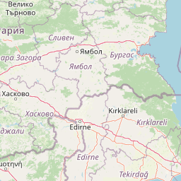
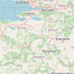
The shortest route between Ohrid and Istanbul is 525.56 mi (845.81 km) according to the route planner. The driving time is approx. 10 h 57 m
How far is it between Ohrid and Istanbul.
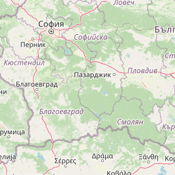
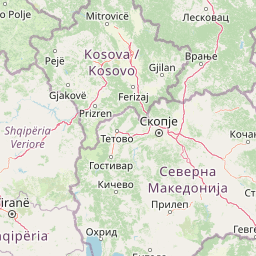
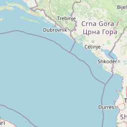
Ohrid is located in Jugozapaden, Macedoniacountry within 41° 7' 0.84" N 20° 48' 6.84" E (41.1169, 20.8019) coordinates. The local time in Ohrid is 21:42 (22.07.2025)
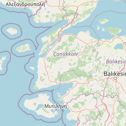
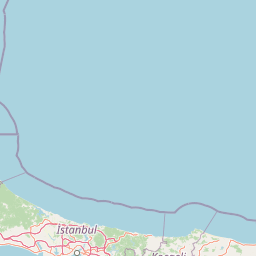
Istanbul is located in Istanbul, Turkeycountry within 41° 0' 48.96" N 28° 57' 18" E (41.0136, 28.9550) coordinates. The local time in Istanbul is 23:42 (22.07.2025)
The calculated flying distance from Ohrid to Istanbul is 424.63miles which is equal to 683.38 km.
If you want to go by car, the driving driving distance between Ohrid and Istanbul is 525.56 miles (845.81 km). If you ride your car with an average speef of 112 kilometers/hour (70 miles/h), travel time will be 7 hours 33 minutes.Please check the avg.speed travel time on the right for various options
Estimated Travel Time Between Ohrid and Istanbul
| Average speed | Travel Time |
|---|---|
| 30 mph (48 km/h) | 17 hours 31 minutes |
| 40 mph (64 km/h) | 13 hours 8 minutes |
| 50 mph (80 km/h) | 10 hours 31 minutes |
| 60 mph (67 km/h) | 8 hours 46 minutes |
| 70 mph (112 km/h) | 7 hours 30 minutes |
| 75 mph (120 km/h) | 7 hours 0 minutes |
Related Distances from Ohrid
| Cities | Distance |
|---|---|
| Ohrid to Struga | 7.65 mi (12.31 km) |
| Ohrid to Vevcani | 13.81 mi (22.22 km) |
| Ohrid to Bitola | 28.37 mi (45.65 km) |
| Ohrid to Kicevo | 28.70 mi (46.18 km) |
| Ohrid to Krusevo | 29.05 mi (46.74 km) |
| Ohrid to Plasnica | 29.18 mi (46.95 km) |
| Ohrid to Mogila | 30.03 mi (48.32 km) |
| Ohrid to Krivogastani | 31.48 mi (50.66 km) |
| Ohrid to Debar | 31.60 mi (50.85 km) |
| Ohrid to Novaci | 34.46 mi (55.46 km) |
| Ohrid to Prilep | 42.18 mi (67.89 km) |
| Ohrid to Gostivar | 47.57 mi (76.56 km) |
| Ohrid to Vrapciste | 49.71 mi (80.01 km) |
| Ohrid to Tetovo | 62.35 mi (100.34 km) |
| Ohrid to Veles | 65.22 mi (104.96 km) |
| Ohrid to Rosoman | 65.64 mi (105.64 km) |
| Ohrid to Sopiste | 66.18 mi (106.51 km) |
| Ohrid to Kavadarci | 66.50 mi (107.03 km) |
| Ohrid to Gradsko | 67.19 mi (108.13 km) |
| Ohrid to Tearce | 67.62 mi (108.82 km) |
| Ohrid to Skopje | 68.92 mi (110.92 km) |
| Ohrid to Negotino | 71.47 mi (115.02 km) |
| Ohrid to Aracinovo | 74.10 mi (119.26 km) |
| Ohrid to Demir Kapija | 77.52 mi (124.76 km) |
| Ohrid to Sveti Nikole | 78.46 mi (126.27 km) |
Related Distances to Istanbul
| Cities | Distance |
|---|---|
| Erzurum to Istanbul | 651.68 mi (1,048.78 km) |
| Esenler to Istanbul | 3.65 mi (5.88 km) |
| Kagithane to Istanbul | 4.07 mi (6.55 km) |
| Bagcilar to Istanbul | 5.34 mi (8.59 km) |
| Kucukcekmece to Istanbul | 8.14 mi (13.09 km) |
| Kartal to Istanbul | 15.06 mi (24.23 km) |
| Esenyurt to Istanbul | 15.65 mi (25.19 km) |
| Pendik to Istanbul | 17.48 mi (28.14 km) |
| Bursa to Istanbul | 57.58 mi (92.67 km) |
| Yildirim to Istanbul | 62.79 mi (101.05 km) |
| Eskisehir to Istanbul | 118.70 mi (191.03 km) |
| Izmir to Istanbul | 203.50 mi (327.50 km) |
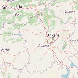
| Ankara to Istanbul | 217.96 mi (350.77 km) |
| Cankaya to Istanbul | 219.86 mi (353.83 km) |
| Denizli to Istanbul | 224.44 mi (361.21 km) |
| Selcuklu to Istanbul | 287.09 mi (462.03 km) |
| Konya to Istanbul | 287.56 mi (462.78 km) |
| Antalya to Istanbul | 300.22 mi (483.16 km) |
| Kayseri to Istanbul | 380.74 mi (612.75 km) |
| Samsun to Istanbul | 384.23 mi (618.36 km) |
| Mersin to Istanbul | 421.68 mi (678.62 km) |
| Adana to Istanbul | 439.94 mi (708.01 km) |
| Seyhan to Istanbul | 441.18 mi (710.02 km) |
| Gaziantep to Istanbul | 527.75 mi (849.33 km) |
| Akcaabat to Istanbul | 552.01 mi (888.38 km) |
 Accedi con Google