


Distance Calculator
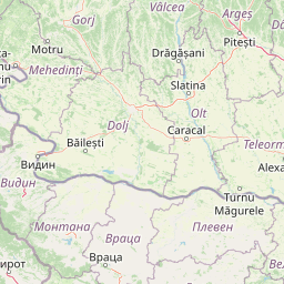

Distance from Vratsa to Istanbul
The shortest distance (air line) between Vratsa and Istanbul is 315.48mi (507.71 km)
The shortest route between Vratsa and Istanbul is 400.38 mi (644.35 km) according to the route planner. The driving time is approx. 6 h 47 m
How far is it between Vratsa and Istanbul.
Vratsa is located in Vratsa, Bulgariacountry within 43° 12' 0" N 23° 33' 0" E (43.2000, 23.5500) coordinates. The local time in Vratsa is 02:13 (09.08.2025)
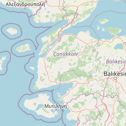
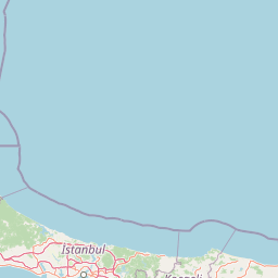
Istanbul is located in Istanbul, Turkeycountry within 41° 0' 48.96" N 28° 57' 18" E (41.0136, 28.9550) coordinates. The local time in Istanbul is 03:13 (09.08.2025)
The calculated flying distance from Vratsa to Istanbul is 315.48miles which is equal to 507.71 km.
If you want to go by car, the driving driving distance between Vratsa and Istanbul is 400.38 miles (644.35 km). If you ride your car with an average speef of 112 kilometers/hour (70 miles/h), travel time will be 5 hours 45 minutes.Please check the avg.speed travel time on the right for various options
Estimated Travel Time Between Vratsa and Istanbul
| Average speed | Travel Time |
|---|---|
| 30 mph (48 km/h) | 13 hours 21 minutes |
| 40 mph (64 km/h) | 10 hours 1 minutes |
| 50 mph (80 km/h) | 8 hours 0 minutes |
| 60 mph (67 km/h) | 6 hours 40 minutes |
| 70 mph (112 km/h) | 5 hours 43 minutes |
| 75 mph (120 km/h) | 5 hours 20 minutes |
Related Distances from Vratsa
| Cities | Distance |
|---|---|
| Vratsa to Montana | 21.86 mi (35.19 km) |
| Vratsa to Sofia | 36.29 mi (58.41 km) |
| Vratsa to Pernik | 49.02 mi (78.88 km) |
| Vratsa to Pleven | 55.70 mi (89.64 km) |
| Vratsa to Lovech | 58.99 mi (94.94 km) |
| Vratsa to Vidin | 64.99 mi (104.60 km) |
| Vratsa to Kyustendil | 77.11 mi (124.09 km) |
| Vratsa to Pazardzhik | 79.72 mi (128.30 km) |
| Vratsa to Blagoevgrad | 85.36 mi (137.38 km) |
| Vratsa to Gabrovo | 92.96 mi (149.60 km) |
| Vratsa to Plovdiv | 94.76 mi (152.49 km) |
| Vratsa to Veliko Tarnovo | 104.54 mi (168.23 km) |
| Vratsa to Stara Zagora | 118.88 mi (191.32 km) |
| Vratsa to Ruse | 127.91 mi (205.86 km) |
| Vratsa to Haskovo | 134.87 mi (217.05 km) |
| Vratsa to Kardzhali | 141.61 mi (227.89 km) |
| Vratsa to Sliven | 145.23 mi (233.72 km) |
| Vratsa to Razgrad | 150.77 mi (242.65 km) |
| Vratsa to Targovishte | 152.75 mi (245.82 km) |
| Vratsa to Yambol | 157.43 mi (253.36 km) |
| Vratsa to Shumen | 170.38 mi (274.19 km) |
| Vratsa to Silistra | 195.99 mi (315.41 km) |
| Vratsa to Burgas | 204.31 mi (328.80 km) |
| Vratsa to Dobrich | 216.55 mi (348.50 km) |
| Vratsa to Varna | 219.88 mi (353.87 km) |
Related Distances to Istanbul
| Cities | Distance |
|---|---|
| Erzurum to Istanbul | 651.68 mi (1,048.78 km) |
| Esenler to Istanbul | 3.65 mi (5.88 km) |
| Kagithane to Istanbul | 4.07 mi (6.55 km) |
| Bagcilar to Istanbul | 5.34 mi (8.59 km) |
| Kucukcekmece to Istanbul | 8.14 mi (13.09 km) |
| Kartal to Istanbul | 15.06 mi (24.23 km) |
| Esenyurt to Istanbul | 15.65 mi (25.19 km) |
| Pendik to Istanbul | 17.48 mi (28.14 km) |
| Bursa to Istanbul | 57.58 mi (92.67 km) |
| Yildirim to Istanbul | 62.79 mi (101.05 km) |
| Eskisehir to Istanbul | 118.70 mi (191.03 km) |
| Izmir to Istanbul | 203.50 mi (327.50 km) |
| Ankara to Istanbul | 217.96 mi (350.77 km) |
| Cankaya to Istanbul | 219.86 mi (353.83 km) |
| Denizli to Istanbul | 224.44 mi (361.21 km) |
| Selcuklu to Istanbul | 287.09 mi (462.03 km) |
| Konya to Istanbul | 287.56 mi (462.78 km) |
| Antalya to Istanbul | 300.22 mi (483.16 km) |
| Kayseri to Istanbul | 380.74 mi (612.75 km) |
| Samsun to Istanbul | 384.23 mi (618.36 km) |
| Mersin to Istanbul | 421.68 mi (678.62 km) |
| Adana to Istanbul | 439.94 mi (708.01 km) |
| Seyhan to Istanbul | 441.18 mi (710.02 km) |
| Gaziantep to Istanbul | 527.75 mi (849.33 km) |
| Akcaabat to Istanbul | 552.01 mi (888.38 km) |
 Accedi con Google