Distance Calculator

A1, Autostrada Bursztynowa

2873.7 km, 31 h

Head north on Slokas iela150 m
Turn right onto Rūdolfa Blaumaņa iela90 m
Turn right100 m
Turn right onto Dubultu prospekts300 m
Turn left onto Kļavu iela80 m
Turn left onto Strēlnieku prospekts200 m
Make a slight left to stay on Strēlnieku prospekts200 m
Continue onto Zigfrīda Meierovica prospekts1.5 km
Continue onto Jomas iela350 m
Continue onto Lienes iela1 km
Continue onto Mežaparka prospekts1.5 km
Continue onto Rīgas iela1 km
Continue onto Pērkona iela1.5 km
Continue onto Rīga — Ventspils3.5 km
Take the ramp700 m
Merge left onto Rīgas apvedceļš (Salaspils — Babīte) (A5)2.5 km
Keep left onto Rīgas apvedceļš (Salaspils — Babīte) (A5)15 km
Turn right onto Baloži — Plakanciems — Iecava (V7)20 km
Turn left to stay on Baloži — Plakanciems — Iecava (V7)9 km
Go straight onto Edvarta Virzas iela (V7)800 m
Turn right onto Rīgas iela (A7)200 m
Keep right onto Rīgas iela (A7)1 km
Continue onto Rīga — Bauska — Lietuvas robeža (Grenctāle) (A7)20 km
Continue onto Kalna iela (A7)1.5 km
Enter the traffic circle and take the 2nd exit onto A745 m
Exit the traffic circle onto A720 km
Continue onto Pasienio g. (A10)800 m
Continue onto Via Baltica (A10)3.5 km
Continue onto Rygos g. (A10)1.5 km
Continue onto Bėrelės g. (A10)6 km
Continue onto Via Baltica (A10)15 km
Enter the traffic circle and take the 2nd exit towards Panevėžys40 m
Exit the traffic circle towards Panevėžys3.5 km
Continue onto Baltijos Kelio g. (A10)2 km
Continue onto Panevėžio g. (A10)1 km
Continue onto Via Baltica (A10)150 m
Continue onto Baltijos Kelio g. (A10)7 km
Continue onto Via Baltica (A10)400 m
Continue onto Kovo 11-osios g. (A10)15 km
Keep left towards Panevėžys200 m
Enter the traffic circle and take the 1st exit towards Šiauliai30 m
Exit the traffic circle towards Šiauliai7 km
Enter Panevėžio aplinkl. and take the 2nd exit towards Šiauliai30 m
Exit the traffic circle towards Šiauliai9 km
Enter the traffic circle and take the 1st exit onto 19520 m
Exit the traffic circle onto 19520 km
Continue onto Pušyno g. (2008)4 km
Continue onto Vilainiai — Šventybrastis — Krekenava (2008)20 km
Continue onto Melioratorių g. (2008)3 km
Continue onto Tiskūnų g. (2008)2 km
Turn left onto 2293 km
Take the ramp onto Aristava — Kėdainiai — Cinkiškis (229)20 m
Keep right towards Kaunas450 m
Merge left onto A835 km
Merge left onto A110 km
Take the ramp towards A5: Marijampolė600 m
Merge left towards Marijampolė600 m
Take the ramp30 m
Keep left at the fork250 m
Merge left onto Vakarinis aplinkl. (A5)4.5 km
Continue onto Via Baltikos kel. (A5)4.5 km
Continue onto Baltijos g. (A5)5.5 km
Take the ramp towards Marijampolė600 m
Merge left onto Marijampolės g. (A5)550 m
Continue onto Via Baltica (A5)35 km
Continue onto Kauno g. (A5)5 km
Continue onto Via Baltica (A5)25 km
Merge left onto A510 km
Continue onto Via Baltica (S61)1 km
Continue straight150 m
Continue straight300 m
Continue onto Via Baltica (S61)250 km
Continue onto Warszawska (S8)2 km
Continue towards S8: Warszawa1.5 km
Continue onto Trasa Bohaterów Bitwy Warszawskiej 1920 (S8)8 km
Continue onto Kardynała Stefana Wyszyńskiego (S8)4 km
Continue onto Marszałka Józefa Piłsudskiego (S8)550 m
Continue onto Kardynała Stefana Wyszyńskiego (S8)1.5 km
Continue onto Trasa Bohaterów Bitwy Warszawskiej 1920 (S8)10 km
Continue onto Aleja Bohaterów Bitwy Warszawskiej 1920 (S8)6 km
Continue onto Toruńska (S8)6 km
Continue onto Most Generała Stefana Grota-Roweckiego (S8)700 m
Continue onto Aleja Armii Krajowej (S8)4 km
Continue onto Aleja Obrońców Grodna (S8)10 km
Keep left towards A2: Poznań1 km
Continue onto Autostrada Wolności (A2)90 km
Take the ramp towards A1: Gdańsk550 m
Keep left towards A1: Katowice2 km
Merge left towards Katowice250 km
Continue onto D180 km
Take the ramp towards D35: Lipník n. B.1.5 km
Keep left towards D35: Olomouc1 km
Keep right towards Olomouc30 km
Take the ramp towards Brno300 m
Keep right towards Prostějov250 m
Keep left towards Prostějov2 km
Merge right onto D4635 km
Keep left towards Brno450 m
Merge left onto D135 km
Take the ramp45 m
Keep left towards D 2: Bratislava350 m
Keep right towards D2: Bratislava350 m
Keep left towards Bratislava450 m
Keep left at the fork300 m
Keep left towards Bratislava (SK)150 m
Merge left onto D2100 km
Continue onto D215 km
Take the ramp towards D4: Žilina150 m
Keep left towards Žilina500 m
Keep left towards D2: Budapest300 m
Merge left onto D29 km
Continue onto M15150 km
Take the ramp towards M0200 m
Keep right towards E 60: Szeged1 km
Keep left towards M0250 m
Merge left onto M030 km
Take the ramp450 m
Keep right towards E 60: Szeged1 km
Merge left onto M5150 km
Take the ramp350 m
Keep left at the fork400 m
Merge left onto M5100 m
Continue onto A1200 km
Keep left towards A 1: Skopje200 km
Take the ramp towards A4: Sofia (BG)1.5 km
Continue onto A4100 km
Continue onto Автомагистрала Европа (A 6)35 km
Keep left towards 8: Петърч15 km
Enter the traffic circle and take the 3rd exit towards Видин150 m
Exit the traffic circle towards Видин350 m
Take the ramp on the left towards Видин100 m
Merge left onto Околовръстен път (8)4 km
Take exit 49 towards А 6: Варна1 km
Merge left onto Автомагистрала Европа (A 6)15 km
Take exit 64 towards А 1: Пловдив1.5 km
Merge left onto Околовръстен път (1)8 km
Take the ramp towards A 1: Пловдив350 m
Merge left onto Автомагистрала Тракия (A 1)150 km
Keep right towards А 4: Свиленград100 km
Keep left towards Turkey500 m
Continue onto Kapıkule Sınır Kapısı (D-100)10 km
Keep left towards Lalapaşa250 km
Keep right towards Bağcılar9 km
Continue onto Adnan Menderes Vatan Bulvarı300 m
Make a slight right45 m
Make a slight left onto Çayır Meydanı Caddesi300 m
Turn right onto Bican Bağcıoğlu Yokuşu100 m
Make a slight left onto Tatlı Pınar Caddesi150 m
Turn left onto Gureba Hastanesi Caddesi900 m
Turn left onto Oğuzhan Caddesi100 m
Continue onto Akdeniz Caddesi600 m
Turn right onto Fevzipaşa Caddesi350 m
Continue onto Macar Kardeşler Caddesi450 m
Continue towards Vezneciler150 m
You have arrived at your destination, on the right0 m
From
    To

      Distance: 1,126.33 mi (1,812.66 km)

      Driving route: 1785.66 mi (2873.74 km).

      Driving time: 30h 34 min

      Distance from Jurmala to Istanbul

      The shortest distance (air line) between Jurmala and Istanbul is 1,126.33mi (1,812.66 km)

      The shortest route between Jurmala and Istanbul is 1785.66 mi (2873.74 km) according to the route planner. The driving time is approx. 30 h 34 m

      How far is it between Jurmala and Istanbul.

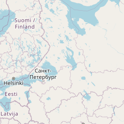
      Jurmala is located in Pieriga, Latviacountry within 56° 58' 5.16" N 23° 46' 13.08" E (56.9681, 23.7703) coordinates. The local time in Jurmala is 07:15 (08.09.2025)

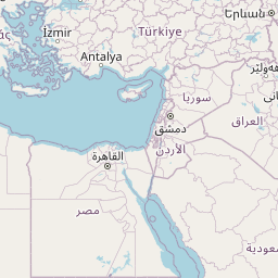
      Istanbul is located in Istanbul, Turkeycountry within 41° 0' 48.96" N 28° 57' 18" E (41.0136, 28.9550) coordinates. The local time in Istanbul is 08:15 (08.09.2025)

      The calculated flying distance from Jurmala to Istanbul is 1,126.33miles which is equal to 1,812.66 km.

      If you want to go by car, the driving driving distance between Jurmala and Istanbul is 1785.66 miles (2873.74 km). If you ride your car with an average speef of 112 kilometers/hour (70 miles/h), travel time will be 25 hours 40 minutes.Please check the avg.speed travel time on the right for various options

      Estimated Travel Time Between Jurmala and Istanbul

      Average speedTravel Time
      30 mph (48 km/h)59 hours 31 minutes
      40 mph (64 km/h)44 hours 38 minutes
      50 mph (80 km/h)35 hours 43 minutes
      60 mph (67 km/h)29 hours 46 minutes
      70 mph (112 km/h)25 hours 31 minutes
      75 mph (120 km/h)23 hours 49 minutes

      Jurmala, Pieriga, Latvia

      Related Distances from Jurmala

      CitiesEdite sus datos personales, tarjetas de crédito guardadas y preferencias de viaje
      Jurmala to Marupe11.65 mi (18.75 km)
      Jurmala to Riga12.73 mi (20.49 km)
      Jurmala to Olaine14.17 mi (22.81 km)
      Jurmala to Jelgava22.20 mi (35.73 km)
      Jurmala to Adazi22.25 mi (35.80 km)
      Jurmala to Salaspils22.96 mi (36.95 km)
      Jurmala to Tukums23.36 mi (37.60 km)
      Jurmala to Dobele30.86 mi (49.67 km)
      Jurmala to Ogre33.17 mi (53.39 km)
      Jurmala to Bauska41.87 mi (67.39 km)
      Jurmala to Sigulda43.07 mi (69.31 km)
      Jurmala to Talsi48.34 mi (77.80 km)
      Jurmala to Saldus52.36 mi (84.26 km)
      Jurmala to Cesis61.05 mi (98.24 km)
      Jurmala to Aizkraukle61.52 mi (99.01 km)
      Jurmala to Kuldiga67.93 mi (109.32 km)
      Jurmala to Valmiera72.97 mi (117.44 km)
      Jurmala to Jekabpils86.20 mi (138.73 km)
      Jurmala to Ventspils87.30 mi (140.49 km)
      Jurmala to Livani100.59 mi (161.88 km)
      Jurmala to Liepaja109.10 mi (175.58 km)
      Jurmala to Daugavpils129.87 mi (209.01 km)
      Jurmala to Rezekne138.96 mi (223.63 km)
      Jurmala to Kraslava149.84 mi (241.15 km)
      Jurmala to Ludza152.21 mi (244.96 km)

      Istanbul, Istanbul, Turkey

      Related Distances to Istanbul

      CitiesEdite sus datos personales, tarjetas de crédito guardadas y preferencias de viaje
      Erzurum to Istanbul651.68 mi (1,048.78 km)
      Esenler to Istanbul3.65 mi (5.88 km)
      Kagithane to Istanbul4.07 mi (6.55 km)
      Bagcilar to Istanbul5.34 mi (8.59 km)
      Kucukcekmece to Istanbul8.14 mi (13.09 km)
      Kartal to Istanbul15.06 mi (24.23 km)
      Esenyurt to Istanbul15.65 mi (25.19 km)
      Pendik to Istanbul17.48 mi (28.14 km)
      Bursa to Istanbul57.58 mi (92.67 km)
      Yildirim to Istanbul62.79 mi (101.05 km)
      Eskisehir to Istanbul118.70 mi (191.03 km)
      Izmir to Istanbul203.50 mi (327.50 km)
      Ankara to Istanbul217.96 mi (350.77 km)
      Cankaya to Istanbul219.86 mi (353.83 km)
      Denizli to Istanbul224.44 mi (361.21 km)
      Selcuklu to Istanbul287.09 mi (462.03 km)
      Konya to Istanbul287.56 mi (462.78 km)
      Antalya to Istanbul300.22 mi (483.16 km)
      Kayseri to Istanbul380.74 mi (612.75 km)
      Samsun to Istanbul384.23 mi (618.36 km)
      Mersin to Istanbul421.68 mi (678.62 km)
      Adana to Istanbul439.94 mi (708.01 km)
      Seyhan to Istanbul441.18 mi (710.02 km)
      Gaziantep to Istanbul527.75 mi (849.33 km)
      Akcaabat to Istanbul552.01 mi (888.38 km)