Distance Calculator

L'Européenne, M20

282.1 km, 3 h 38 min

Head northeast on Maurits Van Coppenollestraat100 m
Turn left onto Hubrecht De Croockstraat200 m
Turn left to stay on Hubrecht De Croockstraat80 m
Turn right onto Zandstraat500 m
Turn right onto Expressweg (N31)450 m
Take the ramp on the left90 m
Merge left onto Expressweg (N31)2 km
Take the ramp onto Expressweg (N31)300 m
Enter the traffic circle and take the 1st exit towards Zedelgem60 m
Exit the traffic circle towards Zedelgem1.5 km
Enter the traffic circle and take the 1st exit25 m
Exit the traffic circle300 m
Merge left onto E408 km
Keep left towards Calais40 km
Continue onto L'Européenne (A 16)55 km
Take the ramp towards Tunnel sous la Manche250 m
Keep left towards Tunnel sous la Manche800 m
Keep right at the fork100 m
Make a slight left55 m
Make a slight right25 m
Keep right at the fork550 m
Keep left at the fork100 m
Keep right at the fork15 m
Keep left at the fork250 m
Keep right at the fork90 m
Keep left at the fork25 m
Turn left10 m
Keep right at the fork200 m
Turn left350 m
Turn right100 m
Make a slight left15 m
Take the ferry Le Shuttle60 km
Continue slight right150 m
Make a slight right onto Over Bridge 3900 m
Keep left at the fork1.5 km
Take the ramp towards London250 m
Keep right towards London80 km
Continue onto A2015 km
Enter Cliftons Roundabout and take the 2nd exit onto Sidcup Road (A20)40 m
Exit the traffic circle onto Sidcup Road (A20)400 m
Keep left onto Eltham Road (A20)1 km
Continue onto Lee High Road (A20)1.5 km
Continue onto Lewisham High Street (A20)200 m
Turn left onto Rennell Street (A20)100 m
Turn right onto Loampit Vale (A20)400 m
Keep left onto Loampit Vale (A20)200 m
Continue onto Loampit Hill (A20)400 m
Continue onto Lewisham Way (A20)1.5 km
Keep left onto Lewisham Way (A2)90 m
Merge right onto New Cross Road (A2)550 m
Keep right onto New Cross Road (A2)800 m
Continue onto Old Kent Road (A2)3 km
Take the ramp on the left onto Bricklayers Arms (A201)200 m
Merge right onto New Kent Road (A201)1 km
Turn left onto Elephant and Castle (A3)45 m
Turn right onto St George's Road (A302)550 m
Continue onto St Georges Road (A302)150 m
Continue onto Westminster Bridge Road (A302)550 m
Turn left onto Westminster Bridge Road (A302)90 m
Turn right to stay on Westminster Bridge Road (A302)500 m
Turn right onto Victoria Embankment (A3211)600 m
Turn left onto Northumberland Avenue (A400)350 m
Enter Charing Cross and exit onto Charing Cross15 m
You have arrived at your destination0 m
From
    To

      Distance: 144.41 mi (232.41 km)

      Driving route: 175.28 mi (282.08 km).

      Driving time: 3h 37 min

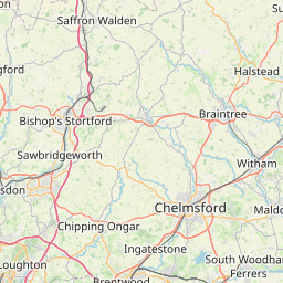
      Distance from Sint-Andries to London

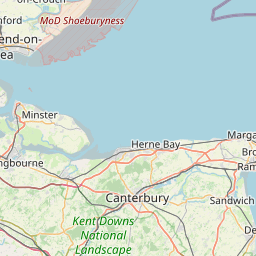
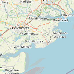
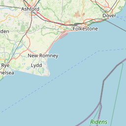
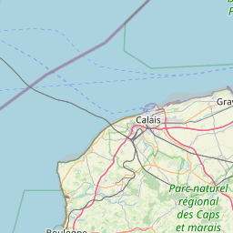
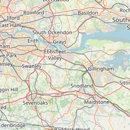
      The shortest distance (air line) between Sint-Andries and London is 144.41mi (232.41 km)

      The shortest route between Sint-Andries and London is 175.28 mi (282.08 km) according to the route planner. The driving time is approx. 3 h 37 m

      How far is it between Sint-Andries and London.

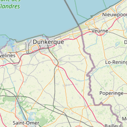
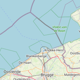
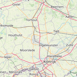
      Sint-Andries is located in Arr. Brugge, Belgiumcountry within 51° 12' 0" N 3° 10' 59.88" E (51.2000, 3.1833) coordinates. The local time in Sint-Andries is 19:40 (22.07.2025)

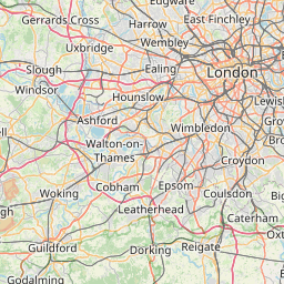
      London is located in Westminster, United Kingdomcountry within 51° 30' 25.92" N -1° 52' 21" W (51.5072, -0.1275) coordinates. The local time in London is 18:41 (22.07.2025)

      The calculated flying distance from Sint-Andries to London is 144.41miles which is equal to 232.41 km.

      If you want to go by car, the driving driving distance between Sint-Andries and London is 175.28 miles (282.08 km). If you ride your car with an average speef of 112 kilometers/hour (70 miles/h), travel time will be 2 hours 31 minutes.Please check the avg.speed travel time on the right for various options

      Estimated Travel Time Between Sint-Andries and London

      Average speedTravel Time
      30 mph (48 km/h)5 hours 51 minutes
      40 mph (64 km/h)4 hours 23 minutes
      50 mph (80 km/h)3 hours 30 minutes
      60 mph (67 km/h)2 hours 55 minutes
      70 mph (112 km/h)2 hours 30 minutes
      75 mph (120 km/h)2 hours 20 minutes

      Sint-Andries, Arr. Brugge, Belgium

      Related Distances from Sint-Andries

      CitiesEdite sus datos personales, tarjetas de crédito guardadas y preferencias de viaje
      Sint-Andries to Bruges1.87 mi (3.02 km)
      Sint-Andries to Gent25.59 mi (41.18 km)
      Sint-Andries to Hoboken51.30 mi (82.57 km)
      Sint-Andries to Wilrijk52.02 mi (83.72 km)
      Sint-Andries to Antwerp52.69 mi (84.80 km)
      Sint-Andries to Berchem53.42 mi (85.97 km)
      Sint-Andries to Borgerhout54.44 mi (87.61 km)
      Sint-Andries to Merksem54.52 mi (87.75 km)
      Sint-Andries to Jette55.02 mi (88.54 km)
      Sint-Andries to Koekelberg55.02 mi (88.54 km)
      Sint-Andries to Deurne55.39 mi (89.15 km)
      Sint-Andries to Moortebeek55.58 mi (89.45 km)
      Sint-Andries to Laeken55.59 mi (89.46 km)
      Sint-Andries to Anderlecht56.04 mi (90.19 km)
      Sint-Andries to Forest56.36 mi (90.71 km)
      Sint-Andries to Brussels56.37 mi (90.72 km)
      Sint-Andries to Vilvoorde57.07 mi (91.85 km)
      Sint-Andries to Sint-Joost-ten-Node57.48 mi (92.51 km)
      Sint-Andries to Mechelen57.51 mi (92.56 km)
      Sint-Andries to Evere57.66 mi (92.80 km)
      Sint-Andries to Etterbeek57.99 mi (93.32 km)
      Sint-Andries to Leuven69.43 mi (111.73 km)
      Sint-Andries to Charleroi77.68 mi (125.02 km)
      Sint-Andries to Namur89.23 mi (143.61 km)
      Sint-Andries to Liege110.95 mi (178.56 km)

      London, Westminster, United Kingdom

      Related Distances to London

      CitiesEdite sus datos personales, tarjetas de crédito guardadas y preferencias de viaje
      Reading to London36.57 mi (58.85 km)
      Worthing to London49.00 mi (78.86 km)
      Portsmouth to London63.86 mi (102.77 km)
      Ipswich to London66.81 mi (107.52 km)
      Southampton to London69.28 mi (111.50 km)
      Coventry to London85.69 mi (137.90 km)
      Leicester to London88.80 mi (142.90 km)
      Birmingham to London101.09 mi (162.69 km)
      Bristol to London106.34 mi (171.14 km)
      Nottingham to London108.88 mi (175.23 km)
      Caerdydd to London131.28 mi (211.27 km)
      Stoke-on-Trent to London134.89 mi (217.09 km)
      Sheffield to London141.26 mi (227.34 km)
      Kingston upon Hull to London154.81 mi (249.15 km)
      Stockport to London156.51 mi (251.88 km)
      Manchester to London162.79 mi (261.98 km)
      Leeds to London169.27 mi (272.42 km)
      Bradford to London172.39 mi (277.43 km)
      Bolton to London172.68 mi (277.90 km)
      Liverpool to London178.25 mi (286.86 km)
      Sunderland to London240.48 mi (387.02 km)
      Newcastle to London247.64 mi (398.53 km)
      Belfast to London321.73 mi (517.78 km)
      Edinburgh to London331.63 mi (533.70 km)
      Glasgow to London344.75 mi (554.83 km)