Distance Calculator

M1, A50

179.3 km, 2 h 12 min

Head west on Old Rectory Close100 m
Turn right onto Frolesworth Road300 m
Turn left onto Main Street400 m
Continue onto Orchard Road200 m
Turn left onto Coventry Road700 m
Turn left onto Coventry Road (B581)700 m
Turn right to stay on Coventry Road (B4114)2.5 km
Continue onto Guthlaxton Gap (B4114)350 m
Continue onto Coventry Road (B4114)1.5 km
Go straight onto King Edward Avenue (B4114)250 m
Enter the traffic circle and take the 2nd exit onto King Edward Avenue (B4114)30 m
Exit the traffic circle onto King Edward Avenue (B4114)900 m
Continue onto Leicester Road (B4114)700 m
Enter Foxhunter Roundabout and take the 2nd exit onto St Johns (B4114)55 m
Exit the traffic circle onto St Johns (B4114)1 km
Continue onto Narborough Road South (B4114)350 m
Make a slight left onto Lubbesthorpe Way (A563)400 m
Take the ramp on the left towards A5460300 m
Merge right onto A5460350 m
Enter the traffic circle and take the 3rd exit towards M1250 m
Exit the traffic circle towards M1450 m
Merge right onto M13.5 km
Keep right onto M125 km
Take the ramp on the left towards A50: Derby500 m
Keep right at the fork80 m
Keep left onto A508 km
Keep right onto A5025 km
Enter the traffic circle and take the 2nd exit onto A5090 m
Exit the traffic circle onto A508 km
Enter the traffic circle and take the 2nd exit onto A5080 m
Exit the traffic circle onto A501.5 km
Enter McDonalds Roundabout and take the 2nd exit onto A5050 m
Exit the traffic circle onto A5015 km
Enter the traffic circle and take the 1st exit onto A5010 m
Exit the traffic circle onto A502 km
Take the ramp on the left towards A521: Blythe Bridge250 m
Enter the traffic circle and take the 2nd exit70 m
Exit the traffic circle300 m
Merge right onto Uttoxeter Road (A50)4.5 km
Take the ramp on the left400 m
Enter Heron Cross Roundabout and take the 2nd exit onto Victoria Place Link (A50)150 m
Exit the traffic circle onto Victoria Place Link (A50)700 m
Enter the traffic circle and take the 1st exit onto King Street (A50)9 m
Exit the traffic circle onto King Street (A50)250 m
Enter the traffic circle and take the 2nd exit onto City Road (A5007)25 m
Exit the traffic circle onto City Road (A5007)1 km
Enter the traffic circle and take the 1st exit onto City Road (A5007)9 m
Exit the traffic circle onto City Road (A5007)250 m
Take the ramp250 m
Keep right at the fork200 m
Merge right onto Queensway (A500)15 km
Enter Barthomley Interchange and take the 4th exit onto M6300 m
Exit the traffic circle onto M630 km
Take the ramp on the left500 m
Keep right at the fork300 m
Continue onto A5566 km
Continue onto M5610 km
Keep left towards M56: Ring Rd3 km
Continue onto M601.5 km
Keep right onto M604.5 km
Take the ramp on the left onto M60200 m
Keep right onto M6060 m
Enter Portwood Roundabout and take the 5th exit onto St. Marys Way (A6188)250 m
Exit the traffic circle onto St. Marys Way (A6188)900 m
Keep right onto St. Marys Way (A6188)100 m
Make a U-turn and continue on St. Marys Way (A6188)40 m
You have arrived at your destination0 m

M1, A623

155.1 km, 2 h 18 min

Head west on Old Rectory Close100 m
Turn right onto Frolesworth Road300 m
Turn left onto Main Street400 m
Continue onto Orchard Road200 m
Turn left onto Coventry Road700 m
Turn left onto Coventry Road (B581)700 m
Turn right to stay on Coventry Road (B4114)2.5 km
Continue onto Guthlaxton Gap (B4114)350 m
Continue onto Coventry Road (B4114)1.5 km
Go straight onto King Edward Avenue (B4114)250 m
Enter the traffic circle and take the 2nd exit onto King Edward Avenue (B4114)30 m
Exit the traffic circle onto King Edward Avenue (B4114)900 m
Continue onto Leicester Road (B4114)700 m
Enter Foxhunter Roundabout and take the 2nd exit onto St Johns (B4114)55 m
Exit the traffic circle onto St Johns (B4114)1 km
Continue onto Narborough Road South (B4114)350 m
Make a slight left onto Lubbesthorpe Way (A563)400 m
Take the ramp on the left towards A5460300 m
Merge right onto A5460350 m
Enter the traffic circle and take the 3rd exit towards M1250 m
Exit the traffic circle towards M1450 m
Merge right onto M13.5 km
Keep right onto M170 km
Take the ramp on the left towards A617: Chesterfield550 m
Keep left onto A6178 km
Keep right at the fork150 m
Keep left onto A617200 m
Take the ramp on the left onto A619100 m
Merge right onto Markham Road (A619)900 m
Enter West Bars and take the 2nd exit onto Wheatbridge Road (A619)55 m
Exit the traffic circle onto Wheatbridge Road (A619)300 m
Merge right onto Chatsworth Road (A619)550 m
Keep left onto Chatsworth Road (A619)300 m
Enter the traffic circle and take the 2nd exit onto Chatsworth Road25 m
Exit the traffic circle onto Chatsworth Road2 km
Continue onto Baslow Road (A619)800 m
Continue onto Chander Hill Bypass (A619)1.5 km
Continue onto Baslow Road (A619)7 km
Enter the traffic circle and take the 1st exit20 m
Exit the traffic circle100 m
Go straight onto A619400 m
Turn right onto Eaton Hill450 m
Turn left onto School Lane150 m
Turn right onto Over Road200 m
Continue onto Over Lane900 m
Turn right onto Baslow Road (A623)1 km
Continue onto Kingsgate (A623)800 m
Continue onto The Avenue (A623)15 km
Continue onto Hernstone Lane (A623)4 km
Turn left to stay on A6232 km
Enter the traffic circle and take the 2nd exit onto A640 m
Exit the traffic circle onto A62.5 km
Enter the traffic circle and take the 2nd exit onto A650 m
Exit the traffic circle onto A65 km
Enter the traffic circle and take the 1st exit onto Buxton Road (A5004)15 m
Exit the traffic circle onto Buxton Road (A5004)900 m
Continue onto Market Street (A5004)150 m
Turn right onto Reservoir Road100 m
Turn left to stay on Whaley Lane800 m
Continue onto Stoneheads350 m
Continue onto Whaley Lane1 km
Continue onto Buxton Old Road3 km
Turn left onto Buxton Road West (A6)5.5 km
Keep right onto Buxton Road (A6)80 m
Continue onto London Road (A6)1.5 km
Continue onto Buxton Road (A6)300 m
Turn right onto Dialstone Lane2 km
Turn left onto Hempshaw Lane900 m
Make a slight right to stay on Hempshaw Lane (A6188)40 m
Continue onto St. Marys Way (A6188)600 m
You have arrived at your destination0 m
From
    To

      Distance: 71.92 mi (115.74 km)

      Driving route: 111.43 mi (179.33 km).

      Driving time: 2h 12 min

      Distance from Broughton Astley to Stockport

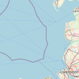
      The shortest distance (air line) between Broughton Astley and Stockport is 71.92mi (115.74 km)

      The shortest route between Broughton Astley and Stockport is 111.43 mi (179.33 km) according to the route planner. The driving time is approx. 2 h 12 m

      How far is it between Broughton Astley and Stockport.

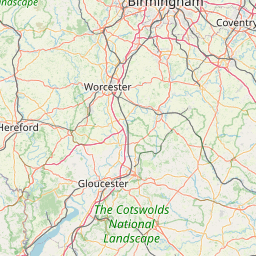
      Broughton Astley is located in Leicestershire CC and Rutland, United Kingdomcountry within 52° 31' 40.08" N -2° 46' 21" W (52.5278, -1.2275) coordinates. The local time in Broughton Astley is 04:20 (13.08.2025)

      Stockport is located in Greater Manchester South East, United Kingdomcountry within 53° 24' 29.88" N -3° 51' 2.16" W (53.4083, -2.1494) coordinates. The local time in Stockport is 04:20 (13.08.2025)

      The calculated flying distance from Broughton Astley to Stockport is 71.92miles which is equal to 115.74 km.

      If you want to go by car, the driving driving distance between Broughton Astley and Stockport is 111.43 miles (179.33 km). If you ride your car with an average speef of 112 kilometers/hour (70 miles/h), travel time will be 1 hours 36 minutes.Please check the avg.speed travel time on the right for various options

      Estimated Travel Time Between Broughton Astley and Stockport

      Average speedTravel Time
      30 mph (48 km/h)3 hours 43 minutes
      40 mph (64 km/h)2 hours 47 minutes
      50 mph (80 km/h)2 hours 14 minutes
      60 mph (67 km/h)1 hours 51 minutes
      70 mph (112 km/h)1 hours 36 minutes
      75 mph (120 km/h)1 hours 29 minutes

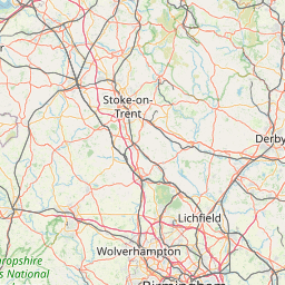
      Broughton Astley, Leicestershire CC and Rutland, United Kingdom

      Related Distances from Broughton Astley

      CitiesDistance
      Broughton Astley to Leicester8.39 mi (13.50 km)
      Broughton Astley to Coventry14.51 mi (23.34 km)
      Broughton Astley to Birmingham28.58 mi (46.00 km)
      Broughton Astley to Nottingham29.58 mi (47.60 km)
      Broughton Astley to Stoke-on-Trent51.59 mi (83.02 km)
      Broughton Astley to Sheffield59.80 mi (96.23 km)
      Broughton Astley to Stockport71.92 mi (115.74 km)
      Broughton Astley to Reading74.96 mi (120.64 km)
      Broughton Astley to Manchester78.19 mi (125.83 km)
      Broughton Astley to London84.62 mi (136.18 km)
      Broughton Astley to Bolton88.06 mi (141.72 km)
      Broughton Astley to Leeds88.93 mi (143.12 km)
      Broughton Astley to Bradford90.53 mi (145.69 km)
      Broughton Astley to Kingston upon Hull91.88 mi (147.87 km)
      Broughton Astley to Bristol94.37 mi (151.87 km)
      Broughton Astley to Liverpool95.31 mi (153.39 km)
      Broughton Astley to Ipswich105.77 mi (170.22 km)
      Broughton Astley to Caerdydd110.06 mi (177.13 km)
      Broughton Astley to Southampton112.55 mi (181.13 km)
      Broughton Astley to Portsmouth119.13 mi (191.72 km)
      Broughton Astley to Worthing123.92 mi (199.42 km)
      Broughton Astley to Newcastle170.15 mi (273.83 km)
      Broughton Astley to Belfast240.06 mi (386.34 km)
      Broughton Astley to Edinburgh249.56 mi (401.62 km)
      Broughton Astley to Glasgow260.65 mi (419.48 km)

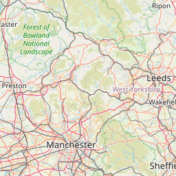
      Stockport, Greater Manchester South East, United Kingdom

      Related Distances to Stockport

      CitiesDistance
      Manchester to Stockport6.30 mi (10.14 km)
      Bolton to Stockport16.42 mi (26.42 km)
      Sheffield to Stockport28.04 mi (45.13 km)
      Stoke-on-Trent to Stockport28.25 mi (45.46 km)
      Bradford to Stockport31.63 mi (50.91 km)
      Liverpool to Stockport34.70 mi (55.84 km)
      Leeds to Stockport36.58 mi (58.87 km)
      Nottingham to Stockport51.97 mi (83.64 km)
      Birmingham to Stockport64.96 mi (104.54 km)
      Leicester to Stockport68.17 mi (109.71 km)
      Coventry to Stockport74.06 mi (119.18 km)
      Kingston upon Hull to Stockport78.07 mi (125.64 km)
      Sunderland to Stockport108.05 mi (173.89 km)
      Newcastle to Stockport110.76 mi (178.25 km)
      Bristol to Stockport136.37 mi (219.46 km)
      Caerdydd to Stockport140.00 mi (225.30 km)
      Reading to Stockport143.82 mi (231.45 km)
      London to Stockport156.51 mi (251.88 km)
      Ipswich to Stockport166.72 mi (268.31 km)
      Belfast to Stockport174.07 mi (280.13 km)
      Southampton to Stockport175.99 mi (283.23 km)
      Edinburgh to Stockport180.68 mi (290.77 km)
      Portsmouth to Stockport185.37 mi (298.33 km)
      Glasgow to Stockport189.13 mi (304.37 km)
      Worthing to Stockport194.42 mi (312.89 km)