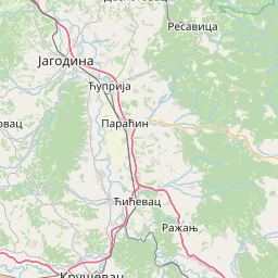
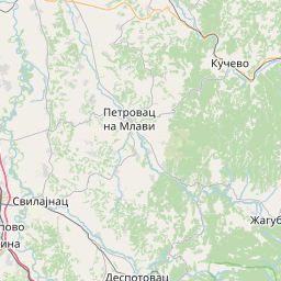
Distance Calculator

Стевана Синђелића, 218

128.4 km, 2 h 40 min

Head south on Караџићева100 m
Turn right onto Николе Пашића300 m
Enter Трг краља Александра Ујединитеља and take the 1st exit onto Кнегиње Љубице0.5 m
Exit the traffic circle onto Кнегиње Љубице350 m
Continue onto Булевар 12. фебруар3 km
Enter the traffic circle and take the 1st exit onto Булевар 12. фебруар20 m
Exit the traffic circle onto Булевар 12. фебруар800 m
Make a slight right towards Aleksinac40 m
Make a slight right towards Aleksinac8 km
Turn right onto Царице Милице (218)5 km
Continue onto Краља Уроша Великог (218)4.5 km
Continue onto Маршала Тита (218)4 km
Make a slight right to stay on 21825 km
Turn left onto Озренских партизана (218)150 m
Continue right onto Хајдук Вељка (218)200 m
Turn right onto Светог Саве (217)1.5 km
Keep left onto Николиначки пут (218)5 km
Continue onto Јасенска (218)20 km
Turn right onto Краља Александра (218)150 m
Turn left onto Обилићева (219)800 m
Turn right onto 3615 km
Turn left towards Бор / Bor10 km
Continue onto Кајмакчаланска (37)9 km
Enter the traffic circle and take the 2nd exit onto Зелени булевар30 m
Exit the traffic circle onto Зелени булевар1 km
Enter the traffic circle and take the 2nd exit onto Зелени булевар20 m
Exit the traffic circle onto Зелени булевар200 m
Continue straight onto Моше Пијаде1 km
Turn left onto Ђорђа Вајферта200 m
Turn left onto Шистекова350 m
Turn right onto Војске Југославије200 m
Turn left onto Доситеја Обрадовића200 m
Make a slight right to stay on Доситеја Обрадовића1 km
Go straight onto Војске Југославије100 m
Continue onto Хердерова2.5 km
Continue slightly right onto Пауна Страиновића (393)4 km
Turn right onto Димитрија Наумовића (393)200 m
Turn left onto Горњанска (393)1.5 km
You have arrived at your destination0 m

35, Српских великана

141.1 km, 2 h 50 min

Head south on Караџићева100 m
Turn right onto Николе Пашића300 m
Enter Трг краља Александра Ујединитеља and take the 1st exit onto Кнегиње Љубице0.5 m
Exit the traffic circle onto Кнегиње Љубице350 m
Turn right to stay on Кеј Мике Палигорића350 m
Go straight onto Шуматовачка60 m
Continue slightly left onto Хероја са Паштрика700 m
Continue onto Нишавска450 m
Turn left onto Краља Милутина150 m
Make a slight right onto Косовке девојке700 m
Turn right onto Булевар Светог Пантелејмона700 m
Enter the traffic circle and take the 2nd exit onto Сомборска45 m
Exit the traffic circle onto Сомборска55 m
Continue onto Булевар Светог Пантелејмона300 m
Enter Сомборски булевар and take the 2nd exit onto Булевар Светог Пантелејмона25 m
Exit the traffic circle onto Булевар Светог Пантелејмона1 km
Enter the traffic circle and take the 3rd exit onto Матејевачки пут70 m
Exit the traffic circle onto Матејевачки пут500 m
Continue straight500 m
Take the ramp on the left800 m
Merge left onto A47 km
Take the ramp towards 35: Зајечар / Zaječar700 m
Make a slight right20 m
Keep left at the fork100 m
Make a slight left onto 3515 km
Continue straight to stay on Радетова (35)30 km
Keep right towards Зајечар / Zaječar8 km
Go straight onto 359 km
Enter the traffic circle and take the 2nd exit onto 3535 m
Exit the traffic circle onto 354 km
Go straight onto 3520 km
Turn right to stay on Грљански пут (35)250 m
Enter the traffic circle and take the 2nd exit onto Милоша Обилића (35)40 m
Exit the traffic circle onto Милоша Обилића (35)10 km
Make a slight right towards Рготина / Rgotina250 m
Go straight onto 1659 km
Keep left onto 1668 km
Make a slight right towards Оштрељ15 km
Turn right onto Димитрија Наумовића (393)200 m
Turn left onto Горњанска (393)1.5 km
You have arrived at your destination0 m
From
    To

      Distance: 56.99 mi (91.72 km)

      Driving route: 79.78 mi (128.39 km).

      Driving time: 2h 39 min

      Distance from Nis to Bor

      The shortest distance (air line) between Nis and Bor is 56.99mi (91.72 km)

      The shortest route between Nis and Bor is 79.78 mi (128.39 km) according to the route planner. The driving time is approx. 2 h 39 m

      How far is it between Nis and Bor.

      Nis is located in Nišavska oblast, Serbiacountry within 43° 19' 9.12" N 21° 53' 45.96" E (43.3192, 21.8961) coordinates. The local time in Nis is 13:00 (14.08.2025)

      Bor is located in Borska oblast, Serbiacountry within 44° 7' 49.08" N 22° 6' 12.96" E (44.1303, 22.1036) coordinates. The local time in Bor is 13:00 (14.08.2025)

      The calculated flying distance from Nis to Bor is 56.99miles which is equal to 91.72 km.

      If you want to go by car, the driving driving distance between Nis and Bor is 79.78 miles (128.39 km). If you ride your car with an average speef of 112 kilometers/hour (70 miles/h), travel time will be 1 hours 9 minutes.Please check the avg.speed travel time on the right for various options

      Estimated Travel Time Between Nis and Bor

      Average speedTravel Time
      30 mph (48 km/h)2 hours 40 minutes
      40 mph (64 km/h)1 hours 60 minutes
      50 mph (80 km/h)1 hours 36 minutes
      60 mph (67 km/h)1 hours 20 minutes
      70 mph (112 km/h)1 hours 8 minutes
      75 mph (120 km/h)1 hours 4 minutes

      Nis, Nišavska oblast, Serbia

      Related Distances from Nis

      CitiesDistance
      Nis to Krusevac33.89 mi (54.54 km)
      Nis to Cuprija49.37 mi (79.45 km)
      Nis to Trstenik49.59 mi (79.81 km)
      Nis to Bor56.99 mi (91.72 km)
      Nis to Kraljevo66.70 mi (107.35 km)
      Nis to Kragujevac67.77 mi (109.06 km)
      Nis to Novi Pazar70.41 mi (113.32 km)
      Nis to Uzice108.77 mi (175.05 km)
      Nis to Kovin109.10 mi (175.59 km)
      Nis to Prijepolje113.69 mi (182.97 km)
      Nis to Valjevo119.84 mi (192.87 km)
      Nis to Pancevo123.98 mi (199.53 km)
      Nis to Bajina Basta125.24 mi (201.55 km)
      Nis to Belgrade125.83 mi (202.51 km)
      Nis to Vrsac127.62 mi (205.38 km)
      Nis to Zemun129.22 mi (207.97 km)
      Nis to Stara Pazova143.42 mi (230.81 km)
      Nis to Pecinci145.22 mi (233.71 km)
      Nis to Indija149.55 mi (240.68 km)
      Nis to Ruma154.72 mi (249.00 km)
      Nis to Sremska Mitrovica160.70 mi (258.62 km)
      Nis to Zrenjanin160.87 mi (258.89 km)
      Nis to Sid181.12 mi (291.48 km)
      Nis to Kikinda187.71 mi (302.10 km)
      Nis to Senta201.14 mi (323.70 km)

      Bor, Borska oblast, Serbia

      Related Distances to Bor

      CitiesDistance
      Cuprija to Bor39.22 mi (63.12 km)
      Krusevac to Bor54.10 mi (87.06 km)
      Nis to Bor56.99 mi (91.72 km)
      Kragujevac to Bor58.35 mi (93.90 km)
      Trstenik to Bor65.47 mi (105.37 km)
      Kovin to Bor70.56 mi (113.55 km)
      Kraljevo to Bor75.89 mi (122.14 km)
      Vrsac to Bor78.70 mi (126.65 km)
      Pancevo to Bor88.41 mi (142.28 km)
      Belgrade to Bor94.00 mi (151.28 km)
      Zemun to Bor97.59 mi (157.05 km)
      Novi Pazar to Bor104.32 mi (167.89 km)
      Valjevo to Bor110.38 mi (177.64 km)
      Stara Pazova to Bor112.10 mi (180.40 km)
      Uzice to Bor113.68 mi (182.96 km)
      Pecinci to Bor117.94 mi (189.81 km)
      Indija to Bor117.98 mi (189.87 km)
      Zrenjanin to Bor120.69 mi (194.24 km)
      Bajina Basta to Bor126.79 mi (204.04 km)
      Ruma to Bor126.88 mi (204.20 km)
      Prijepolje to Bor128.75 mi (207.20 km)
      Sremska Mitrovica to Bor135.68 mi (218.35 km)
      Kikinda to Bor142.74 mi (229.71 km)
      Sid to Bor156.73 mi (252.23 km)
      Senta to Bor158.59 mi (255.22 km)