


Distance Calculator


Distance from Solothurn to Carouge
The shortest distance (air line) between Solothurn and Carouge is 97.46mi (156.85 km)
The shortest route between Solothurn and Carouge is 124.07 mi (199.66 km) according to the route planner. The driving time is approx. 2 h 24 m
How far is it between Solothurn and Carouge.
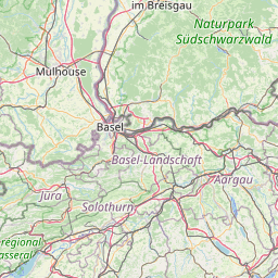
Solothurn is located in Solothurn, Switzerlandcountry within 47° 13' 0.12" N 7° 31' 59.88" E (47.2167, 7.5333) coordinates. The local time in Solothurn is 23:03 (14.06.2025)
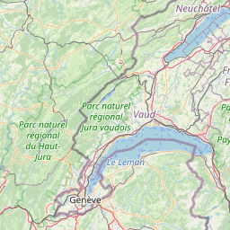
Carouge is located in Genève, Switzerlandcountry within 46° 10' 59.88" N 6° 7' 59.88" E (46.1833, 6.1333) coordinates. The local time in Carouge is 23:03 (14.06.2025)
The calculated flying distance from Solothurn to Carouge is 97.46miles which is equal to 156.85 km.
If you want to go by car, the driving driving distance between Solothurn and Carouge is 124.07 miles (199.66 km). If you ride your car with an average speef of 112 kilometers/hour (70 miles/h), travel time will be 1 hours 47 minutes.Please check the avg.speed travel time on the right for various options
Estimated Travel Time Between Solothurn and Carouge
| Average speed | Travel Time |
|---|---|
| 30 mph (48 km/h) | 4 hours 8 minutes |
| 40 mph (64 km/h) | 3 hours 6 minutes |
| 50 mph (80 km/h) | 2 hours 29 minutes |
| 60 mph (67 km/h) | 2 hours 4 minutes |
| 70 mph (112 km/h) | 1 hours 46 minutes |
| 75 mph (120 km/h) | 1 hours 39 minutes |
Solothurn, Solothurn, Switzerland
Related Distances from Solothurn
| Cities | Distance |
|---|---|
| Solothurn to Biel/Bienne | 14.50 mi (23.34 km) |
| Solothurn to Bern | 18.99 mi (30.57 km) |
| Solothurn to Basel | 23.51 mi (37.83 km) |
| Solothurn to Thun | 31.45 mi (50.61 km) |
| Solothurn to Neuchatel | 31.94 mi (51.41 km) |
| Solothurn to Fribourg | 33.99 mi (54.70 km) |
| Solothurn to Lucerne | 37.83 mi (60.89 km) |
| Solothurn to Dietikon | 42.53 mi (68.45 km) |
| Solothurn to Zug | 46.30 mi (74.52 km) |
| Solothurn to Zurich | 48.47 mi (78.00 km) |
| Solothurn to Yverdon-les-Bains | 51.82 mi (83.40 km) |
| Solothurn to Dubendorf | 52.60 mi (84.64 km) |
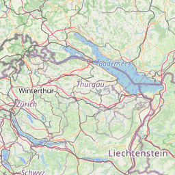
| Solothurn to Winterthur | 59.25 mi (95.35 km) |
| Solothurn to Vevey | 61.06 mi (98.26 km) |
| Solothurn to Schaffhausen | 61.28 mi (98.63 km) |
| Solothurn to Lausanne | 64.23 mi (103.36 km) |
| Solothurn to Renens | 65.14 mi (104.83 km) |
| Solothurn to Sankt Gallen | 87.25 mi (140.41 km) |
| Solothurn to Geneva | 96.08 mi (154.63 km) |
| Solothurn to Carouge | 97.46 mi (156.85 km) |
| Solothurn to Chur | 97.53 mi (156.96 km) |
| Solothurn to Vernier | 97.70 mi (157.23 km) |
| Solothurn to Meyrin | 97.98 mi (157.68 km) |
| Solothurn to Onex | 98.54 mi (158.59 km) |
| Solothurn to Bellinzona | 100.03 mi (160.98 km) |
Related Distances to Carouge
| Cities | Distance |
|---|---|
| Geneva to Carouge | 1.43 mi (2.30 km) |
| Onex to Carouge | 1.59 mi (2.56 km) |
| Vernier to Carouge | 1.97 mi (3.17 km) |
| Meyrin to Carouge | 3.93 mi (6.33 km) |
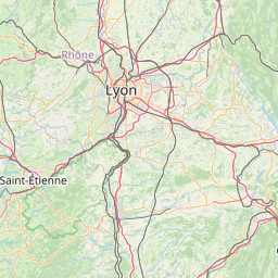
| Renens to Carouge | 32.33 mi (52.03 km) |
| Lausanne to Carouge | 33.31 mi (53.61 km) |
| Vevey to Carouge | 39.41 mi (63.42 km) |
| Yverdon-les-Bains to Carouge | 47.69 mi (76.75 km) |
| Fribourg to Carouge | 64.45 mi (103.73 km) |
| Neuchatel to Carouge | 68.02 mi (109.47 km) |
| Bern to Carouge | 81.79 mi (131.63 km) |
| Thun to Carouge | 81.97 mi (131.91 km) |
| Biel/Bienne to Carouge | 84.34 mi (135.72 km) |
| Allschwil to Carouge | 115.28 mi (185.53 km) |
| Basel to Carouge | 117.12 mi (188.48 km) |
| Lucerne to Carouge | 118.99 mi (191.49 km) |
| Zug to Carouge | 131.89 mi (212.26 km) |
| Dietikon to Carouge | 136.24 mi (219.26 km) |
| Bellinzona to Carouge | 138.53 mi (222.95 km) |
| Zurich to Carouge | 140.53 mi (226.16 km) |
| Dubendorf to Carouge | 145.11 mi (233.52 km) |
| Winterthur to Carouge | 152.65 mi (245.67 km) |
| Schaffhausen to Carouge | 157.75 mi (253.87 km) |
| Chur to Carouge | 168.08 mi (270.49 km) |
| Sankt Gallen to Carouge | 175.46 mi (282.38 km) |
 Connectez-vous avec Google