Distance Calculator

A50, A2

142.8 km, 1 h 59 min

Head east on Deventerstraat1.5 km
Continue onto Zutphensestraat2.5 km
Take the ramp on the right towards A50: Arnhem8 km
Take exit 23 towards Loenen15 km
Merge left onto Europaweg (A12)6 km
Keep right towards A50: Rotterdam40 km
Keep left towards A50: Uden8 km
Take exit 14 towards Zeeland400 m
Enter the traffic circle and take the 2nd exit towards A50: Veghel40 m
Exit the traffic circle towards A50: Veghel25 km
Take exit 6+7 towards Helmond350 m
Keep left towards Helmond600 m
Merge right towards Helmond5 km
Make a slight left90 m
Make a slight left onto Onze Lieve Vrouwestraat (RING)600 m
Continue onto Insulindelaan (RING)700 m
Enter Insulindeplein and take the 2nd exit towards RING: A2 A6770 m
Exit the traffic circle towards RING: A2 A67600 m
Continue onto Jeroen Boschlaan (RING)800 m
Continue onto Hugo van der Goeslaan (RING)400 m
Continue onto Piuslaan (RING)1 km
Turn left onto Leenderweg900 m
Keep right onto Floraplein100 m
Turn right towards Antwerpen1 km
Merge left onto N215 m
Keep left onto N2200 m
Take the ramp towards A2: Maastricht15 km
Take exit 36 towards Maarheeze2.5 km
Take exit 37 towards Budel3 km
Take exit 38 towards Weert-Noord700 m
Turn right onto Eindhovenseweg3 km
Turn right50 m
Turn right onto Eindhovenseweg200 m
Enter the traffic circle and take the 2nd exit onto Eindhovenseweg30 m
Exit the traffic circle onto Eindhovenseweg300 m
Continue onto Bassin100 m
Continue onto Wilhelminasingel450 m
Turn right onto Wilhelminastraat350 m
Turn right onto Molenveldstraat100 m
You have arrived at your destination, on the left0 m
From
    To

      Distance: 67.76 mi (109.05 km)

      Driving route: 88.76 mi (142.85 km).

      Driving time: 1h 58 min

      Distance from Weert to Apeldoorn

      The shortest distance (air line) between Weert and Apeldoorn is 67.76mi (109.05 km)

      The shortest route between Weert and Apeldoorn is 88.76 mi (142.85 km) according to the route planner. The driving time is approx. 1 h 58 m

      How far is it between Weert and Apeldoorn.

      Weert is located in Midden-Limburg, Netherlandscountry within 51° 15' 0" N 5° 42' 0" E (51.2500, 5.7000) coordinates. The local time in Weert is 18:11 (22.07.2025)

      Apeldoorn is located in Veluwe, Netherlandscountry within 52° 13' 0.12" N 5° 58' 0.12" E (52.2167, 5.9667) coordinates. The local time in Apeldoorn is 18:11 (22.07.2025)

      The calculated flying distance from Weert to Apeldoorn is 67.76miles which is equal to 109.05 km.

      If you want to go by car, the driving driving distance between Weert and Apeldoorn is 88.76 miles (142.85 km). If you ride your car with an average speef of 112 kilometers/hour (70 miles/h), travel time will be 1 hours 17 minutes.Please check the avg.speed travel time on the right for various options

      Estimated Travel Time Between Weert and Apeldoorn

      Average speedTravel Time
      30 mph (48 km/h)2 hours 58 minutes
      40 mph (64 km/h)2 hours 13 minutes
      50 mph (80 km/h)1 hours 47 minutes
      60 mph (67 km/h)1 hours 29 minutes
      70 mph (112 km/h)1 hours 16 minutes
      75 mph (120 km/h)1 hours 11 minutes

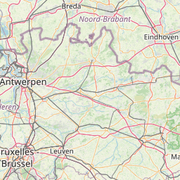
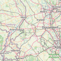
      Weert, Midden-Limburg, Netherlands

      Related Distances from Weert

      CitiesDistance
      Weert to Eindhoven15.74 mi (25.34 km)
      Weert to Maastricht27.65 mi (44.49 km)
      Weert to Tilburg33.71 mi (54.25 km)
      Weert to s-Hertogenbosch34.54 mi (55.58 km)
      Weert to Nijmegen41.87 mi (67.38 km)
      Weert to Breda46.20 mi (74.34 km)
      Weert to Arnhem51.51 mi (82.90 km)
      Weert to Dordrecht57.89 mi (93.16 km)
      Weert to Utrecht62.77 mi (101.01 km)
      Weert to Amersfoort63.65 mi (102.43 km)
      Weert to Apeldoorn67.76 mi (109.05 km)
      Weert to Rotterdam69.11 mi (111.22 km)
      Weert to Alphen aan den Rijn75.39 mi (121.32 km)
      Weert to Zoetermeer76.35 mi (122.87 km)
      Weert to Almere79.87 mi (128.54 km)
      Weert to Leiden81.47 mi (131.11 km)
      Weert to The Hague82.68 mi (133.07 km)
      Weert to Enschede84.25 mi (135.58 km)
      Weert to Hoofddorp84.77 mi (136.42 km)
      Weert to Amsterdam84.88 mi (136.60 km)
      Weert to Zwolle89.17 mi (143.50 km)
      Weert to Haarlem90.59 mi (145.79 km)
      Weert to Zaanstad93.03 mi (149.71 km)
      Weert to Leeuwarden134.78 mi (216.90 km)
      Weert to Groningen140.75 mi (226.51 km)

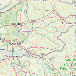
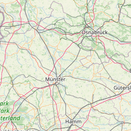
      Apeldoorn, Veluwe, Netherlands

      Related Distances to Apeldoorn

      CitiesDistance
      Arnhem to Apeldoorn16.27 mi (26.18 km)
      Zwolle to Apeldoorn21.48 mi (34.56 km)
      Amersfoort to Apeldoorn25.14 mi (40.46 km)
      Nijmegen to Apeldoorn25.89 mi (41.67 km)
      Almere to Apeldoorn33.35 mi (53.67 km)
      Utrecht to Apeldoorn37.20 mi (59.86 km)
      Enschede to Apeldoorn39.51 mi (63.58 km)
      s-Hertogenbosch to Apeldoorn46.52 mi (74.87 km)
      Amsterdam to Apeldoorn46.61 mi (75.01 km)
      Zaanstad to Apeldoorn53.19 mi (85.59 km)
      Hoofddorp to Apeldoorn54.31 mi (87.41 km)
      Alphen aan den Rijn to Apeldoorn55.38 mi (89.13 km)
      Haarlem to Apeldoorn57.50 mi (92.54 km)
      Eindhoven to Apeldoorn57.93 mi (93.23 km)
      Alkmaar to Apeldoorn58.79 mi (94.61 km)
      Tilburg to Apeldoorn59.51 mi (95.77 km)
      Dordrecht to Apeldoorn62.04 mi (99.84 km)
      Leiden to Apeldoorn62.67 mi (100.86 km)
      Zoetermeer to Apeldoorn63.05 mi (101.47 km)
      Rotterdam to Apeldoorn65.65 mi (105.66 km)
      Breda to Apeldoorn66.77 mi (107.46 km)
      Leeuwarden to Apeldoorn68.37 mi (110.03 km)
      The Hague to Apeldoorn70.87 mi (114.05 km)
      Groningen to Apeldoorn73.51 mi (118.31 km)
      Maastricht to Apeldoorn95.21 mi (153.23 km)