Distance Calculator

Voralpenstraße, West Autobahn

74.2 km, 1 h 6 min

Head southeast on Österreicherstraße90 m
Turn left onto Mittelstraße150 m
Turn right onto Stadlgasse60 m
Turn left onto Eisenstraße150 m
Turn left onto Dukartstraße45 m
Continue onto Schönauerbrücke300 m
Continue onto Tomitzstraße550 m
Continue onto Schwimmschulstraße350 m
Continue onto Wiesenberg400 m
Turn left onto Sierninger Straße (B122)2 km
Continue onto Voralpenstraße (Bierhäuslberg) (B122)6 km
Enter the traffic circle and take the 1st exit onto Voralpenstraße (B122)20 m
Exit the traffic circle onto Voralpenstraße (B122)7 km
Continue onto Ing. Pesendorfer Straße (B122)1.5 km
Continue onto Bahnhofstraße (B122)500 m
Continue onto Rohrer Straße (B122)1.5 km
Continue onto Voralpen Straße (B122)1.5 km
Enter the traffic circle and take the 2nd exit towards B122: Sattledt90 m
Exit the traffic circle towards B122: Sattledt3 km
Continue onto Bad Haller Straße (B122)2 km
Continue onto Voralpen Straße (B122)450 m
Turn right onto Hauptstraße (B122)150 m
Turn left onto Hauptstraße (B122)150 m
Continue onto Fuxjägerstraße (B122)550 m
Continue slightly left onto Welser Straße (B122)1.5 km
Continue onto Voralpen Straße (B122)2 km
Continue onto Kremsmünsterer Straße (B122)1.5 km
Continue onto Hauptstraße (B122)1.5 km
Turn right onto Welser Straße (B138)150 m
Take the ramp on the left towards A1: Wels1 km
Keep left towards A1: Salzburg1 km
Merge left towards Salzburg25 km
Take exit 224 towards B145: Regau450 m
Enter Salzkammergut Straße and take the 2nd exit towards B145: Bad Ischl80 m
Exit the traffic circle towards B145: Bad Ischl4.5 km
Continue onto B1456 km
Turn left onto Fischerweg70 m
Turn right to stay on Fischerweg100 m
You have arrived at your destination, on the right0 m

West Autobahn, B145

88.1 km, 1 h 11 min

Head southeast on Österreicherstraße90 m
Turn left onto Mittelstraße150 m
Turn right onto Stadlgasse60 m
Turn left onto Eisenstraße150 m
Turn left onto Dukartstraße45 m
Continue onto Schönauerbrücke300 m
Continue onto Tomitzstraße550 m
Continue onto Schwimmschulstraße350 m
Continue onto Wiesenberg350 m
Make a sharp right onto Seifentruhe (B122)800 m
Continue onto Voralpenstraße (B122)100 m
Turn left onto Wolfernstraße (L564)3.5 km
Continue onto Wolferner Straße (L564)500 m
Continue onto Steyrer Straße (L564)1 km
Continue onto Linzer Straße (L564)1.5 km
Continue onto Niederlindach (L564)1.5 km
Continue onto Reitererstraße (L564)350 m
Continue onto Leihmannsdorf (L564)700 m
Continue onto Wolferner Straße (L564)5.5 km
Turn left onto L1377700 m
Turn right1 km
Continue onto Obereglsee2 km
Continue straight onto Niederneukirchner Straße (L1399)1.5 km
Continue onto Moos; Kurzenkirchen (L1399)1.5 km
Continue onto Kurzenkirchner Straße (L1399)200 m
Turn right onto Nettingsdorfer Straße1.5 km
Turn right onto Kremstalstraße (B139)1 km
Turn left150 m
Take the ramp on the left towards A1150 m
Merge left onto West Autobahn (A1)50 km
Take exit 224 towards B145: Regau450 m
Enter Salzkammergut Straße and take the 2nd exit towards B145: Bad Ischl80 m
Exit the traffic circle towards B145: Bad Ischl4.5 km
Continue onto B1456 km
Turn left onto Fischerweg70 m
Turn right to stay on Fischerweg100 m
You have arrived at your destination, on the right0 m
From
    To

      Distance: 31.45 mi (50.61 km)

      Driving route: 46.08 mi (74.15 km).

      Driving time: 1h 5 min

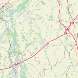
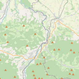
      Distance from Altmunster to Steyr

      The shortest distance (air line) between Altmunster and Steyr is 31.45mi (50.61 km)

      The shortest route between Altmunster and Steyr is 46.08 mi (74.15 km) according to the route planner. The driving time is approx. 1 h 5 m

      How far is it between Altmunster and Steyr.

      Altmunster is located in Traunviertel, Austriacountry within 47° 53' 60" N 13° 46' 0.12" E (47.9000, 13.7667) coordinates. The local time in Altmunster is 23:53 (22.07.2025)

      Steyr is located in Steyr-Kirchdorf, Austriacountry within 48° 1' 59.88" N 14° 25' 0.12" E (48.0333, 14.4167) coordinates. The local time in Steyr is 23:53 (22.07.2025)

      The calculated flying distance from Altmunster to Steyr is 31.45miles which is equal to 50.61 km.

      If you want to go by car, the driving driving distance between Altmunster and Steyr is 46.08 miles (74.15 km). If you ride your car with an average speef of 112 kilometers/hour (70 miles/h), travel time will be 0 hours 40 minutes.Please check the avg.speed travel time on the right for various options

      Estimated Travel Time Between Altmunster and Steyr

      Average speedTravel Time
      30 mph (48 km/h)1 hours 32 minutes
      40 mph (64 km/h)1 hours 9 minutes
      50 mph (80 km/h)0 hours 55 minutes
      60 mph (67 km/h)0 hours 46 minutes
      70 mph (112 km/h)0 hours 39 minutes
      75 mph (120 km/h)0 hours 37 minutes

      Altmunster, Traunviertel, Austria

      Related Distances from Altmunster

      CitiesDistance
      Altmunster to Wels20.78 mi (33.44 km)
      Altmunster to Traun31.16 mi (50.15 km)
      Altmunster to Steyr31.45 mi (50.61 km)
      Altmunster to Salzburg34.17 mi (54.99 km)
      Altmunster to Leonding34.49 mi (55.51 km)
      Altmunster to Linz36.89 mi (59.37 km)
      Altmunster to Amstetten53.01 mi (85.30 km)
      Altmunster to Leoben71.55 mi (115.14 km)
      Altmunster to Sankt Polten87.92 mi (141.50 km)
      Altmunster to Wolfsberg88.72 mi (142.77 km)
      Altmunster to Villach88.72 mi (142.78 km)
      Altmunster to Klagenfurt92.13 mi (148.26 km)
      Altmunster to Krems an der Donau92.44 mi (148.76 km)
      Altmunster to Graz96.83 mi (155.83 km)
      Altmunster to Hall in Tirol113.89 mi (183.28 km)
      Altmunster to Baden114.43 mi (184.15 km)
      Altmunster to Wiener Neustadt115.26 mi (185.50 km)
      Altmunster to Modling117.05 mi (188.38 km)
      Altmunster to Innsbruck118.90 mi (191.36 km)
      Altmunster to Klosterneuburg120.92 mi (194.60 km)
      Altmunster to Vienna122.21 mi (196.68 km)
      Altmunster to Eisenstadt127.49 mi (205.17 km)
      Altmunster to Bregenz188.77 mi (303.79 km)
      Altmunster to Dornbirn189.86 mi (305.56 km)
      Altmunster to Lustenau193.34 mi (311.15 km)

      Steyr, Steyr-Kirchdorf, Austria

      Related Distances to Steyr

      CitiesDistance
      Traun to Steyr15.36 mi (24.73 km)
      Leonding to Steyr18.59 mi (29.92 km)
      Linz to Steyr19.76 mi (31.80 km)
      Wels to Steyr20.14 mi (32.42 km)
      Amstetten to Steyr21.56 mi (34.70 km)
      Leoben to Steyr55.03 mi (88.56 km)
      Sankt Polten to Steyr56.54 mi (90.99 km)
      Kapfenberg to Steyr57.69 mi (92.85 km)
      Krems an der Donau to Steyr61.26 mi (98.59 km)
      Salzburg to Steyr65.53 mi (105.46 km)
      Graz to Steyr81.81 mi (131.66 km)
      Baden to Steyr84.02 mi (135.22 km)
      Wolfsberg to Steyr84.67 mi (136.26 km)
      Wiener Neustadt to Steyr86.19 mi (138.71 km)
      Modling to Steyr86.26 mi (138.83 km)
      Klosterneuburg to Steyr89.53 mi (144.08 km)
      Vienna to Steyr91.01 mi (146.47 km)
      Eisenstadt to Steyr98.02 mi (157.74 km)
      Klagenfurt to Steyr98.03 mi (157.76 km)
      Villach to Steyr101.62 mi (163.54 km)
      Hall in Tirol to Steyr145.28 mi (233.81 km)
      Innsbruck to Steyr150.31 mi (241.90 km)
      Bregenz to Steyr219.77 mi (353.69 km)
      Dornbirn to Steyr221.01 mi (355.68 km)
      Lustenau to Steyr224.45 mi (361.22 km)