| Head northwest on St. Mary's Lane | 6 m |
| Turn right onto Church Street (B6087) | 250 m |
| Turn right onto Mill Road (B6087) | 400 m |
| Continue onto Nether Lane (B6087) | 1 km |
| Enter the traffic circle and take the 1st exit onto Nether Lane (B6087) | 20 m |
| Exit the traffic circle onto Nether Lane (B6087) | 150 m |
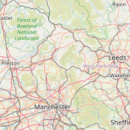
| Turn right onto Cowley Lane (A629) | 700 m |
| Enter Thorpe Hesley Interchange and take the 3rd exit | 250 m |
| Exit the traffic circle | 600 m |
| Merge right onto M1 | 15 km |
| Take the ramp on the left towards Worksop | 450 m |
| Enter Aston Interchange and take the 1st exit onto Worksop Road (A57) | 8 m |
| Exit the traffic circle onto Worksop Road (A57) | 2 km |
| Enter the traffic circle and take the 2nd exit onto Sheffield Road (A57) | 70 m |
| Exit the traffic circle onto Sheffield Road (A57) | 8 km |
| Keep left onto A57 | 600 m |
| Enter the traffic circle and take the 2nd exit onto A57 | 70 m |
| Exit the traffic circle onto A57 | 1.5 km |
| Enter the traffic circle and take the 2nd exit onto A57 | 55 m |
| Exit the traffic circle onto A57 | 1 km |
| Keep left onto A57 | 2 km |
| Enter the traffic circle and take the 2nd exit onto A57 | 70 m |
| Exit the traffic circle onto A57 | 2.5 km |
| Enter the traffic circle and take the 2nd exit onto A57 | 60 m |
| Exit the traffic circle onto A57 | 3.5 km |
| Enter the traffic circle and take the 2nd exit onto Apleyhead (A57) | 100 m |
| Exit the traffic circle onto Apleyhead (A57) | 400 m |
| Take the ramp on the left towards A1 | 450 m |
| Merge right onto Worksop Road (A1) | 4.5 km |
| Continue onto Twyford Lane (A1) | 25 km |
| Take the ramp on the left towards A46: Newark | 200 m |
| Turn left towards A46 | 60 m |
| Enter the traffic circle and take the 3rd exit onto A17 | 90 m |
| Exit the traffic circle onto A17 | 250 m |
| Enter the traffic circle and take the 2nd exit onto A17 | 40 m |
| Exit the traffic circle onto A17 | 3 km |
| Enter the traffic circle and take the 2nd exit onto Sleaford Road (A17) | 40 m |
| Exit the traffic circle onto Sleaford Road (A17) | 2.5 km |
| Continue onto Beckingham Bypass (A17) | 1.5 km |
| Continue onto Sleaford Road (A17) | 10 km |
| Go straight onto Heath Road (A17) | 2.5 km |
| Continue onto Newark Road (A17) | 7 km |
| Enter Holdingham Roundabout and take the 2nd exit onto Sleaford Bypass (A17) | 100 m |
| Exit the traffic circle onto Sleaford Bypass (A17) | 5 km |
| Continue onto Sleaford Road (A17) | 3 km |
| Go straight onto Heckington Bypass (A17) | 15 km |
| Enter the traffic circle and take the 2nd exit onto A17 | 25 m |
| Exit the traffic circle onto A17 | 7 km |
| Enter Sutterton Roundabout and take the 3rd exit onto Station Road (A17) | 100 m |
| Exit the traffic circle onto Station Road (A17) | 3.5 km |
| Continue onto Moulton Washway (A17) | 200 m |
| Continue onto Washway Road (A17) | 7 km |
| Enter Peppermint Junction and take the 1st exit onto A17 | 40 m |
| Exit the traffic circle onto A17 | 550 m |
| Enter the traffic circle and take the 2nd exit onto A17 | 40 m |
| Exit the traffic circle onto A17 | 6 km |
| Enter the traffic circle and take the 3rd exit onto A17 | 45 m |
| Exit the traffic circle onto A17 | 2.5 km |
| Enter the traffic circle and take the 2nd exit onto A17 | 45 m |
| Exit the traffic circle onto A17 | 1.5 km |
| Enter the traffic circle and take the 2nd exit onto A17 | 50 m |
| Exit the traffic circle onto A17 | 4 km |
| Enter the traffic circle and take the 2nd exit onto A17 | 30 m |
| Exit the traffic circle onto A17 | 200 m |
| Enter the traffic circle and take the 2nd exit onto A17 | 50 m |
| Exit the traffic circle onto A17 | 15 km |
| Enter Pullover Roundabout and take the 2nd exit onto A47 | 100 m |
| Exit the traffic circle onto A47 | 800 m |
| Take the ramp on the left onto A47 | 300 m |
| Enter Saddlebow Interchange and take the 3rd exit onto High Road | 200 m |
| Exit the traffic circle onto High Road | 1 km |
| Enter the traffic circle and take the 1st exit onto Low Road | 15 m |
| Exit the traffic circle onto Low Road | 1.5 km |
| Continue onto Thiefgate Lane | 2 km |
| Turn left onto Mill Road | 3 km |
| Turn right onto Lynn Road (A10) | 1 km |
| Enter Oakwood Corner Roundabout and take the 1st exit onto Stoke Road (A134) | 25 m |
| Exit the traffic circle onto Stoke Road (A134) | 2.5 km |
| Continue onto Lynn Road (A134) | 5.5 km |
| Turn left onto Downham Road (A1122) | 80 m |
| Turn right onto Lynn Road (A134) | 3 km |
| Enter the traffic circle and take the 1st exit onto Lynn Road (A134) | 25 m |
| Exit the traffic circle onto Lynn Road (A134) | 1 km |
| Continue onto Stoke Road (A134) | 1 km |
| Continue onto Stoke Ferry Bypass (A134) | 3 km |
| Enter the traffic circle and take the 2nd exit onto Methwold Road (B1112) | 20 m |
| Exit the traffic circle onto Methwold Road (B1112) | 3 km |
| Continue onto Main Road (B1112) | 900 m |
| Continue onto Stoke Road (B1112) | 1.5 km |
| Continue onto Brandon Road (B1112) | 3.5 km |
| Continue onto Lynn Road | 4 km |
| Continue onto Park View | 200 m |
| Go straight onto South Park | 200 m |
| Continue onto Brandon Road | 1.5 km |
| Turn right onto Mundford Road (A1065) | 40 m |
| Continue slightly left onto High Street (A1065) | 700 m |
| Turn left onto Thetford Road (B1107) | 60 m |
| Turn right onto Bury Road (B1106) | 7 km |
| Continue onto Brandon Road (B1106) | 15 km |
| Enter the traffic circle and take the 1st exit onto B1106 | 15 m |
| Exit the traffic circle onto B1106 | 550 m |
| Enter the traffic circle and take the 3rd exit onto A134 | 90 m |
| Exit the traffic circle onto A134 | 1.5 km |
| Enter the traffic circle and take the 2nd exit onto A134 | 50 m |
| Exit the traffic circle onto A134 | 250 m |
| Enter the traffic circle and take the 2nd exit onto Compiegne Way (A134) | 100 m |
| Exit the traffic circle onto Compiegne Way (A134) | 1 km |
| Enter St Saviours Interchange and take the 1st exit onto A14 | 100 m |
| Exit the traffic circle onto A14 | 35 km |
| Take the ramp on the left | 600 m |
| Enter Whitehouse Interchange and take the 1st exit onto Bury Road (A1156) | 15 m |
| Exit the traffic circle onto Bury Road (A1156) | 350 m |
| Enter the traffic circle and take the 2nd exit onto Bury Road | 40 m |
| Exit the traffic circle onto Bury Road | 550 m |
| Continue slightly right onto Norwich Road (A1156) | 2 km |
| Turn right | 15 m |
| Turn left onto Norwich Road (A1156) | 700 m |
| Continue onto St Matthew's Street (A1156) | 150 m |
| Enter the traffic circle and take the 2nd exit onto St Matthew's Street (A1156) | 30 m |
| Exit the traffic circle onto St Matthew's Street (A1156) | 100 m |
| Continue onto Crown Street (A1156) | 400 m |
| You have arrived at your destination | 0 m |


 Accedi con Google