Distance Calculator

M6, M62

145.0 km, 1 h 47 min

Head southwest on Paul Ware Street15 m
Turn right onto Boothen Old Road30 m
Turn right onto Lonsdale Street (A5006)7 m
Turn left onto Boothen Road250 m
Turn left onto Fleming Road (A52)150 m
Turn right onto London Road (A52)250 m
Keep left onto Hartshill Road (A52)300 m
Keep right onto Shelton Old Road (A52)300 m
Take the ramp on the left450 m
Merge right onto Queensway (A500)15 km
Enter Barthomley Interchange and take the 4th exit onto M6300 m
Exit the traffic circle onto M645 km
Take the ramp on the left1 km
Merge right onto M6215 km
Take the ramp on the left towards M60: Leeds550 m
Continue towards M6010 km
Continue onto M6245 km
Keep left onto M6064.5 km
Take the ramp on the left onto M606350 m
Enter Staygate Roundabout and take the 4th exit onto Rooley Lane (A6177)200 m
Exit the traffic circle onto Rooley Lane (A6177)1 km
Keep left onto Rooley Lane (A6177)600 m
Enter Dudley Hill and take the 2nd exit onto Sticker Lane (A6177)70 m
Exit the traffic circle onto Sticker Lane (A6177)1.5 km
Continue onto Laisterdyke (A6177)350 m
Turn right onto Leeds Road (A647)1 km
Turn left onto Leeds Road (A647)200 m
Keep left onto Bradford Road (A647)800 m
Keep right onto Bradford Road (A647)600 m
Merge right onto Dawsons Corner3.5 m
Keep right onto Dawsons Corner35 m
Go straight onto Bradford Road550 m
Turn left onto Old Road (B6156)700 m
Turn right onto Old Fold2.5 m
You have arrived at your destination0 m

M6, M62

141.5 km, 1 h 48 min

Head southwest on Paul Ware Street15 m
Turn right onto Boothen Old Road30 m
Turn right onto Lonsdale Street (A5006)7 m
Turn left onto Boothen Road250 m
Turn left onto Fleming Road (A52)150 m
Turn right onto London Road (A52)250 m
Keep left onto Hartshill Road (A52)300 m
Keep right onto Shelton Old Road (A52)300 m
Take the ramp on the left450 m
Merge right onto Queensway (A500)15 km
Enter Barthomley Interchange and take the 4th exit onto M6300 m
Exit the traffic circle onto M630 km
Take the ramp on the left500 m
Keep right at the fork300 m
Continue onto A5566 km
Continue onto M5610 km
Keep left towards M56: Ring Rd3 km
Continue onto M601.5 km
Keep right onto M6020 km
Take the ramp on the left onto M60350 m
Merge left onto Semple Way (A6104)500 m
Turn right onto Broadway (A663)8 km
Enter Thornham Interchange and take the 3rd exit onto M62350 m
Exit the traffic circle onto M6235 km
Keep left onto M6064.5 km
Take the ramp on the left onto M606350 m
Enter Staygate Roundabout and take the 4th exit onto Rooley Lane (A6177)200 m
Exit the traffic circle onto Rooley Lane (A6177)1 km
Keep left onto Rooley Lane (A6177)600 m
Enter Dudley Hill and take the 2nd exit onto Sticker Lane (A6177)70 m
Exit the traffic circle onto Sticker Lane (A6177)1.5 km
Continue onto Laisterdyke (A6177)350 m
Turn right onto Leeds Road (A647)1 km
Turn left onto Leeds Road (A647)200 m
Keep left onto Bradford Road (A647)800 m
Keep right onto Bradford Road (A647)600 m
Merge right onto Dawsons Corner3.5 m
Keep right onto Dawsons Corner35 m
Go straight onto Bradford Road550 m
Turn left onto Old Road (B6156)700 m
Turn right onto Old Fold2.5 m
You have arrived at your destination0 m
From
    To

      Distance: 59.90 mi (96.40 km)

      Driving route: 90.07 mi (144.96 km).

      Driving time: 1h 46 min

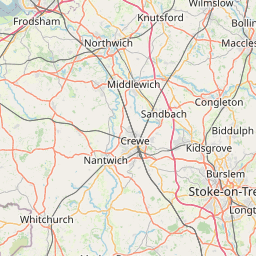
      Distance from Farsley to Stoke-on-Trent

      The shortest distance (air line) between Farsley and Stoke-on-Trent is 59.90mi (96.40 km)

      The shortest route between Farsley and Stoke-on-Trent is 90.07 mi (144.96 km) according to the route planner. The driving time is approx. 1 h 46 m

      How far is it between Farsley and Stoke-on-Trent.

      Farsley is located in Leeds, United Kingdomcountry within 53° 48' 41.76" N -2° 19' 41.52" W (53.8116, -1.6718) coordinates. The local time in Farsley is 06:19 (13.08.2025)

      Stoke-on-Trent is located in Stoke-on-Trent, United Kingdomcountry within 53° 0' 0" N -3° 49' 0.12" W (53.0000, -2.1833) coordinates. The local time in Stoke-on-Trent is 06:19 (13.08.2025)

      The calculated flying distance from Farsley to Stoke-on-Trent is 59.90miles which is equal to 96.40 km.

      If you want to go by car, the driving driving distance between Farsley and Stoke-on-Trent is 90.07 miles (144.96 km). If you ride your car with an average speef of 112 kilometers/hour (70 miles/h), travel time will be 1 hours 18 minutes.Please check the avg.speed travel time on the right for various options

      Estimated Travel Time Between Farsley and Stoke-on-Trent

      Average speedTravel Time
      30 mph (48 km/h)3 hours 0 minutes
      40 mph (64 km/h)2 hours 15 minutes
      50 mph (80 km/h)1 hours 48 minutes
      60 mph (67 km/h)1 hours 30 minutes
      70 mph (112 km/h)1 hours 17 minutes
      75 mph (120 km/h)1 hours 12 minutes

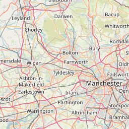
      Farsley, Leeds, United Kingdom

      Related Distances from Farsley

      CitiesDistance
      Farsley to Bradford3.29 mi (5.29 km)
      Farsley to Leeds5.04 mi (8.12 km)
      Farsley to Sheffield30.89 mi (49.71 km)
      Farsley to Manchester32.84 mi (52.85 km)
      Farsley to Stockport34.06 mi (54.81 km)
      Farsley to Bolton34.93 mi (56.21 km)
      Farsley to Kingston upon Hull54.88 mi (88.32 km)
      Farsley to Stoke-on-Trent59.90 mi (96.40 km)
      Farsley to Liverpool60.89 mi (97.99 km)
      Farsley to Nottingham63.08 mi (101.52 km)
      Farsley to Newcastle80.77 mi (129.98 km)
      Farsley to Leicester84.35 mi (135.74 km)
      Farsley to Birmingham92.50 mi (148.86 km)
      Farsley to Coventry97.20 mi (156.43 km)
      Farsley to Edinburgh159.79 mi (257.15 km)
      Farsley to Reading165.49 mi (266.33 km)
      Farsley to Bristol167.48 mi (269.53 km)
      Farsley to Ipswich168.85 mi (271.74 km)
      Farsley to London171.86 mi (276.58 km)
      Farsley to Caerdydd172.93 mi (278.30 km)
      Farsley to Glasgow174.84 mi (281.37 km)
      Farsley to Belfast180.39 mi (290.31 km)
      Farsley to Southampton201.32 mi (323.99 km)
      Farsley to Portsmouth209.14 mi (336.58 km)
      Farsley to Worthing214.22 mi (344.75 km)

      Stoke-on-Trent, Stoke-on-Trent, United Kingdom

      Related Distances to Stoke-on-Trent

      CitiesDistance
      Stockport to Stoke-on-Trent28.25 mi (45.46 km)
      Manchester to Stoke-on-Trent33.22 mi (53.47 km)
      Birmingham to Stoke-on-Trent37.80 mi (60.83 km)
      Sheffield to Stoke-on-Trent39.54 mi (63.63 km)
      Bolton to Stoke-on-Trent41.21 mi (66.31 km)
      Nottingham to Stoke-on-Trent43.11 mi (69.38 km)
      Liverpool to Stoke-on-Trent43.73 mi (70.38 km)
      Coventry to Stoke-on-Trent49.66 mi (79.91 km)
      Leicester to Stoke-on-Trent50.65 mi (81.52 km)
      Bradford to Stoke-on-Trent58.09 mi (93.48 km)
      Leeds to Stoke-on-Trent61.15 mi (98.40 km)
      Kingston upon Hull to Stoke-on-Trent92.01 mi (148.07 km)
      Bristol to Stoke-on-Trent108.27 mi (174.25 km)
      Caerdydd to Stoke-on-Trent113.05 mi (181.93 km)
      Reading to Stoke-on-Trent118.45 mi (190.62 km)
      London to Stoke-on-Trent134.89 mi (217.09 km)
      Sunderland to Stoke-on-Trent135.67 mi (218.34 km)
      Newcastle to Stoke-on-Trent138.77 mi (223.33 km)
      Southampton to Stoke-on-Trent148.67 mi (239.26 km)
      Ipswich to Stoke-on-Trent154.64 mi (248.87 km)
      Portsmouth to Stoke-on-Trent158.64 mi (255.30 km)
      Worthing to Stoke-on-Trent169.58 mi (272.92 km)
      Belfast to Stoke-on-Trent188.49 mi (303.35 km)
      Edinburgh to Stoke-on-Trent208.00 mi (334.75 km)
      Glasgow to Stoke-on-Trent214.40 mi (345.04 km)