Distance Calculator
Distance from Feldbach to Leoben
The shortest distance (air line) between Feldbach and Leoben is 47.43mi (76.34 km)
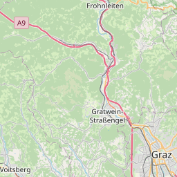
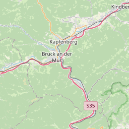
The shortest route between Feldbach and Leoben is 75.42 mi (121.37 km) according to the route planner. The driving time is approx. 1 h 33 m
How far is it between Feldbach and Leoben.
Feldbach is located in Oststeiermark, Austriacountry within 46° 57' 18" N 15° 53' 17.88" E (46.9550, 15.8883) coordinates. The local time in Feldbach is 17:10 (25.07.2025)
Leoben is located in Östliche Obersteiermark, Austriacountry within 47° 22' 54.12" N 15° 5' 49.92" E (47.3817, 15.0972) coordinates. The local time in Leoben is 17:10 (25.07.2025)
The calculated flying distance from Feldbach to Leoben is 47.43miles which is equal to 76.34 km.
If you want to go by car, the driving driving distance between Feldbach and Leoben is 75.42 miles (121.37 km). If you ride your car with an average speef of 112 kilometers/hour (70 miles/h), travel time will be 1 hours 5 minutes.Please check the avg.speed travel time on the right for various options
Estimated Travel Time Between Feldbach and Leoben
| Average speed | Travel Time |
|---|---|
| 30 mph (48 km/h) | 2 hours 31 minutes |
| 40 mph (64 km/h) | 1 hours 53 minutes |
| 50 mph (80 km/h) | 1 hours 30 minutes |
| 60 mph (67 km/h) | 1 hours 15 minutes |
| 70 mph (112 km/h) | 1 hours 5 minutes |
| 75 mph (120 km/h) | 1 hours 0 minutes |
Feldbach, Oststeiermark, Austria
Related Distances from Feldbach
| Cities | Distance |
|---|---|
| Feldbach to Graz | 22.65 mi (36.45 km) |
| Feldbach to Leoben | 47.43 mi (76.34 km) |
| Feldbach to Wolfsberg | 50.07 mi (80.57 km) |
| Feldbach to Wiener Neustadt | 61.90 mi (99.61 km) |
| Feldbach to Eisenstadt | 68.47 mi (110.18 km) |
| Feldbach to Baden | 74.49 mi (119.89 km) |
| Feldbach to Klagenfurt | 78.69 mi (126.64 km) |
| Feldbach to Modling | 80.26 mi (129.16 km) |
| Feldbach to Sankt Polten | 86.95 mi (139.93 km) |
| Feldbach to Vienna | 89.49 mi (144.01 km) |
| Feldbach to Amstetten | 93.34 mi (150.22 km) |
| Feldbach to Klosterneuburg | 95.33 mi (153.42 km) |
| Feldbach to Villach | 99.99 mi (160.92 km) |
| Feldbach to Steyr | 101.34 mi (163.09 km) |
| Feldbach to Krems an der Donau | 101.78 mi (163.80 km) |
| Feldbach to Traun | 116.45 mi (187.41 km) |
| Feldbach to Leonding | 119.05 mi (191.59 km) |
| Feldbach to Linz | 119.47 mi (192.27 km) |
| Feldbach to Wels | 120.14 mi (193.34 km) |
| Feldbach to Salzburg | 145.27 mi (233.78 km) |
| Feldbach to Hall in Tirol | 207.54 mi (334.00 km) |
| Feldbach to Innsbruck | 212.44 mi (341.90 km) |
| Feldbach to Dornbirn | 289.92 mi (466.58 km) |
| Feldbach to Bregenz | 290.45 mi (467.44 km) |
| Feldbach to Lustenau | 293.65 mi (472.59 km) |
Leoben, Östliche Obersteiermark, Austria
Related Distances to Leoben
| Cities | Distance |
|---|---|
| Kapfenberg to Leoben | 9.83 mi (15.82 km) |
| Graz to Leoben | 26.80 mi (43.12 km) |
| Wolfsberg to Leoben | 39.20 mi (63.08 km) |
| Amstetten to Leoben | 51.90 mi (83.53 km) |
| Steyr to Leoben | 55.03 mi (88.56 km) |
| Sankt Polten to Leoben | 61.47 mi (98.92 km) |
| Wiener Neustadt to Leoben | 61.55 mi (99.05 km) |
| Klagenfurt to Leoben | 64.85 mi (104.36 km) |
| Baden to Leoben | 68.31 mi (109.94 km) |
| Traun to Leoben | 70.37 mi (113.25 km) |
| Wels to Leoben | 73.05 mi (117.56 km) |
| Leonding to Leoben | 73.34 mi (118.03 km) |
| Modling to Leoben | 73.50 mi (118.29 km) |
| Eisenstadt to Leoben | 73.61 mi (118.46 km) |
| Linz to Leoben | 74.10 mi (119.25 km) |
| Krems an der Donau to Leoben | 75.45 mi (121.43 km) |
| Villach to Leoben | 79.63 mi (128.15 km) |
| Vienna to Leoben | 82.25 mi (132.37 km) |
| Klosterneuburg to Leoben | 85.21 mi (137.13 km) |
| Salzburg to Leoben | 99.90 mi (160.77 km) |
| Hall in Tirol to Leoben | 168.57 mi (271.29 km) |
| Innsbruck to Leoben | 173.63 mi (279.43 km) |
| Bregenz to Leoben | 250.00 mi (402.34 km) |
| Dornbirn to Leoben | 250.04 mi (402.40 km) |
| Lustenau to Leoben | 253.71 mi (408.31 km) |


