


Distance Calculator

Distance from Merksplas to Mechelen
The shortest distance (air line) between Merksplas and Mechelen is 28.77mi (46.30 km)
The shortest route between Merksplas and Mechelen is 41.09 mi (66.13 km) according to the route planner. The driving time is approx. 0 h 54 m
How far is it between Merksplas and Mechelen.
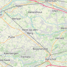
Merksplas is located in Arr. Turnhout, Belgiumcountry within 51° 22' 0.12" N 4° 52' 0.12" E (51.3667, 4.8667) coordinates. The local time in Merksplas is 07:40 (08.09.2025)
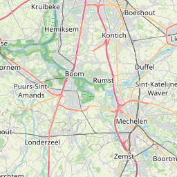
Mechelen is located in Arr. Mechelen, Belgiumcountry within 51° 1' 40.08" N 4° 28' 50.16" E (51.0278, 4.4806) coordinates. The local time in Mechelen is 07:40 (08.09.2025)
The calculated flying distance from Merksplas to Mechelen is 28.77miles which is equal to 46.30 km.
If you want to go by car, the driving driving distance between Merksplas and Mechelen is 41.09 miles (66.13 km). If you ride your car with an average speef of 112 kilometers/hour (70 miles/h), travel time will be 0 hours 35 minutes.Please check the avg.speed travel time on the right for various options
Estimated Travel Time Between Merksplas and Mechelen
| Average speed | Travel Time |
|---|---|
| 30 mph (48 km/h) | 1 hours 22 minutes |
| 40 mph (64 km/h) | 1 hours 2 minutes |
| 50 mph (80 km/h) | 0 hours 49 minutes |
| 60 mph (67 km/h) | 0 hours 41 minutes |
| 70 mph (112 km/h) | 0 hours 35 minutes |
| 75 mph (120 km/h) | 0 hours 33 minutes |
Merksplas, Arr. Turnhout, Belgium
Related Distances from Merksplas
| Cities | Distance |
|---|---|
| Merksplas to Deurne | 20.03 mi (32.24 km) |
| Merksplas to Merksem | 20.27 mi (32.62 km) |
| Merksplas to Borgerhout | 21.30 mi (34.27 km) |
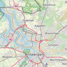
| Merksplas to Antwerp | 22.63 mi (36.41 km) |
| Merksplas to Berchem | 23.21 mi (37.36 km) |
| Merksplas to Wilrijk | 25.05 mi (40.32 km) |
| Merksplas to Hoboken | 25.66 mi (41.29 km) |
| Merksplas to Mechelen | 28.77 mi (46.30 km) |
| Merksplas to Leuven | 34.17 mi (55.00 km) |
| Merksplas to Vilvoorde | 35.86 mi (57.71 km) |
| Merksplas to Evere | 40.04 mi (64.44 km) |
| Merksplas to Laeken | 40.40 mi (65.01 km) |
| Merksplas to Sint-Joost-ten-Node | 41.40 mi (66.63 km) |
| Merksplas to Koekelberg | 41.58 mi (66.91 km) |
| Merksplas to Jette | 41.58 mi (66.91 km) |
| Merksplas to Moortebeek | 42.14 mi (67.83 km) |
| Merksplas to Brussels | 42.29 mi (68.06 km) |
| Merksplas to Etterbeek | 42.40 mi (68.24 km) |
| Merksplas to Anderlecht | 43.52 mi (70.04 km) |
| Merksplas to Forest | 44.90 mi (72.26 km) |
| Merksplas to Gent | 53.93 mi (86.80 km) |
| Merksplas to Liege | 58.82 mi (94.66 km) |
| Merksplas to Namur | 62.18 mi (100.08 km) |
| Merksplas to Charleroi | 69.41 mi (111.71 km) |
| Merksplas to Bruges | 71.81 mi (115.56 km) |
Mechelen, Arr. Mechelen, Belgium
Related Distances to Mechelen
| Cities | Distance |
|---|---|
| Vilvoorde to Mechelen | 7.31 mi (11.76 km) |
| Wilrijk to Mechelen | 10.48 mi (16.87 km) |
| Hoboken to Mechelen | 10.79 mi (17.37 km) |
| Berchem to Mechelen | 11.10 mi (17.86 km) |
| Evere to Mechelen | 11.67 mi (18.78 km) |
| Laeken to Mechelen | 11.70 mi (18.83 km) |
| Borgerhout to Mechelen | 12.82 mi (20.64 km) |
| Jette to Mechelen | 12.85 mi (20.67 km) |
| Koekelberg to Mechelen | 12.85 mi (20.67 km) |
| Sint-Joost-ten-Node to Mechelen | 12.99 mi (20.91 km) |
| Ganshoren to Mechelen | 13.22 mi (21.28 km) |
| Moortebeek to Mechelen | 13.46 mi (21.67 km) |
| Antwerp to Mechelen | 13.58 mi (21.86 km) |
| Deurne to Mechelen | 13.63 mi (21.93 km) |
| Brussels to Mechelen | 13.70 mi (22.05 km) |
| Leuven to Mechelen | 13.82 mi (22.23 km) |
| Etterbeek to Mechelen | 14.09 mi (22.68 km) |
| Anderlecht to Mechelen | 14.89 mi (23.96 km) |
| Merksem to Mechelen | 14.95 mi (24.06 km) |
| Forest to Mechelen | 16.31 mi (26.26 km) |
| Gent to Mechelen | 32.86 mi (52.89 km) |
| Namur to Mechelen | 42.28 mi (68.05 km) |
| Charleroi to Mechelen | 43.43 mi (69.89 km) |
| Liege to Mechelen | 54.60 mi (87.87 km) |
| Bruges to Mechelen | 55.91 mi (89.98 km) |
 Accedi con Google