Distance Calculator

DN79, DN19

304.9 km, 5 h 4 min

Head southeast10 m
Turn left onto Strada Episcopiei350 m
Turn right onto Strada Horia100 m
Turn left onto Bulevardul Revoluției (DN79)900 m
Continue onto Piața Academinican Caius Iacob (DN79)400 m
Continue onto Strada Petru Rareș (DN79)2 km
Continue onto Calea Zimandului (DN79)1.5 km
Enter Centura Arad Nord and take the 2nd exit towards DN79: Oradea50 m
Exit the traffic circle towards DN79: Oradea1 km
Enter the traffic circle and take the 2nd exit towards DN79: Oradea40 m
Exit the traffic circle towards DN79: Oradea1.5 km
Enter the traffic circle and take the 2nd exit towards DN79: Oradea30 m
Exit the traffic circle towards DN79: Oradea15 km
Enter the traffic circle and take the 2nd exit towards DN79: Oradea35 m
Exit the traffic circle towards DN79: Oradea20 km
Enter the traffic circle and take the 2nd exit towards Oradea25 m
Exit the traffic circle towards Oradea35 km
Continue onto Strada Republicii (DN79)550 m
Enter the traffic circle and take the 2nd exit towards DN79: Oradea45 m
Exit the traffic circle towards DN79: Oradea1.5 km
Enter the traffic circle and take the 1st exit towards DN79: Oradea20 m
Exit the traffic circle towards DN79: Oradea2 km
Enter the traffic circle and take the 1st exit towards DN79: Oradea30 m
Exit the traffic circle towards DN79: Oradea25 km
Enter the traffic circle and take the 2nd exit onto DN7930 m
Exit the traffic circle onto DN79600 m
Continue straight onto DN791.5 km
Enter the traffic circle and take the 2nd exit onto DN7930 m
Exit the traffic circle onto DN793.5 km
Enter the traffic circle and take the 1st exit onto Calea Aradului (DN79)40 m
Exit the traffic circle onto Calea Aradului (DN79)450 m
Enter the traffic circle and take the 3rd exit towards Satu Mare100 m
Exit the traffic circle towards Satu Mare800 m
Continue onto DN1Y7 km
Continue onto DEx1610 km
Take the ramp towards A3300 m
Continue towards A3400 m
Merge left onto Autostrada Transilvania (A3)2 km
Make a slight left900 m
Merge left onto DN1925 km
Enter the traffic circle and take the 1st exit onto Centura Săcueni (DN19K)20 m
Exit the traffic circle onto Centura Săcueni (DN19K)4.5 km
Enter the traffic circle and take the 2nd exit onto Centura Săcueni (DN19K)50 m
Exit the traffic circle onto Centura Săcueni (DN19K)500 m
Enter Centura Săcueni and take the 2nd exit onto Centura Săcueni (DN19K)40 m
Exit the traffic circle onto Centura Săcueni (DN19K)2.5 km
Enter the traffic circle and take the 1st exit onto DN1930 m
Exit the traffic circle onto DN198 km
Enter the traffic circle and take the 2nd exit towards DN19: Satu Mare45 m
Exit the traffic circle towards DN19: Satu Mare10 km
Turn right onto Strada Szilárd Leó350 m
Turn left onto Strada Bem József500 m
Turn right onto Strada Revoluției (DN19)25 km
Enter the traffic circle and take the 1st exit onto Centura Carei (DN19G)15 m
Exit the traffic circle onto Centura Carei (DN19G)3.5 km
Enter the traffic circle and take the 2nd exit onto Centura Carei (DN19G)35 m
Exit the traffic circle onto Centura Carei (DN19G)3 km
Enter the traffic circle and take the 2nd exit onto Centura Carei (DN19G)35 m
Exit the traffic circle onto Centura Carei (DN19G)3.5 km
Enter the traffic circle and take the 1st exit onto DN1915 m
Exit the traffic circle onto DN1930 km
Enter the traffic circle and take the 3rd exit towards DN19H70 m
Exit the traffic circle towards DN19H400 m
Merge left onto Centura Satu Mare (DN19H)9 km
Enter the traffic circle and take the 2nd exit onto DN1970 m
Exit the traffic circle onto DN1915 km
Enter the traffic circle and take the 1st exit towards DN1C: Baia Mare30 m
Exit the traffic circle towards DN1C: Baia Mare4.5 km
Enter the traffic circle and take the 2nd exit towards DN19: Negrești Oaș45 m
Exit the traffic circle towards DN19: Negrești Oaș15 km
Turn left onto DN1910 km
Turn left150 m
Turn left40 m
You have arrived at your destination, on the left0 m
From
    To

      Distance: 153.61 mi (247.21 km)

      Driving route: 189.48 mi (304.94 km).

      Driving time: 5h 4 min

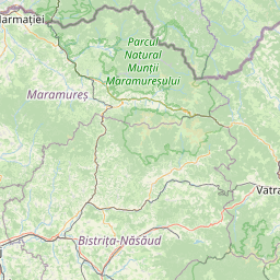
      Distance from Negresti-Oas to Arad

      The shortest distance (air line) between Negresti-Oas and Arad is 153.61mi (247.21 km)

      The shortest route between Negresti-Oas and Arad is 189.48 mi (304.94 km) according to the route planner. The driving time is approx. 5 h 4 m

      How far is it between Negresti-Oas and Arad.

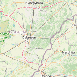
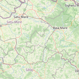
      Negresti-Oas is located in Satu Mare, Romaniacountry within 47° 52' 9.84" N 23° 25' 27.12" E (47.8694, 23.4242) coordinates. The local time in Negresti-Oas is 19:54 (12.06.2025)

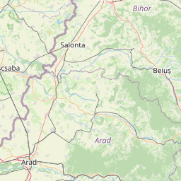
      Arad is located in Arad, Romaniacountry within 46° 10' 30" N 21° 18' 45" E (46.1750, 21.3125) coordinates. The local time in Arad is 19:54 (12.06.2025)

      The calculated flying distance from Negresti-Oas to Arad is 153.61miles which is equal to 247.21 km.

      If you want to go by car, the driving driving distance between Negresti-Oas and Arad is 189.48 miles (304.94 km). If you ride your car with an average speef of 112 kilometers/hour (70 miles/h), travel time will be 2 hours 43 minutes.Please check the avg.speed travel time on the right for various options

      Estimated Travel Time Between Negresti-Oas and Arad

      Average speedTravel Time
      30 mph (48 km/h)6 hours 19 minutes
      40 mph (64 km/h)4 hours 44 minutes
      50 mph (80 km/h)3 hours 47 minutes
      60 mph (67 km/h)3 hours 9 minutes
      70 mph (112 km/h)2 hours 42 minutes
      75 mph (120 km/h)2 hours 32 minutes

      Negresti-Oas, Satu Mare, Romania

      Related Distances from Negresti-Oas

      CitiesDistance
      Negresti-Oas to Baia Mare15.83 mi (25.48 km)
      Negresti-Oas to Satu Mare25.38 mi (40.84 km)
      Negresti-Oas to Cluj-Napoca76.55 mi (123.20 km)
      Negresti-Oas to Oradea89.23 mi (143.60 km)
      Negresti-Oas to Targu-Mures105.92 mi (170.47 km)
      Negresti-Oas to Alba Iulia124.73 mi (200.73 km)
      Negresti-Oas to Suceava132.36 mi (213.02 km)
      Negresti-Oas to Sibiu147.54 mi (237.45 km)
      Negresti-Oas to Botosani150.81 mi (242.70 km)
      Negresti-Oas to Arad153.61 mi (247.21 km)
      Negresti-Oas to Timisoara178.90 mi (287.92 km)
      Negresti-Oas to Brasov184.18 mi (296.41 km)
      Negresti-Oas to Resita191.85 mi (308.75 km)
      Negresti-Oas to Targu Jiu196.02 mi (315.47 km)
      Negresti-Oas to Ramnicu Valcea196.31 mi (315.92 km)
      Negresti-Oas to Iasi200.36 mi (322.46 km)
      Negresti-Oas to Pitesti218.97 mi (352.41 km)
      Negresti-Oas to Vaslui219.04 mi (352.51 km)
      Negresti-Oas to Focsani232.41 mi (374.03 km)
      Negresti-Oas to Ploiesti237.16 mi (381.67 km)
      Negresti-Oas to Slatina241.88 mi (389.26 km)
      Negresti-Oas to Craiova245.04 mi (394.36 km)
      Negresti-Oas to Bucharest269.85 mi (434.28 km)
      Negresti-Oas to Giurgiu300.33 mi (483.34 km)
      Negresti-Oas to Tulcea315.43 mi (507.63 km)

      Arad, Arad, Romania

      Related Distances to Arad

      CitiesDistance
      Timisoara to Arad28.97 mi (46.62 km)
      Resita to Arad66.50 mi (107.01 km)
      Oradea to Arad68.39 mi (110.06 km)
      Hunedoara to Arad82.13 mi (132.17 km)
      Alba Iulia to Arad108.37 mi (174.40 km)
      Cluj-Napoca to Arad115.53 mi (185.92 km)
      Targu Jiu to Arad123.32 mi (198.46 km)
      Satu Mare to Arad134.08 mi (215.79 km)
      Sibiu to Arad138.85 mi (223.45 km)
      Baia Mare to Arad148.67 mi (239.26 km)
      Targu-Mures to Arad157.06 mi (252.76 km)
      Ramnicu Valcea to Arad165.41 mi (266.19 km)
      Craiova to Arad176.13 mi (283.45 km)
      Slatina to Arad191.12 mi (307.58 km)
      Pitesti to Arad194.59 mi (313.15 km)
      Brasov to Arad209.81 mi (337.66 km)
      Ploiesti to Arad243.24 mi (391.46 km)
      Suceava to Arad254.57 mi (409.69 km)
      Bucharest to Arad262.07 mi (421.76 km)
      Botosani to Arad274.93 mi (442.46 km)
      Giurgiu to Arad276.49 mi (444.96 km)
      Focsani to Arad283.76 mi (456.67 km)
      Iasi to Arad305.21 mi (491.18 km)
      Vaslui to Arad307.29 mi (494.54 km)
      Tulcea to Arad367.63 mi (591.65 km)