Distance Calculator

N 1, Route de Sapotille

62.9 km, 60 min

Head southwest150 m
Turn left onto Allées des Samanas250 m
Turn right to stay on Allées des Samanas50 m
Turn left onto Route Armand Dain (N 3)500 m
Continue onto Route Montdésir (N 3)1 km
Continue onto Route de Mondésir (N 3)1 km
Enter the traffic circle and take the 2nd exit onto Rue Ali Tur (N 3)20 m
Exit the traffic circle onto Rue Ali Tur (N 3)90 m
Enter the traffic circle and take the 1st exit onto Boulevard du Gouverneur Général Félix Eboué (N 3)9 m
Exit the traffic circle onto Boulevard du Gouverneur Général Félix Eboué (N 3)55 m
Enter Boulevard du Gouverneur Général Félix Eboué and take the 1st exit onto Boulevard du Gouverneur Général Félix Eboué (N 3)4 m
Exit the traffic circle onto Boulevard du Gouverneur Général Félix Eboué (N 3)200 m
Enter the traffic circle and take the 1st exit onto Boulevard du Gouverneur Général Félix Eboué (N 3)15 m
Exit the traffic circle onto Boulevard du Gouverneur Général Félix Eboué (N 3)60 m
Enter the traffic circle and take the 2nd exit onto Boulevard Gerty Archimède (N 1)50 m
Exit the traffic circle onto Boulevard Gerty Archimède (N 1)1 km
Continue onto Avenue du Général de Gaulle (N 1)800 m
Turn right onto Avenue du Général de Gaulle (N 1)20 m
Turn left to stay on Avenue du Général de Gaulle (N 1)3.5 km
Continue straight to stay on Avenue du Général de Gaulle (N 1)500 m
Enter the traffic circle and take the 2nd exit onto N 125 m
Exit the traffic circle onto N 1700 m
Enter the traffic circle and take the 1st exit onto N 130 m
Exit the traffic circle onto N 115 km
Enter the traffic circle and take the 2nd exit onto Allée Saint-Sauveur (N 1)45 m
Exit the traffic circle onto Allée Saint-Sauveur (N 1)2 km
Enter Rond-point des Mineurs and take the 2nd exit onto Rocade de Capesterre-belle-Eau (N 1)30 m
Exit the traffic circle onto Rocade de Capesterre-belle-Eau (N 1)700 m
Keep left onto Rocade de Capesterre-belle-Eau (N 1)3.5 km
Enter Rond-Point de la Kassaverie and take the 2nd exit onto N 180 m
Exit the traffic circle onto N 14 km
Enter Rond-Point Bélair and take the 2nd exit onto N 130 m
Exit the traffic circle onto N 12.5 km
Keep left onto N 1500 m
Keep right onto N 12.5 km
Enter the traffic circle and take the 2nd exit onto N 145 m
Exit the traffic circle onto N 14.5 km
Enter Rond-Point de Montebello and take the 2nd exit onto N 135 m
Exit the traffic circle onto N 115 km
Take the ramp towards Baimbridge100 m
Turn right onto Boulevard des Héros (D 129)200 m
Enter the traffic circle and take the 3rd exit onto Boulevard des Héros (D 129)25 m
Exit the traffic circle onto Boulevard des Héros (D 129)500 m
Enter the traffic circle and take the 2nd exit onto Boulevard Nelson Mandela (D 129)20 m
Exit the traffic circle onto Boulevard Nelson Mandela (D 129)200 m
Turn right onto Rue des Cités Unies150 m
You have arrived at your destination, on the left0 m
From
    To

      Distance: 19.62 mi (31.58 km)

      Driving route: 39.09 mi (62.91 km).

      Driving time: 0h 59 min

      Distance from Pointe-a-Pitre to Basse-Terre

      The shortest distance (air line) between Pointe-a-Pitre and Basse-Terre is 19.62mi (31.58 km)

      The shortest route between Pointe-a-Pitre and Basse-Terre is 39.09 mi (62.91 km) according to the route planner. The driving time is approx. 0 h 59 m

      How far is it between Pointe-a-Pitre and Basse-Terre.

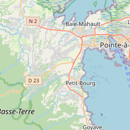
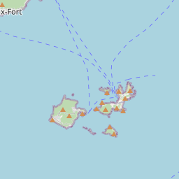
      Pointe-a-Pitre is located in Guadeloupe, Guadeloupecountry within 16° 14' 27.96" N -62° 28' 0.84" W (16.2411, -61.5331) coordinates. The local time in Pointe-a-Pitre is 13:49 (12.07.2025)

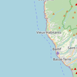
      Basse-Terre is located in Guadeloupe, Guadeloupecountry within 16° 0' 37.44" N -62° 17' 40.2" W (16.0104, -61.7055) coordinates. The local time in Basse-Terre is 13:49 (12.07.2025)

      The calculated flying distance from Pointe-a-Pitre to Basse-Terre is 19.62miles which is equal to 31.58 km.

      If you want to go by car, the driving driving distance between Pointe-a-Pitre and Basse-Terre is 39.09 miles (62.91 km). If you ride your car with an average speef of 112 kilometers/hour (70 miles/h), travel time will be 0 hours 34 minutes.Please check the avg.speed travel time on the right for various options

      Estimated Travel Time Between Pointe-a-Pitre and Basse-Terre

      Average speedTravel Time
      30 mph (48 km/h)1 hours 18 minutes
      40 mph (64 km/h)0 hours 59 minutes
      50 mph (80 km/h)0 hours 47 minutes
      60 mph (67 km/h)0 hours 39 minutes
      70 mph (112 km/h)0 hours 34 minutes
      75 mph (120 km/h)0 hours 31 minutes

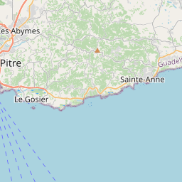
      Pointe-a-Pitre, Guadeloupe, Guadeloupe

      Related Distances from Pointe-a-Pitre

      CitiesDistance
      Pointe-a-Pitre to Basse-Terre19.62 mi (31.58 km)

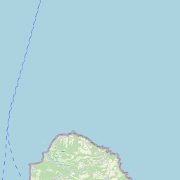
      Basse-Terre, Guadeloupe, Guadeloupe

      Related Distances to Basse-Terre

      CitiesDistance
      Pointe-a-Pitre to Basse-Terre19.62 mi (31.58 km)