Distance Calculator

Monasterevin Bypass, Naas Road

84.1 km, 1 h 6 min

Head north100 m
Turn right onto Kylekiproe Road45 m
Turn left to stay on Kylekiproe Road450 m
Turn left onto New Road (R426)60 m
Go straight onto Well Road (R426)100 m
Enter the traffic circle and take the 3rd exit onto James Fintan Lalor Avenue (N80)30 m
Exit the traffic circle onto James Fintan Lalor Avenue (N80)200 m
Make a slight left onto Dublin Road (R445)150 m
Turn right to stay on Dublin Road (R445)2 km
Enter the traffic circle and take the 2nd exit onto R44525 m
Exit the traffic circle onto R4452 km
Enter the traffic circle and take the 2nd exit towards M7: Dublin60 m
Exit the traffic circle towards M7: Dublin550 m
Merge right onto Monasterevin Bypass (M7)20 km
Continue onto Kildare Bypass (M7)10 km
Continue onto The Curragh Motorway (M7)2.5 km
Continue onto Newbridge Bypass (M7)15 km
Continue onto Naas Bypass (M7)3 km
Continue onto Naas Road (N7)20 km
Take the ramp on the left towards M50: Southbound250 m
Keep right towards M50: Southbound800 m
Merge right onto Western Parkway Motorway (M50)3.5 km
Take the ramp on the left towards N81: Templeogue350 m
Keep left towards R137: City Centre450 m
Go straight onto Tallaght Road (R137)450 m
Enter Spawell Roundabout and take the 2nd exit onto Templeogue Road (R137)50 m
Exit the traffic circle onto Templeogue Road (R137)700 m
Turn right onto Austin Clarke Bridge (R817)60 m
Continue onto Old Bridge Road (R817)200 m
Turn left onto Butterfield Avenue (R114)1.5 km
Turn left onto Rathfarnham Road (R114)300 m
Turn left onto Main Street (L4014)200 m
You have arrived at your destination, on the left0 m
From
    To

      Distance: 45.96 mi (73.96 km)

      Driving route: 52.26 mi (84.11 km).

      Driving time: 1h 5 min

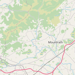
      Distance from Rathfarnham to Port Laoise

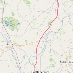
      The shortest distance (air line) between Rathfarnham and Port Laoise is 45.96mi (73.96 km)

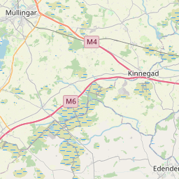
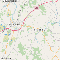
      The shortest route between Rathfarnham and Port Laoise is 52.26 mi (84.11 km) according to the route planner. The driving time is approx. 1 h 5 m

      How far is it between Rathfarnham and Port Laoise.

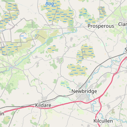
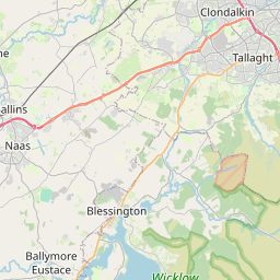
      Rathfarnham is located in Dublin, Irelandcountry within 53° 17' 55.68" N -7° 42' 52.56" W (53.2988, -6.2854) coordinates. The local time in Rathfarnham is 05:47 (20.08.2025)

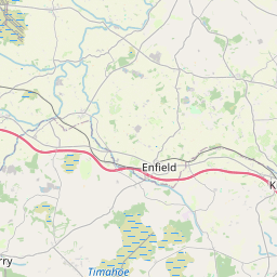
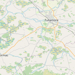
      Port Laoise is located in Midland, Irelandcountry within 53° 1' 50.88" N -8° 41' 57.12" W (53.0308, -7.3008) coordinates. The local time in Port Laoise is 05:47 (20.08.2025)

      The calculated flying distance from Rathfarnham to Port Laoise is 45.96miles which is equal to 73.96 km.

      If you want to go by car, the driving driving distance between Rathfarnham and Port Laoise is 52.26 miles (84.11 km). If you ride your car with an average speef of 112 kilometers/hour (70 miles/h), travel time will be 0 hours 45 minutes.Please check the avg.speed travel time on the right for various options

      Estimated Travel Time Between Rathfarnham and Port Laoise

      Average speedTravel Time
      30 mph (48 km/h)1 hours 45 minutes
      40 mph (64 km/h)1 hours 18 minutes
      50 mph (80 km/h)1 hours 3 minutes
      60 mph (67 km/h)0 hours 52 minutes
      70 mph (112 km/h)0 hours 45 minutes
      75 mph (120 km/h)0 hours 42 minutes

      Rathfarnham, Dublin, Ireland

      Related Distances from Rathfarnham

      CitiesDistance
      Rathfarnham to Tallaght3.05 mi (4.90 km)
      Rathfarnham to Dublin3.69 mi (5.93 km)
      Rathfarnham to Blackrock4.45 mi (7.16 km)
      Rathfarnham to Clondalkin4.75 mi (7.65 km)
      Rathfarnham to Ashtown5.64 mi (9.08 km)
      Rathfarnham to Celbridge10.80 mi (17.39 km)
      Rathfarnham to Swords11.46 mi (18.44 km)
      Rathfarnham to Finglas11.46 mi (18.44 km)
      Rathfarnham to Greystones13.87 mi (22.32 km)
      Rathfarnham to Naas16.78 mi (27.00 km)
      Rathfarnham to Drogheda28.89 mi (46.49 km)
      Rathfarnham to Navan29.38 mi (47.29 km)
      Rathfarnham to Carlow42.03 mi (67.64 km)
      Rathfarnham to Port Laoise45.96 mi (73.96 km)
      Rathfarnham to Mullingar46.01 mi (74.05 km)
      Rathfarnham to Dun Dealgan49.31 mi (79.36 km)
      Rathfarnham to Kilkenny60.46 mi (97.29 km)
      Rathfarnham to Wexford67.03 mi (107.88 km)
      Rathfarnham to Waterford80.17 mi (129.03 km)
      Rathfarnham to Limerick106.66 mi (171.66 km)
      Rathfarnham to Galway114.16 mi (183.72 km)
      Rathfarnham to Ennis116.16 mi (186.95 km)
      Rathfarnham to Cork133.34 mi (214.60 km)
      Rathfarnham to Douglas133.43 mi (214.74 km)
      Rathfarnham to Tralee159.33 mi (256.42 km)

      Port Laoise, Midland, Ireland

      Related Distances to Port Laoise

      CitiesDistance
      Carlow to Port Laoise20.68 mi (33.28 km)
      Kilkenny to Port Laoise26.54 mi (42.70 km)
      Naas to Port Laoise29.23 mi (47.04 km)
      Mullingar to Port Laoise34.00 mi (54.72 km)
      Celbridge to Port Laoise38.02 mi (61.19 km)
      Clondalkin to Port Laoise42.52 mi (68.43 km)
      Tallaght to Port Laoise42.96 mi (69.13 km)
      Rathfarnham to Port Laoise45.96 mi (73.96 km)
      Ashtown to Port Laoise46.61 mi (75.01 km)
      Dublin to Port Laoise48.39 mi (77.88 km)
      Navan to Port Laoise50.00 mi (80.46 km)
      Blackrock to Port Laoise50.13 mi (80.68 km)
      Greystones to Port Laoise51.59 mi (83.02 km)
      Finglas to Port Laoise53.68 mi (86.39 km)
      Swords to Port Laoise53.68 mi (86.39 km)
      Waterford to Port Laoise53.97 mi (86.85 km)
      Wexford to Port Laoise59.70 mi (96.08 km)
      Limerick to Port Laoise60.71 mi (97.70 km)
      Drogheda to Port Laoise61.34 mi (98.72 km)
      Ennis to Port Laoise71.10 mi (114.43 km)
      Galway to Port Laoise74.32 mi (119.61 km)
      Dun Dealgan to Port Laoise76.96 mi (123.85 km)
      Cork to Port Laoise92.50 mi (148.87 km)
      Douglas to Port Laoise92.98 mi (149.64 km)
      Tralee to Port Laoise113.41 mi (182.52 km)