Distance Calculator

West Autobahn, Süd Autobahn

310.5 km, 3 h 27 min

Head south25 m
Turn left onto Voithgasse250 m
Turn left onto Heidenheimer Straße300 m
Turn right onto Mariazeller Straße (B20)2.5 km
Take the ramp on the right towards A1: Wien700 m
Merge left onto West Autobahn (A1)30 km
Keep right towards A21: Wien-Süd/Ost1.5 km
Continue onto Wiener Außenring Autobahn (A21)15 km
Take exit 17 towards B11: Mayerling800 m
Enter the traffic circle and take the 2nd exit towards B11: Mödling70 m
Exit the traffic circle towards B11: Mödling1 km
Make a sharp right onto L40011.5 km
Turn left onto B21010 km
Make a slight right towards B 210: Wien2.5 km
Continue onto B21055 m
Turn right onto Vöslauer Straße (B212)900 m
Continue onto Badner Straße (B212)500 m
Continue onto Bezirksstraße (B212)600 m
Continue onto Badner Straße (B212)150 m
Enter the traffic circle and take the 3rd exit onto Industriestraße (B212)60 m
Exit the traffic circle onto Industriestraße (B212)350 m
Go straight onto Paitzriegelgasse (B212)400 m
Enter the traffic circle and take the 2nd exit towards B212: Kottingbrunn40 m
Exit the traffic circle towards B212: Kottingbrunn1 km
Take the ramp on the right towards A2: Graz250 m
Merge left onto Süd Autobahn (A2)30 km
Keep left towards A2: Grimmenstein200 km
Take exit 255 towards B70: Wolfsberg-Süd900 m
Enter the traffic circle and take the 2nd exit towards B70a: Wolfsberg45 m
Exit the traffic circle towards B70a: Wolfsberg900 m
Enter the traffic circle and take the 1st exit onto Klagenfurter Straße (B70)15 m
Exit the traffic circle onto Klagenfurter Straße (B70)6 km
Turn right onto Neuer Platz45 m
Continue slightly left onto Burgerfeldstraße350 m
Turn left onto Spitzweg100 m
Turn right150 m
You have arrived at your destination, on the left0 m

Semmering Schnellstraße, Obdacher Straße

299.9 km, 3 h 33 min

Head south25 m
Turn left onto Voithgasse250 m
Turn left onto Heidenheimer Straße300 m
Turn right onto Mariazeller Straße (B20)2.5 km
Take the ramp on the right towards A1: Wien700 m
Merge left onto West Autobahn (A1)30 km
Keep right towards A21: Wien-Süd/Ost1.5 km
Continue onto Wiener Außenring Autobahn (A21)15 km
Take exit 17 towards B11: Mayerling800 m
Enter the traffic circle and take the 2nd exit towards B11: Mödling70 m
Exit the traffic circle towards B11: Mödling1 km
Make a sharp right onto L40011.5 km
Turn left onto B21010 km
Make a slight right towards B 210: Wien2.5 km
Continue onto B21055 m
Turn right onto Vöslauer Straße (B212)900 m
Continue onto Badner Straße (B212)500 m
Continue onto Bezirksstraße (B212)600 m
Continue onto Badner Straße (B212)150 m
Enter the traffic circle and take the 3rd exit onto Industriestraße (B212)60 m
Exit the traffic circle onto Industriestraße (B212)350 m
Go straight onto Paitzriegelgasse (B212)400 m
Enter the traffic circle and take the 2nd exit towards B212: Kottingbrunn40 m
Exit the traffic circle towards B212: Kottingbrunn1 km
Take the ramp on the right towards A2: Graz250 m
Merge left onto Süd Autobahn (A2)30 km
Keep right towards S6: Bruck an der Mur2 km
Continue onto Semmering Schnellstraße (S6)100 km
Continue towards S36: Klagenfurt30 km
Take the ramp towards L518: Zeltweg-West350 m
Keep left towards L518: Zeltweg-West35 m
Turn left onto Murtal Begleitstraße (L518)150 m
Continue onto Obdacher Straße (B78)250 m
Turn right onto Obdacher Straße (B78)4.5 km
Enter the traffic circle and take the 2nd exit towards B78: Obdach40 m
Exit the traffic circle towards B78: Obdach10 km
Continue onto Hauptstraße (B78)1.5 km
Continue onto Obdacher Straße (B78)8 km
Continue onto Umfahrung Reichenfels (B78)1.5 km
Continue onto Obdacher Straße (B78)4 km
Go straight onto Umfahrung Bad St. Leonhard (B78)3 km
Enter the traffic circle and take the 1st exit towards B78: Wolfsberg35 m
Exit the traffic circle towards B78: Wolfsberg900 m
Continue onto Wiesenau (B78)1.5 km
Continue onto Obdacher Straße (B78)600 m
Take the ramp on the left towards A2: Graz1 km
Continue straight2.5 km
Keep right at the fork400 m
Merge left onto Süd Autobahn (A2)15 km
Take exit 255 towards B70: Wolfsberg-Süd900 m
Enter the traffic circle and take the 2nd exit towards B70a: Wolfsberg45 m
Exit the traffic circle towards B70a: Wolfsberg900 m
Enter the traffic circle and take the 1st exit onto Klagenfurter Straße (B70)15 m
Exit the traffic circle onto Klagenfurter Straße (B70)6 km
Turn right onto Neuer Platz45 m
Continue slightly left onto Burgerfeldstraße350 m
Turn left onto Spitzweg100 m
Turn right150 m
You have arrived at your destination, on the left0 m
From
    To

      Distance: 105.84 mi (170.33 km)

      Driving route: 192.96 mi (310.54 km).

      Driving time: 3h 26 min

      Distance from Sankt Andra to Sankt Polten

      The shortest distance (air line) between Sankt Andra and Sankt Polten is 105.84mi (170.33 km)

      The shortest route between Sankt Andra and Sankt Polten is 192.96 mi (310.54 km) according to the route planner. The driving time is approx. 3 h 26 m

      How far is it between Sankt Andra and Sankt Polten.

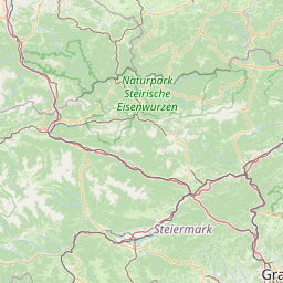
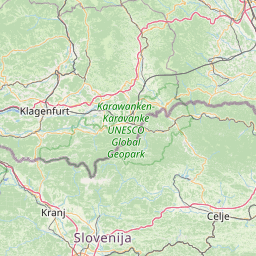
      Sankt Andra is located in Unterkarnten, Austriacountry within 46° 46' 0.12" N 14° 49' 0.12" E (46.7667, 14.8167) coordinates. The local time in Sankt Andra is 06:22 (27.06.2025)

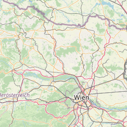
      Sankt Polten is located in Sankt Polten, Austriacountry within 48° 12' 0" N 15° 37' 0.12" E (48.2000, 15.6167) coordinates. The local time in Sankt Polten is 06:22 (27.06.2025)

      The calculated flying distance from Sankt Andra to Sankt Polten is 105.84miles which is equal to 170.33 km.

      If you want to go by car, the driving driving distance between Sankt Andra and Sankt Polten is 192.96 miles (310.54 km). If you ride your car with an average speef of 112 kilometers/hour (70 miles/h), travel time will be 2 hours 46 minutes.Please check the avg.speed travel time on the right for various options

      Estimated Travel Time Between Sankt Andra and Sankt Polten

      Average speedTravel Time
      30 mph (48 km/h)6 hours 26 minutes
      40 mph (64 km/h)4 hours 49 minutes
      50 mph (80 km/h)3 hours 52 minutes
      60 mph (67 km/h)3 hours 13 minutes
      70 mph (112 km/h)2 hours 45 minutes
      75 mph (120 km/h)2 hours 34 minutes

      Sankt Andra, Unterkarnten, Austria

      Related Distances from Sankt Andra

      CitiesDistance
      Sankt Andra to Wolfsberg5.32 mi (8.56 km)
      Sankt Andra to Klagenfurt26.59 mi (42.79 km)
      Sankt Andra to Graz36.09 mi (58.09 km)
      Sankt Andra to Leoben44.50 mi (71.61 km)
      Sankt Andra to Villach47.74 mi (76.84 km)
      Sankt Andra to Steyr89.49 mi (144.02 km)
      Sankt Andra to Amstetten93.31 mi (150.16 km)
      Sankt Andra to Wiener Neustadt98.86 mi (159.11 km)
      Sankt Andra to Wels102.62 mi (165.15 km)
      Sankt Andra to Traun104.08 mi (167.49 km)
      Sankt Andra to Sankt Polten105.84 mi (170.33 km)
      Sankt Andra to Leonding107.76 mi (173.43 km)
      Sankt Andra to Baden108.38 mi (174.43 km)
      Sankt Andra to Linz109.18 mi (175.71 km)
      Sankt Andra to Eisenstadt109.29 mi (175.88 km)
      Sankt Andra to Salzburg109.51 mi (176.24 km)
      Sankt Andra to Modling114.02 mi (183.50 km)
      Sankt Andra to Krems an der Donau119.94 mi (193.03 km)
      Sankt Andra to Vienna123.27 mi (198.39 km)
      Sankt Andra to Klosterneuburg127.20 mi (204.71 km)
      Sankt Andra to Hall in Tirol160.23 mi (257.86 km)
      Sankt Andra to Innsbruck164.93 mi (265.43 km)
      Sankt Andra to Dornbirn242.49 mi (390.25 km)
      Sankt Andra to Bregenz243.53 mi (391.93 km)
      Sankt Andra to Lustenau246.24 mi (396.29 km)

      Sankt Polten, Sankt Polten, Austria

      Related Distances to Sankt Polten

      CitiesDistance
      Krems an der Donau to Sankt Polten14.97 mi (24.10 km)
      Baden to Sankt Polten31.45 mi (50.62 km)
      Modling to Sankt Polten31.72 mi (51.06 km)
      Klosterneuburg to Sankt Polten33.00 mi (53.11 km)
      Vienna to Sankt Polten34.81 mi (56.02 km)
      Amstetten to Sankt Polten35.04 mi (56.40 km)
      Wiener Neustadt to Sankt Polten39.48 mi (63.53 km)
      Eisenstadt to Sankt Polten48.11 mi (77.42 km)
      Kapfenberg to Sankt Polten54.70 mi (88.03 km)
      Steyr to Sankt Polten56.54 mi (90.99 km)
      Leoben to Sankt Polten61.47 mi (98.92 km)
      Linz to Sankt Polten61.64 mi (99.19 km)
      Leonding to Sankt Polten63.00 mi (101.39 km)
      Traun to Sankt Polten63.42 mi (102.06 km)
      Wels to Sankt Polten73.80 mi (118.77 km)
      Graz to Sankt Polten78.46 mi (126.27 km)
      Wolfsberg to Sankt Polten100.58 mi (161.86 km)
      Salzburg to Sankt Polten122.06 mi (196.44 km)
      Klagenfurt to Sankt Polten125.53 mi (202.02 km)
      Villach to Sankt Polten137.55 mi (221.36 km)
      Hall in Tirol to Sankt Polten201.46 mi (324.22 km)
      Innsbruck to Sankt Polten206.52 mi (332.36 km)
      Bregenz to Sankt Polten276.18 mi (444.46 km)
      Dornbirn to Sankt Polten277.49 mi (446.58 km)
      Lustenau to Sankt Polten280.92 mi (452.09 km)