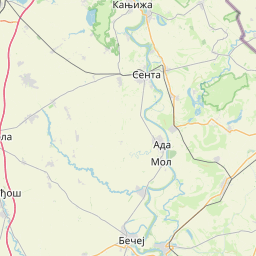
Distance Calculator

18, 102

180.4 km, 3 h 15 min

Head south on Хероја Пинкија70 m
Turn right onto Васка Попе450 m
Turn left onto Николе Тесле300 m
Turn right onto Николе Тесле200 m
Turn right onto Трг Николе Пашића35 m
Turn left to stay on Трг Николе Пашића150 m
Keep right onto Живе Јовановића800 m
Enter the traffic circle and take the 2nd exit towards 18: Зрењанин / Zrenjanin30 m
Exit the traffic circle towards 18: Зрењанин / Zrenjanin500 m
Continue onto Зрењанински пут (18)20 km
Continue slightly left onto Илинденска (18)800 m
Turn right onto Хајдук Вељкова (18)15 km
Continue onto Добровољачка700 m
Continue onto 1815 km
Make a slight left onto Маршала Тита (18)7 km
Turn left onto Партизански пут (18)800 m
Continue onto Сечањска (18)20 km
Continue onto Лазаревачки друм (18)8 km
Turn right onto Темишварски друм (12)1 km
Enter the traffic circle and take the 2nd exit80 m
Exit the traffic circle80 m
Continue onto Обилазница Зрењанин1.5 km
Enter the traffic circle and take the 2nd exit onto Обилазница Зрењанин30 m
Exit the traffic circle onto Обилазница Зрењанин2 km
Enter the traffic circle and take the 2nd exit onto Обилазница Зрењанин35 m
Exit the traffic circle onto Обилазница Зрењанин1 km
Enter the traffic circle and take the 1st exit onto Меленачки друм (13)10 m
Exit the traffic circle onto Меленачки друм (13)10 km
Make a slight right55 m
Make a sharp left35 m
Turn right onto Зрењанински пут (13)150 m
Continue onto Српских владара (13)400 m
Turn left onto Лењинова1.5 km
Continue right onto Железничка100 m
Make a sharp left onto Браће Барнић (116)4 km
Continue onto Меленачки друм (116)4 km
Continue onto Љубице Одаџић (116)900 m
Turn left onto Маршала Тита (116)2 km
Continue onto Новобечејски друм (116)3 km
Continue onto Куманачки друм (116)4.5 km
Enter the traffic circle and take the 2nd exit towards 15: Бечеј / Bečej40 m
Exit the traffic circle towards 15: Бечеј / Bečej10 km
Enter the traffic circle and take the 1st exit towards 109: Бачка Топола / Bačka Topola20 m
Exit the traffic circle towards 109: Бачка Топола / Bačka Topola700 m
Turn right onto Петефи Шандора1.5 km
Turn left onto Светозара Марковића700 m
Turn right onto Петровоселски пут (102)9 km
Continue onto Патријарха Вићентија Проданова (102)1.5 km
Continue onto Трг ослобођења (102)150 m
Continue onto Дожа Ђерђа (102)4 km
Continue onto Југословенске народне армије (102)3 km
Enter the traffic circle and take the 1st exit towards Мол центар15 m
Exit the traffic circle towards Мол центар2 km
Enter the traffic circle and take the 3rd exit onto Ивана Милутиновића35 m
Exit the traffic circle onto Ивана Милутиновића1 km
Continue onto Доша Андраша (102)800 m
Continue onto Моше Пијаде (102)1 km
Turn left onto Трг ослобођења (102)100 m
Continue onto Лењинова (102)1.5 km
Enter the traffic circle and take the 1st exit towards 102: Семта20 m
Exit the traffic circle towards 102: Семта200 m
Continue onto Сенћански пут (102)15 km
Turn right onto Новосадски пут800 m
Turn left onto Карађорђева900 m
Continue onto Ађанска250 m
Turn left onto Главни трг200 m
Turn right onto Главни трг90 m
You have arrived at your destination, on the right0 m

DN59, DN59A

185.1 km, 3 h 17 min

Head north on Хероја Пинкија150 m
Turn left onto Вука Караџића200 m
Turn right onto Жарка Зрењанина (18)350 m
Turn left onto Стевана Немање (18)450 m
Continue onto Зелена пијаца (18)150 m
Continue onto Милоша Обилића (18)700 m
Go straight onto Војводе Степе Степановића (10)15 km
Continue onto DN59200 m
Keep left onto DN593 km
Enter the traffic circle and take the 2nd exit onto DN5925 m
Exit the traffic circle onto DN5950 km
Enter the traffic circle and take the 1st exit onto DN5960 m
Exit the traffic circle onto DN591 km
Enter the traffic circle and take the 3rd exit onto Centura Timișoara Sud (DNVTM)80 m
Exit the traffic circle onto Centura Timișoara Sud (DNVTM)5 km
Enter the traffic circle and take the 1st exit onto Strada Paul Morand20 m
Exit the traffic circle onto Strada Paul Morand55 m
Turn right onto Strada Wilhelm Tell400 m
Turn right onto Strada Polonă3.5 km
Continue onto DJ591550 m
Make a slight left onto DJ5912.5 km
Enter the traffic circle and take the 1st exit towards Săcălaz3 m
Exit the traffic circle towards Săcălaz350 m
Turn left onto DJ591C5 km
Turn left onto Strada a 4-a (DN59A)30 km
Continue onto Strada Liviu Rebreanu (DN59C)350 m
Turn right onto Strada Peter Jung (DN59C)600 m
Turn left onto Calea Mărășești (DN59C)300 m
Make a slight right onto Calea Kikindei (DN59C)15 km
Turn left onto DN59E3.5 km
Continue onto Главна (15)1.5 km
Continue onto Пут за Кикинду (15)3 km
Continue onto Наковачки друм (15)3.5 km
Turn right onto Ослобођења (15)100 m
Continue onto Николе Тесле (15)1 km
Continue onto Дистричка (15)700 m
Turn right onto Мокрински друм (104)1.5 km
Continue onto Пут за Кикинду (104)9 km
Continue onto Раде Трнића (104)500 m
Continue onto Бранка Бачулова (104)450 m
Continue slightly left onto Светог Саве (104)3 km
Continue onto Пут за Црну бару (104)7 km
Turn left onto 10415 km
Turn left onto Потиска (13)300 m
Make a sharp right to stay on 1054.5 km
Enter the traffic circle and take the 3rd exit onto Народне баште25 m
Exit the traffic circle onto Народне баште90 m
Turn left onto Главни трг45 m
You have arrived at your destination, on the right0 m
From
    To

      Distance: 81.35 mi (130.92 km)

      Driving route: 112.12 mi (180.44 km).

      Driving time: 3h 14 min

      Distance from Senta to Vrsac

      The shortest distance (air line) between Senta and Vrsac is 81.35mi (130.92 km)

      The shortest route between Senta and Vrsac is 112.12 mi (180.44 km) according to the route planner. The driving time is approx. 3 h 14 m

      How far is it between Senta and Vrsac.

      Senta is located in Severnobanatska oblast, Serbiacountry within 45° 55' 53.04" N 20° 5' 24" E (45.9314, 20.0900) coordinates. The local time in Senta is 14:36 (14.08.2025)

      Vrsac is located in Južnobanatska oblast, Serbiacountry within 45° 7' 0.12" N 21° 18' 11.88" E (45.1167, 21.3033) coordinates. The local time in Vrsac is 14:36 (14.08.2025)

      The calculated flying distance from Senta to Vrsac is 81.35miles which is equal to 130.92 km.

      If you want to go by car, the driving driving distance between Senta and Vrsac is 112.12 miles (180.44 km). If you ride your car with an average speef of 112 kilometers/hour (70 miles/h), travel time will be 1 hours 37 minutes.Please check the avg.speed travel time on the right for various options

      Estimated Travel Time Between Senta and Vrsac

      Average speedTravel Time
      30 mph (48 km/h)3 hours 44 minutes
      40 mph (64 km/h)2 hours 48 minutes
      50 mph (80 km/h)2 hours 15 minutes
      60 mph (67 km/h)1 hours 52 minutes
      70 mph (112 km/h)1 hours 36 minutes
      75 mph (120 km/h)1 hours 30 minutes

      Senta, Severnobanatska oblast, Serbia

      Related Distances from Senta

      CitiesDistance
      Senta to Kikinda18.59 mi (29.93 km)
      Senta to Zrenjanin40.54 mi (65.24 km)
      Senta to Indija60.90 mi (98.01 km)
      Senta to Ruma65.54 mi (105.48 km)
      Senta to Stara Pazova65.61 mi (105.59 km)
      Senta to Sid69.92 mi (112.52 km)
      Senta to Sremska Mitrovica70.34 mi (113.21 km)
      Senta to Pecinci71.51 mi (115.09 km)
      Senta to Zemun76.22 mi (122.66 km)
      Senta to Pancevo78.00 mi (125.54 km)
      Senta to Belgrade78.86 mi (126.92 km)
      Senta to Vrsac81.35 mi (130.92 km)
      Senta to Kovin92.06 mi (148.16 km)
      Senta to Valjevo115.46 mi (185.82 km)
      Senta to Bajina Basta137.77 mi (221.71 km)
      Senta to Kragujevac138.82 mi (223.40 km)
      Senta to Uzice144.29 mi (232.21 km)
      Senta to Cuprija152.20 mi (244.94 km)
      Senta to Kraljevo155.34 mi (249.99 km)
      Senta to Bor158.59 mi (255.22 km)
      Senta to Trstenik165.88 mi (266.95 km)
      Senta to Prijepolje166.36 mi (267.73 km)
      Senta to Krusevac173.21 mi (278.75 km)
      Senta to Novi Pazar193.32 mi (311.12 km)
      Senta to Nis201.14 mi (323.70 km)

      Vrsac, Južnobanatska oblast, Serbia

      Related Distances to Vrsac

      CitiesDistance
      Kovin to Vrsac30.22 mi (48.63 km)
      Pancevo to Vrsac36.59 mi (58.88 km)
      Belgrade to Vrsac46.04 mi (74.09 km)
      Zemun to Vrsac47.84 mi (76.98 km)
      Zrenjanin to Vrsac48.12 mi (77.44 km)
      Stara Pazova to Vrsac56.24 mi (90.51 km)
      Indija to Vrsac59.70 mi (96.07 km)
      Kikinda to Vrsac64.50 mi (103.81 km)
      Pecinci to Vrsac66.99 mi (107.80 km)
      Ruma to Vrsac72.20 mi (116.19 km)
      Kragujevac to Vrsac78.25 mi (125.94 km)
      Bor to Vrsac78.70 mi (126.65 km)
      Senta to Vrsac81.35 mi (130.92 km)
      Cuprija to Vrsac82.53 mi (132.82 km)
      Sremska Mitrovica to Vrsac83.16 mi (133.84 km)
      Valjevo to Vrsac91.18 mi (146.74 km)
      Sid to Vrsac100.92 mi (162.42 km)
      Kraljevo to Vrsac100.96 mi (162.47 km)
      Trstenik to Vrsac104.61 mi (168.35 km)
      Krusevac to Vrsac105.95 mi (170.52 km)
      Uzice to Vrsac113.10 mi (182.01 km)
      Bajina Basta to Vrsac116.68 mi (187.78 km)
      Nis to Vrsac127.62 mi (205.38 km)
      Prijepolje to Vrsac135.92 mi (218.73 km)
      Novi Pazar to Vrsac141.37 mi (227.52 km)