


Distance Calculator


Distance from Resita to Cluj-Napoca
The shortest distance (air line) between Resita and Cluj-Napoca is 129.85mi (208.97 km)
The shortest route between Resita and Cluj-Napoca is 198.70 mi (319.78 km) according to the route planner. The driving time is approx. 4 h 19 m
How far is it between Resita and Cluj-Napoca.
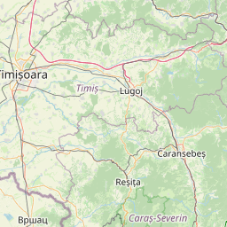
Resita is located in Caras-Severin, Romaniacountry within 45° 18' 2.88" N 21° 53' 21.12" E (45.3008, 21.8892) coordinates. The local time in Resita is 16:54 (12.07.2025)
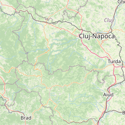
Cluj-Napoca is located in Cluj, Romaniacountry within 46° 46' 0.12" N 23° 34' 59.88" E (46.7667, 23.5833) coordinates. The local time in Cluj-Napoca is 16:54 (12.07.2025)
The calculated flying distance from Resita to Cluj-Napoca is 129.85miles which is equal to 208.97 km.
If you want to go by car, the driving driving distance between Resita and Cluj-Napoca is 198.70 miles (319.78 km). If you ride your car with an average speef of 112 kilometers/hour (70 miles/h), travel time will be 2 hours 51 minutes.Please check the avg.speed travel time on the right for various options
Estimated Travel Time Between Resita and Cluj-Napoca
| Average speed | Travel Time |
|---|---|
| 30 mph (48 km/h) | 6 hours 37 minutes |
| 40 mph (64 km/h) | 4 hours 58 minutes |
| 50 mph (80 km/h) | 3 hours 58 minutes |
| 60 mph (67 km/h) | 3 hours 19 minutes |
| 70 mph (112 km/h) | 2 hours 50 minutes |
| 75 mph (120 km/h) | 2 hours 39 minutes |
Resita, Caras-Severin, Romania
Related Distances from Resita
| Cities | Edite sus datos personales, tarjetas de crédito guardadas y preferencias de viaje |
|---|---|
| Resita to Timisoara | 44.98 mi (72.39 km) |
| Resita to Hunedoara | 59.50 mi (95.75 km) |
| Resita to Arad | 66.50 mi (107.01 km) |
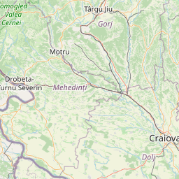
| Resita to Targu Jiu | 69.96 mi (112.59 km) |
| Resita to Alba Iulia | 96.87 mi (155.90 km) |
| Resita to Sibiu | 114.64 mi (184.49 km) |
| Resita to Craiova | 115.72 mi (186.24 km) |
| Resita to Ramnicu Valcea | 121.80 mi (196.01 km) |
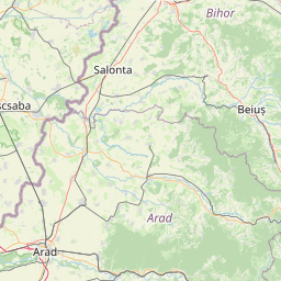
| Resita to Oradea | 122.40 mi (196.99 km) |
| Resita to Cluj-Napoca | 129.85 mi (208.97 km) |
| Resita to Slatina | 135.32 mi (217.77 km) |
| Resita to Pitesti | 148.46 mi (238.92 km) |
| Resita to Targu-Mures | 154.60 mi (248.81 km) |
| Resita to Satu Mare | 178.44 mi (287.17 km) |
| Resita to Baia Mare | 182.25 mi (293.30 km) |
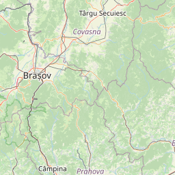
| Resita to Brasov | 182.31 mi (293.40 km) |
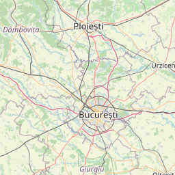
| Resita to Ploiesti | 203.01 mi (326.72 km) |
| Resita to Bucharest | 214.91 mi (345.86 km) |
| Resita to Giurgiu | 222.98 mi (358.86 km) |
| Resita to Focsani | 257.64 mi (414.63 km) |
| Resita to Suceava | 263.64 mi (424.28 km) |
| Resita to Botosani | 283.19 mi (455.75 km) |
| Resita to Vaslui | 295.20 mi (475.08 km) |
| Resita to Iasi | 301.15 mi (484.66 km) |
| Resita to Tulcea | 336.17 mi (541.02 km) |
Related Distances to Cluj-Napoca
| Cities | Edite sus datos personales, tarjetas de crédito guardadas y preferencias de viaje |
|---|---|
| Alba Iulia to Cluj-Napoca | 48.36 mi (77.82 km) |
| Targu-Mures to Cluj-Napoca | 48.89 mi (78.67 km) |
| Baia Mare to Cluj-Napoca | 62.18 mi (100.08 km) |
| Sibiu to Cluj-Napoca | 72.56 mi (116.78 km) |
| Hunedoara to Cluj-Napoca | 75.82 mi (122.01 km) |
| Satu Mare to Cluj-Napoca | 77.81 mi (125.23 km) |
| Oradea to Cluj-Napoca | 81.23 mi (130.73 km) |
| Arad to Cluj-Napoca | 115.53 mi (185.92 km) |
| Targu Jiu to Cluj-Napoca | 120.62 mi (194.12 km) |
| Ramnicu Valcea to Cluj-Napoca | 120.98 mi (194.70 km) |
| Brasov to Cluj-Napoca | 123.39 mi (198.58 km) |
| Resita to Cluj-Napoca | 129.85 mi (208.97 km) |
| Timisoara to Cluj-Napoca | 132.19 mi (212.74 km) |
| Suceava to Cluj-Napoca | 139.52 mi (224.54 km) |
| Pitesti to Cluj-Napoca | 145.50 mi (234.16 km) |
| Botosani to Cluj-Napoca | 159.82 mi (257.20 km) |
| Slatina to Cluj-Napoca | 165.82 mi (266.87 km) |
| Craiova to Cluj-Napoca | 168.51 mi (271.19 km) |
| Ploiesti to Cluj-Napoca | 172.29 mi (277.27 km) |
| Focsani to Cluj-Napoca | 187.00 mi (300.94 km) |
| Iasi to Cluj-Napoca | 190.82 mi (307.10 km) |
| Vaslui to Cluj-Napoca | 196.62 mi (316.44 km) |
| Bucharest to Cluj-Napoca | 202.11 mi (325.27 km) |
| Giurgiu to Cluj-Napoca | 229.52 mi (369.38 km) |
| Tulcea to Cluj-Napoca | 273.07 mi (439.47 km) |
 Inicia sesión con Google