


Distance Calculator


Distance from Sarpsborg to Molde
The shortest distance (air line) between Sarpsborg and Molde is 272.64mi (438.77 km)
The shortest route between Sarpsborg and Molde is 361.81 mi (582.28 km) according to the route planner. The driving time is approx. 8 h 45 m
How far is it between Sarpsborg and Molde.
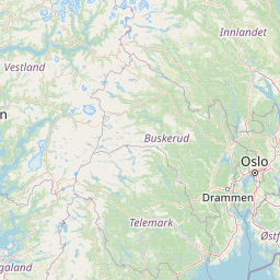
Sarpsborg is located in Viken, Norwaycountry within 59° 17' 8.88" N 11° 6' 42.84" E (59.2858, 11.1119) coordinates. The local time in Sarpsborg is 18:17 (12.07.2025)
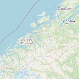
Molde is located in More og Romsdal, Norwaycountry within 62° 44' 15" N 7° 9' 32.76" E (62.7375, 7.1591) coordinates. The local time in Molde is 18:17 (12.07.2025)
The calculated flying distance from Sarpsborg to Molde is 272.64miles which is equal to 438.77 km.
If you want to go by car, the driving driving distance between Sarpsborg and Molde is 361.81 miles (582.28 km). If you ride your car with an average speef of 112 kilometers/hour (70 miles/h), travel time will be 5 hours 12 minutes.Please check the avg.speed travel time on the right for various options
Estimated Travel Time Between Sarpsborg and Molde
| Average speed | Travel Time |
|---|---|
| 30 mph (48 km/h) | 12 hours 4 minutes |
| 40 mph (64 km/h) | 9 hours 3 minutes |
| 50 mph (80 km/h) | 7 hours 14 minutes |
| 60 mph (67 km/h) | 6 hours 2 minutes |
| 70 mph (112 km/h) | 5 hours 10 minutes |
| 75 mph (120 km/h) | 4 hours 49 minutes |
Related Distances from Sarpsborg
| Cities | Edite sus datos personales, tarjetas de crédito guardadas y preferencias de viaje |
|---|---|
| Sarpsborg to Tromso | 753.78 mi (1,213.09 km) |
| Sarpsborg to Fredrikstad | 7.98 mi (12.84 km) |
| Sarpsborg to Moss | 18.79 mi (30.23 km) |
| Sarpsborg to Tonsberg | 24.30 mi (39.11 km) |
| Sarpsborg to Nordre Fale | 33.20 mi (53.44 km) |
| Sarpsborg to Sandefjord | 33.43 mi (53.80 km) |
| Sarpsborg to Lorenskog | 42.67 mi (68.68 km) |
| Sarpsborg to Asker | 44.55 mi (71.69 km) |
| Sarpsborg to Drammen | 44.56 mi (71.72 km) |
| Sarpsborg to Oslo | 45.27 mi (72.86 km) |
| Sarpsborg to Sandvika | 46.24 mi (74.41 km) |
| Sarpsborg to Porsgrunn | 50.97 mi (82.03 km) |
| Sarpsborg to Skien | 55.34 mi (89.07 km) |
| Sarpsborg to Arendal | 101.32 mi (163.06 km) |
| Sarpsborg to Hamar | 104.25 mi (167.78 km) |
| Sarpsborg to Kristiansand | 136.64 mi (219.90 km) |
| Sarpsborg to Stavanger | 191.95 mi (308.91 km) |
| Sarpsborg to Sandnes | 193.21 mi (310.93 km) |
| Sarpsborg to Haugesund | 204.91 mi (329.77 km) |
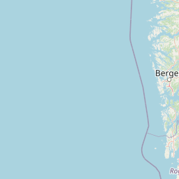
| Sarpsborg to Bergen | 214.63 mi (345.42 km) |
| Sarpsborg to Molde | 272.64 mi (438.77 km) |
| Sarpsborg to Alesund | 276.00 mi (444.18 km) |
| Sarpsborg to Trondheim | 287.30 mi (462.36 km) |
| Sarpsborg to Steinkjer | 326.98 mi (526.23 km) |
| Sarpsborg to Bodo | 561.56 mi (903.74 km) |
Molde, More og Romsdal, Norway
Related Distances to Molde
| Cities | Edite sus datos personales, tarjetas de crédito guardadas y preferencias de viaje |
|---|---|
| Alesund to Molde | 36.66 mi (59.00 km) |
| Trondheim to Molde | 111.88 mi (180.05 km) |
| Steinkjer to Molde | 160.62 mi (258.49 km) |
| Bergen to Molde | 173.02 mi (278.45 km) |
| Hamar to Molde | 185.27 mi (298.16 km) |
| Sandvika to Molde | 226.41 mi (364.37 km) |
| Asker to Molde | 228.25 mi (367.33 km) |
| Oslo to Molde | 228.31 mi (367.44 km) |
| Drammen to Molde | 230.62 mi (371.14 km) |
| Lorenskog to Molde | 233.13 mi (375.18 km) |
| Haugesund to Molde | 235.71 mi (379.34 km) |
| Nordre Fale to Molde | 240.32 mi (386.76 km) |
| Moss to Molde | 255.44 mi (411.09 km) |
| Skien to Molde | 256.68 mi (413.09 km) |
| Tonsberg to Molde | 261.49 mi (420.82 km) |
| Porsgrunn to Molde | 264.45 mi (425.59 km) |
| Stavanger to Molde | 264.69 mi (425.98 km) |
| Sandefjord to Molde | 269.45 mi (433.63 km) |
| Sarpsborg to Molde | 272.64 mi (438.77 km) |
| Sandnes to Molde | 272.72 mi (438.90 km) |
| Fredrikstad to Molde | 275.06 mi (442.66 km) |
| Arendal to Molde | 300.45 mi (483.53 km) |
| Kristiansand to Molde | 318.44 mi (512.47 km) |
| Bodo to Molde | 377.62 mi (607.72 km) |
| Tromso to Molde | 579.36 mi (932.39 km) |
 Inicia sesión con Google