Distance Calculator

Autoestrada do Sul do Tejo, Autoestrada do Norte

350.5 km, 3 h 49 min

Head west on Praça do Bocage150 m
Turn right onto Avenida 22 de Dezembro25 m
Enter the traffic circle and take the 1st exit onto Avenida 22 de Dezembro8 m
Exit the traffic circle onto Avenida 22 de Dezembro50 m
Turn right onto Avenida 5 de Outubro600 m
Keep left onto Avenida Manuel Maria Portela350 m
Keep right onto Avenida dos Ciprestes70 m
Enter the traffic circle and take the 1st exit15 m
Exit the traffic circle50 m
Keep left onto Rua António José Batista35 m
Turn left to stay on Rua António José Batista1 km
Enter the traffic circle and take the 3rd exit onto Avenida Pedro Álvares Cabral70 m
Exit the traffic circle onto Avenida Pedro Álvares Cabral250 m
Keep left onto Avenida Pedro Álvares Cabral150 m
Enter Praça 25 de Abril de 1974 and take the 2nd exit towards Lisboa60 m
Exit the traffic circle towards Lisboa3.5 km
Keep right onto Autoestrada do Sul do Tejo (A 12)20 km
Continue towards Lisboa (Ponte Vasco da Gama)15 km
Take the ramp towards A 1: Norte550 m
Keep right towards A 1: Norte400 m
Merge left onto Autoestrada do Norte (A 1)300 km
Keep right onto Autoestrada do Norte (A 1)7 km
Keep left towards Porto (Ponte do Freixo) / Braga / Gondomar9 km
Take exit 5 towards A43: Circunvalação200 m
Keep left towards A43: Gondomar350 m
Merge left onto Via rápida de Gondomar (A 43)3 km
Take exit 4 towards Valbom250 m
Enter Rotunda Alvarinho Santos and take the 3rd exit onto Rua Alvarinho Santos150 m
Exit the traffic circle onto Rua Alvarinho Santos450 m
Enter Rotunda da Associação Comercial e Industrial de Gondomar and take the 1st exit onto Rua Azenha de Cima (CM 1427)25 m
Exit the traffic circle onto Rua Azenha de Cima (CM 1427)500 m
Make a sharp left onto Rua Manuel Ribeiro de Almeida (EM 611-1)150 m
Turn right onto Rua Vilar (CM 1427)100 m
Turn right onto Avenida Doutor Mário Soares350 m
Keep left onto Avenida Doutor Mário Soares55 m
Turn left to stay on Avenida Doutor Mário Soares25 m
Turn right onto Largo do Souto da Pereira70 m
Turn right onto Rua do Rego200 m
Turn right onto Rua do Taralhão15 m
Turn left onto Rua Almada Negreiros10 m
Make a slight left9 m
You have arrived at your destination, on the left0 m

Autoestrada do Oeste, Autoestrada do Litoral Centro

360.0 km, 3 h 59 min

Head west on Praça do Bocage150 m
Turn right onto Avenida 22 de Dezembro25 m
Enter the traffic circle and take the 1st exit onto Avenida 22 de Dezembro8 m
Exit the traffic circle onto Avenida 22 de Dezembro50 m
Turn right onto Avenida 5 de Outubro600 m
Keep left onto Avenida Manuel Maria Portela350 m
Keep right onto Avenida dos Ciprestes70 m
Enter the traffic circle and take the 1st exit15 m
Exit the traffic circle50 m
Keep left onto Rua António José Batista35 m
Turn left to stay on Rua António José Batista1 km
Enter the traffic circle and take the 3rd exit onto Avenida Pedro Álvares Cabral70 m
Exit the traffic circle onto Avenida Pedro Álvares Cabral250 m
Keep left onto Avenida Pedro Álvares Cabral150 m
Enter Praça 25 de Abril de 1974 and take the 2nd exit towards Lisboa60 m
Exit the traffic circle towards Lisboa3.5 km
Keep right onto Autoestrada do Sul do Tejo (A 12)20 km
Continue towards Lisboa (Ponte Vasco da Gama)20 km
Continue onto Circular Regional Interior de Lisboa (CRIL) (IC 17)2.5 km
Take the ramp towards A 8: Leiria900 m
Keep left towards Leiria700 m
Keep left towards A 8: Leiria450 m
Merge left onto Autoestrada do Oeste (A 8)50 km
Keep left onto Autoestrada do Oeste (A 8)70 km
Keep left towards A 17: Aveiro90 km
Keep left onto Autoestrada do Litoral Centro (A 17)20 km
Take the ramp towards EN 235: Aveiro Sul300 m
Enter the traffic circle and take the 1st exit onto EN 23560 m
Exit the traffic circle onto EN 235800 m
Enter the traffic circle and take the 1st exit onto EN 23525 m
Exit the traffic circle onto EN 2351.5 km
Enter the traffic circle and take the 2nd exit towards Lisboa25 m
Exit the traffic circle towards Lisboa1 km
Enter the traffic circle and take the 3rd exit towards Porto80 m
Exit the traffic circle towards Porto300 m
Keep right towards Porto200 m
Keep left towards Porto700 m
Merge left onto Autoestrada do Norte (A 1)50 km
Keep right onto Autoestrada do Norte (A 1)7 km
Keep left towards Porto (Ponte do Freixo) / Braga / Gondomar9 km
Take exit 5 towards A43: Circunvalação200 m
Keep left towards A43: Gondomar350 m
Merge left onto Via rápida de Gondomar (A 43)3 km
Take exit 4 towards Valbom250 m
Enter Rotunda Alvarinho Santos and take the 3rd exit onto Rua Alvarinho Santos150 m
Exit the traffic circle onto Rua Alvarinho Santos450 m
Enter Rotunda da Associação Comercial e Industrial de Gondomar and take the 1st exit onto Rua Azenha de Cima (CM 1427)25 m
Exit the traffic circle onto Rua Azenha de Cima (CM 1427)500 m
Make a sharp left onto Rua Manuel Ribeiro de Almeida (EM 611-1)150 m
Turn right onto Rua Vilar (CM 1427)100 m
Turn right onto Avenida Doutor Mário Soares350 m
Keep left onto Avenida Doutor Mário Soares55 m
Turn left to stay on Avenida Doutor Mário Soares25 m
Turn right onto Largo do Souto da Pereira70 m
Turn right onto Rua do Rego200 m
Turn right onto Rua do Taralhão15 m
Turn left onto Rua Almada Negreiros10 m
Make a slight left9 m
You have arrived at your destination, on the left0 m
From
    To

      Distance: 182.42 mi (293.57 km)

      Driving route: 217.77 mi (350.46 km).

      Driving time: 3h 48 min

      Distance from Setubal to Gondomar

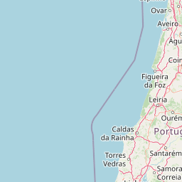
      The shortest distance (air line) between Setubal and Gondomar is 182.42mi (293.57 km)

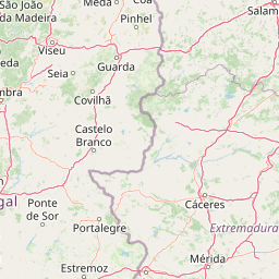
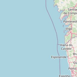
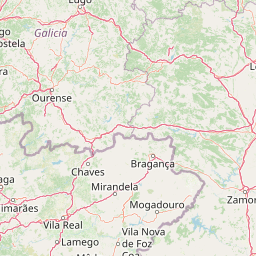
      The shortest route between Setubal and Gondomar is 217.77 mi (350.46 km) according to the route planner. The driving time is approx. 3 h 48 m

      How far is it between Setubal and Gondomar.

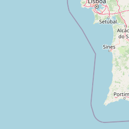
      Setubal is located in Area Metropolitana de Lisboa, Portugalcountry within 38° 31' 27.48" N -9° 6' 26.64" W (38.5243, -8.8926) coordinates. The local time in Setubal is 09:05 (29.07.2025)

      Gondomar is located in Area Metropolitana do Porto, Portugalcountry within 41° 8' 60" N -9° 28' 0.12" W (41.1500, -8.5333) coordinates. The local time in Gondomar is 09:05 (29.07.2025)

      The calculated flying distance from Setubal to Gondomar is 182.42miles which is equal to 293.57 km.

      If you want to go by car, the driving driving distance between Setubal and Gondomar is 217.77 miles (350.46 km). If you ride your car with an average speef of 112 kilometers/hour (70 miles/h), travel time will be 3 hours 8 minutes.Please check the avg.speed travel time on the right for various options

      Estimated Travel Time Between Setubal and Gondomar

      Average speedTravel Time
      30 mph (48 km/h)7 hours 16 minutes
      40 mph (64 km/h)5 hours 27 minutes
      50 mph (80 km/h)4 hours 21 minutes
      60 mph (67 km/h)3 hours 38 minutes
      70 mph (112 km/h)3 hours 7 minutes
      75 mph (120 km/h)2 hours 54 minutes

      Setubal, Area Metropolitana de Lisboa, Portugal

      Related Distances from Setubal

      CitiesEdite sus datos personales, tarjetas de crédito guardadas y preferencias de viaje
      Setubal to Barreiro13.61 mi (21.90 km)
      Setubal to Almada17.94 mi (28.88 km)
      Setubal to Lisbon19.64 mi (31.62 km)
      Setubal to Amadora23.38 mi (37.63 km)
      Setubal to Odivelas24.04 mi (38.68 km)
      Setubal to Oeiras25.40 mi (40.87 km)
      Setubal to Queluz25.56 mi (41.13 km)
      Setubal to Loures25.97 mi (41.79 km)
      Setubal to Cascais30.79 mi (49.55 km)
      Setubal to Sintra32.80 mi (52.79 km)
      Setubal to Leiria84.83 mi (136.53 km)
      Setubal to Coimbra119.15 mi (191.75 km)
      Setubal to Viseu156.88 mi (252.47 km)
      Setubal to Vila Nova de Gaia180.86 mi (291.06 km)
      Setubal to Gondomar182.42 mi (293.57 km)
      Setubal to Porto182.82 mi (294.22 km)
      Setubal to Matosinhos184.00 mi (296.12 km)
      Setubal to Maia187.74 mi (302.15 km)
      Setubal to Famalicao200.83 mi (323.21 km)
      Setubal to Aves203.88 mi (328.12 km)
      Setubal to Guimaraes204.56 mi (329.21 km)
      Setubal to Barcelos207.27 mi (333.57 km)
      Setubal to Braga210.56 mi (338.87 km)
      Setubal to Viana do Castelo219.44 mi (353.16 km)
      Setubal to Funchal606.18 mi (975.55 km)

      Gondomar, Area Metropolitana do Porto, Portugal

      Related Distances to Gondomar

      CitiesEdite sus datos personales, tarjetas de crédito guardadas y preferencias de viaje
      Funchal to Gondomar747.18 mi (1,202.47 km)
      Vila Nova de Gaia to Gondomar4.49 mi (7.23 km)
      Porto to Gondomar4.69 mi (7.55 km)
      Maia to Gondomar7.21 mi (11.60 km)
      Matosinhos to Gondomar8.97 mi (14.44 km)
      Famalicao to Gondomar18.45 mi (29.69 km)
      Aves to Gondomar23.41 mi (37.68 km)
      Guimaraes to Gondomar24.01 mi (38.63 km)
      Barcelos to Gondomar25.70 mi (41.37 km)
      Braga to Gondomar28.28 mi (45.50 km)
      Viana do Castelo to Gondomar41.06 mi (66.07 km)
      Viseu to Gondomar46.39 mi (74.65 km)
      Coimbra to Gondomar65.10 mi (104.77 km)
      Leiria to Gondomar97.74 mi (157.30 km)
      Loures to Gondomar163.54 mi (263.19 km)
      Odivelas to Gondomar166.59 mi (268.10 km)
      Sintra to Gondomar168.61 mi (271.36 km)
      Queluz to Gondomar170.21 mi (273.93 km)
      Lisbon to Gondomar170.68 mi (274.69 km)
      Amadora to Gondomar171.04 mi (275.27 km)
      Almada to Gondomar173.82 mi (279.74 km)
      Barreiro to Gondomar173.89 mi (279.85 km)
      Oeiras to Gondomar175.41 mi (282.30 km)
      Cascais to Gondomar175.63 mi (282.65 km)
      Setubal to Gondomar182.42 mi (293.57 km)