


Distance Calculator


Distance from Svencionys to Elektrenai
The shortest distance (air line) between Svencionys and Elektrenai is 63.95mi (102.93 km)
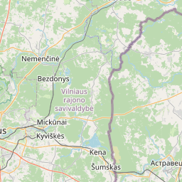
The shortest route between Svencionys and Elektrenai is 82.27 mi (132.39 km) according to the route planner. The driving time is approx. 1 h 59 m
How far is it between Svencionys and Elektrenai.
Svencionys is located in Vilniaus apskritis, Lithuaniacountry within 55° 7' 59.88" N 26° 9' 20.16" E (55.1333, 26.1556) coordinates. The local time in Svencionys is 03:56 (30.06.2025)
Elektrenai is located in Vilniaus apskritis, Lithuaniacountry within 54° 47' 9.96" N 24° 39' 39.96" E (54.7861, 24.6611) coordinates. The local time in Elektrenai is 03:56 (30.06.2025)
The calculated flying distance from Svencionys to Elektrenai is 63.95miles which is equal to 102.93 km.
If you want to go by car, the driving driving distance between Svencionys and Elektrenai is 82.27 miles (132.39 km). If you ride your car with an average speef of 112 kilometers/hour (70 miles/h), travel time will be 1 hours 11 minutes.Please check the avg.speed travel time on the right for various options
Estimated Travel Time Between Svencionys and Elektrenai
| Average speed | Travel Time |
|---|---|
| 30 mph (48 km/h) | 2 hours 45 minutes |
| 40 mph (64 km/h) | 2 hours 3 minutes |
| 50 mph (80 km/h) | 1 hours 39 minutes |
| 60 mph (67 km/h) | 1 hours 22 minutes |
| 70 mph (112 km/h) | 1 hours 11 minutes |
| 75 mph (120 km/h) | 1 hours 6 minutes |
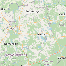
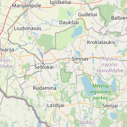
Svencionys, Vilniaus apskritis, Lithuania
Related Distances from Svencionys
| Cities | Edite sus datos personales, tarjetas de crédito guardadas y preferencias de viaje |
|---|---|
| Svencionys to Ignalina | 14.98 mi (24.11 km) |
| Svencionys to Moletai | 29.96 mi (48.21 km) |
| Svencionys to Utena | 33.45 mi (53.84 km) |
| Svencionys to Visaginas | 33.97 mi (54.67 km) |
| Svencionys to Zarasai | 41.62 mi (66.98 km) |
| Svencionys to Vilnius | 46.47 mi (74.79 km) |
| Svencionys to Sirvintos | 47.39 mi (76.26 km) |
| Svencionys to Anyksciai | 49.85 mi (80.22 km) |
| Svencionys to Grigiskes | 52.90 mi (85.13 km) |
| Svencionys to Aukstieji Paneriai | 52.93 mi (85.18 km) |
| Svencionys to Ukmerge | 56.02 mi (90.16 km) |
| Svencionys to Trakai | 59.61 mi (95.93 km) |
| Svencionys to Elektrenai | 63.95 mi (102.93 km) |
| Svencionys to Salcininkai | 64.29 mi (103.46 km) |
| Svencionys to Kaisiadorys | 70.06 mi (112.74 km) |
| Svencionys to Jonava | 74.23 mi (119.47 km) |
| Svencionys to Kedainiai | 86.91 mi (139.87 km) |
| Svencionys to Varena | 89.78 mi (144.49 km) |
| Svencionys to Kaunas | 91.37 mi (147.05 km) |
| Svencionys to Birstonas | 92.46 mi (148.80 km) |
| Svencionys to Prienai | 94.53 mi (152.12 km) |
| Svencionys to Alytus | 98.01 mi (157.73 km) |
| Svencionys to Druskininkai | 116.77 mi (187.92 km) |
| Svencionys to Raseiniai | 120.75 mi (194.33 km) |
| Svencionys to Lazdijai | 122.37 mi (196.93 km) |
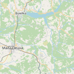
Elektrenai, Vilniaus apskritis, Lithuania
Related Distances to Elektrenai
| Cities | Edite sus datos personales, tarjetas de crédito guardadas y preferencias de viaje |
|---|---|
| Kaisiadorys to Elektrenai | 10.08 mi (16.22 km) |
| Trakai to Elektrenai | 15.15 mi (24.38 km) |
| Grigiskes to Elektrenai | 19.36 mi (31.15 km) |
| Sirvintos to Elektrenai | 21.17 mi (34.08 km) |
| Jonava to Elektrenai | 24.88 mi (40.04 km) |
| Aukstieji Paneriai to Elektrenai | 25.07 mi (40.34 km) |
| Vilnius to Elektrenai | 25.62 mi (41.23 km) |
| Birstonas to Elektrenai | 28.54 mi (45.93 km) |
| Prienai to Elektrenai | 30.60 mi (49.24 km) |
| Kaunas to Elektrenai | 31.78 mi (51.14 km) |
| Ukmerge to Elektrenai | 32.25 mi (51.89 km) |
| Alytus to Elektrenai | 36.15 mi (58.17 km) |
| Varena to Elektrenai | 39.89 mi (64.19 km) |
| Moletai to Elektrenai | 43.02 mi (69.24 km) |
| Salcininkai to Elektrenai | 43.47 mi (69.95 km) |
| Kedainiai to Elektrenai | 44.00 mi (70.81 km) |
| Anyksciai to Elektrenai | 54.46 mi (87.64 km) |
| Lazdijai to Elektrenai | 59.72 mi (96.10 km) |
| Druskininkai to Elektrenai | 60.05 mi (96.64 km) |
| Utena to Elektrenai | 61.71 mi (99.30 km) |
| Svencionys to Elektrenai | 63.95 mi (102.93 km) |
| Ignalina to Elektrenai | 71.17 mi (114.54 km) |
| Raseiniai to Elektrenai | 73.08 mi (117.61 km) |
| Visaginas to Elektrenai | 89.76 mi (144.46 km) |
| Zarasai to Elektrenai | 90.53 mi (145.70 km) |
 Inicia sesión con Google