Distance Calculator

Tallinn — Tartu — Võru — Luhamaa, Jõhvi — Tartu — Valga

244.0 km, 3 h 27 min

Head southeast20 m
Turn left onto Langu40 m
Turn left onto Keemikute150 m
Turn left onto Orumetsa450 m
Continue onto Maardu tee1.5 km
Turn left onto Põhjaranna tee (94)2 km
Continue onto Muuga sadama tee (94)1.5 km
Take the ramp on the right700 m
Merge left onto Peterburi tee (1)3.5 km
Take the ramp250 m
Keep left at the fork55 m
Continue straight150 m
Enter the traffic circle and take the 2nd exit onto Tallinna ringtee (11)150 m
Exit the traffic circle onto Tallinna ringtee (11)300 m
Continue onto Lagedi tee (11)1 km
Continue onto Tallinna ringtee (11)9 km
Enter the traffic circle and take the 3rd exit towards 2: Tartu700 m
Exit the traffic circle towards 2: Tartu450 m
Merge left onto Tallinn — Tartu — Võru — Luhamaa (2)100 km
Continue onto Tallinna mnt (2)1 km
Continue onto Tallinn — Tartu — Võru — Luhamaa (2)4 km
Make a slight right onto Põltsamaa — Võhma (38)2.5 km
Continue onto Tallinna mnt (38)800 m
Turn right onto Viljandi mnt (38)800 m
Continue onto Põltsamaa — Võhma (38)1.5 km
Turn left onto Viljandi — Põltsamaa (51)15 km
Turn left onto Kolga-Jaani — Leie (24133)15 km
Turn slight left onto Tartu — Viljandi — Kilingi-Nõmme (92)15 km
Turn right onto Sangla — Rõngu (47)20 km
Continue onto Valguta tee (47)350 m
Continue onto Sangla — Rõngu (47)4 km
Turn left onto Viljandi — Rõngu (52)200 m
Continue onto Viljandi mnt (52)900 m
Turn right onto Valga mnt (3)700 m
Continue onto Jõhvi — Tartu — Valga (3)25 km
Continue onto Valga tee (3)350 m
Continue onto Jõhvi — Tartu — Valga (3)15 km
Continue onto Tartu mnt (3)400 m
Enter the traffic circle and take the 1st exit onto Tartu5.5 m
Exit the traffic circle onto Tartu1 km
Turn right onto Paju100 m
You have arrived at your destination, on the left0 m

Tallinn — Tartu — Võru — Luhamaa, Imavere — Viljandi — Karksi-Nuia

239.2 km, 3 h 27 min

Head southeast20 m
Turn left onto Langu40 m
Turn left onto Keemikute150 m
Turn left onto Orumetsa450 m
Continue onto Maardu tee1.5 km
Turn left onto Põhjaranna tee (94)2 km
Continue onto Muuga sadama tee (94)1.5 km
Take the ramp on the right700 m
Merge left onto Peterburi tee (1)3.5 km
Take the ramp250 m
Keep left at the fork55 m
Continue straight150 m
Enter the traffic circle and take the 2nd exit onto Tallinna ringtee (11)150 m
Exit the traffic circle onto Tallinna ringtee (11)300 m
Continue onto Lagedi tee (11)1 km
Continue onto Tallinna ringtee (11)9 km
Enter the traffic circle and take the 3rd exit towards 2: Tartu700 m
Exit the traffic circle towards 2: Tartu450 m
Merge left onto Tallinn — Tartu — Võru — Luhamaa (2)90 km
Turn right onto Imavere — Viljandi — Karksi-Nuia (49)1 km
Continue onto Viljandi mnt (49)600 m
Continue onto Imavere — Viljandi — Karksi-Nuia (49)45 km
Continue onto Viljandi tee (50)2.5 km
Continue onto Tallinna (50)1.5 km
Turn left onto Lembitu pst900 m
Turn left onto Uus (92)100 m
Make a slight right25 m
Turn left onto Uus (92)100 m
Turn right onto Kooli150 m
Turn left onto Carl Robert Jakobsoni (92)700 m
Continue onto Tartu (92)800 m
Enter the traffic circle and take the 1st exit onto Mustla mnt (52)15 m
Exit the traffic circle onto Mustla mnt (52)700 m
Continue onto Viljandi — Rõngu (52)10 km
Continue onto Mustla tee (52)550 m
Continue onto Viljandi — Rõngu (52)4.5 km
Turn right onto Kärstna — Raassilla (24173)10 km
Turn right onto Mustla — Kärstna (24176)1 km
Continue onto Pärna (24176)600 m
Turn right20 m
Turn left onto Loodi — Helme (24162)15 km
Turn left onto Valga — Uulu (6)2.5 km
Continue onto Viljandi (6)800 m
Make a slight left onto Valga (6)60 m
Enter the traffic circle and take the 2nd exit onto Valga (6)20 m
Exit the traffic circle onto Valga (6)25 km
Continue onto Viljandi mnt (6)2 km
Turn left onto Pärna pst100 m
Continue onto Paju300 m
You have arrived at your destination, on the right0 m
From
    To

      Distance: 122.68 mi (197.43 km)

      Driving route: 151.64 mi (244.04 km).

      Driving time: 3h 26 min

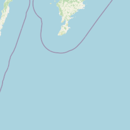
      Distance from Valga to Maardu

      The shortest distance (air line) between Valga and Maardu is 122.68mi (197.43 km)

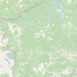
      The shortest route between Valga and Maardu is 151.64 mi (244.04 km) according to the route planner. The driving time is approx. 3 h 26 m

      How far is it between Valga and Maardu.

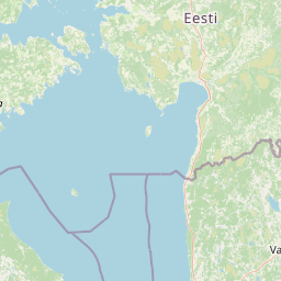
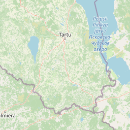
      Valga is located in Louna-Eesti, Estoniacountry within 57° 46' 59.88" N 26° 1' 59.88" E (57.7833, 26.0333) coordinates. The local time in Valga is 08:54 (04.07.2025)

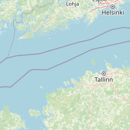
      Maardu is located in Pohja-Eesti, Estoniacountry within 59° 28' 41.16" N 25° 0' 57.96" E (59.4781, 25.0161) coordinates. The local time in Maardu is 08:54 (04.07.2025)

      The calculated flying distance from Valga to Maardu is 122.68miles which is equal to 197.43 km.

      If you want to go by car, the driving driving distance between Valga and Maardu is 151.64 miles (244.04 km). If you ride your car with an average speef of 112 kilometers/hour (70 miles/h), travel time will be 2 hours 11 minutes.Please check the avg.speed travel time on the right for various options

      Estimated Travel Time Between Valga and Maardu

      Average speedTravel Time
      30 mph (48 km/h)5 hours 3 minutes
      40 mph (64 km/h)3 hours 47 minutes
      50 mph (80 km/h)3 hours 2 minutes
      60 mph (67 km/h)2 hours 32 minutes
      70 mph (112 km/h)2 hours 10 minutes
      75 mph (120 km/h)2 hours 1 minutes

      Valga, Louna-Eesti, Estonia

      Related Distances from Valga

      CitiesEdite sus datos personales, tarjetas de crédito guardadas y preferencias de viaje
      Valga to Voru35.60 mi (57.29 km)
      Valga to Polva41.91 mi (67.44 km)
      Valga to Viljandi43.31 mi (69.69 km)
      Valga to Tartu48.39 mi (77.88 km)
      Valga to Jogeva67.90 mi (109.27 km)
      Valga to Parnu69.68 mi (112.14 km)
      Valga to Paide77.94 mi (125.43 km)
      Valga to Rapla94.83 mi (152.61 km)
      Valga to Rakvere108.85 mi (175.17 km)
      Valga to Johvi119.79 mi (192.78 km)
      Valga to Kohtla-Jarve119.94 mi (193.02 km)
      Valga to Keila120.32 mi (193.64 km)
      Valga to Haapsalu120.57 mi (194.04 km)
      Valga to Maardu122.68 mi (197.43 km)
      Valga to Tallinn123.31 mi (198.45 km)
      Valga to Sillamae127.67 mi (205.46 km)
      Valga to Kuressaare133.84 mi (215.40 km)
      Valga to Narva134.80 mi (216.94 km)
      Valga to Kardla145.61 mi (234.34 km)

      Maardu, Pohja-Eesti, Estonia

      Related Distances to Maardu

      CitiesEdite sus datos personales, tarjetas de crédito guardadas y preferencias de viaje
      Tallinn to Maardu9.92 mi (15.96 km)
      Keila to Maardu23.94 mi (38.53 km)
      Rapla to Maardu34.27 mi (55.16 km)
      Paide to Maardu45.34 mi (72.97 km)
      Rakvere to Maardu47.72 mi (76.80 km)
      Haapsalu to Maardu64.09 mi (103.15 km)
      Jogeva to Maardu70.44 mi (113.36 km)
      Parnu to Maardu77.85 mi (125.29 km)
      Kohtla-Jarve to Maardu78.93 mi (127.02 km)
      Viljandi to Maardu79.56 mi (128.04 km)
      Johvi to Maardu85.15 mi (137.04 km)
      Kardla to Maardu86.78 mi (139.66 km)
      Tartu to Maardu96.94 mi (156.01 km)
      Sillamae to Maardu97.07 mi (156.23 km)
      Narva to Maardu111.97 mi (180.20 km)
      Polva to Maardu122.57 mi (197.26 km)
      Valga to Maardu122.68 mi (197.43 km)
      Kuressaare to Maardu124.03 mi (199.61 km)
      Voru to Maardu133.11 mi (214.22 km)