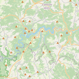
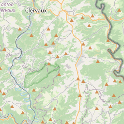
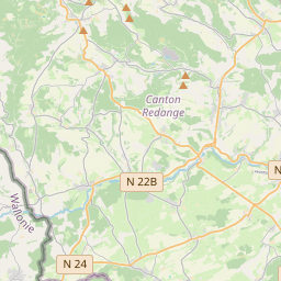
Distance Calculator

N 22, CR 305

41.3 km, 46 min

Head north on Rue d'Ospern (CR 304A)10 m
Turn right onto Rue de la Gendarmerie550 m
Turn right onto Rue de la Piscine300 m
Turn left onto Rue de Reichlange (N 22)250 m
Enter the traffic circle and take the 1st exit onto Rue de Reichlange (N 22)25 m
Exit the traffic circle onto Rue de Reichlange (N 22)2 km
Turn slight left90 m
Continue onto Rue de Bettborn (N 12)500 m
Turn right onto N 224.5 km
Turn left onto Rue de Boevange (N 22)200 m
Turn left onto Rue de Vichten (CR 305)2 km
Keep right onto CR 3052.5 km
Turn right onto Rue Principale (CR 305)100 m
Turn left onto Rue de Michelbouch (CR 305)6 km
Enter the traffic circle and take the 2nd exit onto CR 30530 m
Exit the traffic circle onto CR 3054 km
Keep right onto CR 345B70 m
Continue slightly right onto N 15200 m
Enter the traffic circle and take the 4th exit onto Grand-Rue (N 7)50 m
Exit the traffic circle onto Grand-Rue (N 7)350 m
Continue onto Rue du Canal (N 7)350 m
Continue onto Rue Prince Henri (N 7)200 m
Continue onto Rue de la Gare (N 7)100 m
Keep right onto Rue de la Gare (N 7)30 m
Go straight onto Avenue John F. Kennedy (N 7)700 m
Enter the traffic circle and take the 2nd exit onto N 730 m
Exit the traffic circle onto N 7600 m
Enter the traffic circle and take the 2nd exit onto Route d'Ettelbruck (N 7)90 m
Exit the traffic circle onto Route d'Ettelbruck (N 7)150 m
Continue onto N 71.5 km
Continue onto Ettelbréckerstrooss (N 7)100 m
Continue onto Route d'Ettelbruck (N 7)800 m
Go straight onto Avenue de la Gare (N 7)600 m
Turn right onto N 14150 m
Keep left onto Route de Gilsdorf (CR 356)500 m
Enter An der Laach and take the 2nd exit onto Route de Gilsdorf (CR 356)45 m
Exit the traffic circle onto Route de Gilsdorf (CR 356)450 m
Continue onto Rue Principale (CR 356)550 m
Turn left onto Rue du Pont (CR 356A)400 m
Continue right onto Rue Clairefontaine (N 17)700 m
Enter the traffic circle and take the 2nd exit onto N 1760 m
Exit the traffic circle onto N 175 km
Turn left to stay on Dikricherstrooss (N 17)3.5 km
Continue onto Grand-Rue (N 17)700 m
You have arrived at your destination, on the right0.5 m

Route du Nord, Veianerstrooss

53.2 km, 49 min

Head north on Rue d'Ospern (CR 304A)10 m
Turn right onto Rue de la Gendarmerie550 m
Turn right onto Rue de la Piscine300 m
Turn left onto Rue de Reichlange (N 22)250 m
Enter the traffic circle and take the 1st exit onto Rue de Reichlange (N 22)25 m
Exit the traffic circle onto Rue de Reichlange (N 22)2 km
Turn right onto Rue de Saeul (N 12)3.5 km
Enter the traffic circle and take the 2nd exit onto N 1270 m
Exit the traffic circle onto N 122.5 km
Make a sharp left1.5 km
Continue onto An Uerbech250 m
Make a slight left to stay on An Uerbech250 m
Turn right onto An Uerbech (CR 116)150 m
Continue onto Am Fuert (CR 116)200 m
Continue onto Helperterwee (CR 116)2 km
Turn left onto CR 11415 m
Turn right onto CR 115900 m
Turn left onto N 83.5 km
Take the ramp on the left onto A 7450 m
Merge left onto Autoroute du Nord (A 7)8 km
Continue onto Route du Nord (B 7)7 km
Continue onto N 27A1.5 km
Enter Rond-Point Fridhaff and take the 2nd exit towards N 7: St. Vith150 m
Exit the traffic circle towards N 7: St. Vith1.5 km
Turn right onto Branebuergerstrooss (CR 377)2 km
Turn right onto CR 353800 m
Turn left onto Hënneschtgaass (CR 352)200 m
Turn right onto Neie Wee1.5 km
Turn left onto CR 3524 km
Turn right onto Veianerstrooss (CR 322)6 km
Make a sharp left onto Rue Gaessel350 m
Turn right onto Montée du Château80 m
Make a slight left onto Grand-Rue (N 17)550 m
You have arrived at your destination, on the right0.5 m
From
    To

      Distance: 18.34 mi (29.51 km)

      Driving route: 25.64 mi (41.26 km).

      Driving time: 0h 45 min

      Distance from Vianden to Redange-sur-Attert

      The shortest distance (air line) between Vianden and Redange-sur-Attert is 18.34mi (29.51 km)

      The shortest route between Vianden and Redange-sur-Attert is 25.64 mi (41.26 km) according to the route planner. The driving time is approx. 0 h 45 m

      How far is it between Vianden and Redange-sur-Attert.

      Vianden is located in Luxembourg, Luxembourgcountry within 49° 56' 0.96" N 6° 12' 27" E (49.9336, 6.2075) coordinates. The local time in Vianden is 17:34 (18.08.2025)

      Redange-sur-Attert is located in Luxembourg, Luxembourgcountry within 49° 45' 54.72" N 5° 53' 21.84" E (49.7652, 5.8894) coordinates. The local time in Redange-sur-Attert is 17:34 (18.08.2025)

      The calculated flying distance from Vianden to Redange-sur-Attert is 18.34miles which is equal to 29.51 km.

      If you want to go by car, the driving driving distance between Vianden and Redange-sur-Attert is 25.64 miles (41.26 km). If you ride your car with an average speef of 112 kilometers/hour (70 miles/h), travel time will be 0 hours 22 minutes.Please check the avg.speed travel time on the right for various options

      Estimated Travel Time Between Vianden and Redange-sur-Attert

      Average speedTravel Time
      30 mph (48 km/h)0 hours 51 minutes
      40 mph (64 km/h)0 hours 38 minutes
      50 mph (80 km/h)0 hours 31 minutes
      60 mph (67 km/h)0 hours 26 minutes
      70 mph (112 km/h)0 hours 22 minutes
      75 mph (120 km/h)0 hours 21 minutes

      Vianden, Luxembourg, Luxembourg

      Related Distances from Vianden

      CitiesEdite sus datos personales, tarjetas de crédito guardadas y preferencias de viaje
      Vianden to Diekirch5.06 mi (8.14 km)
      Vianden to Clervaux11.16 mi (17.96 km)
      Vianden to Wiltz12.40 mi (19.96 km)
      Vianden to Echternach12.72 mi (20.48 km)
      Vianden to Mersch13.56 mi (21.82 km)
      Vianden to Redange-sur-Attert18.34 mi (29.51 km)
      Vianden to Grevenmacher20.36 mi (32.77 km)
      Vianden to Capellen22.22 mi (35.76 km)
      Vianden to Luxembourg22.50 mi (36.20 km)
      Vianden to Remich27.81 mi (44.76 km)
      Vianden to Dudelange31.60 mi (50.86 km)
      Vianden to Differdange31.73 mi (51.07 km)
      Vianden to Esch-sur-Alzette31.83 mi (51.23 km)

      Redange-sur-Attert, Luxembourg, Luxembourg

      Related Distances to Redange-sur-Attert

      CitiesEdite sus datos personales, tarjetas de crédito guardadas y preferencias de viaje
      Mersch to Redange-sur-Attert9.46 mi (15.22 km)
      Capellen to Redange-sur-Attert9.47 mi (15.25 km)
      Diekirch to Redange-sur-Attert13.88 mi (22.33 km)
      Wiltz to Redange-sur-Attert14.06 mi (22.63 km)
      Luxembourg to Redange-sur-Attert15.17 mi (24.41 km)
      Differdange to Redange-sur-Attert16.79 mi (27.02 km)
      Vianden to Redange-sur-Attert18.34 mi (29.51 km)
      Esch-sur-Alzette to Redange-sur-Attert18.98 mi (30.55 km)
      Clervaux to Redange-sur-Attert20.69 mi (33.30 km)
      Dudelange to Redange-sur-Attert21.32 mi (34.32 km)
      Echternach to Redange-sur-Attert23.96 mi (38.56 km)
      Grevenmacher to Redange-sur-Attert25.35 mi (40.80 km)
      Remich to Redange-sur-Attert26.24 mi (42.23 km)