| Head southeast | 15 m |
| Turn right onto Rruga Qemal Stafa | 100 m |
| Enter the traffic circle and take the 2nd exit onto Rruga Qemal Stafa | 55 m |
| Exit the traffic circle onto Rruga Qemal Stafa | 700 m |
| Enter the traffic circle and take the 2nd exit onto Rruga 11 Nëntori (SH3) | 40 m |
| Exit the traffic circle onto Rruga 11 Nëntori (SH3) | 1 km |
| Continue onto Rruga Elbasan-Metalurgji (SH3) | 2.5 km |
| Enter the traffic circle and take the 2nd exit towards SH3: Tiranë | 30 m |
| Exit the traffic circle towards SH3: Tiranë | 700 m |
| Enter the traffic circle and take the 1st exit towards Autostrada Tiranë-Elbasan: Tiranë | 9 m |
| Exit the traffic circle towards Autostrada Tiranë-Elbasan: Tiranë | 25 km |
| Continue towards Tiranë | 9 km |
| Keep right towards SH1: Durrës | 700 m |
| Continue towards SH2: Aeroport | 8 km |
| Take the ramp | 300 m |
| Merge left onto Autostrada Thumanë Kashar (A1) | 35 km |
| Take the ramp towards A1: Kukës | 100 km |
| Continue onto Doktor Ibrahim Rugova (R 7) | 70 km |
| Continue towards Prishtinë / Priština | 1 km |
| Continue onto Doktor Ibrahim Rugova (M-9) | 7 km |
| Continue onto Rruga e Pejës (M-9) | 10 km |
| Take the ramp towards R 6: Nish / Niš | 2.5 km |
| Take the ramp towards R 7: Nish / Niš | 15 km |
| Take the ramp onto Doktor Ibrahim Rugova (R 7) | 1.5 km |
| Enter the traffic circle and take the 2nd exit onto Pranvera e Lirisë (M-25) | 100 m |
| Exit the traffic circle onto Pranvera e Lirisë (M-25) | 1 km |
| Continue straight to stay on Pranvera e Lirisë (M-25) | 450 m |
| Go straight onto Pranvera e Lirisë (M-25) | 2 km |
| Continue onto Batalioni Kështjella (M-25) | 4 km |
| Turn right onto M-25 | 1.5 km |
| Turn right onto Gryka e Llapit (M-25) | 4 km |
| Enter the traffic circle and take the 2nd exit onto Gryka e Llapit (M-25) | 20 m |
| Exit the traffic circle onto Gryka e Llapit (M-25) | 1 km |
| Enter the traffic circle and take the 2nd exit onto Gryka e Llapit (M-25) | 15 m |
| Exit the traffic circle onto Gryka e Llapit (M-25) | 2.5 km |
| Make a slight left onto Gryka e Llapit (M-25) | 1.5 km |
| Make a slight right onto Gryka e Llapit (M-25) | 1.5 km |
| Enter the traffic circle and take the 2nd exit onto Gryka e Llapit (M-25) | 25 m |
| Exit the traffic circle onto Gryka e Llapit (M-25) | 1.5 km |
| Turn right to stay on Gryka e Llapit (M-25) | 5 km |
| Turn right onto Мердарска (35) | 4 km |
| Continue onto Косанчић Ивана (35) | 5.5 km |
| Continue onto Краљице Марије (35) | 7 km |
| Continue onto Браће Ћирића (35) | 4 km |
| Continue onto Славка Родића (35) | 900 m |
| Continue onto Воћарска (35) | 3 km |
| Continue onto Косовска (35) | 3.5 km |
| Continue onto Петра Бојовића (35) | 600 m |
| Make a sharp left onto 212 | 1.5 km |
| Turn right onto Краљевића Марка | 700 m |
| Turn right onto Краља Владислава (214) | 3 km |
| Continue onto Рада Драинца (214) | 2 km |
| Continue onto Главна (214) | 4 km |
| Continue onto Барбатовац (214) | 5 km |
| Continue onto Кашевар (214) | 2.5 km |
| Continue onto Трбуње (214) | 2 km |
| Continue onto Стевана Немање (214) | 1.5 km |
| Turn left onto Цара Лазара | 450 m |
| Turn left onto Карађорђева (38) | 5.5 km |
| Continue onto Џепница (38) | 35 km |
| Continue onto Горана Раичевића (38) | 1 km |
| Continue onto Бруски пут (38) | 3.5 km |
| Enter the traffic circle and take the 2nd exit onto Бруски пут (38) | 15 m |
| Exit the traffic circle onto Бруски пут (38) | 200 m |
| Enter the traffic circle and take the 2nd exit onto Бруски пут | 35 m |
| Exit the traffic circle onto Бруски пут | 250 m |
| Enter the traffic circle and take the 3rd exit onto Душанова | 20 m |
| Exit the traffic circle onto Душанова | 1.5 km |
| Enter the traffic circle and take the 2nd exit onto Југ Богданова | 25 m |
| Exit the traffic circle onto Југ Богданова | 800 m |
| Enter the traffic circle and take the 1st exit onto Јасички пут | 5 m |
| Exit the traffic circle onto Јасички пут | 150 m |
| Enter the traffic circle and take the 2nd exit onto Јасички пут | 20 m |
| Exit the traffic circle onto Јасички пут | 2.5 km |
| Enter the traffic circle and take the 1st exit towards Чачак / Čačak | 15 m |
| Exit the traffic circle towards Чачак / Čačak | 600 m |
| Keep right towards Појате / Pojate | 400 m |
| Merge left onto Моравски коридор (A5) | 20 km |
| Keep left towards A 1: Београд / Beograd | 600 m |
| Merge left onto A1 | 150 km |
| Keep left towards Budapest | 10 km |
| Continue onto Кијевски поток (A1) | 550 m |
| Continue onto Обилазница око Београда (A1) | 20 km |
| Keep right towards 22: Budapest (HU) | 200 km |
| Continue onto M5 | 150 km |
| Take the ramp towards Győr | 350 m |
| Keep right towards E 60: Győr | 400 m |
| Keep left towards E 60: Győr | 1.5 km |
| Merge left onto M0 | 30 km |
| Take the ramp towards M1: Győr | 800 m |
| Continue towards M1 | 250 m |
| Keep left towards E 60: Győr | 1.5 km |
| Merge left onto M1 | 150 km |
| Take the ramp towards M15: Pozsony-Bratislava | 15 km |
| Continue onto D2 | 150 km |
| Take the ramp | 200 m |
| Keep left at the fork | 500 m |
| Keep right towards Praha | 100 m |
| Keep right towards Ostrava | 600 m |
| Merge left onto D1 | 35 km |
| Take the ramp towards 46: Olomouc | 40 km |
| Take the ramp towards D35: Ostrava | 1 km |
| Merge left onto D35 | 30 km |
| Keep left towards D1: Ostrava | 1.5 km |
| Merge left onto D1 | 80 km |
| Continue onto Autostrada Bursztynowa (A1) | 250 km |
| Take the ramp towards A2: Poznań | 400 m |
| Keep right towards A2: Warszawa | 1 km |
| Merge left towards Warszawa | 90 km |
| Continue onto S2 | 2.5 km |
| Take the ramp towards S7: Gdańsk | 1 km |
| Continue towards Gdańsk | 100 km |
| Keep right towards S61: Łomża | 200 km |
| Continue onto Europos g. (A5) | 4 km |
| Continue onto Muitinės g. (A5) | 4.5 km |
| Continue onto Plento g. (A5) | 20 km |
| Continue onto Europos g. (A5) | 1.5 km |
| Continue onto Via Baltica (A5) | 7 km |
| Continue onto Kauno g. (A5) | 5 km |
| Continue onto Via Baltica (A5) | 35 km |
| Continue onto Marijampolės g. (A5) | 2 km |
| Take the ramp towards Kaunas | 800 m |
| Continue onto Baltijos g. (A5) | 5.5 km |
| Continue onto Via Baltikos kel. (A5) | 5 km |
| Keep left onto Vakarinis aplinkl. (A5) | 6 km |
| Merge left onto Islandijos pl. (A1) | 100 m |
| Take the ramp towards A1: Vandžiogala | 350 m |
| Merge left onto Žemaičių pl. (222) | 1 km |
| Continue onto Automagistralės g. (A1) | 10 km |
| Take the ramp towards A8: Panevėžys | 500 m |
| Merge left onto A8 | 35 km |
| Take the ramp towards Kėdainiai | 3.5 km |
| Turn right onto Tiskūnų g. (2008) | 2 km |
| Continue onto Melioratorių g. (2008) | 3 km |
| Continue onto Vilainiai — Šventybrastis — Krekenava (2008) | 20 km |
| Continue onto Pušyno g. (2008) | 4 km |
| Continue onto 195 | 20 km |
| Enter the traffic circle and take the 3rd exit onto Panevėžio aplinkl. (A17) | 70 m |
| Exit the traffic circle onto Panevėžio aplinkl. (A17) | 5.5 km |
| Continue onto Nausodės viadukas (A17) | 3.5 km |
| Keep right onto Panevėžio aplinkl. | 70 m |
| Merge left onto Panevėžio aplinkkelis (A17) | 25 m |
| Make a slight left towards Ryga/Rīga | 7 km |
| Keep left onto Panevėžio aplinkl. | 100 m |
| Keep right towards Pasvalys | 15 km |
| Continue onto Via Baltica (A10) | 400 m |
| Continue onto Baltijos Kelio g. (A10) | 7 km |
| Continue onto Via Baltica (A10) | 150 m |
| Continue onto Panevėžio g. (A10) | 1 km |
| Continue onto Baltijos Kelio g. (A10) | 2 km |
| Continue onto Via Baltica (A10) | 3.5 km |
| Enter the traffic circle and take the 2nd exit towards Ryga/Rīga | 40 m |
| Exit the traffic circle towards Ryga/Rīga | 3 km |
| Continue onto Biržų g. (A10) | 4.5 km |
| Continue onto A10 | 20 km |
| Continue onto Pasienio g. (A10) | 800 m |
| Continue onto A7 | 20 km |
| Enter the traffic circle and take the 1st exit onto A7 | 10 m |
| Exit the traffic circle onto A7 | 40 km |
| Make a slight right onto Ķekavas apvedceļš (A7) | 350 m |
| Take the ramp towards Ķekava | 4 km |
| Enter the traffic circle and take the 1st exit onto Rīgas apvedceļš (Salaspils — Babīte) (A5) | 40 m |
| Exit the traffic circle onto Rīgas apvedceļš (Salaspils — Babīte) (A5) | 1.5 km |
| Enter the traffic circle and take the 3rd exit onto Rīgas apvedceļš (Salaspils — Babīte) (A5) | 200 m |
| Exit the traffic circle onto Rīgas apvedceļš (Salaspils — Babīte) (A5) | 7 km |
| Enter the traffic circle and take the 1st exit | 15 m |
| Exit the traffic circle | 250 m |
| Continue straight | 200 m |
| Merge left onto Rīga — Daugavpils — Krāslava — Baltkrievijas robeža (Pāternieki) (A6) | 250 m |
| Continue onto Ķesterciema iela (A6) | 2 km |
| Continue onto Rīga — Daugavpils — Krāslava — Baltkrievijas robeža (Pāternieki) (A6) | 2.5 km |
| Take the ramp onto A4 | 20 km |
| Continue onto Rīga (Baltezers) — Igaunijas robeža (Ainaži) (A1) | 2.5 km |
| Continue onto Cielaviņu iela (A1) | 250 m |
| Continue onto Tallinas šoseja (A1) | 2 km |
| Continue onto Rīga (Baltezers) — Igaunijas robeža (Ainaži) (A1) | 80 km |
| Continue onto Vidzemes iela (A1) | 2.5 km |
| Continue onto Rīga (Baltezers) — Igaunijas robeža (Ainaži) (A1) | 550 m |
| Continue onto Viļņu iela (A1) | 1 km |
| Continue onto Pērnavas iela (A1) | 4 km |
| Continue onto Rīga (Baltezers) — Igaunijas robeža (Ainaži) (A1) | 9 km |
| Continue onto Tallinn — Pärnu — Ikla (4) | 35 km |
| Continue onto Riia mnt (4) | 3.5 km |
| Continue onto Tallinn — Pärnu — Ikla (4) | 15 km |
| Continue onto Riia mnt (4) | 1 km |
| Continue onto Riia mnt (4) | 450 m |
| Continue slightly right onto Liivi tee (4) | 2 km |
| Continue onto Papiniidu (4) | 500 m |
| Continue onto Ehitajate tee (4) | 5 km |
| Merge left onto Ehitajate tee (4) | 90 m |
| Take the ramp | 150 m |
| Continue slightly right onto Tallinna mnt (4) | 2.5 km |
| Enter the traffic circle and take the 2nd exit onto Tallinna mnt (4) | 60 m |
| Exit the traffic circle onto Tallinna mnt (4) | 1.5 km |
| Continue onto Tallinn — Pärnu — Ikla (4) | 9 km |
| Continue onto Pärnu mnt (4) | 2 km |
| Continue onto Tallinn — Pärnu — Ikla (4) | 90 km |
| Take the ramp towards 11: Narva | 800 m |
| Continue towards 11: Narva | 5 km |
| Take the ramp | 800 m |
| Turn left onto Männiku tee (11340) | 2.5 km |
| Keep left onto Männiku tee (11340) | 7 km |
| Continue onto Pärnu mnt (4) | 1 km |
| Take the ramp towards Stockholm | 400 m |
| Keep right at the fork | 80 m |
| Merge left onto Järvevana tee | 2 km |
| Continue onto Peterburi tee | 1.5 km |
| Take the ramp | 250 m |
| Keep left at the fork | 100 m |
| Turn left onto Tartu mnt (2) | 1.5 km |
| Turn right onto Friedrich Reinhold Kreutzwaldi | 550 m |
| Turn right onto Raua | 500 m |
| Continue onto Petrooleumi | 400 m |
| Continue straight | 900 m |
| Keep right at the fork | 400 m |
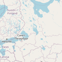
| Take the ferry Helsinki–Tallinn | 80 km |
| Continue straight | 700 m |
| Turn left | 250 m |
| Make a slight left onto Tyynenmerenkatu | 400 m |
| Keep right onto Jätkäsaarenlaituri | 300 m |
| Turn left onto Mechelininkatu | 600 m |
| Turn right towards Keskusta | 400 m |
| Turn right onto Runeberginkatu | 30 m |
| Turn left onto Eteläinen Rautatiekatu | 350 m |
| Turn right onto Arkadiankatu | 200 m |
| Make a slight right onto Mannerheimintie | 35 m |
| Keep left onto Postikatu | 50 m |
| You have arrived at your destination | 0 m |


 Log in with Google