Distance Calculator

7, Avrupa Otoyolu

746.7 km, 9 h 59 min

Head northwest on Strada Victoriei30 m
Turn right onto Strada Maternității80 m
Turn right15 m
Enter the traffic circle and take the 1st exit onto Bulevardul I. C. Brătianu5.5 m
Exit the traffic circle onto Bulevardul I. C. Brătianu250 m
Turn left onto Calea București (DN65)800 m
Enter the traffic circle and take the 1st exit onto Calea București (DN7)25 m
Exit the traffic circle onto Calea București (DN7)600 m
Take the ramp on the left towards DN73: Brașov150 m
Take the ramp on the left towards București70 m
Merge right onto Calea Câmpulung (DN7)40 m
Take the ramp towards A1: București55 m
Keep left towards A1: București450 m
Merge left onto Autostrada București-Pitești (A1)100 km
Take the ramp towards A0: Constanța900 m
Merge left onto Autostrada Centura București (A0)25 km
Take the ramp towards DN5: Ruse900 m
Keep right towards DN5: Giurgiu200 m
Merge left onto Șoseaua Giurgiului (DN5)200 m
Enter the traffic circle and take the 1st exit onto Șoseaua Giurgiului (DN5)20 m
Exit the traffic circle onto Șoseaua Giurgiului (DN5)2 km
Enter the traffic circle and take the 2nd exit onto Șoseaua Giurgiului (DN5)25 m
Exit the traffic circle onto Șoseaua Giurgiului (DN5)1 km
Enter the traffic circle and take the 2nd exit onto Șoseaua Giurgiului (DN5)25 m
Exit the traffic circle onto Șoseaua Giurgiului (DN5)2.5 km
Enter the traffic circle and take the 2nd exit onto DN545 m
Exit the traffic circle onto DN510 km
Enter the traffic circle and take the 2nd exit towards DN5: Giurgiu25 m
Exit the traffic circle towards DN5: Giurgiu1.5 km
Enter the traffic circle and take the 2nd exit towards Giurgiu20 m
Exit the traffic circle towards Giurgiu3.5 km
Enter the traffic circle and take the 2nd exit towards DN5: Giurgiu20 m
Exit the traffic circle towards DN5: Giurgiu20 km
Enter the traffic circle and take the 1st exit onto DN525 m
Exit the traffic circle onto DN52.5 km
Enter the traffic circle and take the 2nd exit onto Centura Giurgiu (DN5D)70 m
Exit the traffic circle onto Centura Giurgiu (DN5D)5 km
Enter the traffic circle and take the 2nd exit onto Strada Progresului (DN5)55 m
Exit the traffic circle onto Strada Progresului (DN5)600 m
Enter the traffic circle and take the 2nd exit towards Ruse70 m
Exit the traffic circle towards Ruse450 m
Merge left onto DN52.5 km
Continue onto 21 km
Keep right onto 2250 m
Keep right onto 2500 m
Turn right onto 2200 m
Enter the traffic circle and take the 2nd exit onto бул. Тутракан55 m
Exit the traffic circle onto бул. Тутракан700 m
Enter the traffic circle and take the 2nd exit onto бул. Тутракан40 m
Exit the traffic circle onto бул. Тутракан2.5 km
Continue onto Доростол1.5 km
Continue left onto бул. Съединение700 m
Turn left onto бул. Цар Освободител450 m
Enter the traffic circle and take the 2nd exit onto бул. Цар Освободител80 m
Exit the traffic circle onto бул. Цар Освободител700 m
Turn left onto бул. Христо Ботев6 km
Continue onto 260 km
Make a slight right onto 491.5 km
Turn left onto Търговищко шосе (49)20 km
Enter the traffic circle and take the 2nd exit onto 4970 m
Exit the traffic circle onto 4910 km
Turn right to stay on 42 km
Keep left onto 445 m
Keep right onto 420 km
Make a slight right400 m
Keep left onto 4840 km
Continue straight to stay on Васил Левски (48)25 km
Continue onto 715 km
Enter the traffic circle and take the 2nd exit onto 735 m
Exit the traffic circle onto 730 km
Enter the traffic circle and take the 2nd exit onto 730 m
Exit the traffic circle onto 760 km
Continue onto D-53520 km
Go straight onto Edirne Lalapaşa Yolu (D-535)20 km
Take the ramp on the right towards İstanbul300 m
Merge left towards Kırklareli200 km
Keep right towards Bağcılar9 km
Continue onto Adnan Menderes Vatan Bulvarı300 m
Make a slight right90 m
Continue onto Çayır Meydanı Caddesi250 m
Turn right onto Bican Bağcıoğlu Yokuşu35 m
Make a slight left onto Tatlı Pınar Caddesi150 m
Turn left onto Gureba Hastanesi Caddesi900 m
Turn left onto Oğuzhan Caddesi100 m
Continue onto Akdeniz Caddesi600 m
Turn right onto Fevzipaşa Caddesi350 m
Continue onto Macar Kardeşler Caddesi450 m
Continue towards Vezneciler150 m
You have arrived at your destination, on the right0 m

Автомагистрала Тракия, Avrupa Otoyolu

897.8 km, 11 h 13 min

Head northwest on Strada Victoriei30 m
Turn right onto Strada Maternității80 m
Turn right15 m
Enter the traffic circle and take the 1st exit onto Bulevardul I. C. Brătianu5.5 m
Exit the traffic circle onto Bulevardul I. C. Brătianu1 km
Continue onto Strada C. A. Rosetti400 m
Continue onto Calea Craiovei (DN65)300 m
Go straight onto Strada Craiovei (DN65)200 m
Continue onto Calea Craiovei (DN65)500 m
Enter the traffic circle and take the 2nd exit onto Calea Craiovei (DN65)55 m
Exit the traffic circle onto Calea Craiovei (DN65)250 m
Enter the traffic circle and take the 2nd exit towards DN65A: Craiova35 m
Exit the traffic circle towards DN65A: Craiova35 m
Continue onto Calea Craiovei (DN65)700 m
Enter the traffic circle and take the 1st exit onto Calea Craiovei (DN65)7 m
Exit the traffic circle onto Calea Craiovei (DN65)2 km
Enter the traffic circle and take the 1st exit towards Craiova10 m
Exit the traffic circle towards Craiova2.5 km
Enter the traffic circle and take the 1st exit onto DN6540 m
Exit the traffic circle onto DN6515 km
Turn left onto DJ67935 km
Turn left onto Strada Sublocotenent Ciobanu Nicolae1.5 km
Turn right onto Strada Vilcești200 m
Turn left350 m
Turn left onto Strada Tecuci (DJ703)4.5 km
Continue onto Strada Oltului (DJ703)200 m
Turn right onto Strada Dobrotești (DC48)8 km
Make a slight left onto Strada Primăriei (DC48)350 m
Turn right onto DN65A15 km
Make a slight right onto DN65A2.5 km
Turn left1.5 km
Continue right onto Strada Lebedei150 m
Turn left onto Strada Principală (DN65A)3 km
Enter the traffic circle and take the 1st exit towards DN6: București15 m
Exit the traffic circle towards DN6: București4.5 km
Turn right to stay on DN65A40 km
Go straight onto DN52900 m
Turn right onto Strada Stadionului (DN54)550 m
Turn left onto Strada General Praporgescu1.5 km
Enter the traffic circle and take the 4th exit onto Calea Dunării (DN52)300 m
Exit the traffic circle onto Calea Dunării (DN52)4 km
Turn right onto DN52550 m
Take the ferry Eurobac800 m
Continue slight right450 m
Turn right onto 3420 km
Turn right25 m
Go straight onto 343.5 km
Make a slight right onto 3420 km
Go straight onto 315 km
Keep right towards Враца3.5 km
Keep right towards София40 km
Make a slight right onto Възраждане (3)20 km
Take the ramp3 km
Merge left onto Автомагистрала Хемус (A 2)80 km
Take the ramp on the right towards 1: Пловдив400 m
Merge left onto Околовръстен път (1)9 km
Take the ramp towards A 1: Пловдив350 m
Merge left onto Автомагистрала Тракия (A 1)150 km
Keep right towards А 4: Свиленград100 km
Keep left towards Turkey500 m
Continue onto Kapıkule Sınır Kapısı (D-100)10 km
Keep left towards Lalapaşa250 km
Keep right towards Bağcılar9 km
Continue onto Adnan Menderes Vatan Bulvarı300 m
Make a slight right90 m
Continue onto Çayır Meydanı Caddesi250 m
Turn right onto Bican Bağcıoğlu Yokuşu35 m
Make a slight left onto Tatlı Pınar Caddesi150 m
Turn left onto Gureba Hastanesi Caddesi900 m
Turn left onto Oğuzhan Caddesi100 m
Continue onto Akdeniz Caddesi600 m
Turn right onto Fevzipaşa Caddesi350 m
Continue onto Macar Kardeşler Caddesi450 m
Continue towards Vezneciler150 m
You have arrived at your destination, on the right0 m
From
    To

      Distance: 336.64 mi (541.77 km)

      Driving route: 463.99 mi (746.71 km).

      Driving time: 9h 58 min

      Distance from Pitesti to Istanbul

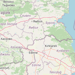
      The shortest distance (air line) between Pitesti and Istanbul is 336.64mi (541.77 km)

      The shortest route between Pitesti and Istanbul is 463.99 mi (746.71 km) according to the route planner. The driving time is approx. 9 h 58 m

      How far is it between Pitesti and Istanbul.

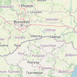
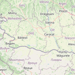
      Pitesti is located in Arges, Romaniacountry within 44° 51' 38.16" N 24° 52' 4.08" E (44.8606, 24.8678) coordinates. The local time in Pitesti is 11:02 (04.07.2025)

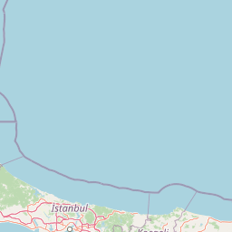
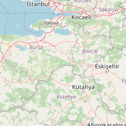
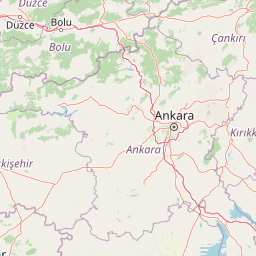
      Istanbul is located in Istanbul, Turkeycountry within 41° 0' 48.96" N 28° 57' 18" E (41.0136, 28.9550) coordinates. The local time in Istanbul is 12:02 (04.07.2025)

      The calculated flying distance from Pitesti to Istanbul is 336.64miles which is equal to 541.77 km.

      If you want to go by car, the driving driving distance between Pitesti and Istanbul is 463.99 miles (746.71 km). If you ride your car with an average speef of 112 kilometers/hour (70 miles/h), travel time will be 6 hours 40 minutes.Please check the avg.speed travel time on the right for various options

      Estimated Travel Time Between Pitesti and Istanbul

      Average speedTravel Time
      30 mph (48 km/h)15 hours 28 minutes
      40 mph (64 km/h)11 hours 36 minutes
      50 mph (80 km/h)9 hours 17 minutes
      60 mph (67 km/h)7 hours 44 minutes
      70 mph (112 km/h)6 hours 38 minutes
      75 mph (120 km/h)6 hours 11 minutes

      Pitesti, Arges, Romania

      Related Distances from Pitesti

      CitiesDistance
      Pitesti to Ramnicu Valcea29.38 mi (47.28 km)
      Pitesti to Slatina38.72 mi (62.31 km)
      Pitesti to Ploiesti56.78 mi (91.39 km)
      Pitesti to Craiova63.26 mi (101.80 km)
      Pitesti to Brasov66.55 mi (107.10 km)
      Pitesti to Bucharest67.58 mi (108.76 km)
      Pitesti to Sibiu73.20 mi (117.80 km)
      Pitesti to Targu Jiu78.82 mi (126.85 km)
      Pitesti to Giurgiu85.91 mi (138.26 km)
      Pitesti to Alba Iulia104.41 mi (168.03 km)
      Pitesti to Hunedoara113.57 mi (182.77 km)
      Pitesti to Targu-Mures117.35 mi (188.86 km)
      Pitesti to Focsani126.47 mi (203.54 km)
      Pitesti to Cluj-Napoca145.50 mi (234.16 km)
      Pitesti to Resita148.46 mi (238.92 km)
      Pitesti to Vaslui184.69 mi (297.23 km)
      Pitesti to Timisoara187.34 mi (301.50 km)
      Pitesti to Tulcea193.35 mi (311.17 km)
      Pitesti to Arad194.59 mi (313.15 km)
      Pitesti to Baia Mare203.35 mi (327.26 km)
      Pitesti to Suceava203.90 mi (328.14 km)
      Pitesti to Iasi205.74 mi (331.10 km)
      Pitesti to Oradea208.24 mi (335.13 km)
      Pitesti to Botosani217.27 mi (349.66 km)
      Pitesti to Satu Mare223.30 mi (359.37 km)

      Istanbul, Istanbul, Turkey

      Related Distances to Istanbul

      CitiesDistance
      Erzurum to Istanbul651.68 mi (1,048.78 km)
      Esenler to Istanbul3.65 mi (5.88 km)
      Kagithane to Istanbul4.07 mi (6.55 km)
      Bagcilar to Istanbul5.34 mi (8.59 km)
      Kucukcekmece to Istanbul8.14 mi (13.09 km)
      Kartal to Istanbul15.06 mi (24.23 km)
      Esenyurt to Istanbul15.65 mi (25.19 km)
      Pendik to Istanbul17.48 mi (28.14 km)
      Bursa to Istanbul57.58 mi (92.67 km)
      Yildirim to Istanbul62.79 mi (101.05 km)
      Eskisehir to Istanbul118.70 mi (191.03 km)
      Izmir to Istanbul203.50 mi (327.50 km)
      Ankara to Istanbul217.96 mi (350.77 km)
      Cankaya to Istanbul219.86 mi (353.83 km)
      Denizli to Istanbul224.44 mi (361.21 km)
      Selcuklu to Istanbul287.09 mi (462.03 km)
      Konya to Istanbul287.56 mi (462.78 km)
      Antalya to Istanbul300.22 mi (483.16 km)
      Kayseri to Istanbul380.74 mi (612.75 km)
      Samsun to Istanbul384.23 mi (618.36 km)
      Mersin to Istanbul421.68 mi (678.62 km)
      Adana to Istanbul439.94 mi (708.01 km)
      Seyhan to Istanbul441.18 mi (710.02 km)
      Gaziantep to Istanbul527.75 mi (849.33 km)
      Akcaabat to Istanbul552.01 mi (888.38 km)