


Distance Calculator

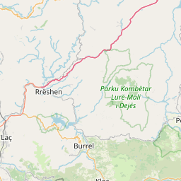


Distance from Rreshen to Skopje
The shortest distance (air line) between Rreshen and Skopje is 81.21mi (130.70 km)
The shortest route between Rreshen and Skopje is 137.60 mi (221.44 km) according to the route planner. The driving time is approx. 3 h 19 m
How far is it between Rreshen and Skopje.
Rreshen is located in Lezhe, Albaniacountry within 41° 46' 0.12" N 19° 52' 59.88" E (41.7667, 19.8833) coordinates. The local time in Rreshen is 04:32 (13.08.2025)
Skopje is located in Skopski, Macedoniacountry within 41° 59' 45.96" N 21° 25' 54.12" E (41.9961, 21.4317) coordinates. The local time in Skopje is 04:32 (13.08.2025)
The calculated flying distance from Rreshen to Skopje is 81.21miles which is equal to 130.70 km.
If you want to go by car, the driving driving distance between Rreshen and Skopje is 137.60 miles (221.44 km). If you ride your car with an average speef of 112 kilometers/hour (70 miles/h), travel time will be 1 hours 59 minutes.Please check the avg.speed travel time on the right for various options
Estimated Travel Time Between Rreshen and Skopje
| Average speed | Travel Time |
|---|---|
| 30 mph (48 km/h) | 4 hours 35 minutes |
| 40 mph (64 km/h) | 3 hours 26 minutes |
| 50 mph (80 km/h) | 2 hours 45 minutes |
| 60 mph (67 km/h) | 2 hours 18 minutes |
| 70 mph (112 km/h) | 1 hours 58 minutes |
| 75 mph (120 km/h) | 1 hours 50 minutes |
Related Distances from Rreshen
| Cities | Distance |
|---|---|
| Rreshen to Lezhe | 12.35 mi (19.88 km) |
| Rreshen to Lac | 12.63 mi (20.33 km) |
| Rreshen to Kruje | 18.92 mi (30.45 km) |
| Rreshen to Fushe-Kruje | 21.39 mi (34.42 km) |
| Rreshen to Kamez | 27.17 mi (43.72 km) |
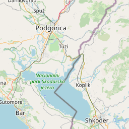
| Rreshen to Shkoder | 28.25 mi (45.47 km) |
| Rreshen to Peshkopi | 28.68 mi (46.15 km) |
| Rreshen to Tirana | 30.44 mi (48.99 km) |
| Rreshen to Sukth | 32.08 mi (51.62 km) |
| Rreshen to Kukes | 35.08 mi (56.45 km) |
| Rreshen to Durres | 38.97 mi (62.71 km) |
| Rreshen to Kavaje | 43.55 mi (70.09 km) |
| Rreshen to Librazhd-Qender | 45.80 mi (73.72 km) |
| Rreshen to Elbasan | 46.44 mi (74.73 km) |
| Rreshen to Lushnje | 58.36 mi (93.92 km) |
| Rreshen to Kucove | 66.54 mi (107.09 km) |
| Rreshen to Pogradec | 71.89 mi (115.69 km) |
| Rreshen to Bucimas | 73.25 mi (117.89 km) |
| Rreshen to Berat | 73.78 mi (118.74 km) |
| Rreshen to Fier | 73.94 mi (119.00 km) |
| Rreshen to Patos | 76.13 mi (122.51 km) |
| Rreshen to Korce | 91.78 mi (147.70 km) |
| Rreshen to Vlore | 92.20 mi (148.39 km) |
| Rreshen to Gjirokaster | 118.18 mi (190.19 km) |
| Rreshen to Sarande | 130.87 mi (210.62 km) |
Related Distances to Skopje
| Cities | Distance |
|---|---|
| Sopiste to Skopje | 3.19 mi (5.13 km) |
| Aracinovo to Skopje | 6.99 mi (11.26 km) |
| Tearce to Skopje | 20.29 mi (32.65 km) |
| Tetovo to Skopje | 23.65 mi (38.07 km) |
| Veles to Skopje | 26.25 mi (42.25 km) |
| Sveti Nikole to Skopje | 27.77 mi (44.70 km) |
| Gostivar to Skopje | 29.75 mi (47.88 km) |
| Vrapciste to Skopje | 30.26 mi (48.70 km) |
| Gradsko to Skopje | 39.11 mi (62.95 km) |
| Plasnica to Skopje | 40.02 mi (64.41 km) |
| Kicevo to Skopje | 41.13 mi (66.20 km) |
| Rosoman to Skopje | 42.58 mi (68.52 km) |
| Krusevo to Skopje | 44.28 mi (71.27 km) |
| Prilep to Skopje | 45.33 mi (72.96 km) |
| Krivogastani to Skopje | 45.91 mi (73.88 km) |
| Negotino to Skopje | 49.00 mi (78.87 km) |
| Kavadarci to Skopje | 49.09 mi (79.00 km) |
| Debar to Skopje | 56.86 mi (91.50 km) |
| Demir Kapija to Skopje | 58.14 mi (93.56 km) |
| Mogila to Skopje | 61.40 mi (98.82 km) |
| Novaci to Skopje | 65.94 mi (106.12 km) |
| Bitola to Skopje | 66.81 mi (107.52 km) |
| Vevcani to Skopje | 67.85 mi (109.19 km) |
| Struga to Skopje | 68.65 mi (110.48 km) |
| Ohrid to Skopje | 68.92 mi (110.92 km) |
 Log in with Google