| Head southwest | 35 m |
| Turn left onto Taikos g. | 60 m |
| Turn right onto Vilniaus g. (102) | 1.5 km |
| Continue onto Aukštaičių g. (102) | 25 km |
| Continue onto Baliulių g. (102) | 4 km |
| Continue onto Švenčionių g. (102) | 700 m |
| Continue onto Dvaro g. (102) | 20 km |
| Continue onto Parčevskių g. (102) | 10 km |
| Enter the traffic circle and take the 2nd exit towards Vilnius | 30 m |
| Exit the traffic circle towards Vilnius | 1.5 km |
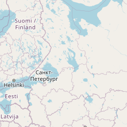
| Continue onto 102 | 10 km |
| Enter the traffic circle and take the 2nd exit onto Nemenčinės pl. (102) | 25 m |
| Exit the traffic circle onto Nemenčinės pl. (102) | 4.5 km |
| Continue onto O. Milašiaus g. | 1.5 km |
| Continue onto Kareivių g. | 2 km |
| Continue onto Ozo g. | 1 km |
| Take the ramp on the right | 200 m |
| Merge left onto Geležinio Vilko g. (A14) | 1.5 km |
| Turn left onto Geležinio Vilko g. (A2) | 50 m |
| Take the ramp | 150 m |
| Continue straight | 100 m |
| Enter Saltoniškių žiedas and take the 1st exit onto T. Narbuto g. | 15 m |
| Exit the traffic circle onto T. Narbuto g. | 2.5 km |
| Continue onto Pilaitės pr. | 900 m |
| Take the ramp on the right towards Kaunas | 200 m |
| Merge left onto Vakarinis aplinkkelis | 3.5 km |
| Merge left onto Oslo g. | 550 m |
| Continue onto Gariūnų g. | 2.5 km |
| Take the ramp towards A1: Kaunas | 700 m |
| Merge left onto Savanorių pr. (A1) | 90 km |
| Keep right towards A5: Marijampolė | 1.5 km |
| Take the ramp | 30 m |
| Keep left at the fork | 250 m |
| Merge left onto Vakarinis aplinkl. (A5) | 4.5 km |
| Continue onto Via Baltikos kel. (A5) | 4.5 km |
| Continue onto Baltijos g. (A5) | 5.5 km |
| Take the ramp towards Marijampolė | 600 m |
| Merge left onto Marijampolės g. (A5) | 550 m |
| Continue onto Via Baltica (A5) | 35 km |
| Continue onto Kauno g. (A5) | 5 km |
| Continue onto Via Baltica (A5) | 30 km |
| Continue onto Muitinės g. (A5) | 9 km |
| Continue onto Via Baltica (S61) | 1 km |
| Continue straight | 150 m |
| Continue straight | 300 m |
| Continue onto Via Baltica (S61) | 250 km |
| Continue onto Warszawska (S8) | 2 km |
| Continue towards S8: Warszawa | 1.5 km |
| Continue onto Trasa Bohaterów Bitwy Warszawskiej 1920 (S8) | 8 km |
| Continue onto Kardynała Stefana Wyszyńskiego (S8) | 4 km |
| Continue onto Marszałka Józefa Piłsudskiego (S8) | 550 m |
| Continue onto Kardynała Stefana Wyszyńskiego (S8) | 1.5 km |
| Continue onto Trasa Bohaterów Bitwy Warszawskiej 1920 (S8) | 10 km |
| Continue onto Aleja Bohaterów Bitwy Warszawskiej 1920 (S8) | 6 km |
| Continue onto Toruńska (S8) | 6 km |
| Continue onto Most Generała Stefana Grota-Roweckiego (S8) | 700 m |
| Continue onto Aleja Armii Krajowej (S8) | 4 km |
| Continue onto Aleja Obrońców Grodna (S8) | 10 km |
| Keep left towards A2: Poznań | 1 km |
| Continue onto Autostrada Wolności (A2) | 90 km |
| Take the ramp towards A1: Gdańsk | 550 m |
| Keep left towards A1: Katowice | 2 km |
| Merge left towards Katowice | 250 km |
| Continue onto D1 | 80 km |
| Keep left towards D35: Olomouc | 1 km |
| Keep right towards Olomouc | 30 km |
| Take the ramp towards Brno | 300 m |
| Keep right towards Prostějov | 250 m |
| Keep left towards Prostějov | 2 km |
| Merge right onto D46 | 35 km |
| Keep left towards Brno | 450 m |
| Merge left onto D1 | 35 km |
| Take the ramp | 45 m |
| Keep left towards D 2: Bratislava | 350 m |
| Keep right towards D2: Bratislava | 350 m |
| Keep left towards Bratislava | 450 m |
| Keep left at the fork | 300 m |
| Keep left towards Bratislava (SK) | 150 m |
| Merge left onto D2 | 100 km |
| Continue onto D2 | 15 km |
| Take the ramp towards D4: Žilina | 150 m |
| Keep left towards Žilina | 500 m |
| Keep left towards D2: Budapest | 300 m |
| Merge left onto D2 | 9 km |
| Continue onto M15 | 150 km |
| Take the ramp towards M0 | 300 m |
| Keep right towards E 60: Szeged | 1 km |
| Keep left towards M0 | 250 m |
| Merge left onto M0 | 30 km |
| Take the ramp | 450 m |
| Keep right towards E 60: Szeged | 1 km |
| Merge left onto M5 | 150 km |
| Take the ramp | 350 m |
| Keep left at the fork | 400 m |
| Merge left onto M5 | 100 m |
| Continue onto A1 | 200 km |
| Keep left towards A 1: Skopje | 200 km |
| Take the ramp towards A4: Sofia (BG) | 1.5 km |
| Continue onto A4 | 100 km |
| Continue onto Автомагистрала Европа (A 6) | 35 km |
| Keep left towards 8 | 15 km |
| Enter the traffic circle and take the 3rd exit towards Видин | 150 m |
| Exit the traffic circle towards Видин | 350 m |
| Take the ramp on the left towards Видин | 100 m |
| Merge left onto Околовръстен път (8) | 4 km |
| Take exit 49 towards А 6: Варна | 1 km |
| Merge left onto Автомагистрала Европа (A 6) | 15 km |
| Take exit 64 towards А 1: Пловдив | 1.5 km |
| Merge left onto Околовръстен път (1) | 8 km |
| Take the ramp towards A 1: Пловдив | 350 m |
| Merge left onto Автомагистрала Тракия (A 1) | 150 km |
| Keep right towards А 4: Свиленград | 100 km |
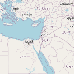
| Keep left towards Turkey | 500 m |
| Continue onto Kapıkule Sınır Kapısı (D-100) | 10 km |
| Keep left towards Lalapaşa | 150 km |
| Take exit K-1 towards O-7: Çatalca | 1 km |
| Keep left towards O-7: Çatalca | 2.5 km |
| Continue towards O-7: Çatalca | 100 km |
| Keep left onto Kuzey Marmara Otoyolu (O-7) | 4.5 km |
| Continue onto Viyadük-29 (O-7) | 600 m |
| Continue onto Kuzey Marmara Otoyolu (O-7) | 30 km |
| Keep left onto Kuzey Marmara Otoyolu (O-7) | 45 km |
| Keep left onto Kuzey Marmara Otoyolu (O-7) | 60 km |
| Merge left onto Anadolu Otoyolu (O-4) | 250 km |
| Merge left onto Ankara Çevre Yolu (O-20) | 2.5 km |
| Take the ramp towards D.140: Şehir Merkezi | 900 m |
| Keep left towards Ayaş | 30 m |
| Keep left towards Eskişehir | 200 m |
| Keep left towards Ulus | 150 m |
| Continue onto Ankara-Nallıhan yolu (D140) | 1 km |
| Continue onto Ankara-Ayaş Yolu | 3 km |
| Take the ramp | 700 m |
| Make a slight right | 800 m |
| Merge left onto Fatih Sultan Mehmet Bulvarı (D750) | 15 km |
| Continue onto İstanbul Caddesi (D750) | 1 km |
| Keep left onto İstanbul Caddesi | 600 m |
| Keep left onto İstanbul Caddesi | 200 m |
| Continue onto İstiklal Caddesi | 450 m |
| Turn right onto Atatürk Bulvarı | 800 m |
| Make a slight right to stay on Atatürk Bulvarı | 150 m |
| Keep right onto Altınsoy Caddesi | 80 m |
| Turn left | 150 m |
| Go straight onto Celal Bayar Bulvarı | 200 m |
| You have arrived at your destination, on the right | 0 m |


 Log in with Google