


Distance Calculator


Distance from Tivoli to Istanbul
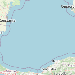
The shortest distance (air line) between Tivoli and Istanbul is 837.45mi (1,347.75 km)
The shortest route between Tivoli and Istanbul is 1387.61 mi (2233.14 km) according to the route planner. The driving time is approx. 22 h 49 m
How far is it between Tivoli and Istanbul.
Tivoli is located in Roma, Italycountry within 41° 58' 0.12" N 12° 48' 0" E (41.9667, 12.8000) coordinates. The local time in Tivoli is 11:54 (29.07.2025)
Istanbul is located in Istanbul, Turkeycountry within 41° 0' 48.96" N 28° 57' 18" E (41.0136, 28.9550) coordinates. The local time in Istanbul is 13:54 (29.07.2025)
The calculated flying distance from Tivoli to Istanbul is 837.45miles which is equal to 1,347.75 km.
If you want to go by car, the driving driving distance between Tivoli and Istanbul is 1387.61 miles (2233.14 km). If you ride your car with an average speef of 112 kilometers/hour (70 miles/h), travel time will be 19 hours 56 minutes.Please check the avg.speed travel time on the right for various options
Estimated Travel Time Between Tivoli and Istanbul
| Average speed | Travel Time |
|---|---|
| 30 mph (48 km/h) | 46 hours 15 minutes |
| 40 mph (64 km/h) | 34 hours 41 minutes |
| 50 mph (80 km/h) | 27 hours 45 minutes |
| 60 mph (67 km/h) | 23 hours 8 minutes |
| 70 mph (112 km/h) | 19 hours 49 minutes |
| 75 mph (120 km/h) | 18 hours 30 minutes |
Related Distances from Tivoli
| Cities | Distance |
|---|---|
| Tivoli to Rome | 17.08 mi (27.49 km) |
| Tivoli to Perugia | 81.87 mi (131.75 km) |
| Tivoli to Naples | 108.53 mi (174.67 km) |
| Tivoli to Florence | 147.22 mi (236.93 km) |
| Tivoli to Prato | 157.85 mi (254.03 km) |
| Tivoli to Livorno | 167.24 mi (269.14 km) |
| Tivoli to Bologna | 189.39 mi (304.79 km) |
| Tivoli to Modena | 207.70 mi (334.26 km) |
| Tivoli to Reggio Emilia | 217.98 mi (350.80 km) |
| Tivoli to Bari | 218.16 mi (351.09 km) |
| Tivoli to Parma | 231.86 mi (373.14 km) |
| Tivoli to Venice | 241.10 mi (388.01 km) |
| Tivoli to Padova | 242.08 mi (389.59 km) |
| Tivoli to Taranto | 252.94 mi (407.07 km) |
| Tivoli to Verona | 256.29 mi (412.46 km) |
| Tivoli to Genoa | 257.78 mi (414.85 km) |
| Tivoli to Cosenza | 258.17 mi (415.48 km) |
| Tivoli to Trieste | 259.06 mi (416.92 km) |
| Tivoli to Palermo | 267.73 mi (430.87 km) |
| Tivoli to Brescia | 278.34 mi (447.94 km) |
| Tivoli to Messina | 298.56 mi (480.48 km) |
| Tivoli to Milan | 301.57 mi (485.33 km) |
| Tivoli to Reggio di Calabria | 305.85 mi (492.22 km) |
| Tivoli to Catania | 331.71 mi (533.84 km) |
| Tivoli to Turin | 334.76 mi (538.74 km) |
Related Distances to Istanbul
| Cities | Distance |
|---|---|
| Erzurum to Istanbul | 651.68 mi (1,048.78 km) |
| Esenler to Istanbul | 3.65 mi (5.88 km) |
| Kagithane to Istanbul | 4.07 mi (6.55 km) |
| Bagcilar to Istanbul | 5.34 mi (8.59 km) |
| Kucukcekmece to Istanbul | 8.14 mi (13.09 km) |
| Kartal to Istanbul | 15.06 mi (24.23 km) |
| Esenyurt to Istanbul | 15.65 mi (25.19 km) |
| Pendik to Istanbul | 17.48 mi (28.14 km) |
| Bursa to Istanbul | 57.58 mi (92.67 km) |
| Yildirim to Istanbul | 62.79 mi (101.05 km) |
| Eskisehir to Istanbul | 118.70 mi (191.03 km) |
| Izmir to Istanbul | 203.50 mi (327.50 km) |
| Ankara to Istanbul | 217.96 mi (350.77 km) |
| Cankaya to Istanbul | 219.86 mi (353.83 km) |
| Denizli to Istanbul | 224.44 mi (361.21 km) |
| Selcuklu to Istanbul | 287.09 mi (462.03 km) |
| Konya to Istanbul | 287.56 mi (462.78 km) |
| Antalya to Istanbul | 300.22 mi (483.16 km) |
| Kayseri to Istanbul | 380.74 mi (612.75 km) |
| Samsun to Istanbul | 384.23 mi (618.36 km) |
| Mersin to Istanbul | 421.68 mi (678.62 km) |
| Adana to Istanbul | 439.94 mi (708.01 km) |
| Seyhan to Istanbul | 441.18 mi (710.02 km) |
| Gaziantep to Istanbul | 527.75 mi (849.33 km) |
| Akcaabat to Istanbul | 552.01 mi (888.38 km) |
 Log in with Google