| Head north | 7 m |
| Turn right onto Carl Robert Jakobsoni (92) | 25 m |
| Turn right onto Juhan Liivi | 80 m |
| Turn right onto Posti | 200 m |
| Turn left onto Tallinna (92) | 300 m |
| Enter the traffic circle and take the 1st exit onto Vaksali (92) | 15 m |
| Exit the traffic circle onto Vaksali (92) | 250 m |
| Enter the traffic circle and take the 1st exit onto Vaksali (92) | 15 m |
| Exit the traffic circle onto Vaksali (92) | 300 m |
| Enter the traffic circle and take the 2nd exit onto Vaksali (92) | 35 m |
| Exit the traffic circle onto Vaksali (92) | 150 m |
| Continue straight onto Vaksali (92) | 400 m |
| Continue onto Pärnu mnt (92) | 1 km |
| Enter the traffic circle and take the 3rd exit onto Imavere — Viljandi — Karksi-Nuia (49) | 80 m |
| Exit the traffic circle onto Imavere — Viljandi — Karksi-Nuia (49) | 30 km |
| Continue onto Viljandi mnt (49) | 1.5 km |
| Turn left onto Tartu mnt (6) | 1 km |
| Enter the traffic circle and take the 1st exit onto Lilli tee (54) | 20 m |
| Exit the traffic circle onto Lilli tee (54) | 800 m |
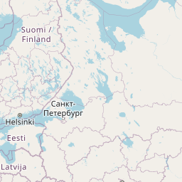
| Continue onto Karksi-Nuia — Lilli (54) | 15 km |
| Continue onto Valmiera — Rūjiena — Igaunijas robeža (Unguriņi) (P17) | 10 km |
| Keep left onto Valmiera — Rūjiena — Igaunijas robeža (Unguriņi) (P17) | 2 km |
| Continue onto Pērnavas iela (P17) | 1 km |
| Continue onto Valmiera — Rūjiena — Igaunijas robeža (Unguriņi) (P17) | 40 km |
| Enter the traffic circle and take the 2nd exit onto A3 | 100 m |
| Exit the traffic circle onto A3 | 3.5 km |
| Enter the traffic circle and take the 2nd exit onto A3 | 150 m |
| Exit the traffic circle onto A3 | 2.5 km |
| Take the ramp onto A3 | 70 km |
| Merge left onto Rīga — Sigulda — Igaunijas robeža (Veclaicene) (A2) | 2 km |
| Keep right onto Rīga — Sigulda — Igaunijas robeža (Veclaicene) (A2) | 20 km |
| Take the ramp | 450 m |
| Continue onto A4 | 20 km |
| Take the ramp onto A4 | 500 m |
| Merge left onto Rīga — Daugavpils — Krāslava — Baltkrievijas robeža (Pāternieki) (A6) | 2.5 km |
| Continue onto Ķesterciema iela (A6) | 2 km |
| Keep right at the fork | 800 m |
| Enter the traffic circle and take the 1st exit onto A5 | 30 m |
| Exit the traffic circle onto A5 | 7 km |
| Enter the traffic circle and take the 1st exit onto Rīgas apvedceļš (Salaspils — Babīte) (A5) | 50 m |
| Exit the traffic circle onto Rīgas apvedceļš (Salaspils — Babīte) (A5) | 1.5 km |
| Enter the traffic circle and take the 3rd exit onto P137 | 200 m |
| Exit the traffic circle onto P137 | 4 km |
| Take the ramp onto P137 | 200 m |
| Merge left onto Ķekavas apvedceļš (A7) | 150 m |
| Continue onto Rīga — Bauska — Lietuvas robeža (Grenctāle) (A7) | 20 km |
| Continue onto Rīgas iela (A7) | 1.5 km |
| Keep right onto Rīgas iela (A7) | 20 km |
| Continue onto Kalna iela (A7) | 1.5 km |
| Enter the traffic circle and take the 2nd exit onto A7 | 45 m |
| Exit the traffic circle onto A7 | 20 km |
| Continue onto Pasienio g. (A10) | 800 m |
| Continue onto Via Baltica (A10) | 3.5 km |
| Continue onto Rygos g. (A10) | 1.5 km |
| Continue onto Bėrelės g. (A10) | 6 km |
| Continue onto Via Baltica (A10) | 15 km |
| Enter the traffic circle and take the 2nd exit towards Panevėžys | 40 m |
| Exit the traffic circle towards Panevėžys | 3.5 km |
| Continue onto Baltijos Kelio g. (A10) | 2 km |
| Continue onto Panevėžio g. (A10) | 1 km |
| Continue onto Via Baltica (A10) | 150 m |
| Continue onto Baltijos Kelio g. (A10) | 7 km |
| Continue onto Via Baltica (A10) | 400 m |
| Continue onto Kovo 11-osios g. (A10) | 15 km |
| Keep left towards Panevėžys | 250 m |
| Keep right towards Šiauliai | 60 m |
| Continue onto Panevėžio aplinkl. (A17) | 7 km |
| Keep right onto Panevėžio aplinkl. | 70 m |
| Turn right towards Šiauliai | 9 km |
| Enter the traffic circle and take the 1st exit onto 195 | 20 m |
| Exit the traffic circle onto 195 | 20 km |
| Continue onto Pušyno g. (2008) | 4 km |
| Continue onto Vilainiai — Šventybrastis — Krekenava (2008) | 20 km |
| Continue onto Melioratorių g. (2008) | 3 km |
| Continue onto Tiskūnų g. (2008) | 2 km |
| Turn left onto 229 | 3 km |
| Take the ramp onto Aristava — Kėdainiai — Cinkiškis (229) | 20 m |
| Keep right towards Kaunas | 450 m |
| Merge left onto A8 | 35 km |
| Merge left onto A1 | 10 km |
| Take the ramp towards A5: Marijampolė | 600 m |
| Merge left towards Marijampolė | 600 m |
| Take the ramp | 30 m |
| Keep left at the fork | 250 m |
| Merge left onto Vakarinis aplinkl. (A5) | 4.5 km |
| Continue onto Via Baltikos kel. (A5) | 4.5 km |
| Continue onto Baltijos g. (A5) | 5.5 km |
| Take the ramp towards Marijampolė | 600 m |
| Merge left onto Marijampolės g. (A5) | 550 m |
| Continue onto Via Baltica (A5) | 35 km |
| Continue onto Kauno g. (A5) | 5 km |
| Continue onto Via Baltica (A5) | 30 km |
| Continue onto Muitinės g. (A5) | 4 km |
| Continue onto Europos g. (A5) | 5 km |
| Continue onto Via Baltica (S61) | 1 km |
| Continue straight | 150 m |
| Continue straight | 300 m |
| Continue onto Via Baltica (S61) | 250 km |
| Continue onto Warszawska (S8) | 2 km |
| Continue towards S8: Warszawa | 1.5 km |
| Continue onto Trasa Bohaterów Bitwy Warszawskiej 1920 (S8) | 8 km |
| Continue onto Kardynała Stefana Wyszyńskiego (S8) | 4 km |
| Continue onto Marszałka Józefa Piłsudskiego (S8) | 550 m |
| Continue onto Kardynała Stefana Wyszyńskiego (S8) | 1.5 km |
| Continue onto Trasa Bohaterów Bitwy Warszawskiej 1920 (S8) | 10 km |
| Continue onto Aleja Bohaterów Bitwy Warszawskiej 1920 (S8) | 1.5 km |
| Continue onto Trasa Bohaterów Bitwy Warszawskiej 1920 (S8) | 1.5 km |
| Continue onto Aleja Bohaterów Bitwy Warszawskiej 1920 (S8) | 3 km |
| Continue onto Toruńska (S8) | 6 km |
| Continue onto Most Generała Stefana Grota-Roweckiego (S8) | 700 m |
| Continue onto Aleja Armii Krajowej (S8) | 4 km |
| Continue onto Aleja Obrońców Grodna (S8) | 10 km |
| Keep left towards A2: Poznań | 1 km |
| Continue onto Autostrada Wolności (A2) | 90 km |
| Take the ramp towards A1: Gdańsk | 550 m |
| Keep left towards A1: Katowice | 2 km |
| Merge left towards Katowice | 250 km |
| Continue onto D1 | 80 km |
| Keep left towards D35: Olomouc | 1 km |
| Keep right towards Olomouc | 30 km |
| Take the ramp towards Brno | 300 m |
| Keep right towards Prostějov | 250 m |
| Keep left towards Prostějov | 2 km |
| Merge right onto D46 | 35 km |
| Keep left towards Brno | 450 m |
| Merge left onto D1 | 35 km |
| Take the ramp | 45 m |
| Keep left towards D 2: Bratislava | 350 m |
| Keep right towards D2: Bratislava | 350 m |
| Keep left towards Bratislava | 450 m |
| Keep left at the fork | 300 m |
| Keep left towards Bratislava (SK) | 150 m |
| Merge left onto D2 | 100 km |
| Continue onto D2 | 15 km |
| Take the ramp towards D4: Žilina | 150 m |
| Keep left towards Žilina | 500 m |
| Keep left towards D2: Budapest | 300 m |
| Merge left onto D2 | 9 km |
| Continue onto M15 | 150 km |
| Take the ramp towards M0 | 300 m |
| Keep right towards E 60: Szeged | 1 km |
| Keep left towards M0 | 250 m |
| Merge left onto M0 | 30 km |
| Take the ramp | 450 m |
| Keep right towards E 60: Szeged | 1 km |
| Merge left onto M5 | 150 km |
| Take the ramp | 350 m |
| Keep left at the fork | 400 m |
| Merge left onto M5 | 100 m |
| Continue onto A1 | 200 km |
| Keep left towards A 1: Skopje | 200 km |
| Take the ramp towards A4: Sofia (BG) | 1.5 km |
| Continue onto A4 | 100 km |
| Continue onto Автомагистрала Европа (A 6) | 35 km |
| Keep left towards 8 | 15 km |
| Enter the traffic circle and take the 3rd exit towards Видин | 150 m |
| Exit the traffic circle towards Видин | 350 m |
| Take the ramp on the left towards Видин | 100 m |
| Merge left onto Околовръстен път (8) | 4 km |
| Take exit 49 towards А 6: Варна | 1 km |
| Merge left onto Автомагистрала Европа (A 6) | 15 km |
| Take exit 64 towards А 1: Пловдив | 1.5 km |
| Merge left onto Околовръстен път (1) | 8 km |
| Take the ramp towards A 1: Пловдив | 350 m |
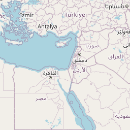
| Merge left onto Автомагистрала Тракия (A 1) | 150 km |
| Keep right towards А 4: Свиленград | 100 km |
| Keep left towards Turkey | 500 m |
| Continue onto Kapıkule Sınır Kapısı (D-100) | 10 km |
| Keep left towards Lalapaşa | 250 km |
| Keep right towards Bağcılar | 9 km |
| Continue onto Adnan Menderes Vatan Bulvarı | 300 m |
| Make a slight right | 90 m |
| Continue onto Çayır Meydanı Caddesi | 250 m |
| Turn right onto Bican Bağcıoğlu Yokuşu | 35 m |
| Make a slight left onto Tatlı Pınar Caddesi | 150 m |
| Turn left onto Gureba Hastanesi Caddesi | 900 m |
| Turn left onto Oğuzhan Caddesi | 100 m |
| Continue onto Akdeniz Caddesi | 600 m |
| Turn right onto Fevzipaşa Caddesi | 350 m |
| Continue onto Macar Kardeşler Caddesi | 450 m |
| Continue towards Vezneciler | 150 m |
| You have arrived at your destination, on the right | 0 m |


 Log in with Google