Distance Calculator
Distance from Alabaster to Atlanta
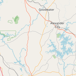
The shortest distance (air line) between Alabaster and Atlanta is 143.31mi (230.64 km)
The shortest route between Alabaster and Atlanta is 162.10 mi (260.87 km) according to the route planner. The driving time is approx. 3 h 6 m
How far is it between Alabaster and Atlanta.
Alabaster is located in Alabama, United Statescountry within 33° 13' 11.28" N -87° 10' 39" W (33.2198, -86.8225) coordinates. The local time in Alabaster is 20:10 (09.07.2025)
Atlanta is located in Georgia, United Statescountry within 33° 45' 46.08" N -85° 34' 40.8" W (33.7628, -84.4220) coordinates. The local time in Atlanta is 21:10 (09.07.2025)
The calculated flying distance from Alabaster to Atlanta is 143.31miles which is equal to 230.64 km.
If you want to go by car, the driving driving distance between Alabaster and Atlanta is 162.10 miles (260.87 km). If you ride your car with an average speef of 112 kilometers/hour (70 miles/h), travel time will be 2 hours 20 minutes.Please check the avg.speed travel time on the right for various options
Estimated Travel Time Between Alabaster and Atlanta
| Average speed | Travel Time |
|---|---|
| 30 mph (48 km/h) | 5 hours 24 minutes |
| 40 mph (64 km/h) | 4 hours 3 minutes |
| 50 mph (80 km/h) | 3 hours 15 minutes |
| 60 mph (67 km/h) | 2 hours 42 minutes |
| 70 mph (112 km/h) | 2 hours 19 minutes |
| 75 mph (120 km/h) | 2 hours 10 minutes |
Alabaster, Alabama, United States
Related Distances from Alabaster
| Cities | Distance |
|---|---|
| Alabaster to Miami | 649.30 mi (1,044.94 km) |
| Alabaster to Detroit | 664.73 mi (1,069.78 km) |
| Alabaster to Washington | 673.33 mi (1,083.62 km) |
| Alabaster to Baltimore | 706.48 mi (1,136.96 km) |
| Alabaster to Philadelphia | 798.97 mi (1,285.82 km) |
| Alabaster to Brooklyn | 875.39 mi (1,408.81 km) |
| Alabaster to New York | 878.11 mi (1,413.17 km) |
| Alabaster to Minneapolis | 881.22 mi (1,418.19 km) |
| Alabaster to Queens | 885.79 mi (1,425.54 km) |
| Alabaster to Boston | 1,062.03 mi (1,709.18 km) |
| Alabaster to Denver | 1,097.32 mi (1,765.97 km) |
| Alabaster to Phoenix | 1,454.09 mi (2,340.12 km) |
| Alabaster to Las Vegas | 1,622.66 mi (2,611.42 km) |
| Alabaster to San Diego | 1,749.26 mi (2,815.16 km) |
| Alabaster to Riverside | 1,754.02 mi (2,822.82 km) |
| Alabaster to Los Angeles | 1,810.04 mi (2,912.98 km) |
| Alabaster to Atlanta | 143.31 mi (230.64 km) |
| Alabaster to San Francisco | 2,016.09 mi (3,244.59 km) |
| Alabaster to Portland | 2,072.17 mi (3,334.84 km) |
| Alabaster to Seattle | 2,090.74 mi (3,364.72 km) |
| Alabaster to St. Louis | 420.28 mi (676.37 km) |
| Alabaster to Tampa | 444.99 mi (716.14 km) |
| Alabaster to Houston | 557.35 mi (896.97 km) |
| Alabaster to Dallas | 576.72 mi (928.15 km) |
| Alabaster to Chicago | 597.30 mi (961.25 km) |
Atlanta, Georgia, United States
Related Distances to Atlanta
| Cities | Distance |
|---|---|
| Philadelphia to Atlanta | 669.88 mi (1,078.06 km) |
| Houston to Atlanta | 699.80 mi (1,126.22 km) |
| Dallas to Atlanta | 715.77 mi (1,151.93 km) |
| Brooklyn to Atlanta | 746.42 mi (1,201.24 km) |
| New York to Atlanta | 749.27 mi (1,205.83 km) |
| Queens to Atlanta | 756.91 mi (1,218.13 km) |
| Minneapolis to Atlanta | 905.47 mi (1,457.21 km) |
| Boston to Atlanta | 934.07 mi (1,503.23 km) |
| Denver to Atlanta | 1,202.32 mi (1,934.94 km) |
| Phoenix to Atlanta | 1,586.21 mi (2,552.76 km) |
| Las Vegas to Atlanta | 1,746.68 mi (2,811.00 km) |
| San Diego to Atlanta | 1,881.62 mi (3,028.17 km) |
| Riverside to Atlanta | 1,883.80 mi (3,031.68 km) |
| Los Angeles to Atlanta | 1,939.13 mi (3,120.72 km) |
| San Francisco to Atlanta | 2,134.92 mi (3,435.82 km) |
| Portland to Atlanta | 2,165.47 mi (3,484.99 km) |
| Seattle to Atlanta | 2,176.07 mi (3,502.04 km) |
| Orlando to Atlanta | 408.18 mi (656.90 km) |
| Tampa to Atlanta | 415.41 mi (668.54 km) |
| St. Louis to Atlanta | 467.53 mi (752.41 km) |
| Washington to Atlanta | 543.83 mi (875.20 km) |
| Baltimore to Atlanta | 577.95 mi (930.13 km) |
| Chicago to Atlanta | 585.56 mi (942.36 km) |
| Detroit to Atlanta | 599.91 mi (965.46 km) |
| Miami to Atlanta | 606.22 mi (975.62 km) |


