Distance Calculator
Distance from Cheb to Teplice
The shortest distance (air line) between Cheb and Teplice is 75.31mi (121.21 km)
The shortest route between Cheb and Teplice is 89.59 mi (144.18 km) according to the route planner. The driving time is approx. 2 h 2 m
How far is it between Cheb and Teplice.
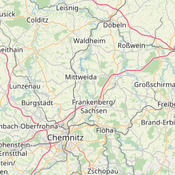
Cheb is located in Karlovarsky kraj, Czechiacountry within 50° 4' 45.84" N 12° 22' 14.16" E (50.0794, 12.3706) coordinates. The local time in Cheb is 23:34 (17.06.2025)
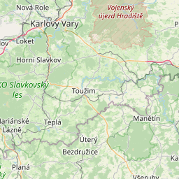
Teplice is located in Ústecky kraj, Czechiacountry within 50° 38' 39.84" N 13° 49' 54.84" E (50.6444, 13.8319) coordinates. The local time in Teplice is 23:34 (17.06.2025)
The calculated flying distance from Cheb to Teplice is 75.31miles which is equal to 121.21 km.
If you want to go by car, the driving driving distance between Cheb and Teplice is 89.59 miles (144.18 km). If you ride your car with an average speef of 112 kilometers/hour (70 miles/h), travel time will be 1 hours 17 minutes.Please check the avg.speed travel time on the right for various options
Estimated Travel Time Between Cheb and Teplice
| Average speed | Travel Time |
|---|---|
| 30 mph (48 km/h) | 2 hours 59 minutes |
| 40 mph (64 km/h) | 2 hours 14 minutes |
| 50 mph (80 km/h) | 1 hours 48 minutes |
| 60 mph (67 km/h) | 1 hours 30 minutes |
| 70 mph (112 km/h) | 1 hours 17 minutes |
| 75 mph (120 km/h) | 1 hours 12 minutes |
Cheb, Karlovarsky kraj, Czechia
Related Distances from Cheb
| Cities | Distance |
|---|---|
| Cheb to Karlovy Vary | 24.55 mi (39.51 km) |
| Cheb to Chomutov | 53.20 mi (85.61 km) |
| Cheb to Most | 63.09 mi (101.53 km) |
| Cheb to Teplice | 75.31 mi (121.21 km) |
| Cheb to Usti nad Labem | 83.80 mi (134.87 km) |
| Cheb to Brevnov | 88.11 mi (141.80 km) |
| Cheb to Prague | 90.92 mi (146.32 km) |
| Cheb to Decin | 93.58 mi (150.60 km) |
| Cheb to Ceska Lipa | 104.37 mi (167.97 km) |
| Cheb to Liberec | 127.82 mi (205.71 km) |
| Cheb to Jablonec nad Nisou | 131.00 mi (210.83 km) |
| Cheb to Pardubice | 151.21 mi (243.35 km) |
| Cheb to Hradec Kralove | 153.52 mi (247.07 km) |
| Cheb to Znojmo | 185.52 mi (298.57 km) |
| Cheb to Brno | 199.25 mi (320.66 km) |
| Cheb to Prostejov | 215.58 mi (346.94 km) |
| Cheb to Olomouc | 220.01 mi (354.07 km) |
| Cheb to Prerov | 230.74 mi (371.34 km) |
| Cheb to Zlin | 243.95 mi (392.60 km) |
| Cheb to Opava | 245.86 mi (395.68 km) |
| Cheb to Ostrava | 263.71 mi (424.39 km) |
| Cheb to Frydek-Mistek | 267.55 mi (430.58 km) |
| Cheb to Havirov | 269.88 mi (434.33 km) |
| Cheb to Karvina | 274.67 mi (442.04 km) |
| Cheb to Trinec | 281.88 mi (453.65 km) |
Teplice, Ústecky kraj, Czechia
Related Distances to Teplice
| Cities | Distance |
|---|---|
| Usti nad Labem to Teplice | 9.24 mi (14.87 km) |
| Most to Teplice | 12.99 mi (20.90 km) |
| Decin to Teplice | 18.27 mi (29.40 km) |
| Chomutov to Teplice | 22.20 mi (35.72 km) |
| Ceska Lipa to Teplice | 31.10 mi (50.05 km) |
| Brevnov to Teplice | 45.17 mi (72.70 km) |
| Prague to Teplice | 46.43 mi (74.72 km) |
| Karlovy Vary to Teplice | 50.99 mi (82.06 km) |
| Liberec to Teplice | 54.69 mi (88.01 km) |
| Jablonec nad Nisou to Teplice | 58.75 mi (94.56 km) |
| Cheb to Teplice | 75.31 mi (121.21 km) |
| Hradec Kralove to Teplice | 93.04 mi (149.73 km) |
| Pardubice to Teplice | 95.52 mi (153.73 km) |
| Znojmo to Teplice | 158.32 mi (254.80 km) |
| Brno to Teplice | 159.10 mi (256.05 km) |
| Prostejov to Teplice | 166.45 mi (267.87 km) |
| Olomouc to Teplice | 167.94 mi (270.27 km) |
| Prerov to Teplice | 180.33 mi (290.22 km) |
| Opava to Teplice | 186.25 mi (299.74 km) |
| Zlin to Teplice | 196.41 mi (316.09 km) |
| Ostrava to Teplice | 204.85 mi (329.67 km) |
| Frydek-Mistek to Teplice | 210.64 mi (339.00 km) |
| Havirov to Teplice | 211.49 mi (340.36 km) |
| Karvina to Teplice | 215.13 mi (346.23 km) |
| Trinec to Teplice | 224.39 mi (361.12 km) |


