| Head northwest on Strada Victoriei | 30 m |
| Turn right onto Strada Maternității | 80 m |
| Turn right | 15 m |
| Enter the traffic circle and take the 1st exit onto Bulevardul I. C. Brătianu | 5.5 m |
| Exit the traffic circle onto Bulevardul I. C. Brătianu | 250 m |
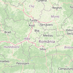
| Turn left onto Calea București (DN65) | 800 m |
| Enter the traffic circle and take the 1st exit onto Calea București (DN7) | 25 m |
| Exit the traffic circle onto Calea București (DN7) | 600 m |
| Take the ramp on the left towards DN73: Brașov | 150 m |
| Take the ramp on the left towards București | 70 m |
| Merge right onto Calea Câmpulung (DN7) | 40 m |
| Take the ramp towards A1: București | 55 m |
| Keep left towards A1: București | 450 m |
| Merge left onto Autostrada București-Pitești (A1) | 100 km |
| Take the ramp towards Centura București | 150 m |
| Enter the traffic circle and take the 2nd exit onto Strada Comerțului | 60 m |
| Exit the traffic circle onto Strada Comerțului | 700 m |
| Go straight onto Șoseaua de Centură (DNCB) | 700 m |
| Keep left onto Șoseaua de Centură (DNCB) | 70 m |
| Make a slight right to stay on Șoseaua de Centură (DNCB) | 1 km |
| Enter the traffic circle and take the 1st exit onto Șoseaua de Centură (DNCB) | 80 m |
| Exit the traffic circle onto Șoseaua de Centură (DNCB) | 1.5 km |
| Enter the traffic circle and take the 1st exit onto Șoseaua de Centură (DNCB) | 30 m |
| Exit the traffic circle onto Șoseaua de Centură (DNCB) | 500 m |
| Enter the traffic circle and take the 1st exit towards Călărași | 15 m |
| Exit the traffic circle towards Călărași | 3.5 km |
| Enter the traffic circle and take the 1st exit onto Șoseaua de Centură (DNCB) | 10 m |
| Exit the traffic circle onto Șoseaua de Centură (DNCB) | 2 km |
| Enter the traffic circle and take the 1st exit onto Șoseaua de Centură (DNCB) | 25 m |
| Exit the traffic circle onto Șoseaua de Centură (DNCB) | 1.5 km |
| Continue onto Șoseaua Odăii (DNCB) | 1.5 km |
| Make a slight right towards DN1A | 350 m |
| Enter the traffic circle and take the 2nd exit towards DNCB: Oradea | 30 m |
| Exit the traffic circle towards DNCB: Oradea | 350 m |
| Go straight onto Șoseaua Odăii (DNCB) | 1.5 km |
| Enter the traffic circle and take the 1st exit towards DNCB: Constanța | 50 m |
| Exit the traffic circle towards DNCB: Constanța | 3 km |
| Continue onto Strada Horea, Cloșca și Crișan (DNCB) | 1 km |
| Enter the traffic circle and take the 1st exit towards A2: Constanța | 30 m |
| Exit the traffic circle towards A2: Constanța | 2 km |
| Continue onto Șoseaua de Centură (DNCB) | 2.5 km |
| Enter the traffic circle and take the 1st exit towards DNCB: Constanța | 25 m |
| Exit the traffic circle towards DNCB: Constanța | 3 km |
| Make a slight left to stay on Șoseaua de Centură (DNCB) | 70 m |
| Enter the traffic circle and take the 2nd exit towards A3: Oradea | 80 m |
| Exit the traffic circle towards A3: Oradea | 350 m |
| Enter the traffic circle and take the 2nd exit | 60 m |
| Exit the traffic circle | 500 m |
| Merge left onto A3 | 40 km |
| Take the ramp | 1.5 km |
| Continue onto A7 | 25 km |
| Enter the traffic circle and take the 1st exit onto DJ100C | 15 m |
| Exit the traffic circle onto DJ100C | 900 m |
| Enter the traffic circle and take the 2nd exit onto DJ100C | 60 m |
| Exit the traffic circle onto DJ100C | 4.5 km |
| Continue slightly right onto Bulevardul Gării | 350 m |
| Enter the traffic circle and take the 2nd exit | 15 m |
| Exit the traffic circle | 20 m |
| Continue onto Strada 24 Ianuarie | 400 m |
| Turn right onto Strada Nicolae Bălcescu | 600 m |
| Go straight onto Strada Mihai Bravu (DN1B) | 25 km |
| Continue straight onto DN1B | 5 km |
| Enter the traffic circle and take the 2nd exit towards DN2: Suceava | 40 m |
| Exit the traffic circle towards DN2: Suceava | 3.5 km |
| Enter the traffic circle and take the 1st exit onto Calea Eroilor | 30 m |
| Exit the traffic circle onto Calea Eroilor | 700 m |
| Go straight onto Bulevardul Unirii | 100 m |
| Continue slightly right onto Bulevardul 1 Decembrie 1918 | 150 m |
| Enter the traffic circle and take the 2nd exit onto Bulevardul 1 Decembrie 1918 | 20 m |
| Exit the traffic circle onto Bulevardul 1 Decembrie 1918 | 1 km |
| Enter the traffic circle and take the 1st exit onto Bulevardul Republicii | 10 m |
| Exit the traffic circle onto Bulevardul Republicii | 1 km |
| Make a slight right onto Șoseaua Brăilei | 3 km |
| Enter the traffic circle and take the 1st exit onto Șoseaua Brăilei (DN2B) | 60 m |
| Exit the traffic circle onto Șoseaua Brăilei (DN2B) | 900 m |
| Enter the traffic circle and take the 2nd exit | 100 m |
| Exit the traffic circle | 2 km |
| Continue onto A7 | 80 km |
| Keep left at the fork | 350 m |
| Enter the traffic circle and take the 1st exit onto DN2 | 10 m |
| Exit the traffic circle onto DN2 | 15 km |
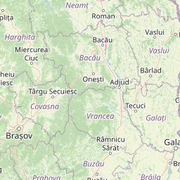
| Enter the traffic circle and take the 2nd exit towards Bacău | 40 m |
| Exit the traffic circle towards Bacău | 25 km |
| Keep right onto DN2 | 90 m |
| Keep right onto DN2 | 6 km |
| Enter the traffic circle and take the 2nd exit towards DN2: Bacău | 35 m |
| Exit the traffic circle towards DN2: Bacău | 50 km |
| Continue onto Calea Republicii (DN2) | 800 m |
| Take the ramp | 20 km |
| Make a slight right towards DN2: Suceava | 100 m |
| Merge left onto DN2 | 30 km |
| Enter the traffic circle and take the 2nd exit towards DN2: Suceava | 25 m |
| Exit the traffic circle towards DN2: Suceava | 800 m |
| Enter the traffic circle and take the 3rd exit onto Strada Sucedava | 70 m |
| Exit the traffic circle onto Strada Sucedava | 700 m |
| Enter the traffic circle and take the 2nd exit onto Strada Ștefan cel Mare | 25 m |
| Exit the traffic circle onto Strada Ștefan cel Mare | 700 m |
| Make a sharp left towards Suceava | 150 m |
| Go straight onto Strada Ștefan cel Mare (DN2) | 3 km |
| Enter the traffic circle and take the 2nd exit towards Iași | 25 m |
| Exit the traffic circle towards Iași | 8 km |
| Enter the traffic circle and take the 1st exit towards DN28: Iași | 40 m |
| Exit the traffic circle towards DN28: Iași | 25 km |
| Turn left onto Strada Bogdan Vodă (DJ280B) | 60 m |
| Make a slight right to stay on Strada Bogdan Vodă | 500 m |
| Turn left onto Strada Petru Rareș (DN28B) | 25 km |
| Continue onto Strada Ștefan cel Mare (DN28B) | 900 m |
| Enter the traffic circle and take the 1st exit onto Strada Bogdan Vodă (DN28B) | 15 m |
| Exit the traffic circle onto Strada Bogdan Vodă (DN28B) | 15 km |
| Continue onto Strada Dumitru Iov (DN28B) | 2 km |
| Enter the traffic circle and take the 4th exit onto Strada Dumitru Iov (DN28B) | 50 m |
| Exit the traffic circle onto Strada Dumitru Iov (DN28B) | 25 km |
| Enter the traffic circle and take the 1st exit onto Șoseaua Iașului (DN28B) | 10 m |
| Exit the traffic circle onto Șoseaua Iașului (DN28B) | 1.5 km |
| Enter the traffic circle and take the 2nd exit onto Șoseaua Iașului (DN28B) | 30 m |
| Exit the traffic circle onto Șoseaua Iașului (DN28B) | 800 m |
| Enter the traffic circle and take the 2nd exit onto Bulevardul Mihai Eminescu | 30 m |
| Exit the traffic circle onto Bulevardul Mihai Eminescu | 1.5 km |
| Enter the traffic circle and take the 2nd exit onto Bulevardul Mihai Eminescu | 30 m |
| Exit the traffic circle onto Bulevardul Mihai Eminescu | 1 km |
| Enter the traffic circle and take the 2nd exit onto Bulevardul Mihai Eminescu | 30 m |
| Exit the traffic circle onto Bulevardul Mihai Eminescu | 1.5 km |
| Turn right to stay on Bulevardul Mihai Eminescu | 40 m |
| Turn left onto Calea Națională (DN29B) | 150 m |
| Enter the traffic circle and take the 1st exit onto Calea Națională (DN29B) | 15 m |
| Exit the traffic circle onto Calea Națională (DN29B) | 2.5 km |
| Continue onto Strada MIhai Eminescu (DN29B) | 30 km |
| Enter the traffic circle and take the 2nd exit onto Bulevardul Victoriei (DN29B) | 35 m |
| Exit the traffic circle onto Bulevardul Victoriei (DN29B) | 1 km |
| Exit the traffic circle onto Bulevardul Victoriei (DN29B) | 150 m |
| Enter the traffic circle and take the 2nd exit onto Strada Profesor Dimitrie Pompeiu (DN29A) | 30 m |
| Exit the traffic circle onto Strada Profesor Dimitrie Pompeiu (DN29A) | 350 m |
| Enter the traffic circle and take the 1st exit onto Strada Constantin Dobrogeanu Gherea (DN29A) | 25 m |
| Exit the traffic circle onto Strada Constantin Dobrogeanu Gherea (DN29A) | 600 m |
| Turn right onto Strada Crișan | 10 m |
| You have arrived at your destination | 0 m |


 Log in with Google