Distance Calculator
Distance from Falkenberg to Halmstad
The shortest distance (air line) between Falkenberg and Halmstad is 21.16mi (34.05 km)
The shortest route between Falkenberg and Halmstad is 28.59 mi (46.00 km) according to the route planner. The driving time is approx. 0 h 35 m
How far is it between Falkenberg and Halmstad.
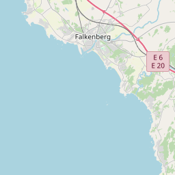
Falkenberg is located in Hallands lan, Swedencountry within 56° 54' 19.08" N 12° 29' 27.96" E (56.9053, 12.4911) coordinates. The local time in Falkenberg is 20:37 (25.06.2025)
Halmstad is located in Hallands lan, Swedencountry within 56° 40' 26.04" N 12° 51' 25.92" E (56.6739, 12.8572) coordinates. The local time in Halmstad is 20:37 (25.06.2025)
The calculated flying distance from Falkenberg to Halmstad is 21.16miles which is equal to 34.05 km.
If you want to go by car, the driving driving distance between Falkenberg and Halmstad is 28.59 miles (46.00 km). If you ride your car with an average speef of 112 kilometers/hour (70 miles/h), travel time will be 0 hours 25 minutes.Please check the avg.speed travel time on the right for various options
Estimated Travel Time Between Falkenberg and Halmstad
| Average speed | Travel Time |
|---|---|
| 30 mph (48 km/h) | 0 hours 57 minutes |
| 40 mph (64 km/h) | 0 hours 43 minutes |
| 50 mph (80 km/h) | 0 hours 34 minutes |
| 60 mph (67 km/h) | 0 hours 29 minutes |
| 70 mph (112 km/h) | 0 hours 25 minutes |
| 75 mph (120 km/h) | 0 hours 23 minutes |
Falkenberg, Hallands lan, Sweden
Related Distances from Falkenberg
| Cities | Distance |
|---|---|
| Falkenberg to Lulea | 678.53 mi (1,091.99 km) |
| Falkenberg to Halmstad | 21.16 mi (34.05 km) |
| Falkenberg to Gothenburg | 58.77 mi (94.58 km) |
| Falkenberg to Helsingborg | 59.72 mi (96.11 km) |
| Falkenberg to Jonkoping | 86.89 mi (139.83 km) |
| Falkenberg to Vaxjo | 87.51 mi (140.83 km) |
| Falkenberg to Malmo | 92.19 mi (148.36 km) |
| Falkenberg to Karlskrona | 128.64 mi (207.03 km) |
| Falkenberg to Vimmerby | 135.99 mi (218.86 km) |
| Falkenberg to Kalmar | 147.49 mi (237.36 km) |
| Falkenberg to Linkoping | 155.89 mi (250.88 km) |
| Falkenberg to Karlstad | 174.81 mi (281.33 km) |
| Falkenberg to Norrkoping | 179.97 mi (289.64 km) |
| Falkenberg to Orebro | 191.34 mi (307.93 km) |
| Falkenberg to Eskilstuna | 224.65 mi (361.53 km) |
| Falkenberg to Vasteras | 238.40 mi (383.66 km) |
| Falkenberg to Tumba | 250.97 mi (403.89 km) |
| Falkenberg to Stockholm | 263.45 mi (423.98 km) |
| Falkenberg to Upplands Vasby | 267.34 mi (430.25 km) |
| Falkenberg to Taby | 268.24 mi (431.69 km) |
| Falkenberg to Uppsala | 276.36 mi (444.77 km) |
| Falkenberg to Uppsala | 276.38 mi (444.79 km) |
| Falkenberg to Gavle | 308.95 mi (497.21 km) |
| Falkenberg to Ostersund | 439.69 mi (707.62 km) |
| Falkenberg to Umea | 546.02 mi (878.74 km) |
Halmstad, Hallands lan, Sweden
Related Distances to Halmstad
| Cities | Distance |
|---|---|
| Lulea to Halmstad | 687.72 mi (1,106.77 km) |
| Helsingborg to Halmstad | 43.44 mi (69.91 km) |
| Malmo to Halmstad | 74.12 mi (119.28 km) |
| Vaxjo to Halmstad | 75.21 mi (121.05 km) |
| Gothenburg to Halmstad | 78.80 mi (126.81 km) |
| Jonkoping to Halmstad | 90.81 mi (146.14 km) |
| Karlskrona to Halmstad | 110.15 mi (177.26 km) |
| Vimmerby to Halmstad | 131.41 mi (211.48 km) |
| Kalmar to Halmstad | 133.08 mi (214.18 km) |
| Linkoping to Halmstad | 158.15 mi (254.52 km) |
| Norrkoping to Halmstad | 181.60 mi (292.26 km) |
| Karlstad to Halmstad | 188.35 mi (303.12 km) |
| Orebro to Halmstad | 199.19 mi (320.56 km) |
| Nykoping to Halmstad | 209.96 mi (337.90 km) |
| Eskilstuna to Halmstad | 229.24 mi (368.93 km) |
| Vasteras to Halmstad | 243.82 mi (392.38 km) |
| Tumba to Halmstad | 251.98 mi (405.52 km) |
| Stockholm to Halmstad | 264.56 mi (425.77 km) |
| Upplands Vasby to Halmstad | 269.51 mi (433.74 km) |
| Taby to Halmstad | 269.77 mi (434.15 km) |
| Uppsala to Halmstad | 280.34 mi (451.17 km) |
| Uppsala to Halmstad | 280.34 mi (451.17 km) |
| Gavle to Halmstad | 316.23 mi (508.93 km) |
| Ostersund to Halmstad | 453.63 mi (730.04 km) |
| Umea to Halmstad | 554.70 mi (892.71 km) |


