


Distance Calculator


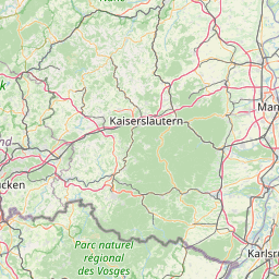


Distance from Greiz to Mannheim
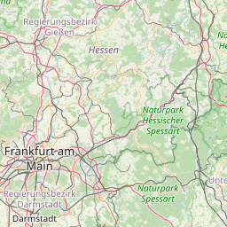
The shortest distance (air line) between Greiz and Mannheim is 184.13mi (296.33 km)
The shortest route between Greiz and Mannheim is 264.78 mi (426.11 km) according to the route planner. The driving time is approx. 4 h 24 m
How far is it between Greiz and Mannheim.
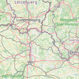
Greiz is located in Greiz, Germanycountry within 50° 39' 16.92" N 12° 11' 58.92" E (50.6547, 12.1997) coordinates. The local time in Greiz is 21:34 (20.06.2025)
Mannheim is located in Mannheim; Stadtkreis, Germanycountry within 49° 29' 16.08" N 8° 27' 57.96" E (49.4878, 8.4661) coordinates. The local time in Mannheim is 21:34 (20.06.2025)
The calculated flying distance from Greiz to Mannheim is 184.13miles which is equal to 296.33 km.
If you want to go by car, the driving driving distance between Greiz and Mannheim is 264.78 miles (426.11 km). If you ride your car with an average speef of 112 kilometers/hour (70 miles/h), travel time will be 3 hours 48 minutes.Please check the avg.speed travel time on the right for various options
Estimated Travel Time Between Greiz and Mannheim
| Average speed | Travel Time |
|---|---|
| 30 mph (48 km/h) | 8 hours 50 minutes |
| 40 mph (64 km/h) | 6 hours 37 minutes |
| 50 mph (80 km/h) | 5 hours 18 minutes |
| 60 mph (67 km/h) | 4 hours 25 minutes |
| 70 mph (112 km/h) | 3 hours 47 minutes |
| 75 mph (120 km/h) | 3 hours 32 minutes |
Related Distances from Greiz
| Cities | Distance |
|---|---|
| Greiz to Leipzig | 47.96 mi (77.18 km) |
| Greiz to Dresden | 72.53 mi (116.72 km) |
| Greiz to Nuremberg | 96.75 mi (155.71 km) |
| Greiz to Berlin | 138.87 mi (223.50 km) |
| Greiz to Hannover | 159.33 mi (256.42 km) |
| Greiz to Frankfurt | 159.45 mi (256.61 km) |
| Greiz to Augsburg | 168.38 mi (270.98 km) |
| Greiz to Munich | 176.17 mi (283.52 km) |
| Greiz to Wiesbaden | 178.91 mi (287.92 km) |
| Greiz to Mannheim | 184.13 mi (296.33 km) |
| Greiz to Bielefeld | 184.19 mi (296.43 km) |
| Greiz to Stuttgart | 187.11 mi (301.13 km) |
| Greiz to Karlsruhe | 203.78 mi (327.95 km) |
| Greiz to Dortmund | 213.83 mi (344.13 km) |
| Greiz to Munster | 217.20 mi (349.54 km) |
| Greiz to Hamburg | 220.73 mi (355.23 km) |
| Greiz to Bremen | 221.75 mi (356.86 km) |
| Greiz to Wuppertal | 222.32 mi (357.79 km) |
| Greiz to Bonn | 223.23 mi (359.25 km) |
| Greiz to Bochum | 223.76 mi (360.11 km) |
| Greiz to Gelsenkirchen | 229.15 mi (368.79 km) |
| Greiz to Cologne | 229.92 mi (370.03 km) |
| Greiz to Essen | 231.83 mi (373.09 km) |
| Greiz to Dusseldorf | 239.11 mi (384.80 km) |
| Greiz to Duisburg | 242.20 mi (389.78 km) |
Mannheim, Mannheim; Stadtkreis, Germany
Related Distances to Mannheim
| Cities | Distance |
|---|---|
| Karlsruhe to Mannheim | 33.19 mi (53.41 km) |
| Wiesbaden to Mannheim | 42.31 mi (68.09 km) |
| Frankfurt to Mannheim | 44.10 mi (70.97 km) |
| Stuttgart to Mannheim | 58.74 mi (94.53 km) |
| Bonn to Mannheim | 105.21 mi (169.32 km) |
| Nuremberg to Mannheim | 117.27 mi (188.72 km) |
| Cologne to Mannheim | 120.39 mi (193.75 km) |
| Augsburg to Mannheim | 134.75 mi (216.87 km) |
| Wuppertal to Mannheim | 135.28 mi (217.71 km) |
| Dusseldorf to Mannheim | 141.58 mi (227.85 km) |
| Dortmund to Mannheim | 146.90 mi (236.41 km) |
| Bochum to Mannheim | 148.33 mi (238.72 km) |
| Monchengladbach to Mannheim | 148.41 mi (238.84 km) |
| Essen to Mannheim | 149.92 mi (241.27 km) |
| Gelsenkirchen to Mannheim | 152.49 mi (245.41 km) |
| Duisburg to Mannheim | 153.97 mi (247.79 km) |
| Munich to Mannheim | 169.43 mi (272.67 km) |
| Munster to Mannheim | 174.89 mi (281.46 km) |
| Bielefeld to Mannheim | 175.06 mi (281.73 km) |
| Hannover to Mannheim | 206.23 mi (331.89 km) |
| Leipzig to Mannheim | 214.42 mi (345.08 km) |
| Bremen to Mannheim | 248.84 mi (400.47 km) |
| Dresden to Mannheim | 256.63 mi (413.00 km) |
| Hamburg to Mannheim | 288.30 mi (463.97 km) |
| Berlin to Mannheim | 299.88 mi (482.60 km) |
 Log in with Google