| Head southwest on Market Street | 35 m |
| Continue right onto Angel Row | 100 m |
| Continue slightly left onto Mount Street | 100 m |
| Make a sharp right onto Maid Marian Way | 150 m |
| Turn right onto Upper Parliament Street (A6008) | 250 m |
| Continue onto Theatre Square | 100 m |
| Go straight onto South Sherwood Street | 250 m |
| Turn right onto Shakespeare Street (A6008) | 150 m |
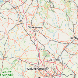
| Continue left onto Mansfield Road | 1.5 km |
| Enter Mansfield Road and take the 2nd exit onto Mansfield Road (A60) | 45 m |
| Exit the traffic circle onto Mansfield Road (A60) | 4 km |
| Make a slight right to stay on Mansfield Road (A60) | 2 km |
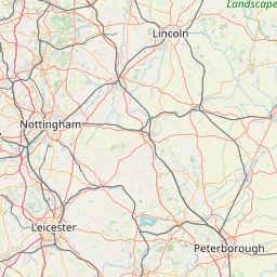
| Enter Leapool Island and take the 2nd exit onto Ollerton Road (A614) | 200 m |
| Exit the traffic circle onto Ollerton Road (A614) | 4.5 km |
| Continue onto Old Rufford Road (A614) | 800 m |
| Enter the traffic circle and take the 2nd exit onto Old Rufford Road (A614) | 55 m |
| Exit the traffic circle onto Old Rufford Road (A614) | 5.5 km |
| Enter the traffic circle and take the 2nd exit onto Old Rufford Road (A614) | 25 m |
| Exit the traffic circle onto Old Rufford Road (A614) | 1.5 km |
| Enter the traffic circle and take the 2nd exit onto Old Rufford Road (A614) | 60 m |
| Exit the traffic circle onto Old Rufford Road (A614) | 9 km |
| Enter the traffic circle and take the 3rd exit onto Blyth Road (A614) | 30 m |
| Exit the traffic circle onto Blyth Road (A614) | 4.5 km |
| Enter the traffic circle and take the 2nd exit onto Blyth Road (A614) | 50 m |
| Exit the traffic circle onto Blyth Road (A614) | 6 km |
| Enter the traffic circle and take the 2nd exit towards A1 | 80 m |
| Exit the traffic circle towards A1 | 350 m |
| Merge right onto Blyth Road (A1) | 45 km |
| Keep right onto A1(M) | 20 km |
| Take the ramp on the left towards A64: York | 550 m |
| Keep right towards A64 | 1 km |
| Merge right onto A64 | 15 km |
| Take the ramp on the left towards A1237 | 250 m |
| Enter the traffic circle and take the 2nd exit onto Ring Road (A1237) | 45 m |
| Exit the traffic circle onto Ring Road (A1237) | 2 km |
| Enter the traffic circle and take the 2nd exit onto Ring Road (A1237) | 70 m |
| Exit the traffic circle onto Ring Road (A1237) | 2 km |
| Enter the traffic circle and take the 2nd exit onto Ring Road (A1237) | 55 m |
| Exit the traffic circle onto Ring Road (A1237) | 2 km |
| Enter Poppleton Bar and take the 2nd exit onto Ring Road (A1237) | 50 m |
| Exit the traffic circle onto Ring Road (A1237) | 800 m |
| Enter the traffic circle and take the 1st exit onto Ring Road (A1237) | 100 m |
| Exit the traffic circle onto Ring Road (A1237) | 1 km |
| Enter the traffic circle and take the 2nd exit onto Ring Road (A1237) | 70 m |
| Exit the traffic circle onto Ring Road (A1237) | 1 km |
| Enter the traffic circle and take the 1st exit onto Ring Road (A1237) | 40 m |
| Exit the traffic circle onto Ring Road (A1237) | 1 km |
| Enter the traffic circle and take the 2nd exit onto Ring Road (A1237) | 80 m |
| Exit the traffic circle onto Ring Road (A1237) | 1.5 km |
| Enter the traffic circle and take the 2nd exit onto Ring Road (A1237) | 30 m |
| Exit the traffic circle onto Ring Road (A1237) | 1 km |
| Enter the traffic circle and take the 2nd exit towards A1237: Scarborough | 35 m |
| Exit the traffic circle towards A1237: Scarborough | 1 km |
| Enter the traffic circle and take the 3rd exit onto Monks Cross Link | 90 m |
| Exit the traffic circle onto Monks Cross Link | 700 m |
| Turn right | 10 m |
| You have arrived at your destination, straight ahead | 0 m |


 Log in with Google