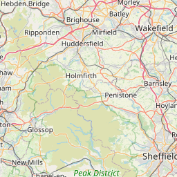
Distance Calculator

M1, Snake Road

139.9 km, 2 h 5 min

Head southwest on Market Street35 m
Continue right onto Angel Row100 m
Continue slightly left onto Mount Street100 m
Make a sharp right onto Maid Marian Way150 m
Continue onto Derby Road (A610)450 m
Keep right onto Alfreton Road (A610)1.5 km
Continue onto Bobbers Mill Bridge (A610)300 m
Continue onto Nuthall Road (A610)2.5 km
Keep left onto A6101.5 km
Keep left onto A610600 m
Enter Nuthall Interchange and take the 3rd exit towards M1: The NORTH250 m
Exit the traffic circle towards M1: The NORTH25 km
Take the ramp on the left towards A617: Chesterfield550 m
Keep left onto A6178 km
Keep right at the fork150 m
Keep right at the fork60 m
Keep left onto A612.5 km
Keep left onto A611 km
Enter the traffic circle and take the 2nd exit onto Dunston Road (B6050)40 m
Exit the traffic circle onto Dunston Road (B6050)3.5 km
Turn right onto Newbold Road (B6051)60 m
Continue onto Barlow Road (B6051)600 m
Continue onto Hackney Lane (B6051)1.5 km
Continue slightly right onto Valley Road (B6051)600 m
Go straight onto Bradley Lane (B6051)1 km
Continue onto New Road (B6051)1 km
Make a slight left onto Cordwell Lane (B6051)900 m
Continue onto Horsleygate Road (B6051)2.5 km
Enter Owler Bar Roundabout and take the 2nd exit onto B6054150 m
Exit the traffic circle onto B605440 m
Turn left to stay on B60543 km
Go straight onto A625500 m
Continue onto Owler Bar Road (A6187)800 m
Continue slightly left onto Hathersage Road (A6187)4.5 km
Continue onto Main Road (A6187)3 km
Turn right onto Sickleholme (A6013)150 m
Continue onto Station Road (A6013)700 m
Continue onto Main Road (A6013)600 m
Continue onto Ashopton Road (A6013)3 km
Turn left onto A5720 km
Make a slight left onto Woodcock Road (A57)600 m
Continue onto Sheffield Road (A57)1 km
Continue onto High Street East (A57)1.5 km
Make a slight right onto Dinting Vale (A57)1 km
Continue onto Brookfield (A57)700 m
Continue onto Woolley Bridge (A57)400 m
Turn left onto Woolley Lane (A57)700 m
Make a slight left35 m
Merge right onto Mottram Moor (A57)800 m
Keep left onto Mottram Moor (A57)350 m
Continue onto Hyde Road (A57)900 m
Enter Mottram Roundabout and take the 3rd exit onto M67150 m
Exit the traffic circle onto M678 km
Enter Denton Roundabout and take the 3rd exit towards Ring Road (N)250 m
Exit the traffic circle towards Ring Road (N)20 m
Continue towards Ring Road (N)15 km
Take the ramp on the left towards M60: Leeds100 m
Keep left towards M60: Ring Road600 m
Continue onto M606 km
Take the ramp on the left towards M61: Preston1 km
Continue onto M61900 m
Keep right towards A666: Bolton2 km
Take the ramp on the left towards A666: Kearsley400 m
Enter Kearsley Interchange and take the 4th exit towards M60250 m
Exit the traffic circle towards M60400 m
Merge right towards M60900 m
Take exit 2 on the left towards A580: Salford1 km
You have arrived at your destination, on the left0 m

A50, M6

171.1 km, 2 h 6 min

Head southwest on Market Street35 m
Continue right onto Angel Row100 m
Continue slightly left onto Mount Street100 m
Turn left onto Maid Marian Way500 m
Continue onto Greyfriar Gate150 m
Keep left onto Wilford Street (A6008)150 m
Continue onto Wilford Road (A6008)200 m
Make a slight right onto Queen's Drive (A453)900 m
Keep left onto Queen's Drive (A453)150 m
Continue onto Queens Drive (A453)1.5 km
Enter the traffic circle and take the 1st exit10 m
Exit the traffic circle300 m
Merge right onto A52450 m
Keep right onto Remembrance Way (A453)1.5 km
Enter Farnbourgh Road Roundabout and take the 2nd exit onto Remembrance Way (A453)55 m
Exit the traffic circle onto Remembrance Way (A453)1.5 km
Enter Crusader Roundabout and take the 2nd exit onto Remembrance Way (A453)45 m
Exit the traffic circle onto Remembrance Way (A453)1 km
Enter Mill Hill Roundabout and take the 2nd exit onto Remembrance Way (A453)80 m
Exit the traffic circle onto Remembrance Way (A453)9 km
Keep right at the fork80 m
Keep left onto A508 km
Keep right onto A5025 km
Enter the traffic circle and take the 2nd exit onto A5090 m
Exit the traffic circle onto A508 km
Enter the traffic circle and take the 2nd exit onto A5080 m
Exit the traffic circle onto A501.5 km
Enter McDonalds Roundabout and take the 2nd exit onto A5050 m
Exit the traffic circle onto A5015 km
Enter the traffic circle and take the 1st exit onto A5010 m
Exit the traffic circle onto A502 km
Take the ramp on the left towards A521: Blythe Bridge250 m
Enter the traffic circle and take the 2nd exit70 m
Exit the traffic circle300 m
Merge right onto Uttoxeter Road (A50)4.5 km
Take the ramp on the left400 m
Enter Heron Cross Roundabout and take the 2nd exit onto Victoria Place Link (A50)150 m
Exit the traffic circle onto Victoria Place Link (A50)700 m
Enter the traffic circle and take the 1st exit onto King Street (A50)9 m
Exit the traffic circle onto King Street (A50)250 m
Enter the traffic circle and take the 2nd exit onto City Road (A5007)25 m
Exit the traffic circle onto City Road (A5007)1 km
Enter the traffic circle and take the 1st exit onto City Road (A5007)9 m
Exit the traffic circle onto City Road (A5007)250 m
Take the ramp250 m
Keep right at the fork200 m
Merge right onto Queensway (A500)15 km
Enter Barthomley Interchange and take the 4th exit onto M6300 m
Exit the traffic circle onto M645 km
Take the ramp on the left1 km
Merge right onto M6215 km
Take the ramp on the left towards M60: Leeds550 m
Continue towards M604 km
Take the ramp on the left onto M60800 m
Continue onto M61900 m
Keep right towards A666: Bolton2 km
Take the ramp on the left towards A666: Kearsley400 m
Enter Kearsley Interchange and take the 4th exit towards M60250 m
Exit the traffic circle towards M60400 m
Merge right towards M60900 m
Take exit 2 on the left towards A580: Salford1 km
You have arrived at your destination, on the left0 m
From
    To

      Distance: 64.28 mi (103.45 km)

      Driving route: 86.94 mi (139.92 km).

      Driving time: 2h 4 min

      Distance from Kearsley to Nottingham

      The shortest distance (air line) between Kearsley and Nottingham is 64.28mi (103.45 km)

      The shortest route between Kearsley and Nottingham is 86.94 mi (139.92 km) according to the route planner. The driving time is approx. 2 h 4 m

      How far is it between Kearsley and Nottingham.

      Kearsley is located in Greater Manchester North West, United Kingdomcountry within 53° 31' 48" N -3° 37' 48" W (53.5300, -2.3700) coordinates. The local time in Kearsley is 17:11 (21.06.2025)

      Nottingham is located in Nottingham, United Kingdomcountry within 52° 57' 11.88" N -2° 51' 0" W (52.9533, -1.1500) coordinates. The local time in Nottingham is 17:11 (21.06.2025)

      The calculated flying distance from Kearsley to Nottingham is 64.28miles which is equal to 103.45 km.

      If you want to go by car, the driving driving distance between Kearsley and Nottingham is 86.94 miles (139.92 km). If you ride your car with an average speef of 112 kilometers/hour (70 miles/h), travel time will be 1 hours 15 minutes.Please check the avg.speed travel time on the right for various options

      Estimated Travel Time Between Kearsley and Nottingham

      Average speedTravel Time
      30 mph (48 km/h)2 hours 54 minutes
      40 mph (64 km/h)2 hours 10 minutes
      50 mph (80 km/h)1 hours 44 minutes
      60 mph (67 km/h)1 hours 27 minutes
      70 mph (112 km/h)1 hours 15 minutes
      75 mph (120 km/h)1 hours 10 minutes

      Kearsley, Greater Manchester North West, United Kingdom

      Related Distances from Kearsley

      CitiesDistance
      Kearsley to Bolton4.11 mi (6.61 km)
      Kearsley to Manchester6.20 mi (9.98 km)
      Kearsley to Stockport12.37 mi (19.91 km)
      Kearsley to Liverpool26.94 mi (43.36 km)
      Kearsley to Bradford31.50 mi (50.69 km)
      Kearsley to Stoke-on-Trent37.42 mi (60.23 km)
      Kearsley to Leeds38.42 mi (61.84 km)
      Kearsley to Sheffield38.42 mi (61.84 km)
      Kearsley to Nottingham64.28 mi (103.45 km)
      Kearsley to Birmingham75.11 mi (120.87 km)
      Kearsley to Leicester80.43 mi (129.44 km)
      Kearsley to Kingston upon Hull84.77 mi (136.42 km)
      Kearsley to Coventry85.37 mi (137.38 km)
      Kearsley to Newcastle104.77 mi (168.62 km)
      Kearsley to Bristol143.78 mi (231.40 km)
      Kearsley to Caerdydd145.56 mi (234.25 km)
      Kearsley to Reading154.99 mi (249.43 km)
      Kearsley to Belfast162.05 mi (260.79 km)
      Kearsley to London168.57 mi (271.29 km)
      Kearsley to Edinburgh170.59 mi (274.54 km)
      Kearsley to Glasgow177.68 mi (285.95 km)
      Kearsley to Ipswich178.91 mi (287.93 km)
      Kearsley to Southampton186.08 mi (299.47 km)
      Kearsley to Portsmouth195.91 mi (315.28 km)
      Kearsley to Worthing205.82 mi (331.23 km)

      Nottingham, Nottingham, United Kingdom

      Related Distances to Nottingham

      CitiesDistance
      Leicester to Nottingham22.05 mi (35.48 km)
      Sheffield to Nottingham32.38 mi (52.11 km)
      Coventry to Nottingham40.59 mi (65.32 km)
      Stoke-on-Trent to Nottingham43.11 mi (69.38 km)
      Birmingham to Nottingham45.40 mi (73.07 km)
      Stockport to Nottingham51.97 mi (83.64 km)
      Manchester to Nottingham58.09 mi (93.49 km)
      Leeds to Nottingham60.80 mi (97.84 km)
      Bradford to Nottingham63.51 mi (102.21 km)
      Kingston upon Hull to Nottingham64.22 mi (103.35 km)
      Bolton to Nottingham68.24 mi (109.82 km)
      Liverpool to Nottingham82.47 mi (132.72 km)
      Reading to Nottingham103.85 mi (167.13 km)
      London to Nottingham108.88 mi (175.23 km)
      Ipswich to Nottingham114.95 mi (185.00 km)
      Bristol to Nottingham120.38 mi (193.74 km)
      Caerdydd to Nottingham133.09 mi (214.19 km)
      Sunderland to Nottingham135.25 mi (217.66 km)
      Newcastle to Nottingham141.27 mi (227.36 km)
      Southampton to Nottingham142.11 mi (228.70 km)
      Portsmouth to Nottingham148.40 mi (238.83 km)
      Worthing to Nottingham151.45 mi (243.73 km)
      Edinburgh to Nottingham222.85 mi (358.65 km)
      Belfast to Nottingham225.72 mi (363.26 km)
      Glasgow to Nottingham236.39 mi (380.43 km)