


Distance Calculator
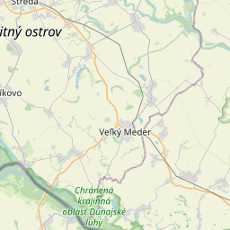
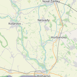
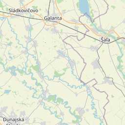
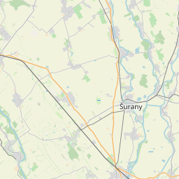

Distance from Komarno to Sal'a
The shortest distance (air line) between Komarno and Sal'a is 29.15mi (46.91 km)
The shortest route between Komarno and Sal'a is 33.82 mi (54.43 km) according to the route planner. The driving time is approx. 1 h 0 m
How far is it between Komarno and Sal'a.
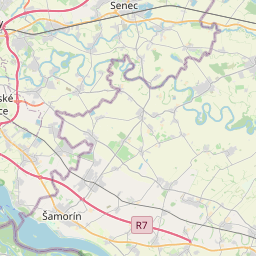
Komarno is located in Nitriansky kraj, Slovakiacountry within 47° 45' 47.88" N 18° 7' 41.88" E (47.7633, 18.1283) coordinates. The local time in Komarno is 18:20 (11.07.2025)
Sal'a is located in Nitriansky kraj, Slovakiacountry within 48° 9' 1.08" N 17° 52' 39" E (48.1503, 17.8775) coordinates. The local time in Sal'a is 18:20 (11.07.2025)
The calculated flying distance from Komarno to Sal'a is 29.15miles which is equal to 46.91 km.
If you want to go by car, the driving driving distance between Komarno and Sal'a is 33.82 miles (54.43 km). If you ride your car with an average speef of 112 kilometers/hour (70 miles/h), travel time will be 0 hours 29 minutes.Please check the avg.speed travel time on the right for various options
Estimated Travel Time Between Komarno and Sal'a
| Average speed | Travel Time |
|---|---|
| 30 mph (48 km/h) | 1 hours 8 minutes |
| 40 mph (64 km/h) | 0 hours 51 minutes |
| 50 mph (80 km/h) | 0 hours 41 minutes |
| 60 mph (67 km/h) | 0 hours 34 minutes |
| 70 mph (112 km/h) | 0 hours 29 minutes |
| 75 mph (120 km/h) | 0 hours 27 minutes |
Komarno, Nitriansky kraj, Slovakia
Related Distances from Komarno
| Cities | Distance |
|---|---|
| Komarno to Nove Zamky | 15.42 mi (24.82 km) |
| Komarno to Nitra | 37.61 mi (60.53 km) |
| Komarno to Levice | 38.37 mi (61.75 km) |
| Komarno to Trnava | 49.22 mi (79.21 km) |
| Komarno to Petrzalka | 53.34 mi (85.84 km) |
| Komarno to Bratislava | 53.97 mi (86.86 km) |
| Komarno to Pezinok | 54.05 mi (86.98 km) |
| Komarno to Topol'cany | 54.69 mi (88.02 km) |
| Komarno to Piest'any | 58.32 mi (93.86 km) |
| Komarno to Zvolen | 72.04 mi (115.93 km) |
| Komarno to Lucenec | 81.19 mi (130.66 km) |
| Komarno to Banska Bystrica | 81.85 mi (131.72 km) |
| Komarno to Martin | 97.02 mi (156.14 km) |
| Komarno to Zilina | 104.66 mi (168.43 km) |
| Komarno to Ruzomberok | 105.76 mi (170.21 km) |
| Komarno to Liptovsky Mikulas | 113.56 mi (182.75 km) |
| Komarno to Cadca | 119.47 mi (192.27 km) |
| Komarno to Poprad | 133.84 mi (215.40 km) |
| Komarno to Spisska Nova Ves | 138.54 mi (222.96 km) |
| Komarno to Kosice | 158.02 mi (254.31 km) |
| Komarno to Presov | 166.42 mi (267.83 km) |
| Komarno to Trebisov | 175.73 mi (282.82 km) |
| Komarno to Bardejov | 178.64 mi (287.49 km) |
| Komarno to Michalovce | 187.09 mi (301.09 km) |
| Komarno to Humenne | 191.45 mi (308.11 km) |
Sal'a, Nitriansky kraj, Slovakia
Related Distances to Sal'a
| Cities | Distance |
|---|---|
| Nitra to Sal'a | 14.47 mi (23.30 km) |
| Nove Zamky to Sal'a | 17.23 mi (27.73 km) |
| Trnava to Sal'a | 20.58 mi (33.11 km) |
| Komarno to Sal'a | 29.15 mi (46.91 km) |
| Pezinok to Sal'a | 29.80 mi (47.95 km) |
| Piest'any to Sal'a | 30.05 mi (48.36 km) |
| Topol'cany to Sal'a | 31.11 mi (50.07 km) |
| Levice to Sal'a | 33.97 mi (54.66 km) |
| Petrzalka to Sal'a | 35.10 mi (56.48 km) |
| Bratislava to Sal'a | 35.40 mi (56.97 km) |
| Zvolen to Sal'a | 63.90 mi (102.84 km) |
| Banska Bystrica to Sal'a | 70.78 mi (113.91 km) |
| Martin to Sal'a | 79.19 mi (127.44 km) |
| Lucenec to Sal'a | 83.36 mi (134.16 km) |
| Zilina to Sal'a | 83.90 mi (135.02 km) |
| Ruzomberok to Sal'a | 91.57 mi (147.37 km) |
| Liptovsky Mikulas to Sal'a | 101.83 mi (163.87 km) |
| Poprad to Sal'a | 127.15 mi (204.63 km) |
| Spisska Nova Ves to Sal'a | 134.70 mi (216.77 km) |
| Kosice to Sal'a | 159.47 mi (256.63 km) |
| Presov to Sal'a | 164.54 mi (264.80 km) |
| Bardejov to Sal'a | 173.86 mi (279.80 km) |
| Trebisov to Sal'a | 179.22 mi (288.42 km) |
| Michalovce to Sal'a | 189.58 mi (305.10 km) |
| Humenne to Sal'a | 192.11 mi (309.17 km) |
 Log in with Google