Distance Calculator

A16, Koning Boudewijnsnelweg

224.5 km, 2 h 46 min

Head south on Aziëweg200 m
Turn left onto Australiëweg (RING)4 km
Turn right onto Nieuwe Hoefweg (N209)1 km
Take the ramp towards A12: Utrecht200 m
Continue left towards A12: Utrecht4.5 km
Take exit 9 towards N219: Zevenhuizen400 m
Turn right onto Provincialeweg (N219)2.5 km
Keep right onto Provincialeweg (N219)35 m
Turn right to stay on N2191.5 km
Continue onto 1e Tochtweg (N219)1.5 km
Turn right onto N21970 m
Take the ramp on the right towards A20: Capelle a/d IJssel7 km
Take the ramp towards A16: Ring Rotterdam (oost)1.5 km
Continue onto A162 km
Keep left onto A1615 km
Keep left towards A16: Antwerpen4 km
Keep left onto A1625 km
Take exit 15 towards N263: Breda9 km
Continue onto E1935 km
Continue towards Ring Antwerpen: Gent5.5 km
Take the ramp towards Luik1.5 km
Merge left onto Koning Boudewijnsnelweg (E34)9 km
Keep left towards Aken (Aachen)80 km
Take the ramp800 m
Enter the traffic circle and take the 2nd exit onto Bilzersteenweg (N730)80 m
Exit the traffic circle onto Bilzersteenweg (N730)70 m
Continue onto Tongersestraat (N730)150 m
Take the ramp on the right250 m
Turn right onto Alden Biesensingel (N700)2.5 km
Enter the traffic circle and take the 1st exit onto Maastrichterstraat (N2)20 m
Exit the traffic circle onto Maastrichterstraat (N2)5 km
Continue onto Bilzerbaan (N2)2 km
Continue straight onto 2e Carabinierslaan (N2)1.5 km
Continue onto Via Regia1.5 km
Enter the traffic circle and take the 2nd exit onto Via Regia70 m
Exit the traffic circle onto Via Regia700 m
Enter the traffic circle and take the 2nd exit onto Sint Annalaan100 m
Exit the traffic circle onto Sint Annalaan20 m
Turn right onto Sint Annadal20 m
Continue onto Sint Annalaan350 m
Continue onto Hertogsingel200 m
Turn left onto Calvariestraat350 m
Continue onto Kommel200 m
Turn left onto Brusselsestraat70 m
Turn right50 m
You have arrived at your destination, on the left0 m

A12, A2

219.1 km, 2 h 51 min

Head south on Aziëweg200 m
Turn left onto Australiëweg (RING)4 km
Turn right onto Nieuwe Hoefweg (N209)1 km
Take the ramp towards A12: Utrecht200 m
Continue left towards A12: Utrecht40 km
Keep right towards A2: Ring Utrecht550 m
Take the ramp towards A2: 's-Hertogenbosch800 m
Merge left onto A240 km
Keep right onto A23.5 km
Keep left towards A2: RING-Zuid5 km
Keep left towards A2: Maastricht25 km
Keep left towards A2: Maastricht2.5 km
Merge left onto Tilburgseweg (A2)3 km
Continue onto Poot van Metz (A2)9 km
Keep left towards A2: Maastricht15 km
Take exit 36 towards Maarheeze2.5 km
Take exit 37 towards Budel3 km
Take exit 38 towards Weert-Noord10 km
Take exit 40 towards N280: Kelpen-Oler400 m
Turn right onto N28050 m
Take the ramp on the right towards A2: Maastricht15 km
Take exit 44 towards N276: Sint Joost400 m
Enter Ei van Sint Joost and take the 2nd exit towards A2: Maastricht90 m
Exit the traffic circle towards A2: Maastricht4 km
Take exit 45 towards Echt300 m
Enter the traffic circle and take the 3rd exit towards A2: Heelen80 m
Exit the traffic circle towards A2: Heelen30 km
Take exit 52 towards A79: Maastricht-Noord550 m
Continue onto N21.5 km
Take exit 53 towards Maastricht-Centrum Noord300 m
Keep right onto N2600 m
Go straight onto Viaductweg350 m
Continue onto Noorderbrug1.5 km
Turn left onto Cabergerweg400 m
Turn right onto Statensingel700 m
Enter the traffic circle and take the 2nd exit onto Hertogsingel60 m
Exit the traffic circle onto Hertogsingel250 m
Turn left onto Calvariestraat350 m
Continue onto Kommel200 m
Turn left onto Brusselsestraat70 m
Turn right50 m
You have arrived at your destination, on the left0 m
From
    To

      Distance: 98.29 mi (158.19 km)

      Driving route: 139.49 mi (224.48 km).

      Driving time: 2h 45 min

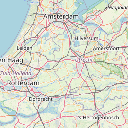
      Distance from Maastricht to Zoetermeer

      The shortest distance (air line) between Maastricht and Zoetermeer is 98.29mi (158.19 km)

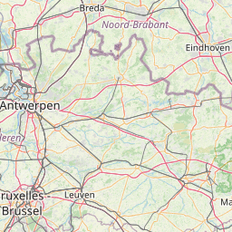
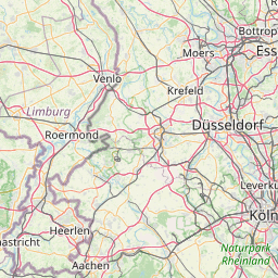
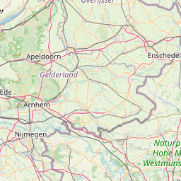
      The shortest route between Maastricht and Zoetermeer is 139.49 mi (224.48 km) according to the route planner. The driving time is approx. 2 h 45 m

      How far is it between Maastricht and Zoetermeer.

      Maastricht is located in Zuid-Limburg, Netherlandscountry within 50° 51' 0" N 5° 40' 59.88" E (50.8500, 5.6833) coordinates. The local time in Maastricht is 00:59 (04.06.2025)

      Zoetermeer is located in Agglomeratie ’s-Gravenhage, Netherlandscountry within 52° 4' 0.12" N 4° 30' 0" E (52.0667, 4.5000) coordinates. The local time in Zoetermeer is 00:59 (04.06.2025)

      The calculated flying distance from Maastricht to Zoetermeer is 98.29miles which is equal to 158.19 km.

      If you want to go by car, the driving driving distance between Maastricht and Zoetermeer is 139.49 miles (224.48 km). If you ride your car with an average speef of 112 kilometers/hour (70 miles/h), travel time will be 2 hours 0 minutes.Please check the avg.speed travel time on the right for various options

      Estimated Travel Time Between Maastricht and Zoetermeer

      Average speedTravel Time
      30 mph (48 km/h)4 hours 39 minutes
      40 mph (64 km/h)3 hours 29 minutes
      50 mph (80 km/h)2 hours 47 minutes
      60 mph (67 km/h)2 hours 19 minutes
      70 mph (112 km/h)1 hours 60 minutes
      75 mph (120 km/h)1 hours 52 minutes

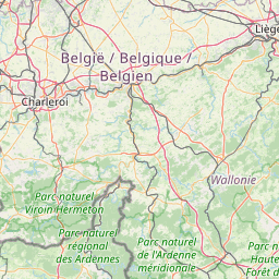
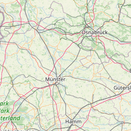
      Maastricht, Zuid-Limburg, Netherlands

      Related Distances from Maastricht

      CitiesDistance
      Maastricht to Eindhoven41.22 mi (66.34 km)
      Maastricht to Tilburg54.90 mi (88.35 km)
      Maastricht to s-Hertogenbosch59.91 mi (96.42 km)
      Maastricht to Breda64.41 mi (103.66 km)
      Maastricht to Nijmegen69.35 mi (111.61 km)
      Maastricht to Dordrecht78.44 mi (126.24 km)
      Maastricht to Arnhem78.95 mi (127.05 km)
      Maastricht to Utrecht88.63 mi (142.64 km)
      Maastricht to Rotterdam89.64 mi (144.26 km)
      Maastricht to Amersfoort90.74 mi (146.04 km)
      Maastricht to Apeldoorn95.21 mi (153.23 km)
      Maastricht to Zoetermeer98.29 mi (158.19 km)
      Maastricht to Alphen aan den Rijn98.86 mi (159.11 km)
      Maastricht to The Hague103.52 mi (166.60 km)
      Maastricht to Leiden104.05 mi (167.45 km)
      Maastricht to Almere106.69 mi (171.70 km)
      Maastricht to Enschede107.94 mi (173.71 km)
      Maastricht to Hoofddorp109.26 mi (175.84 km)
      Maastricht to Amsterdam110.53 mi (177.89 km)
      Maastricht to Haarlem115.12 mi (185.26 km)
      Maastricht to Zwolle116.53 mi (187.54 km)
      Maastricht to Zaanstad118.46 mi (190.65 km)
      Maastricht to Alkmaar129.52 mi (208.44 km)
      Maastricht to Leeuwarden162.42 mi (261.40 km)
      Maastricht to Groningen167.78 mi (270.01 km)

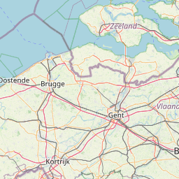
      Zoetermeer, Agglomeratie ’s-Gravenhage, Netherlands

      Related Distances to Zoetermeer

      CitiesDistance
      Leiden to Zoetermeer6.46 mi (10.40 km)
      The Hague to Zoetermeer8.12 mi (13.07 km)
      Alphen aan den Rijn to Zoetermeer8.44 mi (13.58 km)
      Rotterdam to Zoetermeer10.36 mi (16.68 km)
      Hoofddorp to Zoetermeer18.41 mi (29.63 km)
      Dordrecht to Zoetermeer20.20 mi (32.51 km)
      Haarlem to Zoetermeer22.59 mi (36.36 km)
      Utrecht to Zoetermeer26.21 mi (42.19 km)
      Amsterdam to Zoetermeer26.92 mi (43.33 km)
      Zaanstad to Zoetermeer30.20 mi (48.61 km)
      Breda to Zoetermeer35.05 mi (56.41 km)
      Almere to Zoetermeer36.74 mi (59.13 km)
      Amersfoort to Zoetermeer37.92 mi (61.03 km)
      Alkmaar to Zoetermeer40.55 mi (65.25 km)
      s-Hertogenbosch to Zoetermeer43.20 mi (69.52 km)
      Tilburg to Zoetermeer43.54 mi (70.07 km)
      Nijmegen to Zoetermeer59.96 mi (96.49 km)
      Arnhem to Zoetermeer60.50 mi (97.37 km)
      Eindhoven to Zoetermeer60.70 mi (97.68 km)
      Apeldoorn to Zoetermeer63.05 mi (101.47 km)
      Zwolle to Zoetermeer74.42 mi (119.77 km)
      Leeuwarden to Zoetermeer95.01 mi (152.90 km)
      Maastricht to Zoetermeer98.29 mi (158.19 km)
      Enschede to Zoetermeer102.29 mi (164.62 km)
      Groningen to Zoetermeer117.56 mi (189.19 km)