Distance Calculator

M62, A1(M)

312.3 km, 3 h 37 min

Head southwest on Paul Ware Street15 m
Turn right onto Boothen Old Road30 m
Turn right onto Lonsdale Street (A5006)7 m
Turn left onto Boothen Road250 m
Turn left onto Fleming Road (A52)150 m
Turn right onto London Road (A52)250 m
Keep left onto Hartshill Road (A52)300 m
Keep right onto Shelton Old Road (A52)300 m
Take the ramp on the left450 m
Merge right onto Queensway (A500)15 km
Enter Barthomley Interchange and take the 4th exit onto M6300 m
Exit the traffic circle onto M645 km
Take the ramp on the left1 km
Merge right onto M6215 km
Take the ramp on the left towards M60: Leeds550 m
Continue towards M6010 km
Continue onto M6245 km
Keep right onto M627 km
Keep right onto M629 km
Take the ramp on the left1.5 km
Merge right onto M11.5 km
Keep left towards M155 km
Keep right towards A1(M): The North45 km
Keep right towards A1(M): Durham50 km
Keep left towards A1: Newcastle8 km
Take the ramp on the left towards A184: Central Newcastle2 km
Go straight onto A1892 km
Continue straight to stay on St James' Boulevard (A189)50 m
Turn right onto Gallowgate (B1311)250 m
Turn left onto Percy Street (B1307)450 m
Turn right onto Saint Mary's Place (B1307)300 m
Continue onto Sandyford Road (B1307)150 m
Enter the traffic circle and take the 1st exit onto Hancock Street15 m
Exit the traffic circle onto Hancock Street25 m
You have arrived at your destination, on the right0 m

M6, A688

310.1 km, 3 h 51 min

Head southwest on Paul Ware Street15 m
Turn right onto Boothen Old Road30 m
Turn right onto Lonsdale Street (A5006)7 m
Turn left onto Boothen Road250 m
Turn left onto Fleming Road (A52)150 m
Turn right onto London Road (A52)250 m
Keep left onto Hartshill Road (A52)300 m
Keep right onto Shelton Old Road (A52)300 m
Take the ramp on the left450 m
Merge right onto Queensway (A500)15 km
Enter Barthomley Interchange and take the 4th exit onto M6300 m
Exit the traffic circle onto M655 km
Keep right onto M6100 km
Take exit 38 on the left towards A685: Brough1 km
Enter the traffic circle and take the 2nd exit towards Brough55 m
Exit the traffic circle towards Brough20 km
Go straight onto Market Street (A685)3.5 km
Turn right700 m
Continue straight2.5 km
Continue straight5 km
Continue straight150 m
Make a slight left800 m
Go straight onto A6610 km
Continue onto A662 km
Take the ramp on the left350 m
Merge right onto Bowes Road (A67)6 km
Turn right onto A67150 m
Turn left onto Bridgegate (A67)350 m
Continue slightly left onto The Bank (A67)200 m
Continue straight onto Market Place (A67)150 m
Continue onto Horsemarket (A67)150 m
Continue slightly right onto Galgate (A67)600 m
Continue right onto Bede Road (A67)250 m
Turn left onto Prospect Place (A688)2 km
Continue onto Stainton Bank (A688)15 km
Make a slight left onto A68835 m
Enter the traffic circle and take the 2nd exit onto A68850 m
Exit the traffic circle onto A688900 m
Enter the traffic circle and take the 2nd exit towards Bishop Auckland35 m
Exit the traffic circle towards Bishop Auckland1.5 km
Enter the traffic circle and take the 2nd exit onto A68855 m
Exit the traffic circle onto A688400 m
Make a slight right onto A688350 m
Enter the traffic circle and take the 2nd exit onto Fylands Drive (A688)55 m
Exit the traffic circle onto Fylands Drive (A688)550 m
Enter the traffic circle and take the 3rd exit towards Spennymooor80 m
Exit the traffic circle towards Spennymooor1.5 km
Enter the traffic circle and take the 2nd exit onto A68830 m
Exit the traffic circle onto A688700 m
Enter the traffic circle and take the 2nd exit onto A68870 m
Exit the traffic circle onto A688900 m
Enter the traffic circle and take the 2nd exit towards Spennymoor35 m
Exit the traffic circle towards Spennymoor2 km
Continue onto A688600 m
Enter the traffic circle and take the 2nd exit towards Spennymoor30 m
Exit the traffic circle towards Spennymoor2.5 km
Enter the traffic circle and take the 3rd exit onto A688150 m
Exit the traffic circle onto A688900 m
Enter the traffic circle and take the 3rd exit towards A1(M)200 m
Exit the traffic circle towards A1(M)1 km
Enter the traffic circle and take the 2nd exit onto A68820 m
Exit the traffic circle onto A688450 m
Enter Thinford Roundabout and take the 3rd exit towards Bowburn100 m
Exit the traffic circle towards Bowburn2.5 km
Enter the traffic circle and take the 1st exit towards Tursdale10 m
Exit the traffic circle towards Tursdale1 km
Enter Integra 68 South access and take the 1st exit onto A68860 m
Exit the traffic circle onto A688500 m
Enter Integra 61 North and West access and take the 2nd exit onto A68870 m
Exit the traffic circle onto A688600 m
Enter Bowburn Interchange and take the 2nd exit100 m
Exit the traffic circle300 m
Merge right onto A1(M)20 km
Keep left towards A1: Newcastle8 km
Take the ramp on the left towards A184: Central Newcastle2 km
Go straight onto A1892 km
Continue straight to stay on St James' Boulevard (A189)50 m
Turn right onto Gallowgate (B1311)250 m
Turn left onto Percy Street (B1307)450 m
Turn right onto Saint Mary's Place (B1307)300 m
Continue onto Sandyford Road (B1307)150 m
Enter the traffic circle and take the 1st exit onto Hancock Street15 m
Exit the traffic circle onto Hancock Street25 m
You have arrived at your destination, on the right0 m
From
    To

      Distance: 138.77 mi (223.33 km)

      Driving route: 194.06 mi (312.31 km).

      Driving time: 3h 36 min

      Distance from Newcastle to Stoke-on-Trent

      The shortest distance (air line) between Newcastle and Stoke-on-Trent is 138.77mi (223.33 km)

      The shortest route between Newcastle and Stoke-on-Trent is 194.06 mi (312.31 km) according to the route planner. The driving time is approx. 3 h 36 m

      How far is it between Newcastle and Stoke-on-Trent.

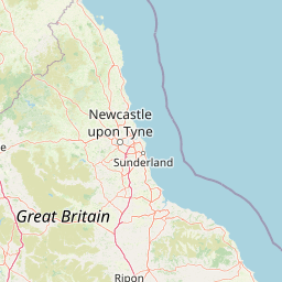
      Newcastle is located in Tyneside, United Kingdomcountry within 54° 58' 48" N -2° 23' 24" W (54.9800, -1.6100) coordinates. The local time in Newcastle is 20:59 (16.06.2025)

      Stoke-on-Trent is located in Stoke-on-Trent, United Kingdomcountry within 53° 0' 0" N -3° 49' 0.12" W (53.0000, -2.1833) coordinates. The local time in Stoke-on-Trent is 20:59 (16.06.2025)

      The calculated flying distance from Newcastle to Stoke-on-Trent is 138.77miles which is equal to 223.33 km.

      If you want to go by car, the driving driving distance between Newcastle and Stoke-on-Trent is 194.06 miles (312.31 km). If you ride your car with an average speef of 112 kilometers/hour (70 miles/h), travel time will be 2 hours 47 minutes.Please check the avg.speed travel time on the right for various options

      Estimated Travel Time Between Newcastle and Stoke-on-Trent

      Average speedTravel Time
      30 mph (48 km/h)6 hours 28 minutes
      40 mph (64 km/h)4 hours 51 minutes
      50 mph (80 km/h)3 hours 53 minutes
      60 mph (67 km/h)3 hours 14 minutes
      70 mph (112 km/h)2 hours 46 minutes
      75 mph (120 km/h)2 hours 35 minutes

      Newcastle, Tyneside, United Kingdom

      Related Distances from Newcastle

      CitiesDistance
      Newcastle to Sunderland10.43 mi (16.78 km)
      Newcastle to Leeds81.55 mi (131.23 km)
      Newcastle to Bradford81.72 mi (131.52 km)
      Newcastle to Edinburgh91.36 mi (147.04 km)
      Newcastle to Kingston upon Hull99.66 mi (160.39 km)
      Newcastle to Bolton102.35 mi (164.71 km)
      Newcastle to Manchester106.81 mi (171.89 km)
      Newcastle to Sheffield110.64 mi (178.06 km)
      Newcastle to Stockport110.76 mi (178.25 km)
      Newcastle to Glasgow120.09 mi (193.26 km)
      Newcastle to Liverpool122.16 mi (196.60 km)
      Newcastle to Stoke-on-Trent138.77 mi (223.33 km)
      Newcastle to Nottingham141.27 mi (227.36 km)
      Newcastle to Leicester163.23 mi (262.70 km)
      Newcastle to Birmingham173.15 mi (278.65 km)
      Newcastle to Belfast174.11 mi (280.20 km)
      Newcastle to Coventry177.75 mi (286.06 km)
      Newcastle to Ipswich231.53 mi (372.62 km)
      Newcastle to Reading245.03 mi (394.33 km)
      Newcastle to Bristol247.05 mi (397.58 km)
      Newcastle to London247.64 mi (398.53 km)
      Newcastle to Caerdydd250.25 mi (402.74 km)
      Newcastle to Southampton281.86 mi (453.61 km)
      Newcastle to Portsmouth289.23 mi (465.47 km)
      Newcastle to Worthing292.38 mi (470.53 km)

      Stoke-on-Trent, Stoke-on-Trent, United Kingdom

      Related Distances to Stoke-on-Trent

      CitiesDistance
      Stockport to Stoke-on-Trent28.25 mi (45.46 km)
      Manchester to Stoke-on-Trent33.22 mi (53.47 km)
      Birmingham to Stoke-on-Trent37.80 mi (60.83 km)
      Sheffield to Stoke-on-Trent39.54 mi (63.63 km)
      Bolton to Stoke-on-Trent41.21 mi (66.31 km)
      Nottingham to Stoke-on-Trent43.11 mi (69.38 km)
      Liverpool to Stoke-on-Trent43.73 mi (70.38 km)
      Coventry to Stoke-on-Trent49.66 mi (79.91 km)
      Leicester to Stoke-on-Trent50.65 mi (81.52 km)
      Bradford to Stoke-on-Trent58.09 mi (93.48 km)
      Leeds to Stoke-on-Trent61.15 mi (98.40 km)
      Kingston upon Hull to Stoke-on-Trent92.01 mi (148.07 km)
      Bristol to Stoke-on-Trent108.27 mi (174.25 km)
      Caerdydd to Stoke-on-Trent113.05 mi (181.93 km)
      Reading to Stoke-on-Trent118.45 mi (190.62 km)
      London to Stoke-on-Trent134.89 mi (217.09 km)
      Sunderland to Stoke-on-Trent135.67 mi (218.34 km)
      Newcastle to Stoke-on-Trent138.77 mi (223.33 km)
      Southampton to Stoke-on-Trent148.67 mi (239.26 km)
      Ipswich to Stoke-on-Trent154.64 mi (248.87 km)
      Portsmouth to Stoke-on-Trent158.64 mi (255.30 km)
      Worthing to Stoke-on-Trent169.58 mi (272.92 km)
      Belfast to Stoke-on-Trent188.49 mi (303.35 km)
      Edinburgh to Stoke-on-Trent208.00 mi (334.75 km)
      Glasgow to Stoke-on-Trent214.40 mi (345.04 km)