


Distance Calculator
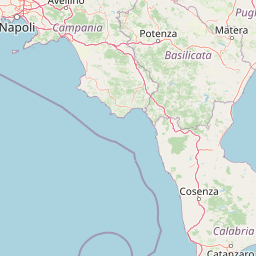

Distance from Pisa to Taranto
The shortest distance (air line) between Pisa and Taranto is 416.18mi (669.77 km)
The shortest route between Pisa and Taranto is 578.45 mi (930.92 km) according to the route planner. The driving time is approx. 9 h 26 m
How far is it between Pisa and Taranto.
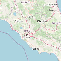
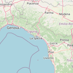
Pisa is located in Pisa, Italycountry within 43° 43' 0.12" N 10° 24' 0" E (43.7167, 10.4000) coordinates. The local time in Pisa is 05:59 (08.07.2025)
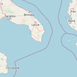
Taranto is located in Taranto, Italycountry within 40° 28' 15.96" N 17° 14' 35.16" E (40.4711, 17.2431) coordinates. The local time in Taranto is 05:59 (08.07.2025)
The calculated flying distance from Pisa to Taranto is 416.18miles which is equal to 669.77 km.
If you want to go by car, the driving driving distance between Pisa and Taranto is 578.45 miles (930.92 km). If you ride your car with an average speef of 112 kilometers/hour (70 miles/h), travel time will be 8 hours 19 minutes.Please check the avg.speed travel time on the right for various options
Estimated Travel Time Between Pisa and Taranto
| Average speed | Travel Time |
|---|---|
| 30 mph (48 km/h) | 19 hours 17 minutes |
| 40 mph (64 km/h) | 14 hours 28 minutes |
| 50 mph (80 km/h) | 11 hours 34 minutes |
| 60 mph (67 km/h) | 9 hours 38 minutes |
| 70 mph (112 km/h) | 8 hours 16 minutes |
| 75 mph (120 km/h) | 7 hours 43 minutes |
Related Distances from Pisa
| Cities | Distance |
|---|---|
| Pisa to Livorno | 12.28 mi (19.76 km) |
| Pisa to Prato | 36.54 mi (58.81 km) |
| Pisa to Florence | 42.80 mi (68.89 km) |
| Pisa to Reggio Emilia | 68.91 mi (110.91 km) |
| Pisa to Modena | 69.28 mi (111.49 km) |
| Pisa to Bologna | 71.21 mi (114.61 km) |
| Pisa to Parma | 75.04 mi (120.76 km) |
| Pisa to Genoa | 87.22 mi (140.37 km) |
| Pisa to Perugia | 108.20 mi (174.14 km) |
| Pisa to Verona | 122.50 mi (197.14 km) |
| Pisa to Brescia | 126.21 mi (203.12 km) |
| Pisa to Milan | 134.78 mi (216.91 km) |
| Pisa to Padova | 137.55 mi (221.37 km) |
| Pisa to Venice | 152.35 mi (245.18 km) |
| Pisa to Turin | 164.13 mi (264.15 km) |
| Pisa to Rome | 164.37 mi (264.54 km) |
| Pisa to Trieste | 212.71 mi (342.33 km) |
| Pisa to Naples | 279.99 mi (450.60 km) |
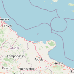
| Pisa to Bari | 375.14 mi (603.73 km) |
| Pisa to Taranto | 416.18 mi (669.77 km) |
| Pisa to Palermo | 416.66 mi (670.55 km) |
| Pisa to Cosenza | 429.60 mi (691.38 km) |
| Pisa to Messina | 466.64 mi (750.99 km) |
| Pisa to Reggio di Calabria | 474.08 mi (762.96 km) |
| Pisa to Catania | 494.79 mi (796.29 km) |
Related Distances to Taranto
| Cities | Distance |
|---|---|
| Bari to Taranto | 49.30 mi (79.34 km) |
| Cosenza to Taranto | 96.54 mi (155.36 km) |
| Naples to Taranto | 158.87 mi (255.68 km) |
| Messina to Taranto | 181.40 mi (291.93 km) |
| Reggio di Calabria to Taranto | 183.76 mi (295.73 km) |
| Catania to Taranto | 235.58 mi (379.13 km) |
| Palermo to Taranto | 263.71 mi (424.41 km) |
| Rome to Taranto | 266.28 mi (428.53 km) |
| Perugia to Taranto | 309.48 mi (498.05 km) |
| Ravenna to Taranto | 374.51 mi (602.71 km) |
| Florence to Taranto | 382.19 mi (615.08 km) |
| Prato to Taranto | 392.95 mi (632.39 km) |
| Trieste to Taranto | 398.38 mi (641.14 km) |
| Bologna to Taranto | 409.24 mi (658.61 km) |
| Livorno to Taranto | 414.59 mi (667.21 km) |
| Venice to Taranto | 423.53 mi (681.60 km) |
| Modena to Taranto | 431.70 mi (694.75 km) |
| Padova to Taranto | 435.59 mi (701.02 km) |
| Reggio Emilia to Taranto | 445.19 mi (716.47 km) |
| Parma to Taranto | 461.29 mi (742.38 km) |
| Verona to Taranto | 466.29 mi (750.43 km) |
| Brescia to Taranto | 498.15 mi (801.69 km) |
| Genoa to Taranto | 503.26 mi (809.91 km) |
| Milan to Taranto | 533.30 mi (858.26 km) |
| Turin to Taranto | 579.73 mi (932.98 km) |
 Log in with Google