


Distance Calculator

Distance from Pljevlja to Golubovci
The shortest distance (air line) between Pljevlja and Golubovci is 70.95mi (114.19 km)
The shortest route between Pljevlja and Golubovci is 108.48 mi (174.58 km) according to the route planner. The driving time is approx. 3 h 36 m
How far is it between Pljevlja and Golubovci.
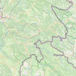
Pljevlja is located in Crna Gora, Montenegrocountry within 43° 21' 24.12" N 19° 21' 29.88" E (43.3567, 19.3583) coordinates. The local time in Pljevlja is 10:16 (15.07.2025)
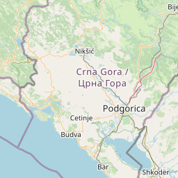
Golubovci is located in Crna Gora, Montenegrocountry within 42° 20' 3.84" N 19° 13' 31.08" E (42.3344, 19.2253) coordinates. The local time in Golubovci is 10:16 (15.07.2025)
The calculated flying distance from Pljevlja to Golubovci is 70.95miles which is equal to 114.19 km.
If you want to go by car, the driving driving distance between Pljevlja and Golubovci is 108.48 miles (174.58 km). If you ride your car with an average speef of 112 kilometers/hour (70 miles/h), travel time will be 1 hours 34 minutes.Please check the avg.speed travel time on the right for various options
Estimated Travel Time Between Pljevlja and Golubovci
| Average speed | Travel Time |
|---|---|
| 30 mph (48 km/h) | 3 hours 37 minutes |
| 40 mph (64 km/h) | 2 hours 43 minutes |
| 50 mph (80 km/h) | 2 hours 10 minutes |
| 60 mph (67 km/h) | 1 hours 48 minutes |
| 70 mph (112 km/h) | 1 hours 33 minutes |
| 75 mph (120 km/h) | 1 hours 27 minutes |
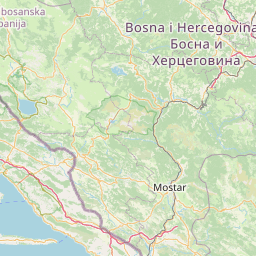
Pljevlja, Crna Gora, Montenegro
Related Distances from Pljevlja
| Cities | Distance |
|---|---|
| Pljevlja to Zabljak | 18.36 mi (29.55 km) |
| Pljevlja to Bijelo Polje | 29.46 mi (47.42 km) |
| Pljevlja to Mojkovac | 29.60 mi (47.64 km) |
| Pljevlja to Pluzine | 30.18 mi (48.57 km) |
| Pljevlja to Savnik | 30.97 mi (49.84 km) |
| Pljevlja to Kolasin | 37.75 mi (60.76 km) |
| Pljevlja to Petnjica | 43.49 mi (69.99 km) |
| Pljevlja to Berane | 43.76 mi (70.43 km) |
| Pljevlja to Niksic | 45.00 mi (72.41 km) |
| Pljevlja to Andrijevica | 48.48 mi (78.02 km) |
| Pljevlja to Danilovgrad | 53.89 mi (86.73 km) |
| Pljevlja to Rozaje | 53.95 mi (86.82 km) |
| Pljevlja to Gusinje | 59.95 mi (96.48 km) |
| Pljevlja to Plav | 59.98 mi (96.53 km) |
| Pljevlja to Podgorica | 63.43 mi (102.08 km) |
| Pljevlja to Tuzi | 68.49 mi (110.23 km) |
| Pljevlja to Kotor | 70.61 mi (113.64 km) |
| Pljevlja to Golubovci | 70.95 mi (114.19 km) |
| Pljevlja to Cetinje | 71.04 mi (114.33 km) |
| Pljevlja to Tivat | 72.18 mi (116.16 km) |
| Pljevlja to Herceg Novi | 75.17 mi (120.98 km) |
| Pljevlja to Budva | 78.32 mi (126.05 km) |
| Pljevlja to Bar | 87.81 mi (141.32 km) |
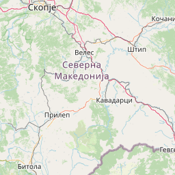
Golubovci, Crna Gora, Montenegro
Related Distances to Golubovci
| Cities | Distance |
|---|---|
| Tuzi to Golubovci | 5.83 mi (9.38 km) |
| Podgorica to Golubovci | 7.63 mi (12.28 km) |
| Cetinje to Golubovci | 15.90 mi (25.59 km) |
| Bar to Golubovci | 17.42 mi (28.03 km) |
| Budva to Golubovci | 19.82 mi (31.90 km) |
| Danilovgrad to Golubovci | 21.03 mi (33.85 km) |
| Kotor to Golubovci | 24.16 mi (38.88 km) |
| Tivat to Golubovci | 27.61 mi (44.44 km) |
| Niksic to Golubovci | 33.69 mi (54.22 km) |
| Gusinje to Golubovci | 34.78 mi (55.98 km) |
| Herceg Novi to Golubovci | 36.35 mi (58.51 km) |
| Kolasin to Golubovci | 37.03 mi (59.59 km) |
| Andrijevica to Golubovci | 39.67 mi (63.84 km) |
| Plav to Golubovci | 40.79 mi (65.64 km) |
| Savnik to Golubovci | 43.01 mi (69.21 km) |
| Mojkovac to Golubovci | 46.83 mi (75.37 km) |
| Berane to Golubovci | 47.57 mi (76.55 km) |
| Petnjica to Golubovci | 54.66 mi (87.97 km) |
| Bijelo Polje to Golubovci | 55.56 mi (89.41 km) |
| Zabljak to Golubovci | 56.95 mi (91.64 km) |
| Rozaje to Golubovci | 59.00 mi (94.95 km) |
| Pluzine to Golubovci | 59.82 mi (96.26 km) |
| Pljevlja to Golubovci | 70.95 mi (114.19 km) |
 Log in with Google