Distance Calculator

A1, 102

199.7 km, 2 h 53 min

Head east80 m
Turn right onto Revuonos g.100 m
Turn left onto F. Martišiaus g. (A16)300 m
Turn right onto Vytauto g. (A16)200 m
Continue onto Greimų tiltas (A16)200 m
Continue onto Greimų g. (A16)5 km
Enter the traffic circle and take the 1st exit towards Trakai40 m
Exit the traffic circle towards Trakai10 km
Enter the traffic circle and take the 3rd exit towards Kaišiadorys80 m
Exit the traffic circle towards Kaišiadorys20 km
Turn right towards Žiežmariai15 km
Enter the traffic circle and take the 2nd exit towards A1: Vilnius55 m
Exit the traffic circle towards A1: Vilnius300 m
Merge left onto A150 km
Take the ramp towards A19: Lazdynai200 m
Continue slightly right onto Gariūnų g. (A19)3 km
Take the ramp towards A2500 m
Go straight towards A2: Panevėžys3.5 km
Take the ramp towards Centras250 m
Go straight onto Pilaitės pr.800 m
Continue onto T. Narbuto g.2.5 km
Enter Saltoniškių žiedas and take the 3rd exit towards Panevėžys250 m
Exit the traffic circle towards Panevėžys90 m
Keep right towards A14200 m
Enter the traffic circle and take the 2nd exit onto Lvivo g.20 m
Exit the traffic circle onto Lvivo g.90 m
Merge left onto Geležinio Vilko g. (A14)1 km
Take the ramp towards Švenčionys70 m
Continue straight150 m
Continue straight200 m
Go straight onto Ozo g.800 m
Continue onto Kareivių g.2 km
Continue onto O. Milašiaus g.1 km
Continue straight to stay on O. Milašiaus g.300 m
Go straight onto Nemenčinės pl. (102)4.5 km
Enter the traffic circle and take the 2nd exit onto Nemenčinės pl. (102)25 m
Exit the traffic circle onto Nemenčinės pl. (102)10 km
Enter the traffic circle and take the 2nd exit towards Švenčionys35 m
Exit the traffic circle towards Švenčionys30 km
Continue onto Švenčionių g. (102)30 km
Continue onto Vilniaus g. (102)1.5 km
Turn left onto Taikos g.60 m
Turn right35 m
You have arrived at your destination, on the left0 m

A1, 102

194.8 km, 2 h 55 min

Head east80 m
Turn right onto Revuonos g.100 m
Turn left onto F. Martišiaus g. (A16)300 m
Turn right onto Vytauto g. (A16)200 m
Continue onto Greimų tiltas (A16)200 m
Continue onto Greimų g. (A16)5 km
Enter the traffic circle and take the 1st exit towards Trakai40 m
Exit the traffic circle towards Trakai10 km
Enter the traffic circle and take the 3rd exit towards Kaišiadorys80 m
Exit the traffic circle towards Kaišiadorys20 km
Turn right towards Žiežmariai15 km
Enter the traffic circle and take the 2nd exit towards A1: Vilnius55 m
Exit the traffic circle towards A1: Vilnius300 m
Merge left onto A125 km
Take the ramp towards 107: Trakai800 m
Turn left onto Kernavės g. (108)700 m
Enter the traffic circle and take the 1st exit onto Kernavės g. (108)100 m
Exit the traffic circle onto Kernavės g. (108)10 km
Enter Vievis — Maišiagala — Nemenčinė and take the 1st exit onto Kernavės kel. (108)20 m
Exit the traffic circle onto Kernavės kel. (108)3 km
Turn left onto Vievis — Maišiagala — Nemenčinė (108)150 m
Continue onto Mokyklos g. (108)10 km
Continue onto Vievis — Maišiagala — Nemenčinė (108)350 m
Continue straight onto Krotošyno g. (108)2.5 km
Continue onto A. Giedraičio g. (108)3 km
Continue onto Antano Giedraičio g. (108)7 km
Turn right onto Paberžės g. (108)250 m
Turn left onto Šaltoniškių g. (108)3.5 km
Enter the traffic circle and take the 2nd exit towards Nemenčinė100 m
Exit the traffic circle towards Nemenčinė3 km
Continue onto Nemenčinės g. (108)8 km
Continue onto Bažnyčios g. (108)500 m
Turn left onto Švenčionių g. (5216)3.5 km
Turn left onto Parčevskių g. (102)25 km
Continue onto Švenčionių g. (102)30 km
Continue onto Vilniaus g. (102)1.5 km
Turn left onto Taikos g.60 m
Turn right35 m
You have arrived at your destination, on the left0 m
From
    To

      Distance: 94.53 mi (152.12 km)

      Driving route: 124.08 mi (199.69 km).

      Driving time: 2h 52 min

      Distance from Prienai to Svencionys

      The shortest distance (air line) between Prienai and Svencionys is 94.53mi (152.12 km)

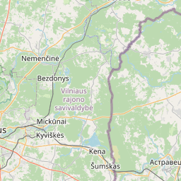
      The shortest route between Prienai and Svencionys is 124.08 mi (199.69 km) according to the route planner. The driving time is approx. 2 h 52 m

      How far is it between Prienai and Svencionys.

      Prienai is located in Kauno apskritis, Lithuaniacountry within 54° 37' 59.88" N 23° 56' 30.12" E (54.6333, 23.9417) coordinates. The local time in Prienai is 15:31 (04.06.2025)

      Svencionys is located in Vilniaus apskritis, Lithuaniacountry within 55° 7' 59.88" N 26° 9' 20.16" E (55.1333, 26.1556) coordinates. The local time in Svencionys is 15:31 (04.06.2025)

      The calculated flying distance from Prienai to Svencionys is 94.53miles which is equal to 152.12 km.

      If you want to go by car, the driving driving distance between Prienai and Svencionys is 124.08 miles (199.69 km). If you ride your car with an average speef of 112 kilometers/hour (70 miles/h), travel time will be 1 hours 47 minutes.Please check the avg.speed travel time on the right for various options

      Estimated Travel Time Between Prienai and Svencionys

      Average speedTravel Time
      30 mph (48 km/h)4 hours 8 minutes
      40 mph (64 km/h)3 hours 6 minutes
      50 mph (80 km/h)2 hours 29 minutes
      60 mph (67 km/h)2 hours 4 minutes
      70 mph (112 km/h)1 hours 46 minutes
      75 mph (120 km/h)1 hours 39 minutes

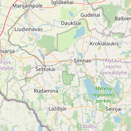
      Prienai, Kauno apskritis, Lithuania

      Related Distances from Prienai

      CitiesDistance
      Prienai to Birstonas3.80 mi (6.11 km)
      Prienai to Alytus16.59 mi (26.70 km)
      Prienai to Kaunas18.37 mi (29.56 km)
      Prienai to Kaisiadorys25.90 mi (41.68 km)
      Prienai to Elektrenai30.60 mi (49.24 km)
      Prienai to Lazdijai32.49 mi (52.29 km)
      Prienai to Jonava33.19 mi (53.41 km)
      Prienai to Varena38.64 mi (62.19 km)
      Prienai to Trakai39.66 mi (63.82 km)
      Prienai to Druskininkai42.61 mi (68.58 km)
      Prienai to Kedainiai44.92 mi (72.29 km)
      Prienai to Grigiskes46.36 mi (74.61 km)
      Prienai to Sirvintos49.47 mi (79.61 km)
      Prienai to Aukstieji Paneriai50.39 mi (81.10 km)
      Prienai to Ukmerge53.34 mi (85.83 km)
      Prienai to Vilnius53.61 mi (86.28 km)
      Prienai to Raseiniai60.30 mi (97.05 km)
      Prienai to Salcininkai61.87 mi (99.57 km)
      Prienai to Moletai71.74 mi (115.45 km)
      Prienai to Anyksciai77.23 mi (124.29 km)
      Prienai to Utena88.82 mi (142.95 km)
      Prienai to Svencionys94.53 mi (152.12 km)
      Prienai to Ignalina101.14 mi (162.77 km)
      Prienai to Zarasai118.60 mi (190.87 km)
      Prienai to Visaginas119.04 mi (191.58 km)

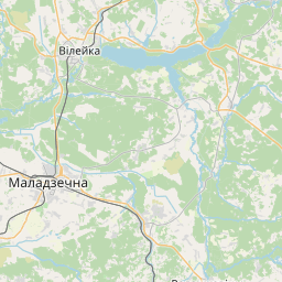
      Svencionys, Vilniaus apskritis, Lithuania

      Related Distances to Svencionys

      CitiesDistance
      Ignalina to Svencionys14.98 mi (24.11 km)
      Moletai to Svencionys29.96 mi (48.21 km)
      Utena to Svencionys33.45 mi (53.84 km)
      Visaginas to Svencionys33.97 mi (54.67 km)
      Zarasai to Svencionys41.62 mi (66.98 km)
      Vilnius to Svencionys46.47 mi (74.79 km)
      Sirvintos to Svencionys47.39 mi (76.26 km)
      Anyksciai to Svencionys49.85 mi (80.22 km)
      Grigiskes to Svencionys52.90 mi (85.13 km)
      Aukstieji Paneriai to Svencionys52.93 mi (85.18 km)
      Ukmerge to Svencionys56.02 mi (90.16 km)
      Trakai to Svencionys59.61 mi (95.93 km)
      Elektrenai to Svencionys63.95 mi (102.93 km)
      Salcininkai to Svencionys64.29 mi (103.46 km)
      Kaisiadorys to Svencionys70.06 mi (112.74 km)
      Jonava to Svencionys74.23 mi (119.47 km)
      Kedainiai to Svencionys86.91 mi (139.87 km)
      Varena to Svencionys89.78 mi (144.49 km)
      Kaunas to Svencionys91.37 mi (147.05 km)
      Birstonas to Svencionys92.46 mi (148.80 km)
      Prienai to Svencionys94.53 mi (152.12 km)
      Alytus to Svencionys98.01 mi (157.73 km)
      Druskininkai to Svencionys116.77 mi (187.92 km)
      Raseiniai to Svencionys120.75 mi (194.33 km)
      Lazdijai to Svencionys122.37 mi (196.93 km)