Distance Calculator

Autoroute d'Esch, Autoroute d'Arlon

48.3 km, 44 min

Head northeast on Rue du Fossé25 m
Turn left onto Rue Large10 m
Turn right onto Rue du Fossé500 m
Turn left onto Rue Marie Curie (N 4)1.5 km
Take the ramp onto Échangeur de Lallange (A 4)550 m
Merge left onto Autoroute d'Esch (A 4)10 km
Take the ramp onto A 61 km
Merge left onto Autoroute d'Arlon (A 6)15 km
Take exit 1 towards N 13: Steinfort250 m
Keep left onto Rue des Trois Cantons (N 13)1 km
Enter Rue d'Arlon and take the 2nd exit onto CR 11045 m
Exit the traffic circle onto CR 1102.5 km
Turn left onto Rue Principale (CR 110)2 km
Turn left onto CR 1052 km
Turn right onto Grand-Rue (CR 106)450 m
Turn right onto Rue de Kreuzerbuch (CR 106)4 km
Continue onto Kräizerbucherstrooss (CR 301)600 m
Continue onto Näerdenerstrooss (CR 301)250 m
Continue onto Naerdenerstroos (CR 301)250 m
Continue onto Schweecherdaulerstrooss (CR 301)2 km
Enter the traffic circle and take the 2nd exit onto Arelerstrooss (N 24)30 m
Exit the traffic circle onto Arelerstrooss (N 24)200 m
Turn right onto Nidderpallenerstrooss (CR 106)1.5 km
Turn left onto Rue de Redange (CR 106)2.5 km
Make a sharp right onto Grand-Rue (N 22)90 m
Turn left to stay on N 22B70 m
Make a slight right onto Rue d'Ospern (CR 304A)7 m
You have arrived at your destination0 m

Collectrice du Sud, N81

43.4 km, 45 min

Head northeast on Rue du Fossé25 m
Turn left onto Rue Large400 m
Continue onto Rue de Belvaux500 m
Turn right onto Boulevard Grande-Duchesse Charlotte (N 4C)600 m
Turn left onto Pénétrante de Lankelz (CR 110)700 m
Go straight onto Collectrice du Sud (A 13)9 km
Continue onto Avenue de l'Europe (N 31)2.5 km
Enter the traffic circle and take the 1st exit onto N 5D25 m
Exit the traffic circle onto N 5D300 m
Continue onto N 5B1 km
Continue onto Avenue de Luxembourg (N88)400 m
Continue onto Grand Rue (N88)600 m
Continue onto Rue de la Jonction (N88)300 m
Continue onto Avenue de la Libération (N88)400 m
Take the ramp on the right towards A28400 m
Merge left onto E411900 m
Continue onto N814 km
Enter the traffic circle and take the 2nd exit onto Rue d'Arlon (N81)70 m
Exit the traffic circle onto Rue d'Arlon (N81)1.5 km
Continue onto Rue des Ardennes (N81)250 m
Enter the traffic circle and take the 2nd exit onto Rue des Ardennes (N81)70 m
Exit the traffic circle onto Rue des Ardennes (N81)1 km
Enter the traffic circle and take the 2nd exit onto N8170 m
Exit the traffic circle onto N811.5 km
Enter the traffic circle and take the 2nd exit towards N81: Bruxelles80 m
Exit the traffic circle towards N81: Bruxelles300 m
Enter the traffic circle and take the 2nd exit onto Route de Longwy (N81)80 m
Exit the traffic circle onto Route de Longwy (N81)900 m
Continue onto Avenue de Longwy (N81)2.5 km
Enter the traffic circle and take the 2nd exit onto Avenue de Longwy (N4)35 m
Exit the traffic circle onto Avenue de Longwy (N4)500 m
Enter the traffic circle and take the 1st exit towards Diekirch30 m
Exit the traffic circle towards Diekirch150 m
Enter the traffic circle and take the 2nd exit onto Rue de Redange (N882)35 m
Exit the traffic circle onto Rue de Redange (N882)600 m
Continue onto Route de Diekirch (N882)2 km
Continue straight to stay on Route de Diekirch (N882)1.5 km
Continue onto Arelerstrooss (N 22)800 m
Enter the traffic circle and take the 2nd exit onto N 2235 m
Exit the traffic circle onto N 227 km
Turn left to stay on N 22B70 m
Make a slight right onto Rue d'Ospern (CR 304A)7 m
You have arrived at your destination0 m
From
    To

      Distance: 18.98 mi (30.55 km)

      Driving route: 30.02 mi (48.31 km).

      Driving time: 0h 43 min

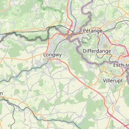
      Distance from Redange-sur-Attert to Esch-sur-Alzette

      The shortest distance (air line) between Redange-sur-Attert and Esch-sur-Alzette is 18.98mi (30.55 km)

      The shortest route between Redange-sur-Attert and Esch-sur-Alzette is 30.02 mi (48.31 km) according to the route planner. The driving time is approx. 0 h 43 m

      How far is it between Redange-sur-Attert and Esch-sur-Alzette.

      Redange-sur-Attert is located in Luxembourg, Luxembourgcountry within 49° 45' 54.72" N 5° 53' 21.84" E (49.7652, 5.8894) coordinates. The local time in Redange-sur-Attert is 18:59 (04.07.2025)

      Esch-sur-Alzette is located in Luxembourg, Luxembourgcountry within 49° 29' 48.84" N 5° 58' 50.16" E (49.4969, 5.9806) coordinates. The local time in Esch-sur-Alzette is 18:59 (04.07.2025)

      The calculated flying distance from Redange-sur-Attert to Esch-sur-Alzette is 18.98miles which is equal to 30.55 km.

      If you want to go by car, the driving driving distance between Redange-sur-Attert and Esch-sur-Alzette is 30.02 miles (48.31 km). If you ride your car with an average speef of 112 kilometers/hour (70 miles/h), travel time will be 0 hours 26 minutes.Please check the avg.speed travel time on the right for various options

      Estimated Travel Time Between Redange-sur-Attert and Esch-sur-Alzette

      Average speedTravel Time
      30 mph (48 km/h)1 hours 0 minutes
      40 mph (64 km/h)0 hours 45 minutes
      50 mph (80 km/h)0 hours 36 minutes
      60 mph (67 km/h)0 hours 30 minutes
      70 mph (112 km/h)0 hours 26 minutes
      75 mph (120 km/h)0 hours 24 minutes

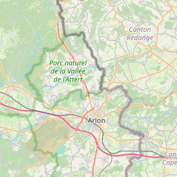
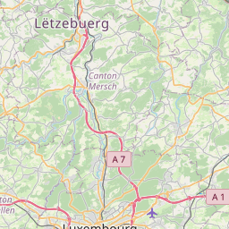
      Redange-sur-Attert, Luxembourg, Luxembourg

      Related Distances from Redange-sur-Attert

      CitiesDistance
      Redange-sur-Attert to Mersch9.46 mi (15.22 km)
      Redange-sur-Attert to Capellen9.47 mi (15.25 km)
      Redange-sur-Attert to Diekirch13.88 mi (22.33 km)
      Redange-sur-Attert to Wiltz14.06 mi (22.63 km)
      Redange-sur-Attert to Luxembourg15.17 mi (24.41 km)
      Redange-sur-Attert to Differdange16.79 mi (27.02 km)
      Redange-sur-Attert to Vianden18.34 mi (29.51 km)
      Redange-sur-Attert to Esch-sur-Alzette18.98 mi (30.55 km)
      Redange-sur-Attert to Clervaux20.69 mi (33.30 km)
      Redange-sur-Attert to Dudelange21.32 mi (34.32 km)
      Redange-sur-Attert to Echternach23.96 mi (38.56 km)
      Redange-sur-Attert to Grevenmacher25.35 mi (40.80 km)
      Redange-sur-Attert to Remich26.24 mi (42.23 km)

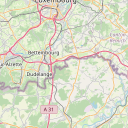
      Esch-sur-Alzette, Luxembourg, Luxembourg

      Related Distances to Esch-sur-Alzette

      CitiesDistance
      Differdange to Esch-sur-Alzette4.35 mi (7.01 km)
      Dudelange to Esch-sur-Alzette4.70 mi (7.57 km)
      Capellen to Esch-sur-Alzette10.20 mi (16.41 km)
      Luxembourg to Esch-sur-Alzette10.44 mi (16.79 km)
      Remich to Esch-sur-Alzette17.63 mi (28.37 km)
      Mersch to Esch-sur-Alzette18.29 mi (29.43 km)
      Redange-sur-Attert to Esch-sur-Alzette18.98 mi (30.55 km)
      Grevenmacher to Esch-sur-Alzette24.24 mi (39.01 km)
      Diekirch to Esch-sur-Alzette26.83 mi (43.18 km)
      Echternach to Esch-sur-Alzette29.37 mi (47.26 km)
      Vianden to Esch-sur-Alzette31.83 mi (51.23 km)
      Wiltz to Esch-sur-Alzette32.53 mi (52.35 km)
      Clervaux to Esch-sur-Alzette38.29 mi (61.62 km)