Distance Calculator

Autoroute de l’Est, L'Ardennaise

354.8 km, 4 h 9 min

Head northeast5.5 m
Turn left onto Rue de Rivoli70 m
Continue onto Rue de la Coutellerie150 m
Go straight onto Rue Saint-Martin80 m
Turn left onto Quai de Gesvres150 m
Continue onto Quai de l'Hôtel de Ville600 m
Continue onto Quai des Célestins400 m
Continue onto Quai Henri IV550 m
Continue onto Voie Mazas300 m
Continue onto Quai de la Rapée900 m
Continue onto Quai de Bercy1.5 km
Take the ramp500 m
Continue onto A 47 km
Keep left towards A 4: Troyes30 km
Keep left towards A 4: Strasbourg25 km
Take the ramp on the left150 m
Merge right onto Autoroute de l’Est (A 4)70 km
Take exit 22 towards Reims-centre1.5 km
Continue onto Voie Jean Taittinger (A 344)9 km
Take the ramp towards A 34: Reims-Cormontreuil150 m
Keep left at the fork600 m
Continue onto Avenue Nicéphore Niepce1.5 km
Continue onto L'Ardennaise (A 34)80 km
Keep right onto L'Ardennaise (A 34)25 km
Keep right towards Arlon10 km
Continue onto N898 km
Continue onto N8915 km
Continue onto N893.5 km
Enter the traffic circle and take the 2nd exit onto N8950 m
Exit the traffic circle onto N89250 m
Continue onto N891 km
Enter the traffic circle and take the 2nd exit onto N8950 m
Exit the traffic circle onto N894.5 km
Take the ramp towards E411550 m
Merge left onto Autoroute des Ardennes (E411)15 km
Continue onto Autoroute du Soleil (E25)30 km
Take exit 31 towards N82: Arlon500 m
Merge left onto N82150 m
Keep right onto N822 km
Enter the traffic circle and take the 2nd exit onto N8250 m
Exit the traffic circle onto N82900 m
Enter the traffic circle and take the 2nd exit onto N8250 m
Exit the traffic circle onto N82200 m
Take the ramp onto N82450 m
Go straight onto Route de Bastogne (N4)200 m
Enter the traffic circle and take the 3rd exit onto N450 m
Exit the traffic circle onto N41 km
Enter the traffic circle and take the 3rd exit towards Diekirch100 m
Exit the traffic circle towards Diekirch150 m
Enter the traffic circle and take the 2nd exit onto Rue de Redange (N882)35 m
Exit the traffic circle onto Rue de Redange (N882)600 m
Continue onto Route de Diekirch (N882)2 km
Continue straight to stay on Route de Diekirch (N882)1.5 km
Continue onto Arelerstrooss (N 22)800 m
Enter the traffic circle and take the 2nd exit onto N 2235 m
Exit the traffic circle onto N 227 km
Turn left to stay on N 22B70 m
Make a slight right onto Rue d'Ospern (CR 304A)7 m
You have arrived at your destination0 m

Autoroute de l’Est, D 618

363.1 km, 4 h 22 min

Head northeast5.5 m
Turn left onto Rue de Rivoli70 m
Continue onto Rue de la Coutellerie150 m
Go straight onto Rue Saint-Martin80 m
Turn left onto Quai de Gesvres150 m
Continue onto Quai de l'Hôtel de Ville600 m
Continue onto Quai des Célestins400 m
Continue onto Quai Henri IV550 m
Continue onto Voie Mazas300 m
Continue onto Quai de la Rapée900 m
Continue onto Quai de Bercy1.5 km
Take the ramp500 m
Continue onto A 47 km
Keep left towards A 4: Troyes30 km
Keep left towards A 4: Strasbourg25 km
Take the ramp on the left150 m
Merge right onto Autoroute de l’Est (A 4)200 km
Take the ramp towards Longwy1.5 km
Enter the traffic circle and take the 2nd exit onto D 90855 m
Exit the traffic circle onto D 9087 km
Enter the traffic circle and take the 2nd exit onto D 60370 m
Exit the traffic circle onto D 6032.5 km
Enter the traffic circle and take the 1st exit onto D 60340 m
Exit the traffic circle onto D 6031 km
Enter the traffic circle and take the 2nd exit onto D 60335 m
Exit the traffic circle onto D 603350 m
Enter the traffic circle and take the 1st exit onto D 61825 m
Exit the traffic circle onto D 61820 km
Turn right onto D 664.5 km
Continue onto D 189 km
Enter the traffic circle and take the 2nd exit onto D 1825 m
Exit the traffic circle onto D 181.5 km
Make a slight left to stay on Route de Cutry (D 18)25 m
Turn left to stay on D 182 km
Turn left onto Rue de Boismont1 km
Make a slight left150 m
Turn right onto Rue de l'Europe550 m
Turn right onto Rue du Pulventeux300 m
Enter the traffic circle and take the 2nd exit80 m
Exit the traffic circle150 m
Merge left onto N 527 km
Continue onto E4113 km
Go straight onto N814 km
Enter the traffic circle and take the 2nd exit onto Rue d'Arlon (N81)70 m
Exit the traffic circle onto Rue d'Arlon (N81)1.5 km
Continue onto Rue des Ardennes (N81)250 m
Enter the traffic circle and take the 2nd exit onto Rue des Ardennes (N81)70 m
Exit the traffic circle onto Rue des Ardennes (N81)1 km
Enter the traffic circle and take the 2nd exit onto N8170 m
Exit the traffic circle onto N811.5 km
Enter the traffic circle and take the 2nd exit towards N81: Bruxelles80 m
Exit the traffic circle towards N81: Bruxelles300 m
Enter the traffic circle and take the 2nd exit onto Route de Longwy (N81)80 m
Exit the traffic circle onto Route de Longwy (N81)900 m
Continue onto Avenue de Longwy (N81)2.5 km
Enter the traffic circle and take the 2nd exit onto Avenue de Longwy (N4)35 m
Exit the traffic circle onto Avenue de Longwy (N4)500 m
Enter the traffic circle and take the 1st exit towards Diekirch30 m
Exit the traffic circle towards Diekirch150 m
Enter the traffic circle and take the 2nd exit onto Rue de Redange (N882)35 m
Exit the traffic circle onto Rue de Redange (N882)600 m
Continue onto Route de Diekirch (N882)2 km
Continue straight to stay on Route de Diekirch (N882)1.5 km
Continue onto Arelerstrooss (N 22)800 m
Enter the traffic circle and take the 2nd exit onto N 2235 m
Exit the traffic circle onto N 227 km
Turn left to stay on N 22B70 m
Make a slight right onto Rue d'Ospern (CR 304A)7 m
You have arrived at your destination0 m
From
    To

      Distance: 171.23 mi (275.57 km)

      Driving route: 220.48 mi (354.83 km).

      Driving time: 4h 8 min

      Distance from Redange-sur-Attert to Paris

      The shortest distance (air line) between Redange-sur-Attert and Paris is 171.23mi (275.57 km)

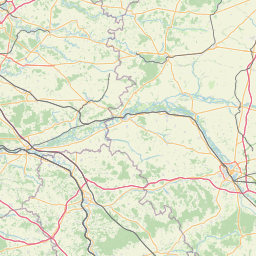
      The shortest route between Redange-sur-Attert and Paris is 220.48 mi (354.83 km) according to the route planner. The driving time is approx. 4 h 8 m

      How far is it between Redange-sur-Attert and Paris.

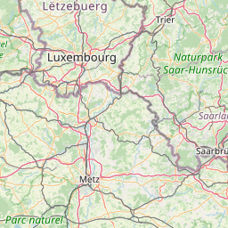
      Redange-sur-Attert is located in Luxembourg, Luxembourgcountry within 49° 45' 54.72" N 5° 53' 21.84" E (49.7652, 5.8894) coordinates. The local time in Redange-sur-Attert is 15:40 (03.09.2025)

      Paris is located in Paris, Francecountry within 48° 51' 24.12" N 2° 21' 7.92" E (48.8567, 2.3522) coordinates. The local time in Paris is 15:40 (03.09.2025)

      The calculated flying distance from Redange-sur-Attert to Paris is 171.23miles which is equal to 275.57 km.

      If you want to go by car, the driving driving distance between Redange-sur-Attert and Paris is 220.48 miles (354.83 km). If you ride your car with an average speef of 112 kilometers/hour (70 miles/h), travel time will be 3 hours 10 minutes.Please check the avg.speed travel time on the right for various options

      Estimated Travel Time Between Redange-sur-Attert and Paris

      Average speedTravel Time
      30 mph (48 km/h)7 hours 21 minutes
      40 mph (64 km/h)5 hours 31 minutes
      50 mph (80 km/h)4 hours 25 minutes
      60 mph (67 km/h)3 hours 40 minutes
      70 mph (112 km/h)3 hours 9 minutes
      75 mph (120 km/h)2 hours 56 minutes

      Redange-sur-Attert, Luxembourg, Luxembourg

      Related Distances from Redange-sur-Attert

      CitiesDistance
      Redange-sur-Attert to Mersch9.46 mi (15.22 km)
      Redange-sur-Attert to Capellen9.47 mi (15.25 km)
      Redange-sur-Attert to Diekirch13.88 mi (22.33 km)
      Redange-sur-Attert to Wiltz14.06 mi (22.63 km)
      Redange-sur-Attert to Luxembourg15.17 mi (24.41 km)
      Redange-sur-Attert to Differdange16.79 mi (27.02 km)
      Redange-sur-Attert to Vianden18.34 mi (29.51 km)
      Redange-sur-Attert to Esch-sur-Alzette18.98 mi (30.55 km)
      Redange-sur-Attert to Clervaux20.69 mi (33.30 km)
      Redange-sur-Attert to Dudelange21.32 mi (34.32 km)
      Redange-sur-Attert to Echternach23.96 mi (38.56 km)
      Redange-sur-Attert to Grevenmacher25.35 mi (40.80 km)
      Redange-sur-Attert to Remich26.24 mi (42.23 km)

      Paris, Paris, France

      Related Distances to Paris

      CitiesDistance
      Boulogne-Billancourt to Paris5.27 mi (8.49 km)
      Reims to Paris81.18 mi (130.64 km)
      Le Havre to Paris110.74 mi (178.22 km)
      Le Mans to Paris114.84 mi (184.82 km)
      Lille to Paris126.37 mi (203.37 km)
      Tours to Paris126.89 mi (204.20 km)
      Dijon to Paris162.60 mi (261.68 km)
      Angers to Paris164.52 mi (264.76 km)
      Rennes to Paris191.59 mi (308.33 km)
      Nantes to Paris212.95 mi (342.71 km)
      Clermont-Ferrand to Paris215.10 mi (346.17 km)
      Lyon to Paris243.61 mi (392.06 km)
      Villeurbanne to Paris244.11 mi (392.86 km)
      Strasbourg to Paris246.53 mi (396.75 km)
      Saint-Etienne to Paris255.07 mi (410.50 km)
      Grenoble to Paris300.00 mi (482.80 km)
      Bordeaux to Paris310.13 mi (499.11 km)
      Brest to Paris314.04 mi (505.40 km)
      Nimes to Paris359.72 mi (578.91 km)
      Toulouse to Paris365.47 mi (588.17 km)
      Montpellier to Paris369.62 mi (594.84 km)
      Aix-en-Provence to Paris396.81 mi (638.61 km)
      Marseille to Paris410.42 mi (660.50 km)
      Nice to Paris426.22 mi (685.94 km)
      Toulon to Paris431.50 mi (694.42 km)