Distance Calculator

Autostrada del Sole, Variante di Valico

622.0 km, 6 h 25 min

Head northwest on Piazzale dell'Automobil Club Enrico Ferrari25 m
Turn right to stay on Piazzale dell'Automobil Club Enrico Ferrari80 m
Turn right onto Via Filippo Re150 m
Turn left onto Via Roma250 m
Make a slight right onto Viale Piave200 m
Turn right onto Via Makallé200 m
Turn left to stay on Via Makallé4 m
Turn right to stay on Via Makallé200 m
Make a slight left onto Viale Regina Margherita250 m
Enter the traffic circle and take the 3rd exit onto Via Cisalpina80 m
Exit the traffic circle onto Via Cisalpina300 m
Enter the traffic circle and take the 1st exit onto Viale Rodolfo Morandi10 m
Exit the traffic circle onto Viale Rodolfo Morandi200 m
Enter the traffic circle and take the 2nd exit onto Viale Rodolfo Morandi35 m
Exit the traffic circle onto Viale Rodolfo Morandi450 m
Enter the traffic circle and take the 3rd exit onto Viale Rodolfo Morandi60 m
Exit the traffic circle onto Viale Rodolfo Morandi350 m
Enter the traffic circle and take the 2nd exit onto Viale Rodolfo Morandi35 m
Exit the traffic circle onto Viale Rodolfo Morandi350 m
Enter the traffic circle and take the 2nd exit onto Via Abramo Lincoln200 m
Exit the traffic circle onto Via Abramo Lincoln200 m
Enter the traffic circle and take the 3rd exit onto Via Abramo Lincoln45 m
Exit the traffic circle onto Via Abramo Lincoln600 m
Enter the traffic circle and take the 1st exit onto Via Abramo Lincoln30 m
Exit the traffic circle onto Via Abramo Lincoln400 m
Enter the traffic circle and take the 2nd exit towards A1: MILANO BOLOGNA150 m
Exit the traffic circle towards A1: MILANO BOLOGNA400 m
Keep left towards A1: BOLOGNA300 m
Merge left onto Autostrada del Sole (A1)50 km
Keep left towards A1: Firenze20 km
Continue straight2.5 km
Continue slightly right onto Autostrada del Sole (A1)10 km
Keep right onto Variante di Valico (A1var)30 km
Continue onto Autostrada del Sole (A1var)500 km
Take the ramp towards Uscita Caserta Marcianise2.5 km
Make a slight right onto Strada Statale Sannitica (SP336)90 m
Keep left towards Caserta150 m
Continue onto Strada Statale Sannitica150 m
Go straight towards Maddaloni150 m
Continue onto Strada Provinciale 335 dei ponti della valle (SP335)800 m
Enter the traffic circle and take the 1st exit onto Strada Provinciale 335 dei ponti della valle (SP335)35 m
Exit the traffic circle onto Strada Provinciale 335 dei ponti della valle (SP335)350 m
Enter the traffic circle and take the 2nd exit onto Strada Provinciale 335 Via Napoli (SP335)35 m
Exit the traffic circle onto Strada Provinciale 335 Via Napoli (SP335)2 km
Continue onto Via Napoli200 m
Make a slight right towards SS265var: Maddaloni600 m
Enter the traffic circle and take the 2nd exit onto Via Forche Caudine (SS265var)30 m
Exit the traffic circle onto Via Forche Caudine (SS265var)2.5 km
Continue onto Strada Statale 7 Via Appia (SS7)200 m
Continue onto Cavalcaferrovia Strada Statale 7 Via Appia (SS7)400 m
Continue onto Strada Statale 7 Via Appia (SS7)3.5 km
Continue onto Via Nazionale (SS7)3 km
Turn left onto Via Novanese200 m
Turn right onto Via Caudio20 m
Turn left onto Via Rosciano200 m
Turn right to stay on Via Rosciano450 m
You have arrived at your destination, on the left0 m
From
    To

      Distance: 319.60 mi (514.34 km)

      Driving route: 386.48 mi (621.98 km).

      Driving time: 6h 24 min

      Distance from Santa Maria a Vico to Reggio Emilia

      The shortest distance (air line) between Santa Maria a Vico and Reggio Emilia is 319.60mi (514.34 km)

      The shortest route between Santa Maria a Vico and Reggio Emilia is 386.48 mi (621.98 km) according to the route planner. The driving time is approx. 6 h 24 m

      How far is it between Santa Maria a Vico and Reggio Emilia.

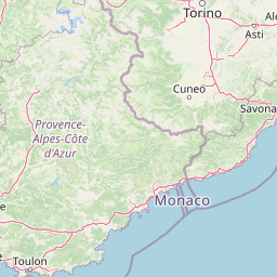
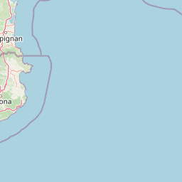
      Santa Maria a Vico is located in Caserta, Italycountry within 41° 1' 59.88" N 14° 28' 59.88" E (41.0333, 14.4833) coordinates. The local time in Santa Maria a Vico is 16:41 (08.07.2025)

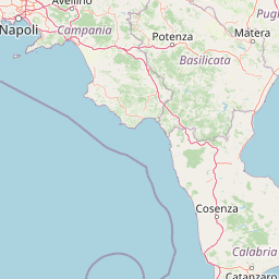
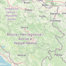
      Reggio Emilia is located in Reggio nell’Emilia, Italycountry within 44° 42' 0" N 10° 37' 59.88" E (44.7000, 10.6333) coordinates. The local time in Reggio Emilia is 16:41 (08.07.2025)

      The calculated flying distance from Santa Maria a Vico to Reggio Emilia is 319.60miles which is equal to 514.34 km.

      If you want to go by car, the driving driving distance between Santa Maria a Vico and Reggio Emilia is 386.48 miles (621.98 km). If you ride your car with an average speef of 112 kilometers/hour (70 miles/h), travel time will be 5 hours 33 minutes.Please check the avg.speed travel time on the right for various options

      Estimated Travel Time Between Santa Maria a Vico and Reggio Emilia

      Average speedTravel Time
      30 mph (48 km/h)12 hours 53 minutes
      40 mph (64 km/h)9 hours 40 minutes
      50 mph (80 km/h)7 hours 44 minutes
      60 mph (67 km/h)6 hours 26 minutes
      70 mph (112 km/h)5 hours 31 minutes
      75 mph (120 km/h)5 hours 9 minutes

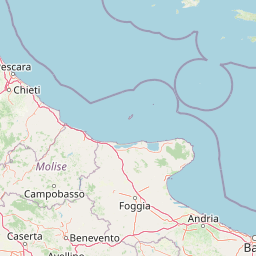
      Santa Maria a Vico, Caserta, Italy

      Related Distances from Santa Maria a Vico

      CitiesDistance
      Santa Maria a Vico to Naples18.42 mi (29.64 km)
      Santa Maria a Vico to Rome119.40 mi (192.16 km)
      Santa Maria a Vico to Bari124.29 mi (200.03 km)
      Santa Maria a Vico to Taranto149.57 mi (240.72 km)
      Santa Maria a Vico to Cosenza151.79 mi (244.29 km)
      Santa Maria a Vico to Perugia179.35 mi (288.63 km)
      Santa Maria a Vico to Messina204.31 mi (328.81 km)
      Santa Maria a Vico to Palermo210.25 mi (338.37 km)
      Santa Maria a Vico to Reggio di Calabria211.03 mi (339.61 km)
      Santa Maria a Vico to Catania246.28 mi (396.34 km)
      Santa Maria a Vico to Florence250.82 mi (403.66 km)
      Santa Maria a Vico to Prato261.70 mi (421.17 km)
      Santa Maria a Vico to Livorno275.28 mi (443.02 km)
      Santa Maria a Vico to Bologna287.26 mi (462.30 km)
      Santa Maria a Vico to Modena307.80 mi (495.36 km)
      Santa Maria a Vico to Reggio Emilia319.60 mi (514.34 km)
      Santa Maria a Vico to Trieste321.01 mi (516.61 km)
      Santa Maria a Vico to Venice323.11 mi (519.99 km)
      Santa Maria a Vico to Padova329.35 mi (530.04 km)
      Santa Maria a Vico to Parma334.56 mi (538.42 km)
      Santa Maria a Vico to Verona351.36 mi (565.46 km)
      Santa Maria a Vico to Genoa365.70 mi (588.53 km)
      Santa Maria a Vico to Brescia377.87 mi (608.13 km)
      Santa Maria a Vico to Milan405.77 mi (653.02 km)
      Santa Maria a Vico to Turin442.73 mi (712.50 km)

      Reggio Emilia, Reggio nell’Emilia, Italy

      Related Distances to Reggio Emilia

      CitiesDistance
      Modena to Reggio Emilia14.85 mi (23.89 km)
      Parma to Reggio Emilia16.54 mi (26.62 km)
      Bologna to Reggio Emilia37.70 mi (60.67 km)
      Verona to Reggio Emilia53.96 mi (86.85 km)
      Prato to Reggio Emilia61.06 mi (98.27 km)
      Brescia to Reggio Emilia61.36 mi (98.75 km)
      Florence to Reggio Emilia71.14 mi (114.49 km)
      Padova to Reggio Emilia77.92 mi (125.40 km)
      Ravenna to Reggio Emilia79.67 mi (128.21 km)
      Livorno to Reggio Emilia80.95 mi (130.27 km)
      Genoa to Reggio Emilia86.07 mi (138.51 km)
      Milan to Reggio Emilia88.12 mi (141.81 km)
      Venice to Reggio Emilia97.37 mi (156.71 km)
      Perugia to Reggio Emilia140.25 mi (225.72 km)
      Turin to Reggio Emilia147.10 mi (236.73 km)
      Trieste to Reggio Emilia166.29 mi (267.62 km)
      Rome to Reggio Emilia215.07 mi (346.12 km)
      Naples to Reggio Emilia324.01 mi (521.44 km)
      Bari to Reggio Emilia400.42 mi (644.42 km)
      Taranto to Reggio Emilia445.19 mi (716.47 km)
      Cosenza to Reggio Emilia471.32 mi (758.51 km)
      Palermo to Reggio Emilia476.31 mi (766.55 km)
      Messina to Reggio Emilia516.52 mi (831.26 km)
      Reggio di Calabria to Reggio Emilia523.80 mi (842.97 km)
      Catania to Reggio Emilia548.71 mi (883.07 km)